


Bad Wurzach, Germany
Bad Wurzach is a town of 14,323 people in Baden-Wurttemberg, Germany.
Why visit Bad Wurzach
Townapedia lists 62 museums and landmarks, 26 parks and trails, 102 places to eat, 18 places to stay and 18 attractions in and around town.
Highlights include Farm shop of the shepherding cooperative "Finkhof", Wachbühl, Kreuzweg and Erwin Hymer Museum.
Weather in Bad Wurzach
Forecast from MET Norway (CC BY 4.0). Full forecast
About Bad Wurzach
Bad Wurzach (German pronunciation: [baːt ˈvʊʁtsax] ; until 1950 Wurzach) is a spa town in the state of Baden-Württemberg in southern Germany. It is a well known health-resort destination, and home to the oldest bog spa (in German: Moorheilbad) in Baden-Württemberg, as well as one of the largest contiguous raised bog areas in Europe. It is situated 25 kilometres (16 mi) northeast of Ravensburg and part of Ravensburg County, located in the Upper Swabia region. Since 1950 the town has carried the predicate Bad (spa).
From the Wikipedia article Bad Wurzach (this version), under CC BY-SA 4.0.
Things to do18

Farm shop of the shepherding cooperative "Finkhof"
Farm and orchard · 6.0 km
1 St.-Ulrich-Straße, Bad Wurzach
Mo-Fr 09:00-12:00,14:00-18:00; Sa 09:00-13:00

Wachbühl
Monument and historic site · 6.8 km
Mountain in Bad Wurzach, Baden-Württemberg, Germany





6 more on the map.
Museums and landmarks62


Erwin Hymer Museum
Museum · 10.7 km
7 Robert-Bosch-Straße, Bad Waldsee
Mo-Su 10:00-18:00; Th 10:00-21:00

Naturschutzzentrum Wurzacher Ried
Museum
1 Rosengarten, Bad Wurzach
Nov 01 - Mar 31 Mo-Su 10:00-17:00; Apr 01 - Oct 31 Mo-Su 10:00-18:00

Oberschwäbisches Torfmuseum
Museum · 1.3 km
Zeiler Torfwerk
4/1 Dr.-Harry-Wiegand-Straße, Bad Wurzach
"Siehe Aushang"


Schloss Zeil
Monument and historic site · 8.6 km
1 Schloß Zeil, Leutkirch im Allgäu
50 more on the map.
Parks, trails and playgrounds26





Gründlenried-Rötseemoos
Hiking and trails · 9.8 km
Https://www2.lubw.baden-wuerttemberg.de/public/abt2/dokablage/oac_12/vo/4/4103.htm
Ehemaliges Hallenbad
Sports field and stadium · 0.7 km
4 Birkenweg, Bad Wurzach
"Dauerhaft geschlossen"

Kneipp-Kräutergarten
Park · 10.1 km
Seit 17 Jahren unterhält der Kneippverein Bad Waldsee einen Heilkräutergarten mitten im Bad Waldseer Kurgebiet, in dem mehr als hundert...

Freibad Bad Waldsee
Sports field and stadium · 10.2 km
1 Robert-Koch-Straße, Bad Waldsee

14 more on the map.
Restaurants and cafes102
Amadeus
Restaurant · Burger, Hot Dog · 10.6 km
23 Ravensburger Straße, Bad Waldsee
Mo-Th 00:00-01:00,11:00-14:00,17:00-24:00; Fr...
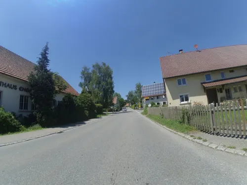
Gasthof Engel
Restaurant · 4.8 km
Freundliches Landgasthaus mit kleinem Biergarten. Leckere schwäbische Küche und gutes Bier (Landzüngle von Härle).
24 Dorfstraße, Bad Wurzach
Fr,Sa,Su 17:00+
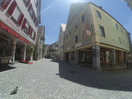
Grüner Baum
Restaurant · Regional · 10.7 km
34 Hauptstraße, Bad Waldsee
We-Su 11:30-15:00,17:00-21:00; Mo,Tu off

Bella Casa
Cafe · Italian · 10.9 km
22 Biberacher Straße, Bad Waldsee
Sa-We 11:30-22:00; Fr 17:00-22:00

Caravano
Restaurant · International · 10.7 km
7 Robert-Bosch-Straße, Bad Waldsee
Tu-Su 10:00-18:00; Mo off
Gaststätte zur Versteigerungshalle
Restaurant · Regional · 10.4 km
12 Hopfenweiler, Bad Waldsee
Mo-Sa 11:30-14:30; Su,PH 11:00-15:00; We off
La Fontana
Restaurant · Italian
14 Weberweg, Bad Wurzach
Tu-Su 11:00-14:00,17:30-22:00; PH 11:00-14:00,17:30-22:00
La Palma
Restaurant · Italian · 10.2 km
28 Hittisweilerstraße, Bad Waldsee
We-Mo 11:30-13:30, 17:00-21:30, Tu off
Landgasthaus Rose
Restaurant · German · 6.9 km
6 Osterhofer Straße, Bad Waldsee
Mo,Th,Fr 17:00-24:00; Sa,Su 11:00-24:00; Tu,We off
Ristorante Bella Casa
Restaurant · Italian · 10.9 km
22 Biberacher Straße, Bad Waldsee
Tu-Su 11:00-22:00; Mo off


Rössle
Restaurant · Regional · 9.8 km
3 Ellwanger Straße, Eberhardzell
We-Sa 17:00-24:00; Su 11:00-14:00, 17:00-22:00
90 more on the map.
History
The town is first recorded on 13 June 1273 as 'Oppidum Wurzun. On 27 May 1333, "Emperor Louis the Bavarian granted to Hans, Truchsess of Waldburg, the town rights of Memmingen, a much larger town 25 kilometres (16 mi) away, to the settlement of "Wurzun". With town rights, Wurzach was given the right to exercise lower jurisdiction, the right to hold markets, and the right and duty to erect a surrounding wall to protect itself. In 1514 the Leinwandschau ("examination") was established. In 1515, the construction of the nunnery of Maria Rosengarten began.
In 1904, the Rossberg-Wurzach railway opened. In 1936, the first moor-bath treatments were made available in the nunnery of Maria Rosengarten. Due to the disbandment of the administrative district of Leutkirch in 1938, Wurzach became part of the county of Wangen.
During the German occupation of the Channel Islands during World War II, many residents of the islands born in Great Britain were arrested and deported to Bad Wurzach, to be housed in camp "Ilag V-C". Despite wartime privations, friendships grew and a formal twinning was eventually made with Saint Helier, capital of Jersey.
From the History section of Bad Wurzach on Wikipedia, under CC BY-SA 4.0.
Where to stay18
Churches and places of worship62
St. Laurentius
Church · Roman Catholic · 8.8 km
8 Kirchstraße, Leutkirch im Allgäu
St. Magnus
Church · Roman Catholic · 9.5 km
2 Greishofstraße, Leutkirch im Allgäu
St. Nikolaus
Church · Roman Catholic · 4.9 km
2 Gräbelgasse, Bad Wurzach
Shopping22
Gas and EV charging9
Schools, colleges and libraries24
Healthcare10
Map of Bad Wurzach
250 places. The map loads OpenStreetMap tiles when you open it.
Getting there and nearby towns
Memmingen Airport (FMM) is the nearest airport with scheduled flights listed in OpenStreetMap, 27 km away.
- Biberach an der Riß 22 km north, about 22 min by car
- Weingarten 22 km southwest, about 22 min by car
- Ravensburg 26 km southwest, about 26 min by car
- Bad Saulgau 32 km west, about 32 min by car
- Meckenbeuren 34 km southwest, about 34 min by car
- Tettnang 35 km southwest, about 35 min by car
- Laupheim 36 km north, about 36 min by car
- Friedrichshafen 42 km southwest, about 42 min by car
- Riedlingen 42 km northwest, about 42 min by car
- Ehingen 44 km north, about 44 min by car
Drive times are estimates from straight-line distance, not routes.
Local news
Headlines from INDB.
Reviews, tips and questions
Loading what members have shared...
Sources and licences
- GeoNames (CC BY 4.0): population, coordinates, regions and time zone
- Mapillary (see each image): photos
- OpenStreetMap contributors (ODbL 1.0): places, airports, map data
- Wikidata (CC0 1.0): elevation, founding date, time zone, website, landmarks and historic places
- Wikimedia Commons (see each image): photos
- Wikipedia (CC BY-SA 4.0): overview and history text
Photo credits
- Bad Wurzach - Schloss und Stadtbrunnen, Okona, CC BY-SA 2.5
- Bad Wurzach Amtshaus - panoramio, Mayer Richard, CC BY 3.0
- Schloss Bad Wurzach, Own work, CC BY-SA 4.0
- Bad Wurzach Fresken am Rathaus erzählen aus der Geschichte der Stadt. - panoramio, Mayer Richard, CC BY 3.0
- Bad Wurzacher Schloss - panoramio, Richard Mayer, CC BY 3.0
- Bad Wurzach Kämmerei und Notariat - panoramio, Mayer Richard, CC BY 3.0
- Bad Wurzach Bachgasse - panoramio, Mayer Richard, CC BY 3.0
- Stolperstein für Clemens Högg (Bad Wurzach) I, Reutlingendorf, CC BY-SA 4.0
- Bad Wurzach Eingang zur Schlosskapelle - panoramio, Mayer Richard, CC BY 3.0
- Stolperstein für Clemens Högg (Bad Wurzach), Reutlingendorf, CC BY-SA 4.0
- Schloss - Bad Wurzach - geo.hlipp.de - 22404, K-H Lipp on geo.hlipp.de, CC BY-SA 2.0
- Schlosskapelle Bad Wurzach - panoramio, Mayer Richard, CC BY 3.0
- Bad Wurzach Schlosskapelle - panoramio, Mayer Richard, CC BY 3.0
- Ochsenhaus Bad Wurzach, Unknown author, CC BY-SA 4.0
- Götterhimmel im Schloss Bad Wurzach - panoramio, Richard Mayer, CC BY 3.0
- Bad Wurzach Marktstraße - panoramio - Mayer Richard, Mayer Richard, CC BY 3.0
- Bad Wurzach Marktstraße - panoramio, Mayer Richard, CC BY 3.0
- Bad Wurzach Turm von St.Verena - panoramio, Mayer Richard, CC BY 3.0
- Bad Wurzach Spruch-Man soll dem Ochsen beim Dreschen das Maul nicht verbinden. - panoramio, Mayer Richard, CC BY 3.0
- Wachbühl-2012, Bene16, CC BY-SA 3.0
- Kisslegg Pfarrkirche, Photo: Andreas Praefcke, CC BY 3.0
- Aerial image of the Schloss Zeil (view from the southwest), Carsten Steger, CC BY-SA 4.0
- Erwin-Hymer-Museum 2012 by-RaBoe 2, © Ra Boe / Wikipedia, CC BY-SA 3.0 de
- Hofkapelle Langensteig, Bene16, CC BY-SA 3.0
- Hohbäumle05, Bene16, CC BY-SA 3.0
- Salvatorkolleg (Bad Wurzach), Bene16, CC BY-SA 3.0
- Seelenkapelle (Bad Wurzach), Bene16, CC BY-SA 3.0
- Unterzeil, die Sankt Magnus Kirche foto4 2014-07-28 09.56, Michielverbeek, CC BY-SA 4.0
- NSG-BW-RV-4.035 Wurzacher Ried 06.06.2013-2NL, KlaraLang, CC BY-SA 3.0
- Bad Waldsee - Stiftskirche St. Peter und Paul, Franzfoto, CC BY-SA 3.0
- 20260806 095217 HDR, Harald Hetzner, CC0
- NSG Mauchenmühle, der große See, Thomas-2801, CC BY-SA 4.0
- Kißlegg - Rötsee, Kapelle und Naturschutzgebiet, Franzfoto, CC BY-SA 3.0
- Leutkirch - Reichenhofen - Kirche v NW, Flodur63, CC BY-SA 4.0
- HaidgauStNikolaus 2021-09, Mussklprozz, CC BY-SA 4.0
- Immenried - panoramio, Richard Mayer, CC BY 3.0
- Leutkirch - Reichenhofen südl - St Wolfgang v N, Flodur63, CC BY-SA 4.0
- Kißlegg - Rötsee, Kapelle und Wirtshausschild, Franzfoto, CC BY-SA 3.0
- Gottesberg Nordseite - panoramio, Richard Mayer, CC BY 3.0
- Marienkapelle Graben bei Bad Waldsee, Thomas-2801, CC BY-SA 4.0
- 20260806 093314 HDR, Harald Hetzner, CC0
- Wurzacher Ried (2012), Bene16, CC BY-SA 3.0
- Bad Waldsee Stiftskirche Fassade, Photo: Andreas Praefcke, CC BY 3.0
- Bad Wurzach Schloss Hauptfassade, Photo: Andreas Praefcke, CC BY 3.0
- NSG-BW-RV-4.013 Rohrsee-KL1, KlaraLang, CC BY-SA 3.0
- Oberschwäbisches Torfmuseum Bad Wurzach, RudolfSimon, CC BY-SA 4.0
- Street-level photo, ray66, CC BY-SA 4.0
- Street-level photo, msdess, CC BY-SA 4.0
- Street-level photo, ray66, CC BY-SA 4.0
- Street-level photo, msdess, CC BY-SA 4.0
- Street-level photo, xdTAGCLAN, CC BY-SA 4.0
- Street-level photo, rausk, CC BY-SA 4.0
- Street-level photo, msdess, CC BY-SA 4.0
- Street-level photo, rausk, CC BY-SA 4.0
- Street-level photo, tst, CC BY-SA 4.0
- Street-level photo, rausk, CC BY-SA 4.0
- Street-level photo, mapnerd_dk, CC BY-SA 4.0
- Street-level photo, mapnerd_dk, CC BY-SA 4.0
- Street-level photo, rausk, CC BY-SA 4.0
- Street-level photo, derzornigemarkus, CC BY-SA 4.0
- Street-level photo, msdess, CC BY-SA 4.0
- Street-level photo, msdess, CC BY-SA 4.0
- Street-level photo, zoegglmeyr, CC BY-SA 4.0
- Street-level photo, rausk, CC BY-SA 4.0
- Street-level photo, rausk, CC BY-SA 4.0
- Street-level photo, rausk, CC BY-SA 4.0
- Street-level photo, rausk, CC BY-SA 4.0
- Street-level photo, rausk, CC BY-SA 4.0
- Street-level photo, ray66, CC BY-SA 4.0
- Street-level photo, rausk, CC BY-SA 4.0
- Street-level photo, ray66, CC BY-SA 4.0
- Street-level photo, rausk, CC BY-SA 4.0


Page built November 8, 2026. Spotted a mistake? Tell us or suggest a place.