


Bad Saulgau, Germany
Bad Saulgau is a town of 17,911 people in Baden-Wurttemberg, Germany.
Why visit Bad Saulgau
Townapedia lists 39 museums and landmarks, 8 parks and trails, 66 places to eat, 8 places to stay and 14 attractions in and around town.
Highlights include Kino Saulgau, Bad Buchau, Stadtmuseum Bad Saulgau and Heuneburg.
Weather in Bad Saulgau
Forecast from MET Norway (CC BY 4.0). Full forecast
About Bad Saulgau
Bad Saulgau (German pronunciation: [baːt ˈzaʊlɡaʊ] ) is a town in the district of Sigmaringen, in Baden-Württemberg, Germany. It is situated 23 km east of Sigmaringen, and 27 km north of Ravensburg between the Danube and Lake Constance.
From the Wikipedia article Bad Saulgau (this version), under CC BY-SA 4.0.
Things to do14


Bad Buchau
Monument and historic site · 9.8 km
Town in Baden-Württemberg, Germany

Knollhof
Farm and orchard · 6.7 km
43 Friedbachstraße, Bad Saulgau
Tu 14:00-18:00; Fr 09:00-18:00; Sa 09:00-13:00

2 more on the map.
Museums and landmarks39

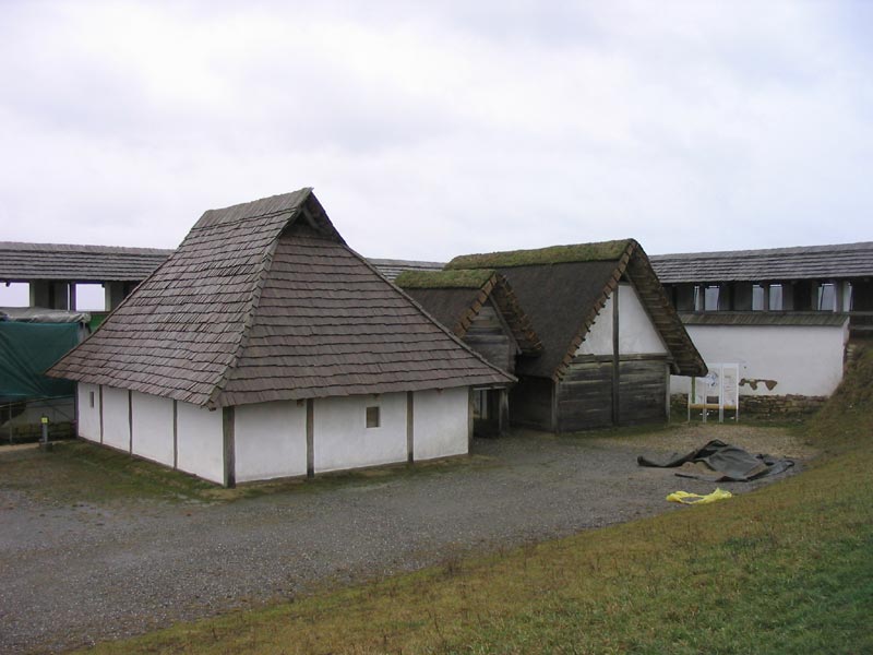
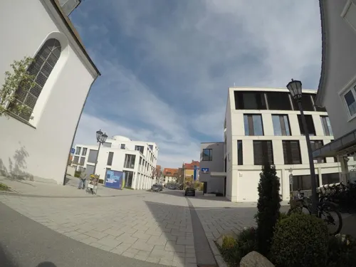

Ehemalige Burg bei Hirschegg
Monument and historic site · 7.6 km
Reste einer mittelalterlichen Burg, nur noch Burghügel und Kellergewölbe erhalten

27 more on the map.
Parks, trails and playgrounds8

Sonnenhof-Therme Bad Saulgau
Sports field and stadium · 1.0 km
1 Am Schönen Moos, Bad Saulgau
Sep 11-May 31 Mo-Su,PH 08:00-22:00; Sep 11-May 31 Fr 22:00-23:00;...




Restaurants and cafes66

Oberamer Hof
Restaurant · German · 2.3 km
34 St.-Bruno-Straße, Bad Saulgau
Mo off; Tu-Sa 17:00+; Su 10:00+

Bochtler Rosengarten
Cafe · Coffee Shop, Sandwich
6 Friedrichstraße, Bad Saulgau
Mo-Fr 07:30-18:00; Sa-Su 07:30-17:30
Gasthaus zur Sonne/Beim Sonnenwirt
Restaurant · Regional · 6.8 km
10 Sonnenstraße, Herbertingen
Tu-Fr 11:45-13:30,18:00-21:00; We 11:45-13:30; Su 11:30-14:00,18:00-21:00
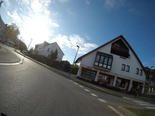
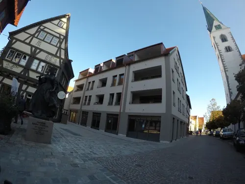


KostBar
Restaurant
2 Marktplatz, Bad Saulgau
Su 09:00-23:00; Mo, Tu 08:00-23:00; We, Th 08:00-00:00; Fr, Sa 08:00-01:00
Thermalbad-Restaurant
Restaurant · 1.0 km
1 Am Schönen Moos, Bad Saulgau
Mo-Sa,PH 10:00-22:00; Su 09:00-22:00; Jul 01-Jul 05: off; Dec 24:...
54 more on the map.
History
The first historical reference to the settlement dates back to 819. In 1239, it received town privileges from Frederick II, Holy Roman Emperor. The town became a possession of the House of Habsburg in 1299, and thus part of Further Austria. In Napoleonic times, it was incorporated into the Kingdom of Württemberg.
During World War II, a subcamp of the Dachau concentration camp was located in the town. In 2005, a memorial commemorating the camp and the victims was inaugurated at the camp's former location.
After World War II, Saulgau was part of the French occupation zone in 1945 and became part of the newly founded state of Württemberg-Hohenzollern in 1947, which was incorporated into the state of Baden-Württemberg in 1952.
In 2000, the name of the town was officially changed from Saulgau to Bad Saulgau, where the German Bad refers to its spa facilities and important natural thermal source.
From the History section of Bad Saulgau on Wikipedia, under CC BY-SA 4.0.
Where to stay8
Churches and places of worship37
Kloster- und Pfarrkirche St. Markus
Church · Roman Catholic · 2.7 km
18 Dominikus-Zimmermann-Straße, Bad Saulgau
Mariä Geburt
Church · Roman Catholic · 4.4 km
12 Pfarrgasse, Bad Saulgau
Mariä Himmelfahrt
Church · Roman Catholic · 6.4 km
15 Am Kirchberg, Bad Saulgau
Kapelle St. Valentin
Church · Roman Catholic · 3.7 km
19 Aulendorfer Straße, Bad Saulgau
Shopping21
Gas and EV charging12
Schools, colleges and libraries13
Helene Weber Schule / KSP Kaufmännische Sozialpflegerische Schule Bad Saulgau
School · 0.7 km
36-38 Wuhrweg, Bad Saulgau
Healthcare12
Map of Bad Saulgau
230 places. The map loads OpenStreetMap tiles when you open it.
Getting there and nearby towns
Friedrichshafen Airport (FDH) is the nearest airport with scheduled flights listed in OpenStreetMap, 38 km away.
- Sigmaringen 22 km west, about 22 min by car
- Weingarten 25 km southeast, about 25 min by car
- Überlingen 37 km southwest, about 37 min by car
- Tettnang 39 km south, about 39 min by car
- Stockach 41 km southwest, about 41 min by car
- Tuttlingen 51 km west, about 51 min by car
- Bad Urach 53 km north, about 53 min by car
- Ulm 56 km northeast, about 56 min by car
- Singen 57 km southwest, about 57 min by car
- Reutlingen 57 km north, about 57 min by car
Drive times are estimates from straight-line distance, not routes.
Local news
Headlines from INDB.
Reviews, tips and questions
Loading what members have shared...
Sources and licences
- GeoNames (CC BY 4.0): population, coordinates, regions and time zone
- Mapillary (see each image): photos
- OpenStreetMap contributors (ODbL 1.0): places, airports, map data
- Wikidata (CC0 1.0): elevation, founding date, time zone, website, landmarks and historic places
- Wikimedia Commons (see each image): photos
- Wikipedia (CC BY-SA 4.0): overview and history text
Photo credits
- Bad Saulgau 130-1, Dietrich Krieger, CC BY-SA 3.0
- Bad Saulgau 086-1, Dietrich Krieger, CC BY-SA 3.0
- Luegebrunnen in Bad Saulgau, 5R-MFT, CC BY-SA 4.0
- Bad Saulgau 078-1, Dietrich Krieger, CC BY-SA 3.0
- Bad Saulgau 074, Dietrich Krieger, CC BY-SA 3.0
- Bad Saulgau 088-1, Dietrich Krieger, CC BY-SA 3.0
- Pfarrstrasse 19 in Bad Saulgau (1), Tournasol7, CC BY-SA 4.0
- Pfarrstrasse 19 in Bad Saulgau (2), Tournasol7, CC BY-SA 4.0
- Paradiesstrasse 5 in Bad Saulgau (3), Tournasol7, CC BY-SA 4.0
- Paradiesstrasse 5 in Bad Saulgau (1), Tournasol7, CC BY-SA 4.0
- Paradiesstrasse 5 in Bad Saulgau (2), Tournasol7, CC BY-SA 4.0
- Eckstrasse 5 in Bad Saulgau (2), Tournasol7, CC BY 4.0
- Eckstrasse 5 in Bad Saulgau (1), Tournasol7, CC BY 4.0
- Bad Saulgau 064-1, Dietrich Krieger, CC BY-SA 3.0
- Bad Saulgau 072-1, Dietrich Krieger, CC BY-SA 3.0
- Bad Saulgau 014-1, Dietrich Krieger, CC BY-SA 3.0
- Bad Saulgau 011-1, Dietrich Krieger, CC BY-SA 3.0
- Bad Saulgau 066-1, Dietrich Krieger, CC BY-SA 3.0
- Narrenbrunnen in Bad Saulgau, 5R-MFT, CC BY-SA 4.0
- Dreikoeniggasse 17 in Bad Saulgau (2), Tournasol7, CC BY-SA 4.0
- Dreikoeniggasse 17 in Bad Saulgau (1), Tournasol7, CC BY-SA 4.0
- Bad Saulgau 070, Dietrich Krieger, CC BY-SA 3.0
- Bad Saulgau 016-1-, Dietrich Krieger, CC BY-SA 3.0
- Bad Saulgau 094-1, Dietrich Krieger, CC BY-SA 3.0
- Bad Saulgau 013-1, Dietrich Krieger, CC BY-SA 3.0
- St John the Baptist church in Bad Saulgau (3), Tournasol7, CC BY-SA 4.0
- St John the Baptist church in Bad Saulgau (8), Tournasol7, CC BY-SA 4.0
- St John the Baptist church in Bad Saulgau (7), Tournasol7, CC BY-SA 4.0
- St John the Baptist church in Bad Saulgau (6), Tournasol7, CC BY-SA 4.0
- St John the Baptist church in Bad Saulgau (4), Tournasol7, CC BY-SA 4.0
- St John the Baptist church in Bad Saulgau (5), Tournasol7, CC BY-SA 4.0
- St John the Baptist church in Bad Saulgau (2), Tournasol7, CC BY-SA 4.0
- St John the Baptist church in Bad Saulgau (1), Tournasol7, CC BY-SA 4.0
- Bad Saulgau-Restaurant Raven-02ASD, Asurnipal, CC BY-SA 4.0
- Bad Saulgau 019-1, Dietrich Krieger, CC BY-SA 3.0
- Bad Saulgau 017-1, Dietrich Krieger, CC BY-SA 3.0
- Bad Saulgau 116-1, Dietrich Krieger, CC BY-SA 3.0
- Bachstrasse 10 in Bad Saulgau (2), Tournasol7, CC BY 4.0
- Bachstrasse 10 in Bad Saulgau (1), Tournasol7, CC BY 4.0
- Bad Saulgau-Buchauer Amtshaus-99ASD, Asurnipal, CC BY-SA 4.0
- Bad Buchau Kappel Blick von Oggelshausen, Photo: Andreas Praefcke, Public domain
- Heuneburg, Ulf at German Wikipedia, CC BY-SA 3.0
- Heilig Kreuz Kirche (Allmannsweiler), Bene16, CC BY-SA 3.0
- Sießen Klosterkirche außen, Photo: Andreas Praefcke, CC BY 3.0
- Saulgau Kino 1, Photo: Andreas Praefcke, CC BY 4.0
- Saulgau Christuskirche außen 02, Photo: Andreas Praefcke, CC BY 4.0
- St-Antonius-Saulgau-aussen, Jk1005, CC BY-SA 4.0
- Saulgau Kreuzkapelle außen 01, Photo: Andreas Praefcke, CC BY 4.0
- Bad Saulgau - Hochberg v NW, Flodur63, CC BY-SA 4.0
- D-BW-Ostrach-Bachhaupten - Pfarrkirche St Michael 001, ANKAWÜ, CC BY-SA 4.0
- Bad Saulgau - Friedberg - Kirche v O, Flodur63, CC BY-SA 4.0
- Herbertingen, SIG - Kapellenstr - Nikolauskapelle v NO, Flodur63, CC BY-SA 4.0
- Eichstegen-Hirschegg Bildausschnitt, Own work von Armin Appel , bearbeitet von Tragopogon (Bildausschnitt), CC0
- Street-level photo, ray66, CC BY-SA 4.0
- Street-level photo, ray66, CC BY-SA 4.0
- Street-level photo, ray66, CC BY-SA 4.0
- Street-level photo, msdess, CC BY-SA 4.0
- Street-level photo, bct, CC BY-SA 4.0
- Street-level photo, ray66, CC BY-SA 4.0
- Street-level photo, ray66, CC BY-SA 4.0
- Street-level photo, ray66, CC BY-SA 4.0
- Street-level photo, ray66, CC BY-SA 4.0
- Street-level photo, ray66, CC BY-SA 4.0
- Street-level photo, ray66, CC BY-SA 4.0
- Street-level photo, ray66, CC BY-SA 4.0
- Street-level photo, ray66, CC BY-SA 4.0
- Street-level photo, msdess, CC BY-SA 4.0
- Street-level photo, ray66, CC BY-SA 4.0
- Street-level photo, msdess, CC BY-SA 4.0
- Street-level photo, ray66, CC BY-SA 4.0
- Street-level photo, ray66, CC BY-SA 4.0
- Street-level photo, msdess, CC BY-SA 4.0


Page built November 8, 2026. Spotted a mistake? Tell us or suggest a place.