


Why visit Fellbach
Townapedia lists 50 museums and landmarks, 46 parks and trails, 269 places to eat, 17 places to stay and 25 attractions in and around town.
Highlights include Traumpalast, Bauerle - Früchtle vom Schmidener Feld, Stadtmuseum and Mahnmal für die Widerstandsgruppe Schlotterbeck.
Weather in Fellbach
Forecast from MET Norway (CC BY 4.0). Full forecast
About Fellbach
Fellbach (German pronunciation: [ˈfɛlbax] ) is a town on the north-east edge of Stuttgart in Baden-Württemberg, Germany. With a population of approximately 45.430 as of December 2020 is the second largest town in the District Rems-Murr-Kreis. The area of the town is 27.7 km2 (10.7 sq mi).
From the Wikipedia article Fellbach (this version), under CC BY-SA 4.0.
Things to do25





Bad Cannstatt
Monument and historic site · 4.6 km
Quarter of Stuttgart, Germany
Kauffmanns Hofladen
Farm and orchard · 2.8 km
6 Butterstraße, Fellbach
Mo-We 08:00-13:00; Th 10:00-18:00; Fr 08:00-18:00; Sa 08:00-13:00

Killesberg Tower
Monument and historic site · 7.8 km
Observation tower in Stuttgart

Observation Tower Burgholzhof
Monument and historic site · 6.1 km
Observation tower in Stuttgart
Theater am Olgaeck
Cinema and theater · 7.7 km
Building in Stuttgart, Stuttgart Government Region, Bade-Württemberg, Germany

Theaterhaus Stuttgart
Cinema and theater · 7.1 km
Building in Stuttgart, Stuttgart Government Region, Bade-Württemberg, Germany

Wilhelma-Theater
Cinema and theater · 5.0 km
Theatre in Stuttgart, Germany

Kapf-Aussichtsanlage
Scenic view · 3.3 km
Http://www.vsv-stuttgart.de/index.php?article_id=101
13 more on the map.
Museums and landmarks50


Mahnmal für die Widerstandsgruppe Schlotterbeck
Monument and historic site · 3.0 km
40 Gehrenwaldstraße, Stuttgart





38 more on the map.
Parks, trails and playgrounds46



TobiDu
Playground · 1.1 km
4 Carl-Zeiss-Straße, Fellbach
Mo-Fr 14:00-19:00; Sa-Su 10:00-14:30, 15:00-19:00



Spielplatz "Thomas Mann Straße"
Playground
Apr-Sep 08:00-22:00; Oct-Mar 08:00-20:00
34 more on the map.
Restaurants and cafes269

Früchtle Scheune
Restaurant · Buschenschank · 2.6 km
Angegebene Öffnungszeiten gelten für April - Oktober. November bis März Mo. bis Fr. 8.00 bis 18.00 Uhr Sa. 8.00 bis 16.00 Uhr Sonntags...
1 Höhe, Fellbach
Mo-Fr 08:00-19:00; Sa 08:00-18:00

Alte Kelter
Restaurant · Swabian, Regional, German · 3.6 km
36 Großglocknerstraße, Stuttgart
Th-Sa 17:00-22:00; Su,PH 11:30-15:00
Asia World
Restaurant · Asian · 0.8 km
62-64 Stuttgarter Straße, Fellbach
Mo-Su 11:30-14:30,17:30-23:00
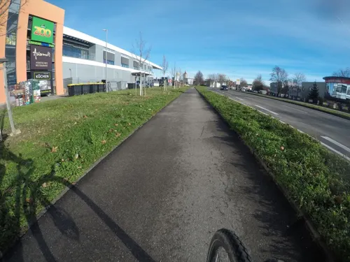
Asiamo
Restaurant · Japanese · 1.9 km
147 Stuttgarter Straße, Waiblingen
Mo-Su 11:30-15:00, 17:00-23:30
Besenwirtschaft Lausterer
Restaurant · Regional · 3.1 km
55 Neustädter Straße, Fellbach
Tu-Th 11:00-20:30; Fr,Sa 11:00-21:00; Su 11:00-21:00
Besenwirtschaft Weingut Lederer - Römerhof
Restaurant · Wine · 3.3 km
40 Sudetenstraße, Kernen im Remstal
"tbd"
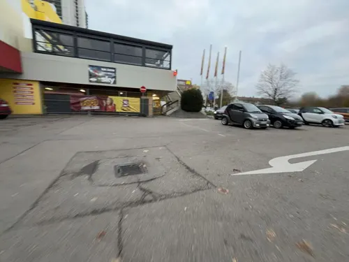


El Mero Mexicano
Restaurant · Mexican
117 Cannstatter Straße, Fellbach
We-Sa 18:00-23:00; Su 17:00-22:00
257 more on the map.
History
Fellbach was first mentioned as "Velbach" in 1121. The name "Velebach" appeared in 1357 and "Fehlbach" in 1800. Several landlords had possessions in Fellbach, the House Württemberg bought piece by piece. First, the village belonged to Oberamt Cannstatt. After its dissolution in 1923 Fellbach came to Oberamt Waiblingen, this became in 1938 Waiblingen district. After Fellbach had grown to the largest Württemberg village, the community was named October 14, 1933 for city. After World War II, the population crossed the 20,000 threshold. Therefore, Fellbach was appointed on April 1, 1956, to the district town in the district of Waiblingen.
Schmiden was first mentioned in 1225 as "Smidheim". Schmiden first belonged to Oberamt Waiblingen and only came in 1718 to Oberamt Cannstatt. After its dissolution in 1923 it came again to Oberamt Waiblingen, later district Waiblingen.
Oeffingen was first mentioned in 789 as "Villa Uffingen im Neckargau". Since this did not import the Reformation, Oeffingen remained Catholic. In 1618 Oeffingen was sold to the Chapter Augsburg and came due to the secularisation of 1803 to the Kingdom of Bavaria. The place was finally annexed in 1810 and assigned to Oberamt Cannstatt. After its dissolution in 1923 it came to Oberamt Waiblingen, later district Waiblingen.
From the History section of Fellbach on Wikipedia, under CC BY-SA 4.0.
Where to stay17
Best Western Plus Hotel Fellbach-Stuttgart
Motel and hotel
9 Tainer Straße, Fellbach
Hotel Gasthof Traube
Motel and hotel · German · 3.3 km
35/37 Hauptstraße, Kernen im Remstal
Churches and places of worship42
Friedenskirche (ev.-meth.)
Church · Methodist · 3.2 km
9 Kurze Straße, Kernen im Remstal
Heilige Geist, Rinnenäcker
Church · Catholic · 2.1 km
79 Gänsäckerstraße, Waiblingen
Herz Jesu-Kirche
Church · Roman Catholic · 3.5 km
55 Lortzingstraße, Kernen im Remstal
Shopping54
Gas and EV charging29
Schools, colleges and libraries40
State University of Music and Performing Arts Stuttgart
School · 7.5 km
Healthcare17
Adler-Apotheke
Clinic and pharmacy · 3.0 km
1 Fellbacher Straße, Kernen im Remstal
Map of Fellbach
250 places. The map loads OpenStreetMap tiles when you open it.
Getting there and nearby towns
Manfred Rommel Airport Stuttgart (STR) is the nearest airport with scheduled flights listed in OpenStreetMap, 14 km away.
- Waiblingen 4 km northeast, about 4 min by car
- Stuttgart 8 km west, about 8 min by car
- Korb 7 km northeast, about 7 min by car
- Kornwestheim 9 km northwest, about 9 min by car
- Ludwigsburg 12 km northwest, about 12 min by car
- Winnenden 12 km northeast, about 12 min by car
- Leutenbach 12 km northeast, about 12 min by car
- Leinfelden-Echterdingen 15 km southwest, about 15 min by car
- Neuhausen auf den Fildern 14 km south, about 14 min by car
- Möglingen 14 km northwest, about 14 min by car
Drive times are estimates from straight-line distance, not routes.
Local news
Headlines from INDB.
Reviews, tips and questions
Loading what members have shared...
Sources and licences
- GeoNames (CC BY 4.0): population, coordinates, regions and time zone
- Mapillary (see each image): photos
- OpenStreetMap contributors (ODbL 1.0): places, airports, map data
- Wikidata (CC0 1.0): elevation, founding date, time zone, website, landmarks and historic places
- Wikimedia Commons (see each image): photos
- Wikipedia (CC BY-SA 4.0): overview and history text
Photo credits
- Stadtbücherei Fellbach, Laserlicht, CC BY-SA 4.0
- Fellbach Lutherkirche Bushaltestelle, Laserlicht, CC BY-SA 4.0
- Fellbach Lutherkirche U1, No machine-readable author provided. Karlo assumed (based on copyright claims)., Public domain
- Fellbach Stadtbahn terminus - geo.hlipp.de - 4469, Dr Neil Clifton, CC BY-SA 2.0
- Berliner Platz Fellbach, Volksbank am Württemberg, CC BY-SA 4.0
- Stadtbahnhaltestelle-Fellbach-Lutherkirche 7259, ( MTheiler ), CC BY-SA 4.0
- Bücherei fellbach nacht, Laserlicht, CC BY-SA 4.0
- Fellbach - Lutherkirche - Innen - Organ, Ecelan, CC BY-SA 4.0
- Fellbach - Lutherkirche - Innen - Podium 01 (cropped), Ecelan, CC BY-SA 4.0
- Fellbach - Lutherkirche - Innen - Podium 01, Ecelan, CC BY-SA 4.0
- Lutherkirche Fellbach Orgel, Laserlicht, CC BY-SA 4.0
- Fellbach - Lutherkirche02, Ecelan, CC BY-SA 4.0
- Fellbach - Lutherkirche - Turm, Ecelan, CC BY-SA 4.0
- Fellbach - Lutherkirche01, Ecelan, CC BY-SA 4.0
- Fellbach - Lutherkirche - Innen - Kreuz (cropped), Ecelan, CC BY-SA 4.0
- Landappbw 387364 1821 Wohncity Fellbach, Martin Hahn, CC0
- Kugelpanorama in der Lutherkirche (Fellbach), Laserlicht, CC BY-SA 4.0
- Fellbach - Lutherkirche - Innen - Erntedank 2019 (02), Ecelan, CC BY-SA 4.0
- Fellbach - Lutherkirche - Innen - Erntedank 2019 (01), Ecelan, CC BY-SA 4.0
- Lutherkirche Fellbach Epitaph Bild 1, Unknown author Unknown author, Public domain
- Fellbach - Lutherkirche - Denkmal02, Ecelan, CC BY-SA 4.0
- Fellbach - Lutherkirche - Denkmal01, Ecelan, CC BY-SA 4.0
- Lutherkirche Fellbach Epitaph, Laserlicht, CC BY-SA 4.0
- Lutherkirche Fellbach Epitaph Bild 2, Unknown author Unknown author, Public domain
- Lutherkirche Fellbach Epitaph Bild 3, Unknown author Unknown author, Public domain
- Fellbach - Lutherkirche - Innen - Sitzplätze (02), Ecelan, CC BY-SA 4.0
- Fellbach - Lutherkirche - Innen - Sitzplätze (01), Ecelan, CC BY-SA 4.0
- Stadtbahnhaltestelle Fellbach Lutherkirche, Silesia711, CC BY-SA 4.0
- Lutherkirche Fellbach innen, Laserlicht, CC BY-SA 4.0
- Fellbach - Lutherkirche - Innen - Sitzplätze (03), Ecelan, CC BY-SA 4.0
- Lutherkirche Fellbach, Laserlicht, CC BY-SA 4.0
- Frühere Produktionsstätte der Alfred Ritter GmbH, Kostas Koufogiorgos, CC BY-SA 4.0
- Killesberg Tower, pjt56, CC BY 3.0
- Burgholzhofturm-pjt, pjt56 / --- If you use the picture outside Wikipedia I would appreciate a short e-mail to [email protected], CC BY-SA 3.0
- Theaterhaus Stuttgart Pragsattel, Andreas Feucht, CC BY-SA 3.0
- Wilhelma-Theater Bad Cannstatt 2, Brücke-Osteuropa, CC0
- StadtmuseumStuttgart, Silesia711, CC BY-SA 4.0
- Zanth, Karl Ludwig von, Ansicht der Wilhelma von 1855, Ludwig von Zanth, 1796-1857, Public domain
- Stuttgart Evang. Friedenskirche, Bear62, CC BY 3.0
- Stuttgart HochschuleFuerMusikUndDarstellendeKunst, Unknown author, CC BY-SA 3.0
- Schwabenlandhalle (Fellbach) Mth 7246, ( MTheiler ), CC BY-SA 4.0
- Grabkapelle Württemberg Eingang (2009), Jochen Teufel, CC BY-SA 3.0
- Stuttgart-Sommerrain Heilig-Kreuz-Kirche, MSeses, CC BY-SA 3.0
- Stuttgart Albertus-Magnus-Gymnasium, MSeses, CC BY-SA 3.0
- Naturschutzgebiet-Kappelberg, Reiner Ugele, CC BY-SA 4.0
- F3 Fellbach, Laserlicht, CC BY-SA 4.0
- Traumpalast Waiblingen, Laserlicht, CC BY 4.0
- Rommelshausen herzjesu, H.-P. Rothmund, CC BY 3.0
- Germany, Baden-W., Fellbach, Stadtmuseum, Diego.fellbach, CC BY-SA 3.0
- Fellbach - Wichernschule, Ecelan, CC BY-SA 4.0
- Krankenhaus Bad Cannstatt Mth 7424, ( MTheiler ), CC BY-SA 4.0
- Elly-Heuss-Knapp-Gymnasium Stuttgart-Bad Cannstatt, Skrippek, CC BY-SA 4.0
- Gottlieb-Daimler-Gymnasium Stuttgart Mth 1, ( MTheiler ), CC BY-SA 4.0
- Anne-Frank-Schule Fellbach MTh 2, ( MTheiler ), CC BY-SA 4.0
- Sommerrainkirche Stuttgart, MSeses, CC BY-SA 3.0
- Cannstatt Andreäkirche, MSeses, CC BY-SA 3.0
- Kappelbergstraße 28 (Stuttgart-Untertürkheim) St. Johanneskirche, R.kaelcke, CC BY-SA 4.0
- Stuttgart-Untertürkheim Evang. Wallmerkirche 1, Bear62, CC BY 3.0
- Alter Pfarrhof (Rommelshausen), Laserlicht, CC BY-SA 4.0
- Friedenskirche Rommelshausen, Laserlicht, CC BY-SA 4.0
- Stuttgart-Uhlbach-Kapf-04, MTheiler, CC BY-SA 3.0
- Best western fellbach, Laserlicht, CC BY-SA 4.0
- Waiblingen heiliggeist ansicht1600x1200 hp rothmund, hp rothmund, CC BY 3.0
- Evang. Johannes-Brenz-Kirche Fellbach, Bear62, CC BY 3.0
- Stolperstein Ernst Rohatsch, User:Enslin, CC BY-SA 4.0
- Saint Dionysios Schmiden 7, Sarang, Public domain
- Grab der Widerstandsgruppe Schlotterbeck - Friedhof Untertürkheim I, Reutlingendorf, CC BY-SA 4.0
- Stolperstein - Stuttgart - Pfalzstraße 66 - Isidor, Lina, Adolf Cahn, Croesch, CC BY-SA 4.0
- Stolperstein - Stuttgart - Pfalzstraße 36 - Ferdinand, Alexandrine, Ury Guggenheim, Croesch, CC BY-SA 4.0
- Stolperstein Anna Brischar Ruhrstr 93 70374 Stuttgart, Thilo Parg, CC BY-SA 4.0
- Stolperstein Carl Frey Ihmlingstr 40 70374 Stuttgart, Thilo Parg, CC BY-SA 4.0
- Stolperstein - Stuttgart - Taubenheimstraße 60 - Edwin Spiro, Croesch, CC BY-SA 4.0
- Stolperstein Eugenie Wolf Ihmlingstr 50 70374 Stuttgart 2, Thilo Parg, CC BY-SA 4.0
- Wais 1955.2, 146, NN, erwähnt 1860, Public domain
- Killesbergpark - panoramio, qwesy qwesy, CC BY 3.0
- Restaurant Alte Kelter in Stuttgart-Untertürkheim - panoramio, qwesy qwesy, CC BY 3.0
- Street-level photo, VIA_CH, CC BY-SA 4.0
- Street-level photo, openjeki, CC BY-SA 4.0
- Street-level photo, bct, CC BY-SA 4.0
- Street-level photo, mfa, CC BY-SA 4.0
- Street-level photo, mfa, CC BY-SA 4.0
- Street-level photo, openjeki, CC BY-SA 4.0
- Street-level photo, bct, CC BY-SA 4.0
- Street-level photo, VIA_CH, CC BY-SA 4.0
- Street-level photo, mfa, CC BY-SA 4.0
- Street-level photo, bct, CC BY-SA 4.0
- Street-level photo, VIA_CH, CC BY-SA 4.0
- Street-level photo, sno, CC BY-SA 4.0
- Street-level photo, VIA_CH, CC BY-SA 4.0
- Street-level photo, mfa, CC BY-SA 4.0
- Street-level photo, mfa, CC BY-SA 4.0
- Street-level photo, mfa, CC BY-SA 4.0
- Street-level photo, jdspam, CC BY-SA 4.0
- Street-level photo, bct, CC BY-SA 4.0
- Street-level photo, tymmmy, CC BY-SA 4.0
- Street-level photo, tobi7524, CC BY-SA 4.0
- Street-level photo, openjeki, CC BY-SA 4.0
- Street-level photo, mfa, CC BY-SA 4.0
- Street-level photo, bct, CC BY-SA 4.0


Page built November 8, 2026. Spotted a mistake? Tell us or suggest a place.