


Why visit Haar
Townapedia lists 11 museums and landmarks, 28 parks and trails, 117 places to eat, 15 places to stay and 10 attractions in and around town.
Highlights include Haarer Kinos, Habeker Hof, Kindermuseum München and Haus der Donauschwaben.
Weather in Haar
Forecast from MET Norway (CC BY 4.0). Full forecast
About Haar
Haar (German pronunciation: [ˈhaːɐ̯] ) is a town in the district of Munich, in Bavaria, Germany. It is 12 km east of Munich (centre). As of 2023, it had a population of more than 23,000.
From the Wikipedia article Haar, Bavaria (this version), under CC BY-SA 4.0.
Things to do10
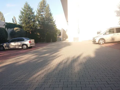



FestSpielHaus
Cinema and theater · 6.2 km
Youth theater and education center in Munich, Bavaria, Germany



Aussichtsturm
Scenic view · 2.1 km
Aussichtsturm mit Western-Windmühle (Westernmill) über der Aussichtsplattform
Museums and landmarks11

Kindermuseum München
Museum · 3.5 km
10 Willy-Brandt-Allee, München
Th,Fr 14:00-17:00; Sa,Su 10:00-17:00; Mo-We off



Mahnmal für die Opfer der nationalsozialistischen Euthanasie
Monument and historic site · 1.7 km

Parks, trails and playgrounds28





Spielplatz Bauernweg
Playground · 3.5 km
08:00-12:00,14:00-20:00

16 more on the map.
Restaurants and cafes117
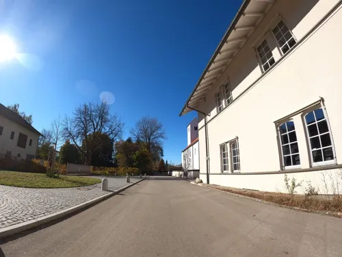
Gasthof Gut Keferloh
Restaurant · Regional · 1.4 km
2 Im Keferloh, Grasbrunn
We-Su 12:00-22:00; Mo-Tu off
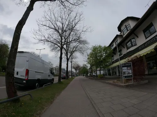
Truderinger Waldwirtschaft
Restaurant · Regional · 1.2 km
272 Wasserburger Landstraße, München
Mo-Su 11:00-21:00

AMICI Haar
Restaurant · Italian · 1.1 km
5 Casinostraße, Haar
Tu-Fr, Su 11:30-14:30, 18:00-23:00; Sa 18:00-23:00; Mo off
Bella Sicilia
Restaurant · Italian
5 Leibstraße, Haar
Mo,We-Fr 11:30-14:30,17:30-22:00; Sa,Su 11:30-22:00
Bella Vista
Restaurant · Italian · 1.6 km
244 Wasserburger Landstraße, München
Mo-Sa 11:30-14:30,17:30-22:00
Bon Bon
Restaurant · Vietnamese · 0.6 km
25 Münchener Straße, Haar
Su-Fr 11:30-14:00,17:30-22:30; Sa 17:30-23:00
Cavo Paradiso
Restaurant · Greek · 2.2 km
2 Rotkehlchenweg, München
Mo off; Tu-Fr 16:30-22:00; Sa-Su,PH 11:30-22:00
Croatica
Restaurant · Balkan · 1.7 km
225 Wasserburger Landstraße, München
Tu-Su 11:00-15:00,17:00-24:00
Der Pavillon
Restaurant · International · 1.9 km
10 Tangastraße, München
Tu-Fr 09:00-17:30; Sa 09:00-13:00


Der Wolfsbarsch
Restaurant · Fish, Sushi · 3.3 km
10 Wendelsteinstraße, Vaterstetten
Tu-Fr 09:00-19:00; Sa 09:00-14:30
105 more on the map.
Where to stay15
B&B Hotel München-Putzbrunn
Motel and hotel · 3.5 km
26a Michael-Haslbeck-Straße, Putzbrunn
Churches and places of worship26
Heilig Kreuz
Church · Roman Catholic · 1.9 km
1 Lorenz-Huber-Straße, Haar
Mariä Himmelfahrt
Church · Roman Catholic · 2.5 km
10 Johann-Karg-Straße, Haar
Mariä Sieben Schmerzen
Church · Roman Catholic · 1.2 km
24 Max-Mannheimer-Ring, Haar
Sankt Martin
Church · Catholic · 2.4 km
31 Feldkirchener Straße, Haar
Shopping37
Gas and EV charging9
Schools, colleges and libraries21
Healthcare8
Widder-Apotheke
Clinic and pharmacy · 1.7 km
226 Wasserburger Landstraße, München
Map of Haar
250 places. The map loads OpenStreetMap tiles when you open it.
Getting there and nearby towns
Munich International Airport (MUC) is the nearest airport with scheduled flights listed in OpenStreetMap, 28 km away.
- Vaterstetten 3 km east, about 3 min by car
- Neubiberg 6 km southwest, about 6 min by car
- Unterhaching 10 km southwest, about 10 min by car
- Poing 10 km northeast, about 10 min by car
- Munich 12 km west, about 12 min by car
- Taufkirchen 11 km southwest, about 11 min by car
- Unterföhring 11 km northwest, about 11 min by car
- Oberhaching 13 km southwest, about 13 min by car
- Markt Schwaben 14 km northeast, about 14 min by car
- Ismaning 14 km north, about 14 min by car
Drive times are estimates from straight-line distance, not routes.
Local news
Headlines from INDB.
Reviews, tips and questions
Loading what members have shared...
Sources and licences
- GeoNames (CC BY 4.0): population, coordinates, regions and time zone
- Mapillary (see each image): photos
- OpenStreetMap contributors (ODbL 1.0): places, airports, map data
- Wikidata (CC0 1.0): elevation, founding date, time zone, website, landmarks and historic places
- Wikimedia Commons (see each image): photos
- Wikipedia (CC BY-SA 4.0): overview and history text
Photo credits
- Bahnhofstr 7-2 Haar-01, AHert, CC BY-SA 3.0
- St. Konrad von Parzham Haar 01, H.Helmlechner, CC BY-SA 4.0
- St. Konrad von Parzham Haar 02, H.Helmlechner, CC BY-SA 4.0
- Kriegerdenkmal bei Sankt Konrad (Haar bei München) 02, Wikitarisch, CC BY 4.0
- Kriegerdenkmal bei Sankt Konrad (Haar bei München) 05, Wikitarisch, CC BY 4.0
- Kriegerdenkmal bei Sankt Konrad (Haar bei München) 06, Wikitarisch, CC BY 4.0
- Kriegerdenkmal bei Sankt Konrad (Haar bei München) 07, Wikitarisch, CC BY 4.0
- Kriegerdenkmal bei Sankt Konrad (Haar bei München) 08, Wikitarisch, CC BY 4.0
- Kriegerdenkmal bei Sankt Konrad (Haar bei München) 10, Wikitarisch, CC BY 4.0
- Kriegerdenkmal bei Sankt Konrad (Haar bei München) 11, Wikitarisch, CC BY 4.0
- Kriegerdenkmal bei Sankt Konrad (Haar bei München) 09, Wikitarisch, CC BY 4.0
- Kriegerdenkmal bei Sankt Konrad (Haar bei München) 03, Wikitarisch, CC BY 4.0
- Kriegerdenkmal bei Sankt Konrad (Haar bei München) 04, Wikitarisch, CC BY 4.0
- Kriegerdenkmal bei Sankt Konrad (Haar bei München) 01, Wikitarisch, CC BY 4.0
- Festspielhaus Neuperlach-1, Rufus46, CC BY-SA 3.0
- Ostpark Muenchen-4, Rufus46, CC BY-SA 3.0
- Maria Rosenkranzkoenigin Neubiberg-1, Rufus46, CC BY-SA 3.0
- Kindermuseum Mch Aussen 2, Tkarcher, CC BY-SA 3.0
- RiemerParkVomBugaHuegelAus, Gentlesea, CC BY-SA 4.0
- Ernst-Mach-Gymnasium Haar bei München, 2014, Deltastrahlung, CC BY-SA 4.0
- Kapelle Solalinden Putzbrunn-1, Rufus46, CC BY-SA 3.0
- Kirche Vaterstetten-01, AHert, CC BY-SA 3.0
- 8. Mai 2020 – Gedenkstätte für die Opfer der »Euthanasie« Haar – Behütet die Kinder, no bias — קיין אומוויסנדיקע פּרעפֿערענצן — keyn umvisndike preferentsn, CC BY-SA 4.0
- MariaeHimmelfahrt Salmdorf-01, AHert, CC BY-SA 3.0
- Feldkirchener Str. 31 St. Martin Ottendichl Haar-1, Rufus46, CC BY-SA 3.0
- Gronsdorf, Hl-Kreuz-Kirche v N, 1, Renardo la vulpo, CC0
- Wegkapelle Haar, Imalipusram, CC BY-SA 3.0
- Casinostr. 78 Anstaltskirche Sieben Schmerzen Mariae Haar-7 (bearb Sp), Rufus46, CC BY-SA 3.0
- Vaterstetten, Blutkirche v N, 1, Renardo la vulpo, CC BY-SA 4.0
- Blick auf den Habeker Hof in Haar in Richtung Eingang 2022-10-10, Strubbl, CC BY-SA 4.0
- München-Messestadt Riem, Sophienkirche (Vordergrund), St. Florian (Hintergrund) und gemeinsamer Kirchturm (1), Cmcmcm1, CC BY-SA 4.0
- Jesuskirche Haar 3, Edelmauswaldgeist, CC0
- St. Bonifatius Haar bei Muenchen-6, Rufus46, CC BY-SA 4.0
- Neukeferloh, St. Christophorus (Außenansicht) (5), Cmcmcm1, CC BY-SA 4.0
- Uta-Brunnen Munich, Truchtaro, Public domain
- Abflug riem, Pahu, CC BY 3.0
- München, Adlerstr., Häherweg, Spielplatz, MrTux, CC BY 4.0
- Riemer Park Luftbild, HardDisk, CC BY-SA 4.0
- Kapelle Solalinden Putzbrunn-2, Rufus46, CC BY-SA 3.0
- Mapillary (osmplus org) 2026-03-22 10H44M02S833 (912589484930554 at 6PMaZbAo8V4FyKrD1vwjRc), osmplus_org, CC BY-SA 4.0
- Aussichtsturm Gronsdorf, Muck, CC BY-SA 4.0
- Haar — Vockestrasse 76 (Psychiatriemuseum) — Medikamentenschachteln, User:Mattes, CC BY 2.0 de
- Kürbisgarten vom Habeker Hof in Haar 2022-10-10, Strubbl, CC BY-SA 4.0
- Street-level photo, umap, CC BY-SA 4.0
- Street-level photo, strubbl, CC BY-SA 4.0
- Street-level photo, strubbl, CC BY-SA 4.0
- Street-level photo, strubbl, CC BY-SA 4.0
- Street-level photo, ente, CC BY-SA 4.0
- Street-level photo, strubbl, CC BY-SA 4.0
- Street-level photo, tonicity, CC BY-SA 4.0
- Street-level photo, umap, CC BY-SA 4.0
- Street-level photo, strubbl, CC BY-SA 4.0
- Street-level photo, umap, CC BY-SA 4.0
- Street-level photo, umap, CC BY-SA 4.0
- Street-level photo, strubbl, CC BY-SA 4.0
- Street-level photo, flo2154, CC BY-SA 4.0
- Street-level photo, umap, CC BY-SA 4.0
- Street-level photo, umap, CC BY-SA 4.0
- Street-level photo, umap, CC BY-SA 4.0
- Street-level photo, strubbl, CC BY-SA 4.0
- Street-level photo, umap, CC BY-SA 4.0
- Street-level photo, tonicity, CC BY-SA 4.0
- Street-level photo, umap, CC BY-SA 4.0
- Street-level photo, umap, CC BY-SA 4.0
- Street-level photo, flo2154, CC BY-SA 4.0
- Street-level photo, umap, CC BY-SA 4.0
- Street-level photo, umap, CC BY-SA 4.0
- Street-level photo, strubbl, CC BY-SA 4.0
- Street-level photo, umap, CC BY-SA 4.0
- Street-level photo, umap, CC BY-SA 4.0
- Street-level photo, chri_som, CC BY-SA 4.0
- Street-level photo, nrailuj, CC BY-SA 4.0
- Street-level photo, it_s_so_funny, CC BY-SA 4.0


Page built November 8, 2026. Spotted a mistake? Tell us or suggest a place.