


Why visit Oberhaching
Townapedia lists 30 museums and landmarks, 24 parks and trails, 111 places to eat, 14 places to stay and 9 attractions in and around town.
Highlights include Schafflers Hofladen, Teatro Solln, Heimathaus Wolfschneiderhof and Heimatmuseum.
Weather in Oberhaching
Forecast from MET Norway (CC BY 4.0). Full forecast
About Oberhaching
Oberhaching (German pronunciation: [oːbɐˈhaxɪŋ] , lit. 'Upper Haching', in contrast to "Lower Haching") is a municipality in Bavaria, Germany, with 13,638 inhabitants (2020) on an area of 26.6 km2 (10.3 sq mi). It is located 15 km (9.3 mi) south of Munich city centre and has a 1,250 year history.
From the Wikipedia article Oberhaching (this version), under CC BY-SA 4.0.
Things to do9


Teatro Solln
Cinema and theater · 8.0 km
German restaurant and theatre




Museums and landmarks30

Heimathaus Wolfschneiderhof
Museum · 2.8 km
Hakenhofanlage, Wohnteil verputzt, Ende 18./Anfang 19. Jh.
12 Münchener Straße, Taufkirchen
"nach Vereinbarung"


Kriegerdenkmal
Monument and historic site · 2.6 km
Kriegerdenkmal zur Erinnerung an den Krieg 1866 und 1870/71, große Gussfigur von Hygin Kiene, 1910; über Sockel mit Gedenkinschrift für...

Ehem. Bahnhof Taufkirchen-Unterhaching
Monument and historic site · 3.1 km
Zweigeschossiger historisierender Blankziegelbau mit Schopfwalmdach, um 1900; Nebengebäude, eingeschossiger Backsteinbau mit Satteldach,...
1 Am Bahnsteig, Taufkirchen




Beim Kaindl
Monument and historic site · 2.7 km
Ehem. Bauernhaus (Beim Kaindl), Wohnteil zweigeschossiger Blockbau, mit Laube, 1776 (Wirtschaftsteil 1980 ausgebaut)
20 Hohenbrunner Weg, Taufkirchen
18 more on the map.
Parks, trails and playgrounds24

Klettergarten Ortspark
Playground · 4.6 km
Mo-Su,PH 08:00-dusk;"spätestens bis 22:00"

Spielplatz A. Schrobenhauser Weg
Playground · 4.8 km
Mo-Su,PH 08:00-dusk;"spätestens bis 22:00"
Spielplatz Blütenweg
Playground · 5.0 km
Mo-Su,PH 08:00-dusk;"spätestens bis 22:00"
Spielplatz Budapester Straße
Playground · 5.0 km
Mo-Su,PH 08:00-dusk;"spätestens bis 22:00"
Spielplatz Eponaweg
Playground · 4.7 km
Mo-Su,PH 08:00-dusk;"spätestens bis 22:00"
Spielplatz Leber Str.
Playground · 4.8 km
Mo-Su,PH 08:00-dusk;"spätestens bis 22:00"
Spielplatz Ortspark
Playground · 4.5 km
Mo-Su,PH 08:00-dusk;"spätestens bis 22:00"
Spielplatz Ortspark Hangrutsche
Playground · 4.5 km
Mo-Su,PH 08:00-dusk;"spätestens bis 22:00"
Spielplatz Ortspark Kletternetz
Playground · 4.5 km
Mo-Su,PH 08:00-dusk;"spätestens bis 22:00"
Spielplatz Ortspark Seilbahn
Playground · 4.5 km
Mo-Su,PH 08:00-dusk;"spätestens bis 22:00"
12 more on the map.
Restaurants and cafes111

Wirtshaus Franz Xaver
Restaurant · Regional · 2.1 km
93 Linienstraße, Oberhaching
We-Sa 12:00-22:00; Su 12:00-21:00
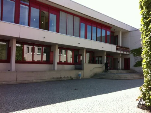

3sine Deisenhofen
Restaurant · 1.1 km
1 Bahnhofplatz, Oberhaching
Mo,Th,Fr 11:30-22:00; Sa 09:00-23:00; Su 09:00-21:00; Tu,We off
Althaching
Restaurant · Regional · 4.7 km
1 Rathausplatz, Unterhaching
Mo-Sa 11:30-14:30,17:00-23:00; Su 11:30-14:30,17:00-21:00
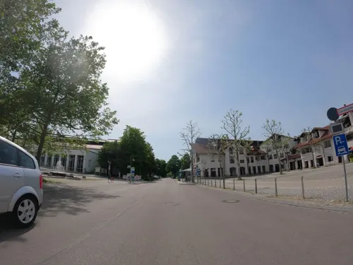
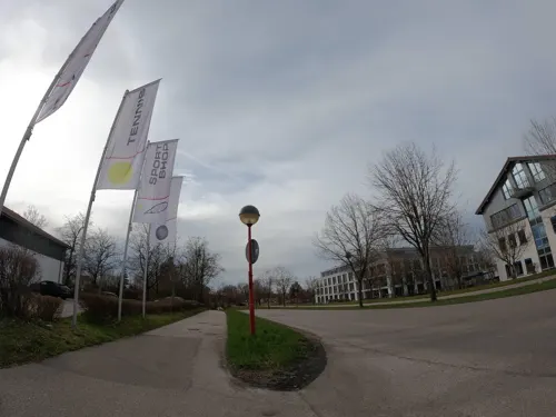
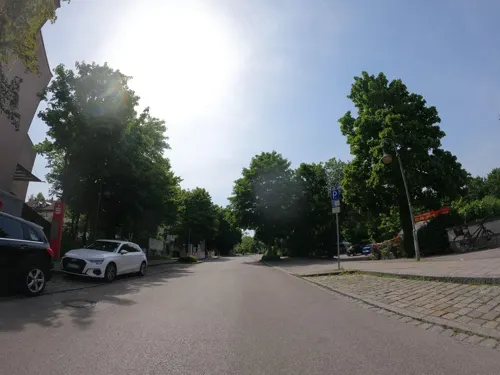
Kilimanjaro Café & Restaurant
Restaurant · African · 2.8 km
22 Köglweg, Taufkirchen
Mo off; Tu-Fr 10:00-22:00; Sa,Su,PH 11:30-22:00
Kugler Alm
Bar and pub · Regional · 2.1 km
93 Linienstraße, Oberhaching
Tu-Su 10:30-22:30; Mo 10:30-22:30 "nur bei schönem Wetter"



Marielitas
Restaurant · Mexican, Burger · 5.1 km
5 Zusestraße, Brunnthal
Mo,We-Th 15:00-23:00; Tu off; Fr 14:00-24:00; Sa 13:00-24:00; Su...
99 more on the map.
History
The term “Oberhaching” (Latin: ad superius Hachingen) first appeared in 1140 in the transfer documents of the Schäftlarn Abbey.
The oldest architectural remains in Oberhaching can be found in the originally Romanesque church of St. Stephan (since 750 AD). Nothing remains of the surrounding wooden huts of the farmers. The oldest wooden farmhouses still standing today date from the 19th century. The current annex of the Oberhaching elementary school dates from 1872.
The town received a new boost with the construction of the railway. Since 1856, there has been a railway line from Munich Central Station via the Großhesseloher Bridge to Deisenhofen and on to Holzkirchen. In 1898, the second railway line was opened from Deisenhofen along the Hachinger Valley via Taufkirchen and Unterhaching to Munich East station.
In 1925, Robert Vorhoelzer and Fritz Norkauer built the Deisenhofen post office. In 1934, the Furth train stop was opened.
Johann Rattenhuber (1897–1957), who was from Oberhaching, rose to the rank of lieutenant general in the police force during World War II. Eleonore Baur (1885–1981), a National Socialist, lived and died in Oberhaching.
From the History section of Oberhaching on Wikipedia, under CC BY-SA 4.0.
Where to stay14
NH Hotel München Unterhaching
Motel and hotel · 4.8 km
1 Leipziger Straße, Unterhaching
Churches and places of worship19
St. Ulrich Kapelle
Church · Catholic · 4.3 km
1 St.-Ulrich-Weg, Sauerlach
Shopping42
Gas and EV charging7
Schools, colleges and libraries25
Geschäftsstelle und Kurszentrum Volkshochschule Oberhaching
School · 1.3 km
6 Raiffeisenallee, Oberhaching
Healthcare11
Map of Oberhaching
250 places. The map loads OpenStreetMap tiles when you open it.
Getting there and nearby towns
Sonderflughafen Oberpfaffenhofen (OBF) is the nearest airport with scheduled flights listed in OpenStreetMap, 24 km away.
- Taufkirchen 3 km northeast, about 3 min by car
- Unterhaching 5 km north, about 5 min by car
- Munich 13 km north, about 13 min by car
- Vaterstetten 16 km northeast, about 16 min by car
- Planegg 16 km northwest, about 16 min by car
- Wolfratshausen 18 km southwest, about 18 min by car
- Starnberg 19 km west, about 19 min by car
- Unterföhring 19 km north, about 19 min by car
- Puchheim 23 km northwest, about 23 min by car
- Poing 23 km northeast, about 23 min by car
Drive times are estimates from straight-line distance, not routes.
Local news
Headlines from INDB.
Reviews, tips and questions
Loading what members have shared...
Sources and licences
- GeoNames (CC BY 4.0): population, coordinates, regions and time zone
- Mapillary (see each image): photos
- OpenStreetMap contributors (ODbL 1.0): places, airports, map data
- Wikidata (CC0 1.0): elevation, founding date, time zone, website, landmarks and historic places
- Wikimedia Commons (see each image): photos
- Wikipedia (CC BY-SA 4.0): overview and history text
Photo credits
- Oberhaching-1, Rufus46, CC BY-SA 3.0
- Gaststätte Iberl, Gras-Ober, CC BY-SA 3.0
- Maria Rosenkranzkoenigin Neubiberg-1, Rufus46, CC BY-SA 3.0
- University of the Bundeswehr Munich main library, Hiwimunich, Public domain
- Gymnasium Oberhaching-3, Rufus46, CC BY-SA 4.0
- Wallfahrtskirche Benefiziatenhaus Kreuzpullach-3, Rufus46, CC BY-SA 3.0
- Unterhaching Sankt Korbinian Kirche 2012-06-03, LepoRello, CC BY-SA 3.0
- Bildstock Tuffsteinpfeiler Baudenkmal 08, Rolandhartmann, CC BY-SA 3.0
- FJG-Set, Spinner110, CC BY-SA 3.0
- Heimatmuseum Uhg-1, Flo Sorg, CC0
- Perlacher Mugl, Richard Bartz, CC BY-SA 3.0
- St. Johannes der Täufer (Taufkirchen), 2023-02-26, 2015 Michael 2015, CC BY-SA 4.0
- Kriegerdenkmal Taufkirchen-1, Rufus46, CC BY-SA 3.0
- HofkapelleTaufkirchen-Pötting, Rolandhartmann, CC BY-SA 3.0
- St. Ulrich Sauerlach-4, Rufus46, CC BY-SA 3.0
- Taufkirchen (bei München), Pfarrkirche St. Georg (1), Cmcmcm1, CC BY-SA 4.0
- Unterhaching, Heilandskirche, Cmcmcm1, CC BY-SA 4.0
- Grünwald, Kirche Maria Königin, 1, Aisano, CC0
- Neuapostolische Kirche Unterhaching-1, Rufus46, CC BY-SA 3.0
- Kirche Zum Guten Hirten (Oberhaching) 1, Ricardalovesmonuments, CC BY-SA 4.0
- Wolfschneiderhof Taufkirchen bei Muenchen-1, Rufus46, CC BY-SA 3.0
- Taufkirchen - Bahnhof - geo.hlipp.de - 9887, Ulrich Meier, CC BY-SA 2.0
- Oberhaching Kirchplatz Kriegerdenkmal, Rudolph Buch, CC0
- Roemer Saeule, Servak11, CC BY-SA 3.0 de
- Taufkirchen bei Muenchen-2, Rufus46, CC BY-SA 3.0
- Unterhaching St. Korbinian-1, Rufus46, CC BY-SA 4.0
- Kugler Alm, Oliver Raupach, CC BY-SA 2.5
- St. Ulrich (Lanzenhaar), 2024-07-27, 2015 Michael 2015, CC BY-SA 4.0
- Schönberg (Grünwalder Forst), Wasquewhat, CC BY 4.0
- Street-level photo, freeview, CC BY-SA 4.0
- Street-level photo, strubbl, CC BY-SA 4.0
- Street-level photo, strubbl, CC BY-SA 4.0
- Street-level photo, utack, CC BY-SA 4.0
- Street-level photo, strubbl, CC BY-SA 4.0
- Street-level photo, strubbl, CC BY-SA 4.0
- Street-level photo, strubbl, CC BY-SA 4.0
- Street-level photo, strubbl, CC BY-SA 4.0
- Street-level photo, strubbl, CC BY-SA 4.0
- Street-level photo, freeview, CC BY-SA 4.0
- Street-level photo, umap, CC BY-SA 4.0
- Street-level photo, strubbl, CC BY-SA 4.0
- Street-level photo, strubbl, CC BY-SA 4.0
- Street-level photo, umap, CC BY-SA 4.0
- Street-level photo, ottor, CC BY-SA 4.0
- Street-level photo, umap, CC BY-SA 4.0
- Street-level photo, strubbl, CC BY-SA 4.0
- Street-level photo, utack, CC BY-SA 4.0
- Street-level photo, utack, CC BY-SA 4.0
- Street-level photo, utack, CC BY-SA 4.0
- Street-level photo, strubbl, CC BY-SA 4.0
- Street-level photo, strubbl, CC BY-SA 4.0
- Street-level photo, strubbl, CC BY-SA 4.0
- Street-level photo, utack, CC BY-SA 4.0
- Street-level photo, strubbl, CC BY-SA 4.0
- Street-level photo, strubbl, CC BY-SA 4.0
- Street-level photo, strubbl, CC BY-SA 4.0
- Street-level photo, strubbl, CC BY-SA 4.0
- Street-level photo, strubbl, CC BY-SA 4.0
- Street-level photo, strubbl, CC BY-SA 4.0
- Street-level photo, utack, CC BY-SA 4.0


Page built November 8, 2026. Spotted a mistake? Tell us or suggest a place.