


Heddesheim, Germany
Heddesheim is a town of 11,544 people in Baden-Wurttemberg, Germany.
Why visit Heddesheim
Townapedia lists 15 museums and landmarks, 12 parks and trails, 114 places to eat, 12 places to stay and 9 attractions in and around town.
Highlights include Kinopolis, hegehof, Automuseum Dr. Carl Benz and Heimatmuseum.
Weather in Heddesheim
Forecast from MET Norway (CC BY 4.0). Full forecast
About Heddesheim
Heddesheim is a municipality in the district of Rhein-Neckar-Kreis, in Baden-Württemberg, Germany. It is situated 9 km east of Mannheim, and 7 km southwest of Weinheim.
From the Wikipedia article Heddesheim (this version), under CC BY-SA 4.0.
Things to do9

Kinopolis
Cinema and theater · 3.6 km
8 Robert-Schuman-Straße, Viernheim
Mo-Sa 13:00-01:00; Su 12:00-01:00

Obsthof Bitzel
Farm and orchard · 3.3 km
22 Lobdengaustraße, Hirschberg an der Bergstraße
Mo-Fr 08:00-18:00;Sa 08:00-16:00
Obsthof Volk
Farm and orchard · 3.5 km
17 In den Langen, Schriesheim
Feb-Dec Mo-Fr 09:00-12:00,15:00-18:30; Sa 09:00-14:00; Jan Fr...
Hofladen Wolk
Farm and orchard · 2.5 km
7 Am Straßenheimer Weg, Viernheim
Mo,We,Th,Fr 09:30-12:00; Sa 09:30-13:00; PH off

Museums and landmarks15




3 more on the map.
Parks, trails and playgrounds12






Restaurants and cafes114
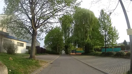
Akropolis
Restaurant · Greek · 3.7 km
Warme Küche bis 22 Uhr
4 Riedweg, Hirschberg an der Bergstraße
Mo,We,Th,Fr,Sa 17:00-24:00; Su,PH 11:30-14:30,17:00-23:00
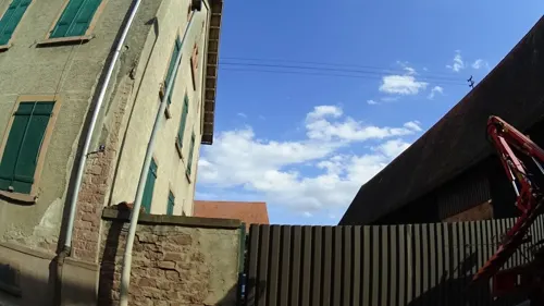
Hotel Landgasthof Bühlerhof
Restaurant · 2.9 km
*** Bis auf weiteres nur Hotel geöffnet, Restaurant geschlossen.
13, Heddesheim
Mo-Su off; Su,PH off
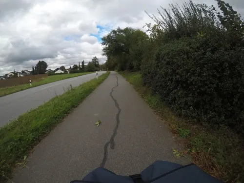
ATB Vereinshaus
Restaurant · Greek · 1.2 km
66 Ahornstraße, Heddesheim
Mo,We-Sa 17:00-24:00; Su 10:30-14:30,17:00-24:00
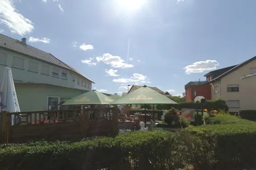
Akropolis
Restaurant · Greek · 0.7 km
15 Lessingstraße, Heddesheim
Mo-Sa 17:00-24:00;Tu off; Su,PH 11:30-14:30, 17:00-24:00

Bäckerei Riegler
Cafe · 3.8 km
21 Bahnhofstraße, Ladenburg
Mo-Fr 06:00-18:30; Sa 06:00-13:00; Su 08:00-17:00
Bäckerei Theurer
Cafe · Coffee Shop, Ice Cream, Juice, Cake, Pasta · 0.9 km
2a Odenwaldstraße, Heddesheim
Mo-Su 06:00-19:00
Cozy & Tasty
Restaurant · Burger, American · 3.6 km
8 Robert-Schuman-Straße, Viernheim
Mo off; Tu-Th 15:00-22:00; Fr 15:00-22:30; Sa 13:00-22:30; Su 13:00-22:00

Goldener Hirsch
Restaurant · German · 3.8 km
18 Hauptstraße, Ladenburg
Mo-Tu 17:30-00:00, Th-Sa 17:30-00:00, Su 11:30-00:00, We off
L'Osteria
Restaurant · Italian · 3.5 km
16 Bürgermeister-Neff-Straße, Viernheim
Mo-Th 11:30-23:00; Fr-Sa 11:30-24:00; Su 12:00-23:00; PH 12:00-23:00
TG-Vereinsgaststätte
Restaurant · Regional · 1.2 km
64 Ahornstraße, Heddesheim
Tu-Sa 17:00-01:00, Su 12:00-14:30,17:00-22:00


102 more on the map.
Where to stay12
Roatel Hirschberg an der Bergstraße (A5)
Motel and hotel · 2.5 km
1 Goldbeckstraße, Hirschberg an der Bergstraße
Hotel Garni Am Kapellenberg
Motel and hotel · 3.5 km
59 Mannheimer Straße, Viernheim
Roatel Hirschberg an der Bergstraße
Motel and hotel · 2.5 km
1 Goldbeckstraße, Hirschberg an der Bergstraße
Churches and places of worship12
Evangelische Stadtmission Ladenburg
Church · Lutheran · 3.8 km
4 Friedrich-Hecker-Weg, Ladenburg
DITIB Türkisch-Islamischer Kulturverein
Place of worship · 2.4 km
12 Hohe Straße, Ladenburg
Shopping46
Gas and EV charging10
Viernheim - Rhein-Neckar-Zentrum Supercharger
EV charging · 3.7 km
8 Robert-Schuman-Straße, Viernheim
Schools, colleges and libraries6
Healthcare9
Map of Heddesheim
245 places. The map loads OpenStreetMap tiles when you open it.
Getting there and nearby towns
City-Airport Mannheim (MHG) is the nearest airport with scheduled flights listed in OpenStreetMap, 7 km away.
- Ladenburg 4 km south, about 4 min by car
- Schriesheim 6 km southeast, about 6 min by car
- Weinheim 7 km northeast, about 7 min by car
- Mannheim 10 km west, about 10 min by car
- Hemsbach 10 km north, about 10 min by car
- Ludwigshafen am Rhein 12 km west, about 12 min by car
- Heidelberg 13 km southeast, about 13 min by car
- Schwetzingen 14 km south, about 14 min by car
- Oftersheim 16 km south, about 16 min by car
- Ketsch 16 km south, about 16 min by car
Drive times are estimates from straight-line distance, not routes.
Local news
Headlines from INDB.
Reviews, tips and questions
Loading what members have shared...
Sources and licences
- GeoNames (CC BY 4.0): population, coordinates, regions and time zone
- Mapillary (see each image): photos
- OpenStreetMap contributors (ODbL 1.0): places, airports, map data
- Wikidata (CC0 1.0): elevation, founding date, time zone, website
- Wikimedia Commons (see each image): photos
- Wikipedia (CC BY-SA 4.0): overview and history text
Photo credits
- Heddesheim Altes Rathaus 20101109, Rudolf Stricker, Attribution
- Heddesheim evangelische Kirche 20110315, Rudolf Stricker, Attribution
- Heddesheim St. Remigius-Kirche 20110315, Rudolf Stricker, Attribution
- Heddesheim - Evangelische Kirche 01, Radosław Drożdżewski (Zwiadowca21), CC BY-SA 3.0
- Heddesheim - Evangelische Kirche 06, Radosław Drożdżewski (Zwiadowca21), CC BY-SA 3.0
- Heddesheim - Evangelische Kirche 05, Radosław Drożdżewski (Zwiadowca21), CC BY-SA 3.0
- Heddesheim - Evangelische Kirche 03, Radosław Drożdżewski (Zwiadowca21), CC BY-SA 3.0
- Heddesheim - Evangelische Kirche 02, Radosław Drożdżewski (Zwiadowca21), CC BY-SA 3.0
- Heddesheim - Evangelische Kirche 04, Radosław Drożdżewski (Zwiadowca21), CC BY-SA 3.0
- Heddesheim Bürgerhaus 20101109, Rudolf Stricker, Attribution
- Heddesheim Altes Rathaus 20100704, Rudolf Stricker, Attribution
- Altes Rathaus (Heddesheim), Rudolf Stricker, Attribution
- Bushaltestelle Johannes-Kepler-Schule, 1, Heddesheim, Rhein-Neckar-Kreis, GeorgDerReisende, CC BY-SA 4.0
- Lidl ABB Terra 360, Heddesheim (20250726-LRM 20250726 110941), Matti Blume, CC BY-SA 4.0
- Muckensturmer Straße, 1, Heddesheim, Rhein-Neckar-Kreis, GeorgDerReisende, CC BY-SA 4.0
- Bushaltestelle Johannes-Kepler-Schule, 2, Heddesheim, Rhein-Neckar-Kreis, GeorgDerReisende, CC BY-SA 4.0
- Muckensturmer Straße, 2, Heddesheim, Rhein-Neckar-Kreis, GeorgDerReisende, CC BY-SA 4.0
- Becherbruch, 1, Heddesheim, Rhein-Neckar-Kreis, GeorgDerReisende, CC BY-SA 4.0
- Hochspannungsleitungen, 1, Heddesheim, Rhein-Neckar-Kreis, GeorgDerReisende, CC BY-SA 4.0
- Automuseum Dr Carl Benz, User:Enslin, CC BY 3.0
- Ladenburg, St. Gallus, von Westen 20170601 001, Tilman2007, CC BY-SA 4.0
- Naturschutzgebiet "Viehwäldchen, Apfelkammer, Neuwäldchen", MWFenkner, CC BY-SA 3.0
- Kinopolis, Graf Foto, CC BY-SA 3.0
- Auferstehungskirche Viernheim 100 3385, No machine-readable author provided. LosHawlos assumed (based on copyright claims)., CC BY-SA 3.0
- Wiki DSC00833 Neuzenlache 1431020, René Schröder, CC BY-SA 4.0
- Ladenburg Automuseum Carl Benz 20100921, Rudolf Stricker, Attribution
- St Gall church in Ladenburg (9), Krzysztof Golik, CC BY-SA 4.0
- 2011.10.15.181740 LH6802 Schriesheim, Hermann Luyken, CC0
- Kraft der Natur, Jaegerndorfer, CC BY-SA 4.0
- 2011.10.15.181743 LH6802 Schriesheim, Hermann Luyken, CC0
- ISS065-E-362873 - View of Earth, Earth Science and Remote Sensing Unit , Lyndon B. Johnson Space Center, Public domain
- ISS067-E-266039 - View of Earth, Earth Science and Remote Sensing Unit , Lyndon B. Johnson Space Center, Public domain
- ISS067-E-266040 - View of Earth, Earth Science and Remote Sensing Unit , Lyndon B. Johnson Space Center, Public domain
- Wasserturm MA-Straßenheim 2020-04-24, Hubert Berberich ( HubiB ), CC BY 4.0
- Street-level photo, wegavision, CC BY-SA 4.0
- Street-level photo, ramap, CC BY-SA 4.0
- Street-level photo, ramap, CC BY-SA 4.0
- Street-level photo, ramap, CC BY-SA 4.0
- Street-level photo, wegavision, CC BY-SA 4.0
- Street-level photo, mfa, CC BY-SA 4.0
- Street-level photo, mfa, CC BY-SA 4.0
- Street-level photo, ramap, CC BY-SA 4.0
- Street-level photo, ramap, CC BY-SA 4.0
- Street-level photo, ramap, CC BY-SA 4.0
- Street-level photo, wegavision, CC BY-SA 4.0
- Street-level photo, wegavision, CC BY-SA 4.0
- Street-level photo, ramap, CC BY-SA 4.0
- Street-level photo, ramap, CC BY-SA 4.0
- Street-level photo, wegavision, CC BY-SA 4.0
- Street-level photo, ramap, CC BY-SA 4.0
- Street-level photo, wegavision, CC BY-SA 4.0
- Street-level photo, knistertoni, CC BY-SA 4.0
- Street-level photo, wegavision, CC BY-SA 4.0
- Street-level photo, wegavision, CC BY-SA 4.0
- Street-level photo, wegavision, CC BY-SA 4.0
- Street-level photo, ramap, CC BY-SA 4.0
- Street-level photo, wegavision, CC BY-SA 4.0


Page built November 8, 2026. Spotted a mistake? Tell us or suggest a place.