


Why visit Hemsbach
Townapedia lists 4 museums and landmarks, 12 parks and trails, 51 places to eat, 4 places to stay and 15 attractions in and around town.
Highlights include Brennessel Programmkino, Kulturbühne Max "Kabarett", alla hopp!-Anlage Hemsbach and Rohrwiesen und Gänswiesen.
Weather in Hemsbach
Forecast from MET Norway (CC BY 4.0). Full forecast
About Hemsbach
Hemsbach (German pronunciation: [ˈhɛmsˌbax] ) is a town with approximately 12,000 inhabitants in the Rhein-Neckar-Kreis of Baden-Württemberg, Germany. It belongs to the European Rhine-Neckar Metropolitan Region (Lower Neckar region until 20 May 2003 and Rhine-Neckar-Odenwald region until 31 December 2005). It is situated on the Bergstraße, 18 km northeast of Mannheim.
From the Wikipedia article Hemsbach (this version), under CC BY-SA 4.0.
Things to do15


Kulturbühne Max "Kabarett"
Cinema and theater
Die neue Hemsbacher Kulturbühne in unserer neuen Location am 21. Januar 2018
44 Hüttenfelder Straße, Hemsbach
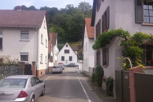


Waldnerturm
Scenic view · 2.6 km
Der Turm ist nicht der Rest einer Ritterburg, sondern das Produkt einer adeligen Laune. Der in Hemsbach begüterte Graf Waldner ließ den...


3 more on the map.
Museums and landmarks4

Postkutschenüberfall durch die Hölzerlips-Bande 1811
Monument and historic site · 1.3 km
Parks, trails and playgrounds12







Restaurants and cafes51


Francos Weinfass
Restaurant · Italian
75 Bachgasse, Hemsbach
Tu-Fr 11:00-14:00,17:30-23:00; Sa 17:00-23:00; Su 11:00-14:00,17:30-23:00
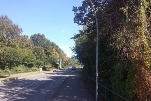
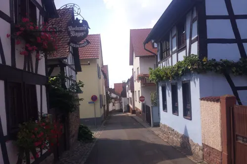
Strammer Max
Restaurant · Regional · 0.6 km
15 Mittelgasse, Hemsbach
Mo-Tu off; We-Sa 17:30-22:00; Su 11:30-14:30,17:30-22:00
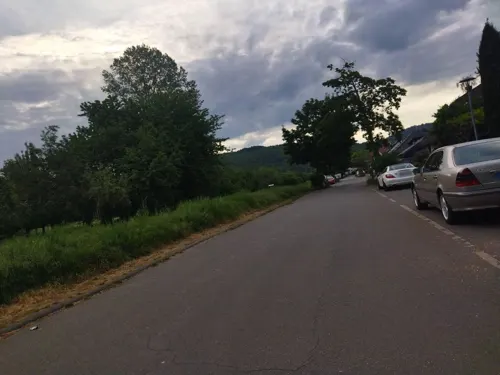
Zur Auszeit
Restaurant · Italian, German · 1.1 km
101 Berliner Straße, Laudenbach
Mo-Tu,Th-Sa 17:00-22:00; We off; Su 12:00-22:00



Bäckerei Grimminger
Bakery
22 Königsberger Straße, Hemsbach
Mo-Fr 06:00-18:00; Sa 06:00-13:00; Su 07:00-17:00
39 more on the map.
History
In 795 the town was first mentioned in a document as Hemmingisbach in the Lorsch Codex. It was about a border settlement to the property of the Lorsch Abbey in the "Mark Heppenheim", including Hemsbach.
After the dissolution of the abbey in 1232, the village was a bone of contention between the Electoral Palatinate and the Archbishops of Mainz for a century, until the Palatinate was adjudicated the villages of Hemsbach, Laudenbach and Sulzbach in 1344 by arbitration. The town was assigned to Palatinate-Mosbach in 1410. Count Otto of Mosbach pledged a large part of the rights to the Prince-Bishopric of Worms in 1449. After the Palatinate-Mosbach line died out in 1499, however, customs privileges were returned to the Electoral Palatinate, which also claimed regional sovereignty. The dispute remained unresolved until Hemsbach finally fell to the Electorate Palatinate in 1705 under an exchange agreement with the Bishop of Worms.
At the dissolution of the Electoral Palatinate Hemsbach was taken by Baden in 1803 and annexed to the Weinheim administration. On the night of May 1, 1811, a stagecoach with two Swiss merchants was attacked by Hölzerlips and his gang on the Bergstraße just short of Hemsbach. Hans Jacob Rieter from Winterthur died of his injuries. In 1812, the Sulzbach settlement in the south of Hemsbach was separated and became independent.
From the History section of Hemsbach on Wikipedia, under CC BY-SA 4.0.
Where to stay4
Churches and places of worship14
Kath. Kirchengemeinde Sta. Maria
Church · Catholic · 1.7 km
6 Gartenstraße, Weinheim
Evangelisch-Freikirchliche Gemeinde
Church · Baptist
13 Reichenberger Straße, Hemsbach
Marienkapelle der unbefleckten Empfängnis
Church · Catholic · 3.3 km
32 Ober-Laudenbacher Straße, Heppenheim
Pater-Delp-Gemeindehaus
Church · Roman Catholic
2 Gottlieb-Daimler-Straße, Hemsbach
Shopping10
Gas and EV charging10
Schools, colleges and libraries11
Healthcare4
Map of Hemsbach
135 places. The map loads OpenStreetMap tiles when you open it.
Getting there and nearby towns
City-Airport Mannheim (MHG) is the nearest airport with scheduled flights listed in OpenStreetMap, 16 km away.
- Weinheim 5 km south, about 5 min by car
- Schriesheim 13 km south, about 13 min by car
- Ladenburg 13 km south, about 13 min by car
- Mannheim 17 km southwest, about 17 min by car
- Ludwigshafen am Rhein 19 km southwest, about 19 min by car
- Heidelberg 21 km south, about 21 min by car
- Schwetzingen 24 km south, about 24 min by car
- Neckargemünd 25 km southeast, about 25 min by car
- Oftersheim 26 km south, about 26 min by car
- Leimen 27 km south, about 27 min by car
Drive times are estimates from straight-line distance, not routes.
Local news
Headlines from INDB.
Reviews, tips and questions
Loading what members have shared...
Sources and licences
- GeoNames (CC BY 4.0): population, coordinates, regions and time zone
- Mapillary (see each image): photos
- OpenStreetMap contributors (ODbL 1.0): places, airports, map data
- Wikidata (CC0 1.0): elevation, founding date, time zone, website
- Wikimedia Commons (see each image): photos
- Wikipedia (CC BY-SA 4.0): overview and history text
Photo credits
- Hemsbach kirko St. Laurentius 1, Thomas Pusch, CC BY-SA 3.0
- Bahnhof Hemsbach, Sarang, Public domain
- Bahnhof Hemsbach 2, Sarang, Public domain
- Hemsbach Bahnhof 20101114, Rudolf Stricker, Attribution
- Hemsbach Zehntscheuer 2, Sarang, Public domain
- Hemsbach Zehntscheuer 1, Sarang, Public domain
- Hemsbach Zehntscheuer 20101114, Rudolf Stricker, Attribution
- Hemsbach an der Bergstraße, Rathaus (Rothschildschloss), Jomaot, CC BY-SA 4.0
- Hemsbach Rathaus 20101114, Rudolf Stricker, Attribution
- Hemsbach ehemalige Synagoge 20110411, Rudolf Stricker, Attribution
- Hemsbach ehemalige Synagoge 20101114, Rudolf Stricker, Attribution
- Hemsbach St. Laurentius Kirche 20101114, Rudolf Stricker, Attribution
- Hemsbach katholisches Pfarrhaus 20101114, Rudolf Stricker, Attribution
- Hemsbach altes Rathaus 20101114, Rudolf Stricker, Attribution
- Brennessel1, Brennessel, Public domain
- Waldnerturm 1, Muck, CC BY-SA 4.0
- Naturschutzgebiet Wüstnächstenbach und Haferbuckel Dickicht, Vollgenervt, CC BY-SA 4.0
- Naturschutzgebiet in Hemsbach, Liebe Uwe, CC BY-SA 4.0
- NSG Schafhof-Teufelsloch, Michael Linnenbach, CC BY-SA 4.0
- Laudenbach Martin-Luther-Kirche 20110411, Rudolf Stricker, Attribution
- Weinheim-Sulzbach, Paul-Gerhardt-Kirche (2), Cmcmcm1, CC BY-SA 4.0
- Weinheim-Sulzbach, Sta. Maria (2), Cmcmcm1, CC BY-SA 4.0
- Laudenbach-Bartholomaeus, Frank, CC BY-SA 2.5
- Ev.Christuskirche 69502 Hemsbach Foto Karl Döringer, Karl Döringer, CC BY-SA 4.0
- Römerbrücke bei Weinheim, Cryptorebel, CC BY-SA 4.0
- Street-level photo, wegavision, CC BY-SA 4.0
- Street-level photo, changchun1, CC BY-SA 4.0
- Street-level photo, wegavision, CC BY-SA 4.0
- Street-level photo, wegavision, CC BY-SA 4.0
- Street-level photo, wegavision, CC BY-SA 4.0
- Street-level photo, ramap, CC BY-SA 4.0
- Street-level photo, wegavision, CC BY-SA 4.0
- Street-level photo, wegavision, CC BY-SA 4.0
- Street-level photo, ramap, CC BY-SA 4.0
- Street-level photo, wegavision, CC BY-SA 4.0
- Street-level photo, changchun1, CC BY-SA 4.0
- Street-level photo, wegavision, CC BY-SA 4.0
- Street-level photo, ramap, CC BY-SA 4.0
- Street-level photo, ramap, CC BY-SA 4.0
- Street-level photo, changchun1, CC BY-SA 4.0
- Street-level photo, ramap, CC BY-SA 4.0
- Street-level photo, wegavision, CC BY-SA 4.0


Page built November 8, 2026. Spotted a mistake? Tell us or suggest a place.