


Why visit Kaarst
Townapedia lists 86 museums and landmarks, 63 parks and trails, 221 places to eat, 12 places to stay and 20 attractions in and around town.
Highlights include Theater am Schlachthof (TAS), Hamm Railway Bridge, Europaschule Marie-Curie-Gymnasium (Standort Annostraße) and Elektrothek.
Weather in Kaarst
Forecast from MET Norway (CC BY 4.0). Full forecast
About Kaarst
Kaarst (German pronunciation: [ˈkaːɐ̯st] ; Limburgish: Kaasj) is a town in Germany. It lies in the district of Rhein-Kreis Neuss in North Rhine-Westphalia. It is 5 km west of Neuss and 12 km east of Mönchengladbach.
From the Wikipedia article Kaarst (this version), under CC BY-SA 4.0.
Photos of Kaarst


Things to do20



Geflügelhof Küppers GbR
Farm and orchard · 1.3 km
Eier- und Geflügelprodukten. Marmeladen,Gewürz- und Essiggurken, Joghurt, Milch, saisonal auch Apfelsaft, Äpfel, Kartoffeln und Honig im...
4b Im Rottfeld, Kaarst
Mo-Fr 08:00-12:00, We-Fr 14:00-18:00, Sa 08:00-13:00
Bioland Lammertzhof
Farm and orchard · 2.7 km
Neu Lammertzhof, Kaarst
Mo-Fr 08:30-18:30; Sa 07:30-14:00
Eggenhof
Farm and orchard · 2.2 km
9 Eggenhofstraße, Neuss
Tu-Th 08:30-13:00,15:00-18:30; Fr 08:30-18:30; Sa 08:30-14:00; Su,Mo off
Hofladen Goetschkes
Farm and orchard · 4.0 km
139 Rottes, Kaarst
Mo-Fr 09:00-18:30; Sa 09:00-17:15; Su, PH 09:00-16:00
Hofmarkt Thessa Küppers
Farm and orchard · 2.0 km
64 Hasselstraße, Kaarst
Mo-Sa 08:30-18:30; Su 10:00-14:00; PH 10:00-14:00
Spargelhof Meyer
Farm and orchard · 4.4 km
Asparagus, potatoes
Apr 01-Jun 26: Mo-Fr 08:00-18:30; Sa-Su 08:00-17:00
Spargelhof Robertz
Farm and orchard · 4.1 km
66 Rottes, Kaarst
Mo-Fr 08:30-18:30; Sa 08:00-16:00; Su,PH 09:00-13:00
8 more on the map.
Museums and landmarks86

Europaschule Marie-Curie-Gymnasium (Standort Annostraße)
Monument and historic site · 4.2 km
26 Annostraße, Neuss


Ehemalige Kleinenbroicher Windmühle
Monument and historic site · 4.8 km
Without wings

Wegekapelle Jan-van-Werth-Straße
Monument and historic site · 4.9 km

Osterather Windmühle
Monument and historic site · 4.3 km
89 Willicher Straße, Meerbusch

Pampusschule
Monument and historic site · 3.9 km
Geschichte https://www.kaarst.geschichte-in-strassen.de/index.php/de/pampusstrasse.html
1 Pampusstraße, Kaarst


Jüdischer Friedhof Bertzweg
Cemetery · 5.1 km
Als Ersatz für Friedhof in Knickelsdorf; im ersten Gräberfeld Grabsteine von 26 Schiefbahner Juden, im zweiten 16 Grabsteinevon...


Dickerhof
Monument and historic site · 4.1 km
Dreiflügelige Wirtschaftsgebäude um den Wohntrakt, giebelständig mit 5:4:3 Achsen; Eingangstor Taubenfluglöchern;...
74 more on the map.
Parks, trails and playgrounds63



Hallenbad Kaarst-Büttgen
Sports field and stadium · 3.2 km
1 Olympiastraße, Kaarst
Mo 14:00-16:00; Tu,Fr 06:45-21:00; We 06:45-20:00; Th 06:45-17:00;...
Nordbad
Sports field and stadium · 3.9 km
14-16 Neusser Weyhe, Neuss
Mo 10:00-21:00; Tu,Th 06:30-21:00; Fr 06:30-20:00; Sa 08:00-18:00;...


51 more on the map.
Restaurants and cafes221

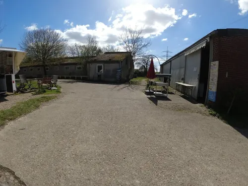
Park der Sinne
Restaurant · 1.7 km
Anmerkung Öffnungszeiten: "Bis Sonnenuntergang", nur geschätzt 20:00
1 Tönishöfe
Mo-Su 10:00-20:00
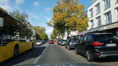
Trattoria Salumeria Casucci
Restaurant · Italian
Italienische Feinkost. Thekenverkauf Tu-Sa 11:00-14:30, 18:00-20:00
31 Maubisstraße, Kaarst
Tu-Sa 12:00-14:15, 18:00-22:00

Eiscafé Pastorelli
Cafe · Ice Cream
Opening Hours in winter: Mo-Su 10:30-19:00
3 Friedensstraße, Kaarst
Mo-Su 10:30-22:00

Leone
Restaurant · Italian · 1.5 km
12 Königstraße, Kaarst
Tu-Sa 11:30-14:30,18:00-22:00; Su 16:00-22:00
Ristorante Toscana
Restaurant · Italian, Pizza, Pasta, Fish · 3.6 km
Ristorante - Pizzeria
14 Matthiasstraße, Kaarst
Mo,We-Su 11:30-15:00,17:00-22:30
Antep Kebaphaus
Restaurant · Turkish · 4.4 km
1 Neusser Feldweg, Meerbusch
Mo-Fr 11:00-22:00; Sa 12:00-22:00; Su,PH 14:00-22:00
BinBir Gece
Restaurant · Turkish · 4.7 km
147 Bockholtstraße, Neuss
Mo-Fr 12:00-23:00; Sa 17:00+; Su off
Bischofshof
Restaurant · German · 1.4 km
Gaststätte sowie Party- und Getränkeservice
18-24 Königstraße, Kaarst
Mo,Tu,Th,Fr 11:00-13:30,16:30+; Sa 10:30+; Su,PH 10:00-14:00,17:00+; We off
Carles Bio-Kaffeerösterei
Cafe · Coffee Shop · 1.9 km
105 Bruchweg, Kaarst
Fr 10:00-18:00, Sa 10:00-14:00
209 more on the map.
History
Before 100 BC Celts lived in the area. Later the Franks came into this area as graves from the 7th century prove. The first written document is the Life of the first bishop of Münster. It describes how bishop Ludger walked from Budica, now Büttgen, through the forest of Hamrithi. The earliest known written mention of Kaarst refers to it as 'Karlesforst' and dates back to 1218. Karl was a very common name for frankish nobles including king Charlemagne ('Karl der Große'), but a link between Charlemagne and Kaarst has not been proven.
Kaarst and Büttgen both have churches built in the 12th century. Both villages were destroyed by Charles the Bold duke of Burgundy (Karl der Kühne, 1474–1475), in the Cologne War (1585 to 1586) and in the Thirty Years' War (1618–1648). Jan von Werth, a celebrated general during the Thirty Years' War, was born near Büttgen in 1591.
Read more of the history
During the Thirty Years' War, Kaarst was attacked several times by hostile armies, e.g. the one of Northern-Hesse (Northern-Hesse collaborated with Sweden and France, whereas the southern part of Hesse did not). Some time in 1642, a Hessian troop entered the city murdering the local preacher and destroying the vicarage. From 1794 till 1814 Kaarst was in the area occupied by France under Napoleon I. The French redrew district boundaries in 1798 and assigned Kaarst to Kanton Neuss. A relic of Napoleon I is the Nordkanal, a canal to connect the rivers Maas and Rhine.
In 1975 Büttgen and villages around Kaarst were formally amalgamated into Kaarst to form administrative area with 33,500 inhabitants.
From the History section of Kaarst on Wikipedia, under CC BY-SA 4.0.
Notable people from Kaarst
 Sebastian VollmerGerman gridiron football player (born 1984)Photo: Jeffrey Beall, CC BY 3.0
- Thomas FothenGerman road bicycle racer
- Manfred PalmenGerman politician (1945–2022)
- Hans-Günter NeuesGerman footballer and manager (1950-2016)
Born in Kaarst, according to Wikidata (CC0). Each name links to its Wikipedia article.
Where to stay12
Churches and places of worship42
Shopping58
Gas and EV charging15
Schools, colleges and libraries40
Healthcare24
Map of Kaarst
250 places. The map loads OpenStreetMap tiles when you open it.
Getting there and nearby towns
Düsseldorf-Mönchengladbach Airport (MGL) is the nearest airport with scheduled flights listed in OpenStreetMap, 8 km away.
- Meerbusch 5 km northeast, about 5 min by car
- Neuss 6 km southeast, about 6 min by car
- Willich 6 km northwest, about 6 min by car
- Korschenbroich 8 km southwest, about 8 min by car
- Neersen 10 km west, about 10 min by car
- Düsseldorf 11 km east, about 11 min by car
- Neubrück 11 km south, about 11 min by car
- Krefeld 13 km north, about 13 min by car
- Mönchengladbach 13 km west, about 13 min by car
- Tönisvorst 13 km northwest, about 13 min by car
Drive times are estimates from straight-line distance, not routes.
Towns near Kaarst


Keep exploring
Local news
Headlines from INDB.
Reviews, tips and questions
Loading what members have shared...
Sources and licences
- GeoNames (CC BY 4.0): population, coordinates, regions and time zone
- Mapillary (see each image): photos
- OpenStreetMap contributors (ODbL 1.0): places, airports, map data
- Wikidata (CC0 1.0): elevation, founding date, time zone, website, landmarks and historic places
- Wikimedia Commons (see each image): photos
- Wikipedia (CC BY-SA 4.0): overview and history text
Photo credits
- Kaarst Mitte2, Klaus Graf, CC BY 2.0
- Kaarst Stele am Wiegandweg (2012), Kasimix, CC BY-SA 3.0
- Kaarst Stele 01 Neumarkt (1994), Kasimix, CC BY-SA 3.0
- Kaarst, am Rathausplatz - geo.hlipp.de - 5919, Udo und Joan Fugel on geo.hlipp.de, CC BY-SA 2.0
- Kaarst Stele 13 Stadtsee (1995), Kasimix, CC BY-SA 3.0
- Kaarst Stele 05 Stadtsee (1994), Kasimix, CC BY-SA 3.0
- Kaarst Stele 14 Stadtsee (1995), Kasimix, CC BY-SA 3.0
- Kaarst Stele 06 Stadtsee (1994), Kasimix, CC BY-SA 3.0
- Kaarst Stele 09 Stadtsee (1995), Kasimix, CC BY-SA 3.0
- Kaarst Stele 08 Stadtsee (1994), Kasimix, CC BY-SA 3.0
- Kaarst Stele 07 Stadtsee (1994), Kasimix, CC BY-SA 3.0
- Kaarst Stele 12 Stadtsee (1994), Kasimix, CC BY-SA 3.0
- Kaarst Stele 20 Stadtsee (1994), Kasimix, CC BY-SA 3.0
- Kaarst Stele 22 Stadtsee (1994), Kasimix, CC BY-SA 3.0
- Kaarst Stele Die Pilgerin (2010), Kasimix, CC BY-SA 3.0
- Kaarst Stele 23 Stadtpark (1994), Kasimix, CC BY-SA 3.0
- Kaarst Stele 24 Stadtpark (1998), Kasimix, CC BY-SA 3.0
- Kaarst, im alten Dorfzentrum. (Kaarst, in the old village square.) - geo.hlipp.de - 5884, Udo und Joan Fugel on geo.hlipp.de, CC BY-SA 2.0
- Kaarst Martinsstele (2010), Kasimix, CC BY-SA 3.0
- Kaarst Martinsstele Mantelteilung (2010), Kasimix, CC BY-SA 3.0
- Kaarst Martinsstele Martinszug (2010), Kasimix, CC BY-SA 3.0
- Neuss - Kaarst - geo.hlipp.de - 6077, Udo und Joan Fugel on geo.hlipp.de, CC BY-SA 2.0
- 10.05.90 Kaarst 515.525 (6438697727), Phil Richards from London, UK, CC BY-SA 2.0
- Bahnhof Kaarster Bahnhof 2403171748, Clic, CC BY 4.0
- Bahnhof Kaarster Bahnhof 2403171747, Clic, CC BY 4.0
- Regiobahn VT114 Kaarster Bahnhof 2403171805, Clic, CC BY 4.0
- Bahnhofsschild Kaarster Bahnhof 2403171749, Clic, CC BY 4.0
- Bahnhof Kaarster Bahnhof 2403171746, Clic, CC BY 4.0
- Regiobahn VT114 Kaarster Bahnhof 2403171756, Clic, CC BY 4.0
- Regiobahn VT114 Kaarster Bahnhof 2403171757, Clic, CC BY 4.0
- Regiobahn VT114 Kaarster Bahnhof 2403171758, Clic, CC BY 4.0
- Hammer Brücke Düsseldorf stromaufwärts, Johann H. Addicks, CC BY-SA 3.0
- 07 (2) Braunsmühle, An der Braunsmühle 2, Büttgen, Käthe u. Bernd Limburg, www.limburg-bernd.de, CC BY-SA 3.0 de
- St. Aldegundis (Büttgen) (02), Chris06, CC BY-SA 4.0
- Umspannwerk Osterath - Elektrothek (8), Tetris L, CC BY-SA 3.0
- Osterrather Windmühle West, Tetris L, CC BY-SA 4.0
- NSG Der Meerbusch (25), Tetris L, CC BY-SA 3.0
- Picture of ISR - International School on the Rhine, Majika 2019, CC BY-SA 4.0
- (017) 2-014 Pfarrkirche, Blücherstraße 20 (Barbaraviertel), Käthe u. Bernd Limburg, www.limburg-bernd.de, CC BY-SA 3.0 de
- MCG Neuss Hauptgebaeude, Reinhard Meissner, CC BY-SA 3.0 de
- Kamillus Neuss 2, Mardon1, CC BY-SA 4.0
- Kapelle Niederdonk, Velopilger, Public domain
- 35 Wegestock, Am Rüttenwege (Kleinenbroich), Käthe u. Bernd Limburg, www.limburg-bernd.de, CC BY-SA 3.0 de
- (219) 2-010 Verwaltungsgebäude, Graf-Landsberg-Straße 1 (Barbaraviertel), Käthe u. Bernd Limburg, www.limburg-bernd.de, CC BY-SA 3.0 de
- Evangelische Kirche (Osterath) (1a), Chris06, CC BY-SA 4.0
- 2021 09 23 Auferstehungskirche Neuss Frankenstraße 63 (5), Rudolfo42, CC BY-SA 4.0
- 2021 09 23 Auferstehungskirche Neuss Weißenberger Weg 172a (2), Rudolfo42, CC BY-SA 4.0
- 2021 11 10 St Thomas Morus (Neuss-Vogelsang) (1), Rudolfo42, CC BY-SA 4.0
- 2021 08 08 Heilig-Geist-Kirche (Meerbusch-Büderich) (1), Rudolfo42, CC BY-SA 4.0
- (008) 2-017 Hauptschule, Annostraße 26 (Neuss-Furth), Käthe u. Bernd Limburg, www.limburg-bernd.de, CC BY-SA 3.0 de
- Braunsmühle, Büttgen, Udo und Joan Fugel, CC BY-SA 2.0
- 37 Ehem. Windmühle, Jan van Werth Straße 17 (Kleinenbroich), Käthe u. Bernd Limburg, www.limburg-bernd.de, CC BY-SA 3.0 de
- 46 Wegekapelle, Nordstraße - Jan van Werth Straße (Kleinenbroich), Käthe u. Bernd Limburg, www.limburg-bernd.de, CC BY-SA 3.0 de
- Pampusschule Buettgen, Gulp21, CC BY-SA 2.0 de
- NSG Der Meerbusch (31), Tetris L, CC BY-SA 3.0
- Pferdsbroich - Grünland, Tetris L, CC BY-SA 3.0
- Johanneskirche Buettgen, Gulp21, CC BY-SA 2.0 de
- Buettgen 01 (RaBoe), Ra Boe, CC BY-SA 3.0
- KGS-Büttgen Eingang, Gulp21, CC BY-SA 2.0 de
- Dyckhof, Meerbusch-Büderich, Haupthaus (14), Tetris L, CC BY-SA 3.0
- TAS Außenfoto Juni 2022, Dennis Prang, CC BY-SA 4.0
- Sportforum Kaarst-Büttgen 2022 01, Nicola, CC BY-SA 4.0
- Street-level photo, miler, CC BY-SA 4.0
- Street-level photo, steelcroissant, CC BY-SA 4.0
- Street-level photo, saschahaberkorn, CC BY-SA 4.0
- Street-level photo, ralrei, CC BY-SA 4.0
- Street-level photo, miler, CC BY-SA 4.0
- Street-level photo, miler, CC BY-SA 4.0
- Street-level photo, miler, CC BY-SA 4.0
- Street-level photo, miler, CC BY-SA 4.0
- Street-level photo, steelcroissant, CC BY-SA 4.0
- Street-level photo, saschahaberkorn, CC BY-SA 4.0
- Street-level photo, descilla, CC BY-SA 4.0
- Street-level photo, endradon, CC BY-SA 4.0
- Street-level photo, hektor1989, CC BY-SA 4.0
- Street-level photo, endradon, CC BY-SA 4.0
- Street-level photo, endradon, CC BY-SA 4.0
- Street-level photo, saschahaberkorn, CC BY-SA 4.0
- Street-level photo, saschahaberkorn, CC BY-SA 4.0
- Street-level photo, phitec, CC BY-SA 4.0
- Street-level photo, rempshaener, CC BY-SA 4.0
- Street-level photo, endradon, CC BY-SA 4.0
- Street-level photo, VIA_KK, CC BY-SA 4.0


Page built November 9, 2026. Spotted a mistake? Tell us or suggest a place.