


Why visit Leutkirch
Townapedia lists 12 museums and landmarks, 12 parks and trails, 41 places to eat, 6 places to stay and 1 attraction in and around town.
Highlights include Central-Theater Cineclub, Elektrotechnisches Museum Leutkirch e.V. and Bocksaal (Städtisches Museum).
Weather in Leutkirch
Forecast from MET Norway (CC BY 4.0). Full forecast
Things to do1

Museums and landmarks12
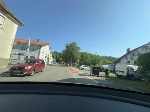
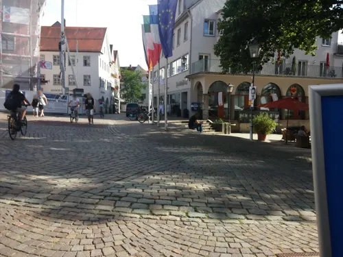
Bocksaal (Städtisches Museum)
Museum
9 Gänsbühl, Leutkirch im Allgäu
We 14:00-17:00; Sa[1],Su,PH 13:00-17:00



Parks, trails and playgrounds12




Restaurants and cafes41

Brauereigasthof Mohren
Restaurant · Regional
1 Wangener Straße, Leutkirch im Allgäu
Mo-Sa 11:30-20:30; Su,PH 11:30-20:00
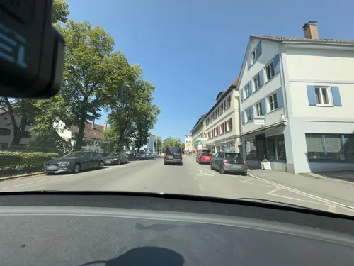
Gasthof zum Rad
Restaurant · Regional
5 Obere Vorstadtstraße, Leutkirch im Allgäu
Mo,Fr off; Tu-Th 17:00+; Sa-Su 11:00-14:00,17:00+
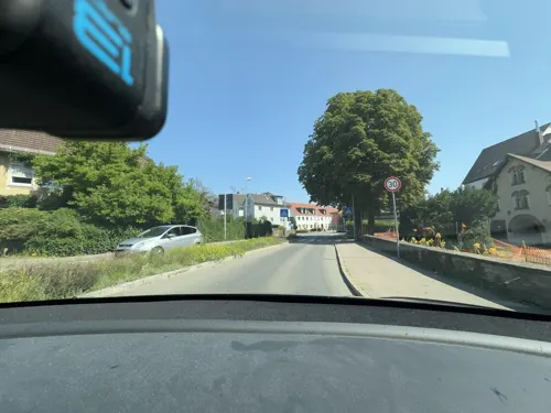
Kaffee- & Weinhaus Harr
Cafe · Coffee Shop
28 Untere Grabenstraße, Leutkirch im Allgäu
Mo-Tu 09:00-12:15, 14:00-17:00; We 09:00-12:15; Th-Fr 09:00-12:15,...
Sai Thai
Restaurant · Thai
1 Landhausstraße, Leutkirch im Allgäu
We,Th,Su,Mo 11:30-14:00, We-Mo 17:30-22:00; Tu off, Fr,Sa...

Bäckerei und Konditorei Wandinger
Bakery
7 Kornhausstraße, Leutkirch im Allgäu
Mo-We 06:00-13:00; Th-Fr 06:00-18:00; Sa 06:00-12:30; Su off


29 more on the map.
Where to stay6
Churches and places of worship6
Dreifaltigkeitskirche
Church · Protestant
1 Martin-Luther-Platz, Leutkirch im Allgäu
Kapelle zur schmerzhaften Muttergottes
Church
5/1 Marienplatz, Leutkirch im Allgäu
Shopping19
Gas and EV charging6
Schools, colleges and libraries9
Healthcare5
Map of Leutkirch
117 places. The map loads OpenStreetMap tiles when you open it.
Getting there and nearby towns
Memmingen Airport (FMM) is the nearest airport with scheduled flights listed in OpenStreetMap, 24 km away.
- Weingarten 29 km west, about 29 min by car
- Ravensburg 31 km west, about 31 min by car
- Tettnang 37 km southwest, about 37 min by car
- Meckenbeuren 37 km west, about 37 min by car
- Bad Saulgau 44 km northwest, about 44 min by car
- Markdorf 49 km west, about 49 min by car
- Riedlingen 55 km northwest, about 55 min by car
- Mengen 57 km northwest, about 57 min by car
- Pfullendorf 58 km west, about 58 min by car
- Ulm 64 km north, about 1 h by car
Drive times are estimates from straight-line distance, not routes.
Local news
Headlines from INDB.
Reviews, tips and questions
Loading what members have shared...
Sources and licences
- GeoNames (CC BY 4.0): population, coordinates, regions and time zone
- Mapillary (see each image): photos
- OpenStreetMap contributors (ODbL 1.0): places, airports, map data
- Wikidata (CC0 1.0): elevation, founding date, time zone, website
- Wikimedia Commons (see each image): photos
Photo credits
- Stolperstein Leutkirch Karlstraße 12 Julie Gollowitsch, Gmbo 2013, CC0
- Stolperstein Leutkirch Karlstraße 12 Heinrich Gollowitsch, Gmbo 2013, CC0
- Stolperstein Leutkirch Karlstraße 12 Alice Gollowitsch, Gmbo 2013, CC0
- 88299 Leutkirch im Allgäu, Germany - panoramio (70), Richard Mayer, CC BY 3.0
- Stolperstein Leutkirch Karlstraße 12 Liselotte Gollowitsch, Gmbo 2013, CC0
- Stolpersteine Leutkirch Karlstraße 12, Gmbo 2013, CC0
- Stolperstein Leutkirch Karlstraße 12 Ilse Neuberger, Gmbo 2013, CC0
- Stolpersteinlage Leutkirch Karlstraße 12, Gmbo 2013, CC0
- Stolpersteine Leutkirch Karlstraße 12 vor der Reinigung, Gmbo 2013, CC0
- Leutkirch - panoramio, Richard Mayer, CC BY 3.0
- Stadtschloss Leutkirch - panoramio (41), Richard Mayer, CC BY 3.0
- 04998-Leutkirch-1903-Gasthof zum Pflug und Post-Brück & Sohn Kunstverlag, Brück & Sohn Kunstverlag Meißen, CC0
- Leutkirch - panoramio (7), Richard Mayer, CC BY 3.0
- Remboldhaus (Leutkirch im Allgäu) - panoramio 68840960 (2012), Richard Mayer, CC BY 3.0
- Leutkirch - panoramio (8), Richard Mayer, CC BY 3.0
- Stolperstein für Margot Forbes (Leutkirch im Allgäu), Christian Michelides, CC BY-SA 4.0
- Stolperstein für Friedrich Gollowitsch (Leutkirch im Allgäu), Christian Michelides, CC BY-SA 4.0
- Stolperstein für Liselotte Gollowitsch (Leutkirch im Allgäu), Christian Michelides, CC BY-SA 4.0
- Stolperstein für Lilly Gollowitsch (Leutkirch im Allgäu), Christian Michelides, CC BY-SA 4.0
- Stolperstein für Ilse Neuberger (Leutkirch im Allgäu), Christian Michelides, CC BY-SA 4.0
- Dampfwolke - panoramio, Mayer Richard, CC BY 3.0
- Zaubernuss Blüte - panoramio, Richard Mayer, CC BY 3.0
- Untere Grabenstraße - panoramio, Richard Mayer, CC BY 3.0
- Untere Grabenstraße - panoramio (1), Richard Mayer, CC BY 3.0
- Tor - panoramio (12), Richard Mayer, CC BY 3.0
- Hotel Linde - panoramio, Richard Mayer, CC BY 3.0
- Backsteinhaus Amtsgericht - panoramio, Richard Mayer, CC BY 3.0
- Karlstraße - panoramio, Richard Mayer, CC BY 3.0
- Feuerwehrhaus - panoramio (7), Richard Mayer, CC BY 3.0
- Ev. Kirche - panoramio (4), Richard Mayer, CC BY 3.0
- Evangelische Kirche - panoramio (8), Richard Mayer, CC BY 3.0
- Stadtschloss - panoramio, Richard Mayer, CC BY 3.0
- Furtenbach Garten - panoramio, Mayer Richard, CC BY 3.0
- Neugotik - panoramio (6), Richard Mayer, CC BY 3.0
- Brunnen - panoramio (61), Richard Mayer, CC BY 3.0
- Beim Bahnhof - panoramio (3), Richard Mayer, CC BY 3.0
- Kornhaus - panoramio (3), Richard Mayer, CC BY 3.0
- Evangelische Kirche - panoramio (3), Mayer Richard, CC BY 3.0
- Stadtschloss der Furtenbacher - panoramio, Richard Mayer, CC BY 3.0
- Adam und Eva - panoramio, Richard Mayer, CC BY 3.0
- Motorradparken Leutkirch Freibad Stadtweier, Gmbo 2013, CC0
- Street-level photo, techODD, CC BY-SA 4.0
- Street-level photo, maturion, CC BY-SA 4.0
- Street-level photo, umap, CC BY-SA 4.0
- Street-level photo, ray66, CC BY-SA 4.0
- Street-level photo, techODD, CC BY-SA 4.0
- Street-level photo, ray66, CC BY-SA 4.0
- Street-level photo, techODD, CC BY-SA 4.0
- Street-level photo, techODD, CC BY-SA 4.0
- Street-level photo, maturion, CC BY-SA 4.0
- Street-level photo, tst, CC BY-SA 4.0
- Street-level photo, umap, CC BY-SA 4.0
- Street-level photo, umap, CC BY-SA 4.0
- Street-level photo, maturion, CC BY-SA 4.0
- Street-level photo, umap, CC BY-SA 4.0
- Street-level photo, ray66, CC BY-SA 4.0
- Street-level photo, umap, CC BY-SA 4.0
- Street-level photo, ray66, CC BY-SA 4.0
- Street-level photo, maturion, CC BY-SA 4.0
- Street-level photo, umap, CC BY-SA 4.0
- Street-level photo, techODD, CC BY-SA 4.0
- Street-level photo, robot8a, CC BY-SA 4.0
- Street-level photo, umap, CC BY-SA 4.0
- Street-level photo, umap, CC BY-SA 4.0
- Street-level photo, maturion, CC BY-SA 4.0


Page built November 8, 2026. Spotted a mistake? Tell us or suggest a place.