


Why visit Lößnitz
Townapedia lists 65 museums and landmarks, 18 parks and trails, 84 places to eat, 13 places to stay and 23 attractions in and around town.
Highlights include Zoo der Minis, Nickel-Odeon Kino-Center, Museum Uranbergbau and Edelhof Alberoda.
Weather in Lößnitz
Forecast from MET Norway (CC BY 4.0). Full forecast
About Lößnitz
Bergstadt Lößnitz (German pronunciation: [ˈløːsnɪts] ; “Mining Town of Lößnitz”, also spelt Lössnitz), sometimes also called Muhme (“Aunt”) for its age, is a town in the district of Erzgebirgskreis, Saxony, Germany, and belongs to the Town League of Silberberg (Städtebund Silberberg). Its name comes from the Slavic lesnice, meaning “forest place”.
From the Wikipedia article Lößnitz (this version), under CC BY-SA 4.0.
Things to do23






11 more on the map.
Museums and landmarks65

Museum Uranbergbau
Museum · 4.7 km
20 Bergstraße, Aue-Bad Schlema
Mo-Th 09:00-17:00, Fr off, Sa-Su,PH 10:00-17:00

Edelhof Alberoda
Monument and historic site · 1.5 km
Ehemalige Wasserburg, jetzt als Gasthof genutzt.
7 An den Teichen


Grünhain Abbey
Monument and historic site · 7.3 km
Cistercian monastery

Betty Schüftan
Monument and historic site · 4.5 km
Stolperstein für Betty Schüftan


ehem. Oberschlemaer Bahnhof
Monument and historic site · 4.8 km
2i Hauptstraße, Aue-Bad Schlema


Hertha Thorn
Monument and historic site · 4.5 km
Stolperstein für Hertha Thorn verh. Kreinberg; Rosa Hertha Kreinberg

53 more on the map.
Parks, trails and playgrounds18


Zwönitzer Schwimmhalle
Sports field and stadium · 4.9 km
8 Wiesenstraße, Zwönitz
Tu 13:30-20:30; We 08:00-13:00; Fr 11:00-18:00; Su 10:00-13:00

Erzgebirgsstadion
Sports field and stadium · 3.0 km
95 Lößnitzer Straße, Aue-Bad Schlema




Freibad Affalter
Sports field and stadium · 2.3 km
2a Weg zur Jugendherberge, Lößnitz

6 more on the map.
Restaurants and cafes84
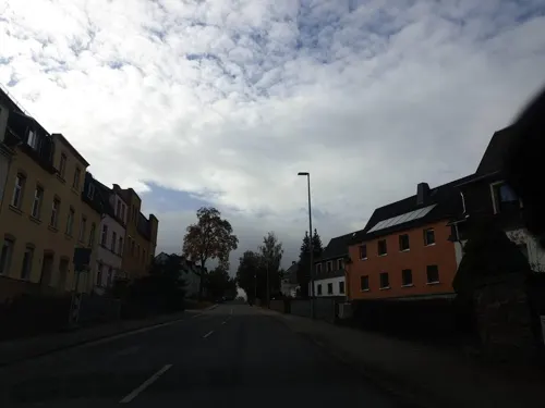
Caramba - Die Spanische Kneipe
Bar and pub · Spanish, Ice Cream · 3.4 km
35 Alte Lößnitzer Straße, Aue-Bad Schlema
Mo-Su 14:30-24:00
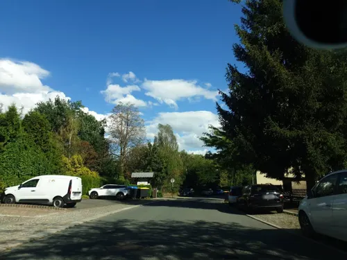
Einkehr am Tiergarten
Restaurant · Regional · 4.6 km
1 Damaschkestraße, Aue-Bad Schlema
Mo-Su 11:00-21:00

Gasthof Dreihansen
Restaurant · Regional, German · 1.1 km
8 Dreihansner Straße, Lößnitz
We,Th 11:00-14:00,17:00-24:00; Fr 17:00-00:00; Sa 11:00-00:00; Su...
Parkwarte
Restaurant · Regional, German · 5.0 km
50 Zur Parkwarte, Aue-Bad Schlema
Th,Fr 17:00-22:00; Sa,Su 11:00-22:00
Brethaus
Restaurant · German · 4.6 km
4 Am Brethaus, Lauter-Bernsbach
We-Su 11:00-20:00

Bäckerei & Konditorei Roscher
Bakery · 4.7 km
1 Albin-Trommler-Straße, Zwönitz
Mo-Th 07:00-19:00; Fr 07:00-20:00; Sa 07:00-19:00; Su,PH off
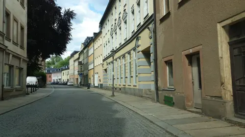
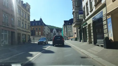
Bäckerei Zum Schellenberger
Bakery · 4.5 km
1 Altmarkt, Aue-Bad Schlema
Mo-Fr 06:00-18:00; Sa 06:00-11:30; Su,PH off
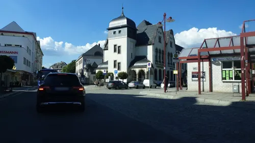
Cafe am Postplatz
Cafe · 4.4 km
1 Postplatz, Aue-Bad Schlema
Mo-Fr 07:00-17:00; Sa 07:00-12:00; Su 07:00-10:00,13:30-16:00
Gasthof "Schönburgscher Hof"
Restaurant · 4.4 km
7 Hartensteiner Straße, Lößnitz
We-Fr 11:00-15:00,17:00-21:00; Sa,Su,PH 11:00+; Mo,Tu off
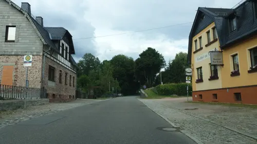


Gasthof "Zur Linde"
Restaurant · 3.4 km
52 Hauptstraße, Lößnitz
Tu,We 11:00-14:00; Th 11:00-14:00,18:00-22:00; Fr,Sa...
72 more on the map.
History
Lößnitz was founded by the Castle Counts (Burggrafen) at Meißen in 1170, and in a document from 1284 it was already described as a Civitas. The town's first documentary mention, however, had already come in 1238, in which it was named as “Lesnitz the forest place”.
Lößnitz's early history is somewhat speculative. A schoolmaster is mentioned as being in the town in 1304, for instance, leading to the inference that the Lößnitz Latin school was already there then. Likewise, the first known mayor Hermann von Buten appears in the town's history in 1372, leading to further speculation that there must have been a town hall by that time.
In 1382, Lößnitz was designated a Bergstadt and a year later the whole town burnt right down as far as the town mill that stood before the gates. In 1406, the Count of Schönburg acquired the County of Hartenstein and made Lößnitz its seat.
In 1542, the Reformation was introduced. In 1601, the town hall portal appeared and the town hall remodelling was finished six years later. However, all of it was lost, along with the church, the parish building, the school and moreover 108 houses, in the “Rote Ruhr” (“Red Dysentery”, a name given this town fire). In the years that followed, the town also had to deal with sackings, the plague and yet another town fire.
From the History section of Lößnitz on Wikipedia, under CC BY-SA 4.0.
Where to stay13
Churches and places of worship24
Evangelisch-Lutherische Kirche
Church · Lutheran · 3.3 km
50 Hauptstraße, Lößnitz
Friedenskirche
Church · Lutheran · 4.0 km
2 Kantstraße, Aue-Bad Schlema
Martin-Luther-Kirche
Church · Lutheran · 3.8 km
9 Schulberg, Aue-Bad Schlema
Nicolaikirche
Church · Lutheran · 4.5 km
12 Schwarzenberger Straße, Aue-Bad Schlema
Shopping21
Gas and EV charging6
Schools, colleges and libraries15
Healthcare10
Apotheke Zeller Berg
Clinic and pharmacy · 3.7 km
1 Prof.-Richard-Beck-Straße, Aue-Bad Schlema
Dialyse Zentrum
Clinic and pharmacy · 3.5 km
33 Albert-Schweitzer-Straße, Aue-Bad Schlema
Map of Lößnitz
250 places. The map loads OpenStreetMap tiles when you open it.
Getting there and nearby towns
Leipzig-Altenburg Airport (AOC) is the nearest airport with scheduled flights listed in OpenStreetMap, 43 km away.
- Zwönitz 6 km east, about 6 min by car
- Stollberg 10 km north, about 10 min by car
- Wilkau-Haßlau 16 km west, about 16 min by car
- Mülsen 18 km northwest, about 18 min by car
- Chemnitz 28 km northeast, about 28 min by car
- Zschopau 28 km northeast, about 28 min by car
- Penig 35 km north, about 35 min by car
- Olbernhau 43 km east, about 43 min by car
- Oelsnitz 46 km southwest, about 46 min by car
- Gera 54 km northwest, about 54 min by car
Drive times are estimates from straight-line distance, not routes.
Local news
Headlines from INDB.
Reviews, tips and questions
Loading what members have shared...
Sources and licences
- GeoNames (CC BY 4.0): population, coordinates, regions and time zone
- Mapillary (see each image): photos
- OpenStreetMap contributors (ODbL 1.0): places, airports, map data
- Wikidata (CC0 1.0): elevation, founding date, time zone, website, landmarks and historic places
- Wikimedia Commons (see each image): photos
- Wikipedia (CC BY-SA 4.0): overview and history text
Photo credits
- Loessnitz Erzgebirge August 2010, Seidel, CC BY-SA 3.0
- Innerstädtischer Lehrpfad Lößnitz Tafel 02 Altes Amtsgericht, Dor Jörsch, CC BY-SA 4.0
- Schachtdeckel in Lößnitz, Erzgebirgskreis 2H1A0635WI, Kora27, CC BY-SA 4.0
- Marktplatz in Lößnitz. Erzgebirgskreis, Sachsen. 2H1A2064WI, Kora27, CC BY-SA 4.0
- Marktplatz in Lößnitz. Erzgebirgskreis, Sachsen. 2H1A2045WI, Kora27, CC BY-SA 4.0
- Historischer Ritterkampf beim Volksfest Lößnitzer Salzmarkt, Sachsen 2H1A1165WI, Kora27, CC BY-SA 4.0
- Historischer Ritterkampf beim Volksfest Lößnitzer Salzmarkt, Sachsen. 2H1A1167WI, Kora27, CC BY-SA 4.0
- Historischer Lößnitzer Salzmarkt 2023. Erzgebirgskreis, Sachsen 2H1A1170WI, Kora27, CC BY-SA 4.0
- Marktplatz in Lößnitz. Erzgebirgskreis, Sachsen. 2H1A2038WI, Kora27, CC BY-SA 4.0
- Historischer Ritterkampf beim Volksfest Lößnitzer Salzmarkt, Sachsen. 2H1A1330WI, Kora27, CC BY-SA 4.0
- Historischer Lößnitzer Salzmarkt 2023. Erzgebirgskreis, Sachsen 2H1A1026WI, Kora27, CC BY-SA 4.0
- Historischer Ritterkampf beim Volksfest Lößnitzer Salzmarkt, Sachsen 2H1A1217WI, Kora27, CC BY-SA 4.0
- Historischer Ritterkampf beim Volksfest Lößnitzer Salzmarkt, Sachsen 2H1A1404WI, Kora27, CC BY-SA 4.0
- Historischer Lößnitzer Salzmarkt 2023. Erzgebirgskreis, Sachsen 2H1A1102WI, Kora27, CC BY-SA 4.0
- Historischer Ritterkampf beim Volksfest Lößnitzer Salzmarkt, Sachsen 2H1A1149WI, Kora27, CC BY-SA 4.0
- Volksfest Lößnitzer Salzmarkt 2023. Erzgebirgskreis, Sachsen. 2H1A1563WI, Kora27, CC BY-SA 4.0
- Volksfest Lößnitzer Salzmarkt 2023. Erzgebirgskreis, Sachsen. 2H1A1529WI, Kora27, CC BY-SA 4.0
- Historische Kleidung beim Volksfest Lößnitzer Salzmarkt. Sachsen. 2H1A0342WI, Kora27, CC BY-SA 4.0
- Historischer Lößnitzer Salzmarkt 2023. Erzgebirgskreis, Sachsen 2H1A1095WI, Kora27, CC BY-SA 4.0
- Historischer Ritterkampf beim Volksfest Lößnitzer Salzmarkt, Sachsen 2H1A1097WI, Kora27, CC BY-SA 4.0
- Historischer Ritterkampf beim Volksfest Lößnitzer Salzmarkt, Sachsen 2H1A1314WI, Kora27, CC BY-SA 4.0
- 24805-Lößnitz-1929-Blick auf Lößnitz-Brück & Sohn Kunstverlag, Brück & Sohn Kunstverlag Meißen, CC BY-SA 3.0
- Historische Kleidung beim Volksfest Lößnitzer Salzmarkt, Sachsen 2H1A0333WI, Kora27, CC BY-SA 4.0
- Historische Kleidung beim Volksfest Lößnitzer Salzmarkt, Sachsen 2H1A0326WI, Kora27, CC BY-SA 4.0
- Historischer Ritterkampf beim Volksfest Lößnitzer Salzmarkt, Sachsen 2H1A1351WI, Kora27, CC BY-SA 4.0
- Historischer Lößnitzer Salzmarkt 2023. Erzgebirgskreis, Sachsen 2H1A2232WI, Kora27, CC BY-SA 4.0
- Historischer Lößnitzer Salzmarkt 2023. Erzgebirgskreis, Sachsen 2H1A2230WI, Kora27, CC BY-SA 4.0
- Historischer Lößnitzer Salzmarkt 2023. Erzgebirgskreis, Sachsen 2H1A2177WI, Kora27, CC BY-SA 4.0
- Historischer Ritterkampf beim Volksfest Lößnitzer Salzmarkt, Sachsen 2H1A1193WI, Kora27, CC BY-SA 4.0
- Historischer Lößnitzer Salzmarkt 2023. Erzgebirgskreis, Sachsen 2H1A1192WI, Kora27, CC BY-SA 4.0
- Historische Kleidung beim Volksfest Lößnitzer Salzmarkt. Sachsen. 2H1A0516WI, Kora27, CC BY-SA 4.0
- Historische Kleidung beim Volksfest Lößnitzer Salzmarkt, Sachsen 2H1A0337WI, Kora27, CC BY-SA 4.0
- Volksfest Lößnitzer Salzmarkt 2023. Erzgebirgskreis, Sachsen. 2H1A0890WI, Kora27, CC BY-SA 4.0
- Volksfest Lößnitzer Salzmarkt 2023. Erzgebirgskreis, Sachsen. 2H1A1579WI, Kora27, CC BY-SA 4.0
- Volksfest Lößnitzer Salzmarkt 2023. Erzgebirgskreis, Sachsen. 2H1A1982WI, Kora27, CC BY-SA 4.0
- Volksfest Lößnitzer Salzmarkt 2023. Erzgebirgskreis, Sachsen. 2H1A1585WI, Kora27, CC BY-SA 4.0
- Volksfest Lößnitzer Salzmarkt 2023. Erzgebirgskreis, Sachsen. 2H1A2079WI, Kora27, CC BY-SA 4.0
- Historischer Lößnitzer Salzmarkt 2023. Erzgebirgskreis, Sachsen 2H1A2082WI, Kora27, CC BY-SA 4.0
- Volksfest Lößnitzer Salzmarkt 2023. Erzgebirgskreis, Sachsen. 2H1A0753WI, Kora27, CC BY-SA 4.0
- Grünhain Klostermauer, Devilsanddust, CC BY-SA 2.0 de
- Schneeberg St. Wolfgangskirche 1 (aka), André Karwath aka Aka, CC BY-SA 2.5
- Katzenstein (Erzgebirge) Triangulierungspunkt, Fireball2 at German Wikipedia, CC BY-SA 3.0
- Aue 110430 AMA fec (291k), Angela M. Arnold (=44penguins), CC BY-SA 3.0
- Kloesterlein Zelle, Devilsanddust, CC BY-SA 3.0
- Edelhof Alberoda, Druck L. Blau, Leipzig, Public domain
- Eisenstein (Erzgebirge), Sewan, CC BY-SA 3.0
- 2009-05-16 120 Aue Friedenskirche, Angela Monika Arnold, CC BY-SA 3.0
- 2009-05-16 195 Aue Gemauerter Stein von Friedenskirche, Angela M. Arnold, Berlin, CC BY-SA 3.0
- Aue Kirche Mater Dolorosa, Amiconn, CC BY-SA 3.0
- Hospitalkirche St. Georg Lößitz 2014-05-17 ama fec (3), Angela Monika Arnold, Berlin (=44Pinguine/44penguins), CC BY-SA 3.0
- 2009-05-16 396 Aue Hohes Holz mit Bruenlasberg, Angela M. Arnold, Berlin, CC BY-SA 3.0
- Eisenbrücke Niederschlema–Alberoda (2), Aagnverglaser, CC BY-SA 4.0
- Johanniskirche Lößnitz, Devilsanddust, CC BY-SA 3.0
- Glockenturm Affalter, Miebner, CC BY-SA 3.0
- Bahnhof Oberschlema, Empfangsgebäude (jetzt FFW Bad Schlema) (2), Aagnverglaser, CC BY-SA 4.0
- Martin-Luther-Kirche Niederschlema (2), Aagnverglaser, CC BY-SA 4.0
- 2010-07-14 Aue-alberoda Angela M. Arnold fec -809, Angela M. Arnold, Berlin (=44penguins), CC BY-SA 3.0
- Stolperstein Schüftan, Betty (Aue), Jana Hecker, uploaded by 44penguins , edited by Cookroach, CC BY-SA 4.0
- Stolperstein Thorn, David (Aue), Jana Hecker, uploaded by 44penguins , edited by Cookroach, CC BY-SA 4.0
- Stolperstein Thorn, Rosette (Aue), Jana Hecker, uploaded by 44penguins , edited by Cookroach, CC BY-SA 4.0
- Stolperstein Schüftan, Max (Aue), Jana Hecker, uploaded by 44penguins , edited by Cookroach, CC BY-SA 4.0
- Gekennzeichneter Eingang in den Hartensteiner Wald.IMG 5878WI, Kora27, CC BY-SA 3.0
- Erzgebirgsstadion im Juni 2018 1, MAyo, CC BY-SA 4.0
- Naturschutzgebiet Kuttenbach 2H1A8710WI, Kora27, CC BY-SA 4.0
- NSG Vordere Aue in Sachsen 2H1A4609WI, Kora27, CC BY-SA 4.0
- Zoo der Minis aue, 2012-09-08, ama fec (1), Angela M. Arnold, Berlin (=44Pinguine))), CC BY-SA 3.0
- Museum Uranbergbau - Bohrgestänge, Bad Schlema-175634, Raimond Spekking, CC BY-SA 4.0
- Street-level photo, canislupus, CC BY-SA 4.0
- Street-level photo, canislupus, CC BY-SA 4.0
- Street-level photo, canislupus, CC BY-SA 4.0
- Street-level photo, canislupus, CC BY-SA 4.0
- Street-level photo, canislupus, CC BY-SA 4.0
- Street-level photo, canislupus, CC BY-SA 4.0
- Street-level photo, canislupus, CC BY-SA 4.0
- Street-level photo, canislupus, CC BY-SA 4.0
- Street-level photo, canislupus, CC BY-SA 4.0
- Street-level photo, canislupus, CC BY-SA 4.0
- Street-level photo, canislupus, CC BY-SA 4.0
- Street-level photo, canislupus, CC BY-SA 4.0
- Street-level photo, canislupus, CC BY-SA 4.0
- Street-level photo, canislupus, CC BY-SA 4.0
- Street-level photo, canislupus, CC BY-SA 4.0
- Street-level photo, canislupus, CC BY-SA 4.0


Page built November 8, 2026. Spotted a mistake? Tell us or suggest a place.