


Why visit Olbernhau
Townapedia lists 119 museums and landmarks, 33 parks and trails, 81 places to eat, 51 places to stay and 75 attractions in and around town.
Highlights include Landhandel Heidersdorf, Seiffen/Erzgeb., Dörnthaler Ölmühle and Erzgebirgisches Spielzeugmuseum.
Weather in Olbernhau
Forecast from MET Norway (CC BY 4.0). Full forecast
About Olbernhau
Olbernhau (German pronunciation: [ˈɔlbɐnhaʊ] ) is a town in the district Erzgebirgskreis, in Saxony, Germany. It is situated in the Ore Mountains, 35 km southeast of Chemnitz, and 23 km north of Chomutov, Czech Republic.
From the Wikipedia article Olbernhau (this version), under CC BY-SA 4.0.
Things to do75
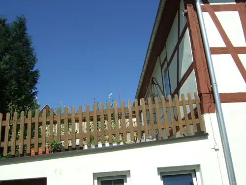
Landhandel Heidersdorf
Farm and orchard · 5.5 km
14 Alte Straße, Heidersdorf
Mo-Fr 08:00-18:00; Sa 08:00-12:00; Su,PH off

Seiffen/Erzgeb.
Monument and historic site · 7.8 km
Municipality in the Erzgebirgskreis of Germany

Skilift Erzgebirge Skiclub Olbernhau
Ski area · 0.9 km
We,Fr 18:00-21:00; Sa 13:00-17:00; Su 10:00-16:00



63 more on the map.
Museums and landmarks119


Museum Olbernhau
Museum · 0.6 km
7 Markt, Olbernhau
Mo,Th-Su,PH 10:00-17:00; Dec 24,Dec 25,Dec 31 off; Jan 10-Jan 31: off

Nußknackermuseum
Museum · 9.0 km
20-24 Bahnhofstraße, Neuhausen/Erzgeb.
Mo-Fr 09:00-18:00; Sa,Su,PH 09:00-17:00

Serpentin- und Heimatmuseum
Museum · 7.9 km
1 Bahnhofstraße, Marienberg
Mo-We 11:00-15:30; Sa,Su 13:00-16:00; PH off

technisches Museum "Alte Stuhlfabrik" Möbelausstellung
Museum · 9.0 km
20-24 Bahnhofstraße, Neuhausen/Erzgeb.
Mo-Fr 09:00-18:00; Sa,Su,PH 09:00-17:00
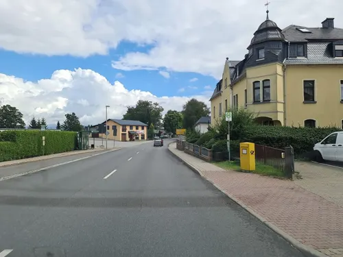
Erzgebirgisches Heimatmuseum „Hospital zu St. Johannis“
Museum · 8.2 km
78 Dresdner Straße, Sayda
Su 09:00-12:00
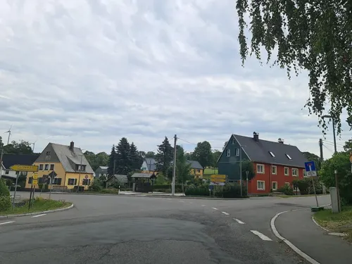
Heimatmuseum Dörnthal
Museum · 8.4 km
516 Freiberger Straße, Olbernhau
Th,Su 14:00-17:00; Mo,We-Sa,PH off
Schauwerkstatt Seiffener Volkskunst
Museum · 7.6 km
12 Bahnhofstraße, Seiffen/Erzgeb.
Mo-Su 10:00-17:00

Bahnstrecke Olbernhau-Grünthal–Deutschneudorf
Monument and historic site · 6.6 km

Glassworks Museum of the Ore Mountains
Museum · 8.7 km
Museum in Germany

107 more on the map.
Parks, trails and playgrounds33



Lernort der Artenvielfalt
Park · 8.1 km
Vom Förderverein Natura Miriqidica e.V. gestaltete naturnahe ehemalige Kulturfläche für die Vielfalt der Pflanzen und Tiere auf dem...




21 more on the map.
Restaurants and cafes81

Schwartenbergbaude
Restaurant · 8.7 km
10 Am Schwartenberg, Neuhausen/Erzgeb.
Mo-Fr 11:00-17:00; PH,Sa,Su 11:00-20:00
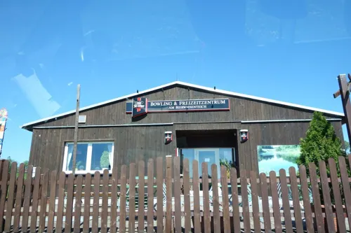
BWT-Bierwiesenteich Pfaffroda I Camping-Freizeit-Gastro-Bowling
Restaurant · German · 4.8 km
Unser kleiner Campingplatz liegt am Bierwiesenteich in Olbernhau-Pfaffroda. Die Stadt Olbernhau ist bekannt durch das Welterbe...
406a Freiberger Straße, Pfaffroda
We-Su

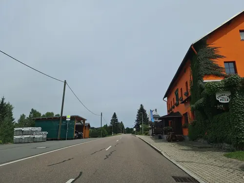
Landhotel Flöhatal
Restaurant · Regional, Pizza · 4.7 km
40 Olbernhauer Straße, Heidersdorf
Mo,Th 17:00-21:00; Fr,Sa 11:30-14:30,17:00-21:00; Su,PH...
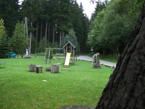
Altsächsischer Gasthof "Kleines Vorwerk"
Restaurant · 8.0 km
Bett+bike
12 Mühlholzweg, Sayda
Mo-Su,PH 11:00+
Bergschänke zum Katzenstein
Restaurant · German · 8.4 km
2 Amtsseite-Katzensteinweg, Marienberg
Mo,Tu off; We-Fr 12:00+; Sa,Su 11:00+
Bollywood
Restaurant · Indian, Italian · 0.8 km
4 Blumenauer Straße, Olbernhau
Mo 10:30-14:00,17:00-22:00; We-Fr 10:00-14:00,17:00-22:00; Sa-Su...

Bäckerei Schmieder
Bakery · 7.5 km
63 Hauptstraße, Seiffen/Erzgeb.
Mo 07:00-10:00; Tu-Th 07:00-17:00; Fr 06:30-17:00; Sa 06:30-10:00;...

Erlebnisgastronomie Braun Mühle Dörnthal
Restaurant · Regional · 8.4 km
55a Dörnthal, Olbernhau
We-Fr 11:30-14:00,17:00-22:00; Sa,Su 11:30-22:00; Mo,Tu off
Philipp's Pizzeria & Ristorante
Restaurant · Italian
45 Grünthaler Straße, Olbernhau
Mo 17:00-23:00; Tu-Th 11:00-14:30,17:00-23:00; Fr...
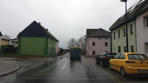
Ratskeller
Restaurant · Regional · 8.1 km
13 Dresdner Straße, Sayda
Mo off; Tu-Su 11:00-14:00,17:30-20:00
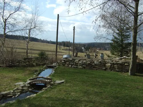


Zur Ofenschenke
Restaurant · Regional · 5.0 km
14 Huthaer Straße, Olbernhau
Tu-Fr 12:00-22:00; Sa-Su 11:00-22:00
69 more on the map.
History
Presumably, the town's name arose from the old German name Albert (Albernhaw, Alberthau, Albernhau, Albretshain). Olbernhau has its origins back in the 13th century. Encouraged by Archbishop Albert I. of Meissen, the so-called White Monks (Cistercians) from Osek founded the first settlement in the upper Flöha valley, shortly after ore was found here. Olbernhau was first mentioned in records in 1434 (as "Albernaw") in a contract documenting the sale of Olbernhau to the patritian Caspar von Berbisdorf.
Ore mining started in 1511. In the course of the Protestant reformation Olbernhau became a parish in 1539. A school is mentioned for the first time in 1556. The solidly built church was consecrated in 1590. About 1684 the industrial art of gunsmithing was introduced in Olbernhau. In 1690, Olbernhau's first barrel forge was erected in the Rungstock valley, and in 1708 the gun manufactory delivered 12,000 guns to the Saxonian Army. In 1815, a gunpowder mill was founded, which was partly destroyed by explosions in the years 1835, 1850 and 1865. The last gun left the Olbernhau factory in 1854.
From the History section of Olbernhau on Wikipedia, under CC BY-SA 4.0.
Where to stay51
Churches and places of worship24
Peter Pauls Kirche Hallbach
Church · Lutheran · 4.6 km
117 Hallbacher Straße, Olbernhau
Römisch-Kath. Kirche
Church · Roman Catholic · 1.0 km
28 Auf der Bleiche, Olbernhau
Schlosskirche St. Georg
Church · Lutheran · 4.3 km
8a Am Schloßberg, Olbernhau
Stadtkirche „Zu unserer lieben Frauen“
Church · Protestant · 8.2 km
5 Am Kirchplatz, Sayda
Shopping34
Gas and EV charging6
BFT Freie Tankstelle Sayda
Gas station · 8.1 km
3 Niederseiffenbacher Straße, Sayda
Schools, colleges and libraries13
Healthcare7
Map of Olbernhau
250 places. The map loads OpenStreetMap tiles when you open it.
Getting there and nearby towns
Dresden Airport (DRS) is the nearest airport with scheduled flights listed in OpenStreetMap, 61 km away.
- Heidersdorf 5 km northeast, about 5 min by car
- Zschopau 21 km northwest, about 21 min by car
- Chemnitz 35 km northwest, about 35 min by car
- Zwönitz 38 km west, about 38 min by car
- Stollberg 40 km west, about 40 min by car
- Dresden 52 km northeast, about 52 min by car
- Penig 54 km northwest, about 54 min by car
- Wilkau-Haßlau 58 km west, about 58 min by car
- Weinböhla 59 km north, about 59 min by car
- Ottendorf-Okrilla 68 km northeast, about 1 h 15 min by car
Drive times are estimates from straight-line distance, not routes.
Local news
Headlines from INDB.
Reviews, tips and questions
Loading what members have shared...
Sources and licences
- GeoNames (CC BY 4.0): population, coordinates, regions and time zone
- Mapillary (see each image): photos
- OpenStreetMap contributors (ODbL 1.0): places, airports, map data
- Wikidata (CC0 1.0): elevation, founding date, time zone, website, landmarks and historic places
- Wikimedia Commons (see each image): photos
- Wikipedia (CC BY-SA 4.0): overview and history text
Photo credits
- Olbernhau Blick auf die Altstadt mit der Stadtkirche (2), Aagnverglaser, CC BY-SA 4.0
- Grünthaler Straße 36, Olbernhau, Gerd Fahrenhorst, CC BY 4.0
- Grünthaler Straße 32, Olbernhau, Gerd Fahrenhorst, CC BY 4.0
- Pension zur Wartburg, Olbernhau, Gerd Fahrenhorst, CC BY 4.0
- Albertstraße 25, Olbernhau, Gerd Fahrenhorst, CC BY 4.0
- Olbernhau, die Pension "Zur Wartburg", Dguendel, CC BY 4.0
- In Olbernhau, die Flöha IMG 8009 2018-08-13 15.07, Michielverbeek, CC BY-SA 4.0
- Olbernhau, Haus August-Bebel-Straße 7, Dguendel, CC BY 4.0
- Schulgebäude Albertstraße 23, Olbernhau, Gerd Fahrenhorst, CC BY 4.0
- Olbernhau, das Rathaus, Dguendel, CC BY 4.0
- 21141-Olbernhau-1919-Blick auf Olbernhau-Brück & Sohn Kunstverlag, Brück & Sohn Kunstverlag Meißen, CC0
- 24259-Olbernhau-1928-Blick auf Olbernhau-Brück & Sohn Kunstverlag, Brück & Sohn Kunstverlag Meißen, CC BY-SA 3.0
- 21147-Olbernhau-1919-Blick auf Olbernhau-Brück & Sohn Kunstverlag, Brück & Sohn Kunstverlag Meißen, CC0
- 11841-Olbernhau-1910-Postamt und Bahnhofstraße-Brück & Sohn Kunstverlag, Brück & Sohn Kunstverlag Meißen, CC0
- 19925-Olbernhau-1915-Zöblitzer Straße-Brück & Sohn Kunstverlag, Brück & Sohn Kunstverlag Meißen, CC0
- 22774-Olbernhau-1924-Blick auf Olbernhau-Brück & Sohn Kunstverlag, Brück & Sohn Kunstverlag Meißen, CC BY-SA 3.0
- 21156-Olbernhau-1919-Blick auf Oberneuschönberg und Kupferhammer-Grüntal-Brück & Sohn Kunstverlag, Brück & Sohn Kunstverlag Meißen, CC0
- 24264-Olbernhau-1928-Blick vom Hainberg auf Olbernhau-Brück & Sohn Kunstverlag, Brück & Sohn Kunstverlag Meißen, CC BY-SA 3.0
- 13894-Olbernhau-1912-Bruchbergfelsen-Brück & Sohn Kunstverlag, Brück & Sohn Kunstverlag Meißen, CC0
- 15067-Olbernhau-1912-Teufelsmauer im Katzensteintal-Brück & Sohn Kunstverlag, Brück & Sohn Kunstverlag Meißen, CC0
- 19931-Olbernhau-1915-Albertstraße-Brück & Sohn Kunstverlag, Brück & Sohn Kunstverlag Meißen, CC0
- 22324-Olbernhau-1923-Blick auf den Ort-Brück & Sohn Kunstverlag, Brück & Sohn Kunstverlag Meißen, CC BY-SA 3.0
- 13356-Olbernhau-1911-Grüntaler Straße-Brück & Sohn Kunstverlag, Brück & Sohn Kunstverlag Meißen, CC0
- 21159-Olbernhau-1919-Blick auf Olbernhau-Brück & Sohn Kunstverlag, Brück & Sohn Kunstverlag Meißen, CC0
- 21155-Olbernhau-1919-Blick auf Olbernhau-Brück & Sohn Kunstverlag, Brück & Sohn Kunstverlag Meißen, CC0
- 25016-Olbernhau-1929-Kriegerdenkmal-Brück & Sohn Kunstverlag, Brück & Sohn Kunstverlag Meißen, CC BY-SA 3.0
- 13355-Olbernhau-1911-Albertstraße-Brück & Sohn Kunstverlag, Brück & Sohn Kunstverlag Meißen, CC0
- 22322-Olbernhau-1923-Blick auf den Ort-Brück & Sohn Kunstverlag, Brück & Sohn Kunstverlag Meißen, CC BY-SA 3.0
- 21149-Olbernhau-1919-Innere Grünthaler Straße-Brück & Sohn Kunstverlag, Brück & Sohn Kunstverlag Meißen, CC0
- 14889-Olbernhau-1912-Natschungtal-Brück & Sohn Kunstverlag, Brück & Sohn Kunstverlag Meißen, CC0
- 15068-Olbernhau-1912-Rungstocktal-Brück & Sohn Kunstverlag, Brück & Sohn Kunstverlag Meißen, CC0
- 19927-Olbernhau-1915-Markt-Brück & Sohn Kunstverlag, Brück & Sohn Kunstverlag Meißen, CC0
- 11844-Olbernhau-1910-Kriegerdenkmal-Brück & Sohn Kunstverlag, Brück & Sohn Kunstverlag Meißen, CC0
- 13311-Olbernhau-1911-Marktplatz-Brück & Sohn Kunstverlag, Brück & Sohn Kunstverlag Meißen, CC0
- 21146-Olbernhau-1919-Blick auf Olbernhau-Brück & Sohn Kunstverlag, Brück & Sohn Kunstverlag Meißen, CC0
- 22325-Olbernhau-1923-Blick auf den Ort-Brück & Sohn Kunstverlag, Brück & Sohn Kunstverlag Meißen, CC BY-SA 3.0
- 13358-Olbernhau-1911-Albertstraße-Brück & Sohn Kunstverlag, Brück & Sohn Kunstverlag Meißen, CC0
- Seiffen (02) 2006-11-30, Norbert Kaiser, CC BY-SA 2.5
- Glashuettenmuseum 001 Museum 2009, René Röder, CC BY 3.0
- Purschenstein, Pessottino, CC BY-SA 3.0
- Katzenstein Erzgebirge, HeikoStamer, CC BY-SA 3.0
- Bahnviadukt Oberlochmühle (1), Aagnverglaser, CC BY-SA 4.0
- Seiffen Museum (01) 2006-11-30, Norbert Kaiser, CC BY-SA 2.5
- Seiffen Kirche 5, Brücke-Osteuropa, Public domain
- PR Buky a javory v Gabrielce 3, Petr Kinšt, CC BY-SA 3.0
- Oberneuschönberg Kirche 1, Geolina163, CC BY-SA 3.0 de
- Stuhlabrik 002, René Röder, CC BY-SA 3.0
- Neuhausen (Erzgeb.), Nussknackermuseum, Riesennussknacker, Dguendel, CC BY 4.0
- Kirche Forchheim, Miebner, CC BY-SA 3.0
- Kirche Pobershau Winter SO, Sebastian Weigelt ( Ambross07 ), CC BY 3.0
- Stadtkirche Zöblitz (09), © 1971markus, CC BY-SA 4.0
- Pfaffroda, Kirche St. Georg, Rauenstein, Public domain
- Kirche Heidersdorf, Aagnverglaser, CC BY-SA 4.0
- 20060924355DR Sayda (Erzg) Stadtkirche Frauenkirche, Jörg Blobelt, CC BY-SA 4.0
- 20150602420DR Neuhausen (Erzgebirge) Schwartenberg Baude, Jörg Blobelt, CC BY-SA 4.0
- Ev.-Luth.Kirche in Neuhausen..2H1A7440WI, Kora27, CC BY-SA 4.0
- Kirche Olbernhau SO, Sebastian Weigelt ( Ambross07 ), CC BY-SA 3.0
- Olbernhau, Museum und Stadtkirche, Dguendel, CC BY 4.0
- Zöblitzer Serpentinsteinmuseum, Lysippos 21:36, 1. Apr. 2008 (CEST), CC BY-SA 2.0 de
- Olbernhau Kath. Kirche (1), Aagnverglaser, CC BY-SA 4.0
- Kirche Hallbach, Sebastian Weigelt ( Ambross07 ), CC BY-SA 3.0
- Dörnthaler Ölmühle (1), © 1971markus, CC BY-SA 4.0
- 0x-kgl-saechs-olb-1, Oxensepp ( talk ), CC BY-SA 3.0
- NSG Schwarzwassertal (Nonnenfelsen), HsBerlin01, CC BY-SA 4.0
- Braun Mühle, Ölmühle Dörnthal (2), © 1971markus, CC BY-SA 4.0
- Friedenslinde (Stadtpark Olbernhau) Gedenkstein, Gerd Fahrenhorst, CC BY 4.0
- Street-level photo, canislupus, CC BY-SA 4.0
- Street-level photo, malenki, CC BY-SA 4.0
- Street-level photo, malenki, CC BY-SA 4.0
- Street-level photo, malenki, CC BY-SA 4.0
- Street-level photo, canislupus, CC BY-SA 4.0
- Street-level photo, canislupus, CC BY-SA 4.0
- Street-level photo, malenki, CC BY-SA 4.0
- Street-level photo, malenki, CC BY-SA 4.0
- Street-level photo, canislupus, CC BY-SA 4.0
- Street-level photo, canislupus, CC BY-SA 4.0
- Street-level photo, canislupus, CC BY-SA 4.0
- Street-level photo, canislupus, CC BY-SA 4.0
- Street-level photo, malenki, CC BY-SA 4.0
- Street-level photo, malenki, CC BY-SA 4.0
- Street-level photo, canislupus, CC BY-SA 4.0
- Street-level photo, canislupus, CC BY-SA 4.0
- Street-level photo, malenki, CC BY-SA 4.0
- Street-level photo, canislupus, CC BY-SA 4.0
- Street-level photo, canislupus, CC BY-SA 4.0
- Street-level photo, canislupus, CC BY-SA 4.0
- Street-level photo, canislupus, CC BY-SA 4.0
- Street-level photo, canislupus, CC BY-SA 4.0
- Street-level photo, canislupus, CC BY-SA 4.0


Page built November 8, 2026. Spotted a mistake? Tell us or suggest a place.