


Why visit Maisach
Townapedia lists 61 museums and landmarks, 33 parks and trails, 183 places to eat, 20 places to stay and 20 attractions in and around town.
Highlights include Vogelpark Olching, Lichtspielhaus, Museum Fürstenfeldbruck and Burgstall Gegenpoint.
Weather in Maisach
Forecast from MET Norway (CC BY 4.0). Full forecast
About Maisach
Maisach (German pronunciation: [ˈmaɪzax]) is a municipality in the district of Fürstenfeldbruck, in Bavaria, Germany.
From the Wikipedia article Maisach (this version), under CC BY-SA 4.0.
Things to do20



Eberlhof
Farm and orchard · 3.7 km
9 Estinger Straße, Emmering
Tu,Th,Fr 08:30-12:30, Th,Fr 14:30-18:00, Sa 08:00-12:00; PH,Su off
Schlammerl Hof
Farm and orchard
25 Estinger Straße, Maisach
Mo "Auf gut Glück", Tu 08:00-13:00, We-Fr 08:00-18:00, Sa 09:00-14:00
Engelsberger Hofladen
Farm and orchard · 5.5 km
1, Fürstenfeldbruck
Th-Fr 09:00-13:00, 15:00-18:00; Sa 09:00-13:00

Maisacher Kleinkunstbühne Hühnerleiter e.V.
Cinema and theater · 0.8 km
17 Schmidhammerstraße, Maisach
Erdbeerfeld Familie Wolf
Farm and orchard · 0.6 km
Erdbeerfeld zum Selberpflücken und Verkauf von fertig gepflückten Erdbeeren der Familie Wolf aus Ebersried
Erdbeerfeld zum Selberpflücken Familie Wolf - Spargel, Erdbeeren, Äpfel
Farm and orchard · 4.0 km
Erdbeerfeld zum Selberpflücken oder fertig gepflückte Erdbeeren kaufen von Familie Wolf

8 more on the map.
Museums and landmarks61
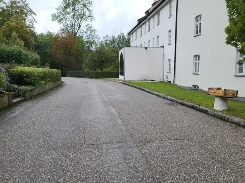
Museum Fürstenfeldbruck
Museum · 5.5 km
6 Fürstenfeld, Fürstenfeldbruck
Tu-Sa 13:00-17:00; Su,PH 11:00-17:00

Burgstall Gegenpoint
Monument and historic site · 5.1 km
The site of a ruined spur castle from the high middle ages, which stood about 2km to the east of Fürstenfeld Abbey in Fürstenfeldbruck,...



Ehrenmal der Luftwaffe
Monument and historic site · 2.8 km
Monument in Fürstenfeldbruck, Germany
Ehrenmal der Luftwaffe und der Luftfahrt
Monument and historic site · 2.8 km


Abschnittsbefestigung Puch
Monument and historic site · 5.5 km
Die Wallburg sitzt auf der südöstlichen Kante des Geländeabbruches. Zwei annähernd rechtwinklige Wallgräben sichern einen etwa 70 mal...
Kunstwerkstatt59
Museum · 4.7 km
59 Schöngeisinger Straße, Fürstenfeldbruck
Sa[1] 11:00+
49 more on the map.
Parks, trails and playgrounds33

Golfanlage Rottbach
Golf course · 3.6 km
3 x 9 hole Par 36
5, Maisach
May-Aug: Mo-Su,PH 08:00-19:00; Apr: Mo-Su,PH 08:00-18:00; Sep:...

Freibad AmperOase
Sports field and stadium · 5.0 km
7 Klosterstraße, Fürstenfeldbruck
Mo 11:00 - 20:00; Th 07:00 - 20:00; We 09:00 - 20:00; Th 07:00 -...

Hallenbad AmperOase
Sports field and stadium · 4.9 km
7 Klosterstraße, Fürstenfeldbruck
Mo 13:00-17:00; Tu 10:00-17:00; We-Fr 10:00-21:00; Sa-Su...
Kletterinsel Monkee Island
Sports field and stadium · 4.9 km
14 Fürstenfeld, Fürstenfeldbruck
Mo off; Tu-Th,Su 10:00-19:00; Fr 13:00-19:00; Sa 11:00-19:00
Freibad Maisach
Sports field and stadium · 0.8 km
Mo 12:00-20:00, Tu,Th 06:00-08:00, We,Th,Sa 10:00-20:00, Tu,Fr...


21 more on the map.
Restaurants and cafes183
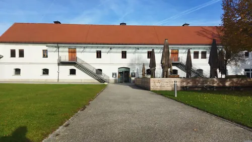
Fürstenfelder
Restaurant · Regional, Barbecue · 5.3 km
Navi Adresse Parkplatz Zisterzienserweg
15 Fürstenfeld, Fürstenfeldbruck
Mo-Sa 11:30-14:00, Tu-Sa 17:30-21:30, Su 11:00-14:00
Avra
Restaurant · Greek · 2.9 km
2a Rudolf-Diesel-Ring, Fürstenfeldbruck
Mo-Su 11:30-14:30,17:00-00:00

Gasthof Heinzinger
Restaurant · Regional · 4.1 km
Greenchefs; Slow Food Chef Alliance
1 Weiherhauser Straße, Maisach
Mo,Tu off; We-Su 11:00-14:30,17:30-22:00
Bei Loren
Restaurant · Bavarian, Croatian · 2.6 km
1 Sportstraße, Maisach
Mo off; Tu-We 17:00-22:00; Th 17:00-24:00; Fr 17:00-23:00; Sa...
Bottles'n'Burgers
Restaurant · Burger · 4.5 km
8 Schöngeisinger Straße, Fürstenfeldbruck
Mo,We,Th 17:00-23:00, Fr,Sa 17:00-01:00, Su 16:00-22:00
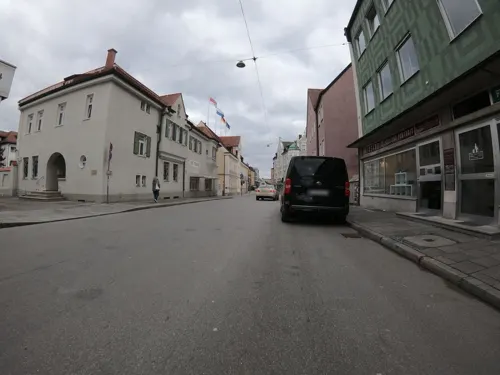
Brucker Hafen
Restaurant · Seafood, Bistro, Fish · 4.3 km
2a Ludwigstraße, Fürstenfeldbruck
Tu-Fr 09:00-18:00, Sa 08:30-14:30
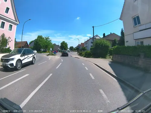
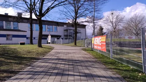
Bürgerhaus Emmering
Restaurant · Bavarian · 3.7 km
Mo, We-Fr 16:00-23:00; Sa, Su 10:00-23:00, PH 10:00-23:00
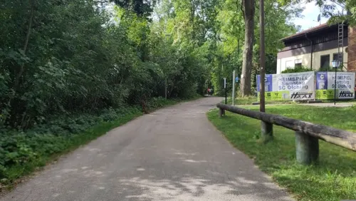
Dahoam
Restaurant · Regional · 4.2 km
25 Toni-März-Straße, Olching
Mo,Tu,Th,Fr 17:00-23:00; Sa 11:00-23:00; Su 11:00-19:00
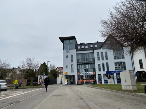
Dailys
Restaurant · Sandwich · 4.5 km
5 Ludwigstraße, Fürstenfeldbruck
Mo-Fr 06:00-23:00; Sa-Su 09:00-21:00


Emmeringer An den Amperauen
Restaurant · 3.7 km
13 Amperstraße, Emmering
Tu-Su 11:30-14:00,17:30-23:00
171 more on the map.
History
The first documentary record of Maisach comes from the year 806. For the other districts excepting Gernlinden there are also records coming from the second half of the 8th and first half of the 9th century. Gernlinden is first recorded in 1436.
In 1818 the community was established. The settlement Gernlinden was built after the first world war. The current organisation of the districts was carried out in 1978.
From the History section of Maisach on Wikipedia, under CC BY-SA 4.0.
Where to stay20
Motorhome area of Fürstenfeldbruck (Upper Bavaria)
Campground · 5.1 km
Klosterstraße, Fürstenfeldbruck
Churches and places of worship52
St. Jakobus der Ältere
Church · Roman Catholic · 6.0 km
10 Am Kreuzweg, Bergkirchen
St. Margareta
Church · Roman Catholic · 5.9 km
16 Brucker Straße, Sulzemoos
Shopping60
Gas and EV charging20
Schools, colleges and libraries35
Healthcare22
Map of Maisach
250 places. The map loads OpenStreetMap tiles when you open it.
Getting there and nearby towns
Sonderflughafen Oberpfaffenhofen (OBF) is the nearest airport with scheduled flights listed in OpenStreetMap, 15 km away.
- Olching 5 km east, about 5 min by car
- Puchheim 10 km southeast, about 10 min by car
- Planegg 17 km southeast, about 17 min by car
- Mering 22 km west, about 22 min by car
- Oberschleißheim 23 km east, about 23 min by car
- Munich 25 km east, about 25 min by car
- Unterschleißheim 24 km east, about 24 min by car
- Starnberg 25 km south, about 25 min by car
- Unterföhring 28 km east, about 28 min by car
- Augsburg 32 km northwest, about 32 min by car
Drive times are estimates from straight-line distance, not routes.
Local news
Headlines from INDB.
Reviews, tips and questions
Loading what members have shared...
Sources and licences
- GeoNames (CC BY 4.0): population, coordinates, regions and time zone
- Mapillary (see each image): photos
- OpenStreetMap contributors (ODbL 1.0): places, airports, map data
- Wikidata (CC0 1.0): elevation, founding date, time zone, website, landmarks and historic places
- Wikimedia Commons (see each image): photos
- Wikipedia (CC BY-SA 4.0): overview and history text
Photo credits
- Maisach Rathaus, Richard Huber, CC BY-SA 3.0
- Gernlindener Str 17 Maisach 2, Ricardalovesmonuments, CC BY-SA 4.0
- Gernlindener Str 17 Maisach 1, Ricardalovesmonuments, CC BY-SA 4.0
- Estinger Str 7 Maisach 3, Ricardalovesmonuments, CC BY-SA 4.0
- Estinger Str 7 Maisach 1, Ricardalovesmonuments, CC BY-SA 4.0
- Estinger Str 7 Maisach 2, Ricardalovesmonuments, CC BY-SA 4.0
- Estinger Str 7 Maisach 4, Ricardalovesmonuments, CC BY-SA 4.0
- Hauptstraße 25 Maisach 3, Ricardalovesmonuments, CC BY-SA 4.0
- Hauptstraße 25 Maisach 1, Ricardalovesmonuments, CC BY-SA 4.0
- Hauptstraße 25 Maisach 2, Ricardalovesmonuments, CC BY-SA 4.0
- Brauerei Maisach v ONO, Ricardalovesmonuments, CC BY-SA 4.0
- Hauptstraße 26 Maisach, Ricardalovesmonuments, CC BY-SA 4.0
- Brauerei Maisach SO-Ansicht, Ricardalovesmonuments, CC BY-SA 4.0
- Emmeringer Str 3 Maisach, Ricardalovesmonuments, CC BY-SA 4.0
- Brauerei Maisach Bräustüberl, Ricardalovesmonuments, CC BY-SA 4.0
- Brauerei Maisach Sudhaus, Ricardalovesmonuments, CC BY-SA 4.0
- Bräuhausstr 21 Maisach 2, Ricardalovesmonuments, CC BY-SA 4.0
- Hauptstraße 23 Maisach alter Rückteil, Ricardalovesmonuments, CC BY-SA 4.0
- Bräuhausstr 21 Maisach 1, Ricardalovesmonuments, CC BY-SA 4.0
- Brauerei Maisach v WNW, Ricardalovesmonuments, CC BY-SA 4.0
- Überackerstr 13 Maisach, Ricardalovesmonuments, CC BY-SA 4.0
- Hauptstraße 22 Maisach, Ricardalovesmonuments, CC BY-SA 4.0
- Friedhofstr 4 Maisach 2, Ricardalovesmonuments, CC BY-SA 4.0
- Hauptstraße 18 Maisach 1, Ricardalovesmonuments, CC BY-SA 4.0
- Hauptstraße 18 Maisach 2, Ricardalovesmonuments, CC BY-SA 4.0
- Friedhofstr 4 Maisach 1, Ricardalovesmonuments, CC BY-SA 4.0
- Hauptstraße 18 Maisach 3, Ricardalovesmonuments, CC BY-SA 4.0
- Hauptstraße 16 Maisach, Ricardalovesmonuments, CC BY-SA 4.0
- Bräuhausstr 6 Maisach 2, Ricardalovesmonuments, CC BY-SA 4.0
- Bräuhausstr 6 Maisach 1, Ricardalovesmonuments, CC BY-SA 4.0
- Bräuhausstr 4 Maisach, Ricardalovesmonuments, CC BY-SA 4.0
- Bräuhausstr 6 Maisach 3, Ricardalovesmonuments, CC BY-SA 4.0
- Kandlerstr 5 Maisach, Ricardalovesmonuments, CC BY-SA 4.0
- Überackerstr 19 Maisach 1, Ricardalovesmonuments, CC BY-SA 4.0
- Burgstall Gegenpoint, Owain2002, CC BY-SA 4.0
- Aerial image of Fürstenfeld Abbey (view from the west), Carsten Steger, CC BY-SA 4.0
- Überreste der Abschnittsbefestigung Puch 01, Jonathan Grundmann, CC BY-SA 4.0
- St. Mariä Himmelfahrt 2022-08-21, 2015 Michael 2015, CC BY-SA 4.0
- Olching, Gymnasium Gesamtansicht vom Haupteingang, Didi43, CC BY-SA 3.0
- Schloss Lauterbach, Richard Huber, CC BY-SA 3.0
- Erlöserkirche 2022-08-21, 2015 Michael 2015, CC BY-SA 4.0
- Maisacher Strasse 7, Kadir Kara, CC BY-SA 3.0 de
- Einsbach Heilig Blut Turm 777, GFreihalter, CC BY-SA 3.0
- Olching, Kirche St.Peter und Paul mit neugestaltetem Nöscherplatz, Didi43, CC BY-SA 3.0
- St. Michael (Rottbach) - 2, Ricardalovesmonuments, CC BY-SA 4.0
- DAH-Lauterbach Kirche St Jakobus 001 201501 270, K.Baas, CC BY-SA 4.0
- St. Margaretha Einsbach 21, Edelmauswaldgeist, CC0
- Gernlinden Bruder Konrad, Mtag, CC BY-SA 4.0
- Johanneskirche (Olching), Ricardalovesmonuments, CC BY-SA 4.0
- Esting, Pfarrzentrum v SO, 2, Renardo la vulpo, CC BY-SA 4.0
- FFB-Gelbenholzen Wasserreservoir, K.Baas, CC BY-SA 3.0 de
- FFB-Pfaffing St. Stephan 001, K.Baas, CC BY-SA 3.0 de
- Ehrenmal der Luftwaffe 10 Vorfeld-, Ehrenmal_der_Luftwaffe_10_Vorfeld.JPG : Smartyo derivative work: An-d ( talk ), Public domain
- Mittelschule Olching Haupteingang, Zipbiker, CC BY-SA 4.0
- Außenansicht Nordseite, Zipbiker, CC BY-SA 4.0
- FFB, Neue Bühne Bruck v S, 1, Renardo la vulpo, CC0
- Street-level photo, thmunichways, CC BY-SA 4.0
- Street-level photo, changchun1, CC BY-SA 4.0
- Street-level photo, maturion, CC BY-SA 4.0
- Street-level photo, meskalin, CC BY-SA 4.0
- Street-level photo, soulcover, CC BY-SA 4.0
- Street-level photo, ramap, CC BY-SA 4.0
- Street-level photo, ffb20fh, CC BY-SA 4.0
- Street-level photo, meskalin, CC BY-SA 4.0
- Street-level photo, santilinares04, CC BY-SA 4.0
- Street-level photo, thmunichways, CC BY-SA 4.0
- Street-level photo, wegatest, CC BY-SA 4.0
- Street-level photo, santilinares04, CC BY-SA 4.0
- Street-level photo, maturion, CC BY-SA 4.0
- Street-level photo, santilinares04, CC BY-SA 4.0
- Street-level photo, changchun1, CC BY-SA 4.0
- Street-level photo, charles58330, CC BY-SA 4.0
- Street-level photo, maturion, CC BY-SA 4.0
- Street-level photo, maturion, CC BY-SA 4.0
- Street-level photo, maturion, CC BY-SA 4.0
- Street-level photo, thmunichways, CC BY-SA 4.0
- Street-level photo, maturion, CC BY-SA 4.0
- Street-level photo, santilinares04, CC BY-SA 4.0
- Street-level photo, maturion, CC BY-SA 4.0
- Street-level photo, soulcover, CC BY-SA 4.0
- Street-level photo, rafleo2008, CC BY-SA 4.0
- Street-level photo, rafleo2008, CC BY-SA 4.0


Page built November 8, 2026. Spotted a mistake? Tell us or suggest a place.