


Unterschleißheim, Germany
Unterschleißheim is a town of 28,482 people in Bavaria, Germany.
Why visit Unterschleißheim
Townapedia lists 26 museums and landmarks, 32 parks and trails, 119 places to eat, 13 places to stay and 9 attractions in and around town.
Highlights include Capitol, Bio-Hofladen, Neues Schloss Schleißheim and Schloss Lustheim.
Weather in Unterschleißheim
Forecast from MET Norway (CC BY 4.0). Full forecast
About Unterschleißheim
Unterschleißheim (German pronunciation: [ʊntɐˈʃlaɪsˌhaɪm] , lit. 'Lower Schleißheim', in contrast to "Upper Schleißheim"; Central Bavarian: Untaschleißheim) is a town in Bavaria, Germany. It is located about 17 km north of Munich central, and has a resident population of 29,464 (December 31, 2021).
From the Wikipedia article Unterschleißheim (this version), under CC BY-SA 4.0.
Things to do9


Bio-Hofladen
Farm and orchard · 2.1 km
37 Mittenheim, Oberschleißheim
Mo-Th 10:00-20:00; Fr 10:00-14:00; Sa,Su,PH off
Marionettentheater Bille Unterschleißheim
Cinema and theater · 0.9 km
25 Raiffeisenstraße, Unterschleißheim
Museums and landmarks26

Neues Schloss Schleißheim
Monument and historic site · 3.7 km
1 Max-Emanuel-Platz, Oberschleißheim
Apr-Sep Tu-Su 09:00-18:00; Oct-Mar Tu-Su 10:00-16:00; Jan 1,Dec...

Schloss Lustheim
Monument and historic site · 3.5 km
1 Schloß Lustheim, Oberschleißheim
Apr-Sep Tu-Su 09:00-18:00; Oct-Mar Tu-Su 10:00-16:00; Jan 1,Dec...

Altes Schloss Schleißheim
Monument and historic site · 3.8 km
Apr-Sep Tu-Su 09:00-18:00; Oct-Mar Tu-Su 10:00-16:00; Jan 01,Dec...

Meißener Porzellan-Sammlung Stiftung Ernst Schneider
Museum · 3.5 km
1 Schloß Lustheim, Oberschleißheim
Apr-Sep Tu-Su 09:00-18:00; Oct-Mar Tu-Su 10:00-16:00; Jan 1,Dec...
Ökumenische Sammlung Gertrud Weinhold
Museum · 3.7 km
1 Max-Emanuel-Platz, Oberschleißheim
Apr-Sep Tu-Su 09:00-18:00; Oct-Mar Tu-Su 10:00-16:00; Jan 1,Dec...
Sammlung zur Landeskunde Ost- und Westpreußens
Museum · 3.8 km
1 Maximilianshof, Oberschleißheim
Apr-Sep Tu-Su 09:00-18:00; Oct-Mar Tu-Su 10:00-16:00; Jan 1,Dec...
Stadtmuseum Unterschleißheim
Museum · 1.0 km
Tu 09:00-12:00; Th 16:00-19:00; Su[1] 13:00-16:00; PH off

Erinnerungsort NS-Zwangsarbeit in der Flachsröste Lohhof
Monument and historic site · 0.9 km
Virtueller Lernort Im Flachsfeld


14 more on the map.
Parks, trails and playgrounds32




20 more on the map.
Restaurants and cafes119

Kurfürst
Restaurant · 3.3 km
15 Hochmuttinger Straße, Oberschleißheim
Mo-Fr 11:30-14:30,18:00-00:30; Sa 11:30-00:30, PH,Su 11:30-23:00
Ashish
Restaurant · Indian · 3.5 km
10d Obere Hauptstraße, Eching
Mo-Fr 11:15-14:30,17:15-22:30; Sa-Su 11:30-22:30
Athene
Restaurant · Greek · 0.9 km
7 Max-Planck-Straße, Unterschleißheim
Su-Fr 11:00-15:00,17:30-00:30; Sa 11:00-15:00,17:00-00:30
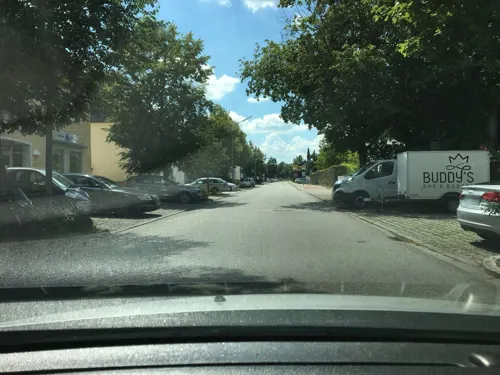
Buddy's Bar & Burger
Restaurant · German, Burger
36 Bezirksstraße, Unterschleißheim
Tu-Fr 11:00-23:00; Sa-Su 09:00-23:00


Clubhaus Eching - Restaurant, Bar & Biergarten
Restaurant · Regional, Burger · 3.7 km
2 Am Dr.-Enßlin-Park, Eching
We-Th 16:00-23:00, Fr 16:00-01:00, Sa 11:30-01:00, Su 11:30-23:00
Cơmviệt
Restaurant · Vietnamese · 0.8 km
40 Hauptstraße, Unterschleißheim
Tu-Su 11:00-14:30,17:00-23:00
Da Rocco
Restaurant · Italian · 1.5 km
2 Orionstraße, Unterschleißheim
Mo-Fr 11:30-14:00,17:30-22:00; Sa 17:30-22:00
Die neuen Bürgerstuben
Restaurant · Regional · 3.3 km
29 Theodor-Heuss-Straße, Oberschleißheim
We-Sa 11:30-23:00; Su 11:00-21:00
Drei Linden
Restaurant · Croatian
42 Bezirksstraße, Unterschleißheim
Mo 11:30-14:00,17:00-22:30; Tu off; We-Th 11:30-14:00,17:00-22:30;...


107 more on the map.
History
Originally, the area was called Schleissheim ("Sleizheim") for centuries. Not until the 19th Century was it divided into (upper) Oberschleissheim and (lower) Unterschleissheim for population and political reasons. The small hamlet of Mittenheim lay between the two communities.
There is evidence that the area was inhabited as far back as the Bronze Age. Remnents of a road marker and a Villa Rustica were found from the Roman Era.
The first surviving document in which Schleißheim is mentioned comes from the year 785 AD in which Rihpalt von Slivesheim donated his estate to the diocese of Freising. The hamlet “Schleyßaim” was already a village as early as the 12th century.
The small church of St. Martin in Mallertshofen, (a Romanesque church) was built in the Schleissheim area in the first half of the 13th century.
The catholic church building of St. Ulrich was first built in 1518.
The community suffered heavy losses during the Thirty Years' War (1618–48).
The Palace Complex in Schleissheim was built over a period of 130 years, (from the 1590s by the Dukes of Bavaria, to the 1720s by the Electors of Bavaria). The palace was mostly used as a summer residence for the Bavarian rulers of the House of Wittelsbach.
From the History section of Unterschleißheim on Wikipedia, under CC BY-SA 4.0.
Where to stay13
Churches and places of worship19
Shopping43
Gas and EV charging19
Heizkraftwerk Oberschleißheim
EV charging · 3.5 km
2 Am Michaelianger, Oberschleißheim
bike-energy Ladestation
EV charging · 1.4 km
2 Hartmut-Hermann-Weg, Unterschleißheim
Schools, colleges and libraries25
Edith-Stein-Schule / Sehbehinderten- und Blinden-Zentrum Südbayern
School · 0.8 km
1 Pater-Setzer-Platz, Unterschleißheim
Healthcare7
KfH-Nierenzentrum
Clinic and pharmacy · 3.6 km
1b Freisinger Straße, Oberschleißheim
Map of Unterschleißheim
250 places. The map loads OpenStreetMap tiles when you open it.
Getting there and nearby towns
Munich International Airport (MUC) is the nearest airport with scheduled flights listed in OpenStreetMap, 17 km away.
- Oberschleißheim 3 km south, about 3 min by car
- Munich 16 km south, about 16 min by car
- Wolnzach 36 km north, about 36 min by car
- Wolfratshausen 42 km south, about 42 min by car
- Augsburg 51 km west, about 51 min by car
- Ingolstadt 55 km north, about 55 min by car
- Wasserburg am Inn 54 km southeast, about 54 min by car
- Weilheim 58 km southwest, about 58 min by car
- Waldkraiburg 61 km east, about 1 h by car
- Vilsbiburg 61 km east, about 1 h by car
Drive times are estimates from straight-line distance, not routes.
Local news
Headlines from INDB.
Reviews, tips and questions
Loading what members have shared...
Sources and licences
- GeoNames (CC BY 4.0): population, coordinates, regions and time zone
- Mapillary (see each image): photos
- OpenStreetMap contributors (ODbL 1.0): places, airports, map data
- Wikidata (CC0 1.0): elevation, founding date, time zone, website
- Wikimedia Commons (see each image): photos
- Wikipedia (CC BY-SA 4.0): overview and history text
Photo credits
- Rathaus Unterschleißheim, Haupteingang, 22.8.2015 - 2, Sacha47, CC BY-SA 4.0
- Genezareth Kirche, Unterschleißheim, Genezareth-USH, CC BY-SA 3.0
- Schleissheim-Maximilianshof-01, AHert, CC BY-SA 3.0
- Schloss Lustheim Gartenseite-2, Rufus46, CC BY-SA 3.0
- Unterschleißheim, See Valentinspark, Sacha47, CC BY-SA 3.0
- Unterschleißheim, Lohwaldpark 1, Sacha47, CC BY-SA 3.0
- Unterschleißheim Alt St. Ulrich 154, GFreihalter, CC BY-SA 3.0
- Kirche Inhausen-01, AHert, CC BY-SA 3.0
- 20220312 Luitpoldpark Oberschleißheim 01, Flocci Nivis, CC BY 4.0
- OberschleißheimAmBergl-01, AHert, CC BY-SA 3.0
- LustheimKapelle-01, AHert, CC BY-SA 3.0
- Trinitatiskirche Oberschleißheim 1 (cropped), Edelmauswaldgeist, CC0
- 20220320 Berglwald 03, Flocci Nivis, CC BY 4.0
- 20220312 Lustheim 01, Flocci Nivis, CC BY 4.0
- Lohhof, St. Korbinian (1), Cmcmcm1, CC BY-SA 4.0
- St. Wilhelm Oberschleißheim, Edelmauswaldgeist, CC0
- Mausoleum Ottershausen-01, AHert, CC BY-SA 3.0
- Mallertshofer Holz mit Heiden GO-4, Gras-Ober, CC BY-SA 3.0
- Oberschleißheim, Kirche Maria PB v SO, 2, Renardo la vulpo, CC BY-SA 4.0
- Lohhof, Kirche St. Korbinian, Sacha47, CC BY-SA 3.0
- Aerial image of the Schleissheim Palace, Carsten Steger, CC BY-SA 4.0
- Mallertshofen GO-1, Gras-Ober, CC BY-SA 3.0
- OberschleißheimLuitpolddenkmal-01, AHert, CC BY-SA 3.0
- Street-level photo, uevchen64, CC BY-SA 4.0
- Street-level photo, chicc0, CC BY-SA 4.0
- Street-level photo, chicc0, CC BY-SA 4.0
- Street-level photo, chicc0, CC BY-SA 4.0
- Street-level photo, chicc0, CC BY-SA 4.0
- Street-level photo, chicc0, CC BY-SA 4.0
- Street-level photo, chicc0, CC BY-SA 4.0
- Street-level photo, chicc0, CC BY-SA 4.0
- Street-level photo, chicc0, CC BY-SA 4.0
- Street-level photo, chicc0, CC BY-SA 4.0
- Street-level photo, chicc0, CC BY-SA 4.0
- Street-level photo, chicc0, CC BY-SA 4.0
- Street-level photo, frhh211, CC BY-SA 4.0
- Street-level photo, chuck, CC BY-SA 4.0
- Street-level photo, frhh211, CC BY-SA 4.0
- Street-level photo, uevchen64, CC BY-SA 4.0
- Street-level photo, fabifrz, CC BY-SA 4.0
- Street-level photo, chicc0, CC BY-SA 4.0
- Street-level photo, thmunichways, CC BY-SA 4.0
- Street-level photo, chuck, CC BY-SA 4.0
- Street-level photo, chuck, CC BY-SA 4.0
- Street-level photo, chicc0, CC BY-SA 4.0
- Street-level photo, chicc0, CC BY-SA 4.0
- Street-level photo, chicc0, CC BY-SA 4.0


Page built November 8, 2026. Spotted a mistake? Tell us or suggest a place.