


Why visit Starnberg
Townapedia lists 96 museums and landmarks, 41 parks and trails, 129 places to eat, 19 places to stay and 20 attractions in and around town.
Highlights include Breitwand, Bismarckturm Assenhausen, Museum Starnberger See and Kaiserin-Elisabeth-Museum.
Weather in Starnberg
Forecast from MET Norway (CC BY 4.0). Full forecast
About Starnberg
Starnberg (German pronunciation: [ˈʃtaʁnbɛʁk] ) is a town in Bavaria, Germany, approximately 23 kilometres (14 mi) southwest of Munich. It is at the north end of Lake Starnberg, in the heart of the "Five Lakes Country", and serves as capital of the district of Starnberg.
From the Wikipedia article Starnberg (this version), under CC BY-SA 4.0.
Travel tips from other travellers: Starnberg on Wikivoyage (CC BY-SA 4.0).
Things to do20



Assenhauserhof
Farm and orchard · 5.1 km
1 Kirchplatz, Berg
We,Sa 08:30-12:00; Fr 14:30-18:00

Mittelpunkt Aufkirchner Hügelkreis
Scenic view · 5.4 km
Mittelpunkt einer geologischen Sonderformation die auf einen nacheiszeitlichen Meteoriteneinschlag hindeuten könnte

8 more on the map.
Museums and landmarks96

Museum Starnberger See
Museum · 0.8 km
5 Possenhofener Straße, Starnberg
We-Fr 14:00-18:00; Sa-Su 11:00-18:00; Mo-Tu off

Kaiserin-Elisabeth-Museum
Museum · 5.2 km
May 01-Oct 15: Fr,Sa,Su,PH 12:00-18:00; Oct 16-Apr 30 off ||...

Berg Castle
Monument and historic site · 3.6 km
29 Wittelsbacherstraße

Burgstall Karlsburg
Monument and historic site · 3.8 km
Im Westen auf einem Plateau die mittelalterliche, um 1313 zerstörte Burganlage. Das Baumaterial wurde im 16. Jahrhundert abgetragen und...

Burgstall Schlossberg
Monument and historic site · 4.9 km
Hochmittelalterliche Ministerialburg. Die Hauptburg im SW ist von einem maximal 1m tiefen Hanggraben umgeben und von der Vorburg durch...

Villa Rustica Leutstetten
Monument and historic site · 2.7 km
Römischer Gutshof aus dem 2. Jahrhundert. Die Grundmauern sind mit Gabionen nachgebildet, der Bereich der Fußbodenheizung ist durch...

ArtForum
Museum · 5.7 km
Atelier von Leonard Lorenz - Skulpturen und Gemälde
103 Starnberger Straße, Schäftlarn

Rose Island
Monument and historic site · 7.2 km
Island in Lake Starnberg, Feldafing, Germany

84 more on the map.
Parks, trails and playgrounds41

Seebad Starnberg
Sports field and stadium · 0.8 km
17 Strandbadstraße, Starnberg
Mo,Th 10:00-21:00; Tu,We,Fr 07:00-21:00; Sa,Su,PH 09:00-21:00


Bootshafen und Service Sattler Werft
Marina and boat launch · 1.2 km


Spielplatz Hanau-Park
Playground · 1.7 km
1a Kempterstraße, Starnberg
Apr-Sep 07:00-22:00; Oct-Mar 08:00-19:00
Spielplatz Söcking
Playground · 2.2 km
21 Carolinenstraße, Starnberg
Apr-Sep 07:00-22:00; Oct-Mar 08:00-19:00
29 more on the map.
Restaurants and cafes129
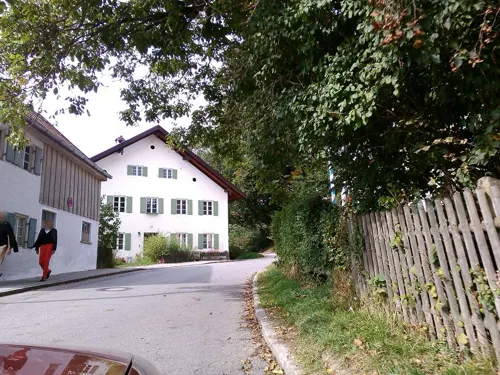

Gasthaus zur Sonne
Restaurant · Regional, German
7 Hanfelder Straße, Starnberg
Mo-Fr 10:00-22:30; Sa,Su,PH off
Amandines et Chocolats
Cafe · French · 0.6 km
27 Hauptstraße, Starnberg
Mo-Fr 07:30-15:30; Sa-Su 07:30-13:00
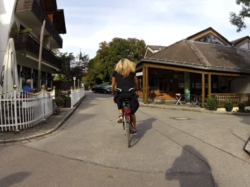
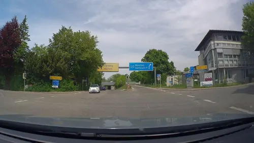
Banthai
Restaurant · Sushi · 1.5 km
2 Buchhofstraße, Starnberg
Mo-Fr 11:30-14:00,17:30-22:00; Su,PH 17:30-22:00; Sa off
Coffee Fellows
Cafe · Coffee Shop · 0.7 km
3b Seepromenade, Starnberg
Mo-Th,Su 09:00-20:00; Fr-Sa 09:00-21:00
Gasthaus zur Schießstätte
Restaurant · Croatian, German, Regional · 1.3 km
4 Am Hofbuchet, Starnberg
Mo-Tu 16:00-22:00; Th 11:00-14:30,17:30-22:00; Sa 11:00-22:00; Su...


Il Duetto dello Stretto
Restaurant · Italian
12a Wittelsbacherstraße, Starnberg
We-Mo 11:30-14:30; 17:30-22:30; Tu off
117 more on the map.
History
The town was first mentioned in 1226 under the name of Aheim am Würmsee. Würmsee (Lake Würm, after the river of the same name) was the official name of Lake Starnberg until 1962.
The founding of Starnberg Castle is attributed to the Counts of Andechs and dates back to the 11th century. As a defensive structure, the castle is probably older due to its strategic location. Starnberg Castle was first mentioned in documents in 1244. After the death of the last Andechser (1248), the Wittelsbach family, dukes of Bavaria, took over the castle. The dukes then integrated the Starnberg area into their administrative and judicial system. From around 1346, it was the seat of its own court.
In 1541, under Duke Wilhelm IV, the medieval castle was demolished and a residential and defensive building was redesigned in the Renaissance style. Under Duke Albert V, the conversion into a pleasure palace and summer residence began. In 1643, the Swedes stormed the castle during the Thirty Years War and partially destroyed it. Under Elector Ferdinand Maria, the castle was an important summer residence, and from 1663 the magnificent ship Bucentaur, based on the Venetian model of the Doges of Venice, floated on Lake Starnberg.
From the History section of Starnberg on Wikipedia, under CC BY-SA 4.0.
Where to stay19
Churches and places of worship44
Shopping32
Gas and EV charging5
Schools, colleges and libraries33
Fachhochschule für öffentliche Verwaltung und Rechtspflege in Bayern Fachbereich Rechtspflege
School · 1.0 km
4 Josef-Sigl-Straße, Starnberg
Healthcare17
Map of Starnberg
250 places. The map loads OpenStreetMap tiles when you open it.
Getting there and nearby towns
Sonderflughafen Oberpfaffenhofen (OBF) is the nearest airport with scheduled flights listed in OpenStreetMap, 10 km away.
- Wolfratshausen 11 km southeast, about 11 min by car
- Taufkirchen 21 km east, about 21 min by car
- Unterhaching 21 km east, about 21 min by car
- Munich 23 km northeast, about 23 min by car
- Weilheim 23 km southwest, about 23 min by car
- Unterföhring 31 km northeast, about 31 min by car
- Vaterstetten 34 km east, about 34 min by car
- Unterschleißheim 35 km northeast, about 35 min by car
- Augsburg 53 km northwest, about 53 min by car
- Wasserburg am Inn 66 km east, about 1 h by car
Drive times are estimates from straight-line distance, not routes.
Local news
Headlines from INDB.
Reviews, tips and questions
Loading what members have shared...
Sources and licences
- GeoNames (CC BY 4.0): population, coordinates, regions and time zone
- Mapillary (see each image): photos
- OpenStreetMap contributors (ODbL 1.0): places, airports, map data
- Wikidata (CC0 1.0): elevation, founding date, time zone, website, landmarks and historic places
- Wikimedia Commons (see each image): photos
- Wikipedia (CC BY-SA 4.0): overview and history text
Photo credits
- Starnberg, HB-06, Boschfoto, CC BY-SA 3.0
- Gymnasium Starnberg, Bruno413, CC0
- Kaiser-Wilhelm-Str 10, Starnberg, Ricardalovesmonuments, CC BY-SA 4.0
- Tutzinger-Hof-Platz, Starnberg - geo.hlipp.de - 22155, Colin Smith on geo.hlipp.de, CC BY-SA 2.0
- Tutzingerhofplatz 3 (Erker), Starnberg, Ricardalovesmonuments, CC BY-SA 4.0
- Starnberg, Tutzinger-Hof-Platz 3, Obermayr-Haus, 2, Renardo la vulpo, CC0
- Hanfelder Str 11, Starnberg - 2, Ricardalovesmonuments, CC BY-SA 4.0
- Hanfelder Str 11, Starnberg - 1, Ricardalovesmonuments, CC BY-SA 4.0
- Söckinger Str 15, Starnberg, Ricardalovesmonuments, CC BY-SA 4.0
- Starnberg, Wittelsbacher Strasse - geo.hlipp.de - 22158, Colin Smith on geo.hlipp.de, CC BY-SA 2.0
- Starnberg, Friedenskirche, 3, Renardo la vulpo, CC BY-SA 4.0
- Hauptstrasse, Starnberg - geo.hlipp.de - 22153, Colin Smith on geo.hlipp.de, CC BY-SA 2.0
- Wittelsbacher Strasse, Starnberg - geo.hlipp.de - 22157, Colin Smith on geo.hlipp.de, CC BY-SA 2.0
- Ev Friedenskirche Starnberg - 6, Ricardalovesmonuments, CC BY-SA 4.0
- Kaiser-Wilhelm-Str 9, Starnberg, Ricardalovesmonuments, CC BY-SA 4.0
- Ev Friedenskirche Starnberg - 5, Ricardalovesmonuments, CC BY-SA 4.0
- Friedhof an der Hanfelder Straße (Starnberg) 07, Wikitarisch, CC BY 4.0
- Starnberg, Villa Wiedemann, 3, Renardo la vulpo, CC BY-SA 4.0
- Starnberg vom Schlossberg - geo.hlipp.de - 22143, Colin Smith on geo.hlipp.de, CC BY-SA 2.0
- Friedhof an der Hanfelder Straße (Starnberg) 08, Wikitarisch, CC BY 4.0
- Zwangsarbeiter Friedhof Hanfelder Straße (Starnberg), Wikitarisch, CC BY 4.0
- Zwangsarbeiter Friedhof Hanfelder Straße (Starnberg) 01, Wikitarisch, CC BY 4.0
- Zwangsarbeiter Friedhof Hanfelder Straße (Starnberg) 04, Wikitarisch, CC BY 4.0
- Zwangsarbeiter Friedhof Hanfelder Straße (Starnberg) 03, Wikitarisch, CC BY 4.0
- Zwangsarbeiter Friedhof Hanfelder Straße (Starnberg) 05, Wikitarisch, CC BY 4.0
- Friedhof an der Hanfelder Straße (Starnberg) 01, Wikitarisch, CC BY 4.0
- Bahnhof Starnberg Nord, Wikitarisch, CC BY 4.0
- Friedhof an der Hanfelder Straße (Starnberg) 02, Wikitarisch, CC BY 4.0
- Friedhof an der Hanfelder Straße (Starnberg) 09, Wikitarisch, CC BY 4.0
- Friedhof an der Hanfelder Straße (Starnberg) 10, Wikitarisch, CC BY 4.0
- Roseninsel vom Feldafinger Park, Reinraum, Public domain
- St. Joseph Starnberg, Schwittus at German Wikipedia, CC BY-SA 3.0
- Schloss berg, Josef Albert, Public domain
- Burgstall Karlsburg-3, Gras-Ober, CC BY-SA 3.0
- Burgstall Schlossberg GO-6, Gras-Ober, CC BY-SA 3.0
- Starnberg, Museum Starnberger See, Boschfoto, CC BY-SA 3.0
- Kaiserin-Elisabeth-Museum Possenhofen (1), Stefan Karl, CC BY-SA 4.0
- Villa Rustica Leutstetten Schutzbau, Mediatus, CC BY-SA 3.0
- LSHK Schulhof, Gemu2, CC BY 3.0
- MISCampus, Munich104, CC BY-SA 4.0
- Bismarckturm Berg-Assenhausen, 2015 Michael 2015, CC BY-SA 4.0
- Berg, Kirche St. Johann Baptist, I. Berger, CC BY-SA 3.0
- Kempfenhausen, Villa Pellet.06, I. Berger, CC BY-SA 3.0
- Kempfenhausen, Villa Pellet.01, I. Berger, CC BY-SA 3.0
- Perchting, Kirche Mariä Heimsuchung.04, I. Berger, CC BY-SA 3.0
- Hausen Hl. Dreifaltigkeit-GO-1, Gras-Ober, CC BY-SA 3.0
- Possenhofen, Fischmeisterkapelle, I. Berger, CC BY-SA 3.0
- Mörlbach, Herrenhaus.1, I. Berger, CC BY-SA 3.0
- KaiserWilhelmStr16 Starnberg-01, AHert, CC BY-SA 3.0
- Starnberg. Kirche St. Maria, Boschfoto, CC BY-SA 3.0
- Söcking, Kirche St. Stephanus.01, I. Berger, CC BY-SA 3.0
- Söcking, Pfarrkirche St. Ulrich, I. Berger, CC BY-SA 3.0
- Pöcking, Evangelische Kirche (2), Cmcmcm1, CC BY-SA 4.0
- Percha, Kirche St. Christophorus HB.1, Boschfoto, CC BY-SA 3.0
- Wuerm-08, AHert, CC BY-SA 3.0
- Maisinger See-HB.06, Boschfoto, CC BY-SA 3.0
- Schloss possenhofen efeu, Wolfgang Paucksch, WPix 2015, CC BY 3.0
- Street-level photo, maturion, CC BY-SA 4.0
- Street-level photo, TechniPorter, CC BY-SA 4.0
- Street-level photo, TechniPorter, CC BY-SA 4.0
- Street-level photo, poxonline, CC BY-SA 4.0
- Street-level photo, danielsarba, CC BY-SA 4.0
- Street-level photo, strubbl, CC BY-SA 4.0
- Street-level photo, TechniPorter, CC BY-SA 4.0
- Street-level photo, maturion, CC BY-SA 4.0
- Street-level photo, poxonline, CC BY-SA 4.0
- Street-level photo, maturion, CC BY-SA 4.0
- Street-level photo, poxonline, CC BY-SA 4.0
- Street-level photo, maturion, CC BY-SA 4.0
- Street-level photo, maturion, CC BY-SA 4.0
- Street-level photo, thmunichways, CC BY-SA 4.0
- Street-level photo, czmrtn, CC BY-SA 4.0
- Street-level photo, czmrtn, CC BY-SA 4.0
- Street-level photo, poxonline, CC BY-SA 4.0
- Street-level photo, TechniPorter, CC BY-SA 4.0
- Street-level photo, poxonline, CC BY-SA 4.0
- Street-level photo, poxonline, CC BY-SA 4.0
- Street-level photo, StefanMunichWays, CC BY-SA 4.0
- Street-level photo, poxonline, CC BY-SA 4.0
- Street-level photo, TechniPorter, CC BY-SA 4.0
- Street-level photo, czmrtn, CC BY-SA 4.0
- Street-level photo, maturion, CC BY-SA 4.0


Page built November 8, 2026. Spotted a mistake? Tell us or suggest a place.