


Why visit Meissen
Townapedia lists 128 museums and landmarks, 31 parks and trails, 166 places to eat, 40 places to stay and 44 attractions in and around town.
Highlights include Theater Meißen, Filmpalast Meißen, Handarbeitsmuseum and Albrechtsburg.
Weather in Meissen
Forecast from MET Norway (CC BY 4.0). Full forecast
About Meissen
Meissen (German: Meißen [ˈmaɪsn̩] ; Upper Sorbian: Mišno; Latin: Misnia, Misena) is a town of approximately 30,000 inhabitants, situated about 25 km (16 mi) north‑west of Dresden and 75 km (47 mi) west of Bautzen, on both banks of the River Elbe in the Free State of Saxony, in eastern Germany. Meissen is renowned as the home of Meissen porcelain, the Albrechtsburg castle, the Gothic Meissen Cathedral, and the Meissen Church of Our Lady. The town of Meissen, designated as a Große Kreisstadt, serves as the administrative seat of the Meissen district.
From the Wikipedia article Meissen (this version), under CC BY-SA 4.0.
Travel tips from other travellers: Meissen on Wikivoyage (CC BY-SA 4.0).
Things to do44


Hofladen Bauernhof Friede
Farm and orchard · 4.2 km
8 Radeburger Straße, Niederau
Mo,Tu 15:00-18:00; Th,Fr 15:00-18:00; Sa 09:00-12:00; We,Su,PH off
Ibisch
Farm and orchard · 2.1 km
Im Elbecenter im Gang
43 Niederauer Straße, Meißen
Th,Fr 08:00-18:00; Mo-We,Sa,Su,PH off



32 more on the map.
Museums and landmarks128
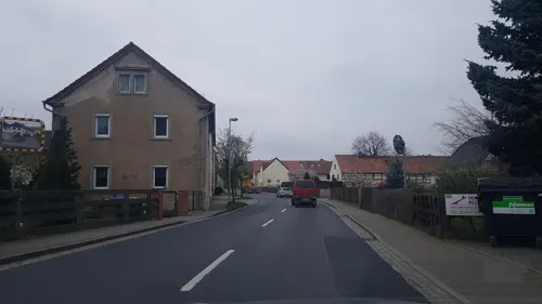

Albrechtsburg
Monument and historic site · 0.6 km
1 Domplatz, Meißen
Mar-Oct: Mo-Su,PH 10:00-18:00, Nov-Feb: Mo-Su,PH 10:00-17:00


Heinrichsbrunnen
Monument and historic site
Mit Denkmal von König Heinrich I, auf dem Heinrichsplatz in Meißen


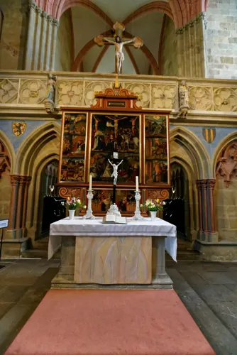

Haus A
Monument and historic site · 0.6 km
Gymnasium Franziskaneum
1 Kändlerstraße, Meißen


Bahrmannsches Brauhaus
Monument and historic site
3 An der Frauenkirche


Kursächsische Postmeilensäule
Monument and historic site
Kursächsische Postmeilensäule-Distanzsäule
116 more on the map.
Parks, trails and playgrounds31
Freizeitbad "Wellenspiel Meißen"
Sports field and stadium · 2.3 km
2 Berghausstraße, Meißen
Mo-Su 10:00-22:00






19 more on the map.
Restaurants and cafes166
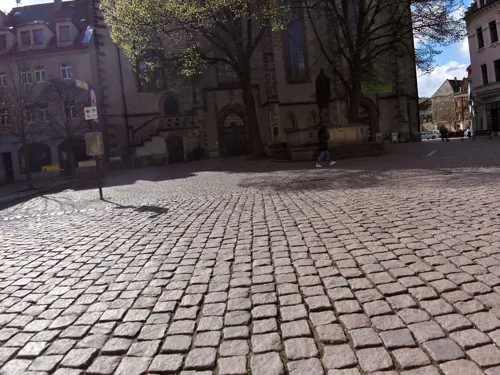
Goldener Löwe
Restaurant
6 Heinrichsplatz, Meißen
Mo-Su,PH 12:00-22:00, Mo-Fr 07:00-10:00, Sa,Su,PH 08:00-11:00

Bennohaus
Restaurant
9 Markt, Meißen
Mo-Tu 11:30-21:30; We off; Th 11:30-21:30; Fr-Sa 11:30-22:00; Su...

Boselspitze
Restaurant · German · 3.4 km
Blick in das östlich gelegene Elbtal bis nach Dresden und bei gutem Wetter auch bis zu den Tafelbergen der Sächsischen Schweiz
101 Boselweg, Coswig
Fr-Su,PH 11:00-22:00




Der Weinladen
Brewery and winery · Tarte Flambee
18 Burgstraße, Meißen
Mo-Sa 11:00-19:00; Su,PH 13:00-19:00
154 more on the map.
History
It grew out of the early Polabian Slavic settlement of Meisa, situated on the stream of the same name and inhabited by the Glomacze (a Polabian Sorbian tribe). In 929, King Henry the Fowler besieged and destroyed the Glomacze fortress of Gana (Siege of Gana), and later founded the fortress of Misnia, around which the German town of Meissen (Meißen) developed. In 968, the Diocese of Meissen was established, and the town became the episcopal see. The Catholic bishopric was suppressed in 1581 after the diocese accepted the Protestant Reformation in 1559, but was re‑created in 1921, with its seat first at Bautzen and now at the Katholische Hofkirche in Dresden.
The origins of Meissen as a political stronghold reach back to 965, when Emperor Otto I founded the Margraviate as a frontier march of the Holy Roman Empire, with Meissen as its capital. By the year 1000, it had grown into a market town of strategic importance. In 1002, Bolesław I the Brave of Poland briefly seized Meissen, though Emperor Henry II reclaimed it within months. The fortress was again tested in 1015, when the Poles under the future King Mieszko II laid siege, though without success. In 1089, the margraviate passed into the hands of the House of Wettin, whose dynasty would rule Meissen and later Saxony for centuries, making the stronghold a cornerstone of their power.
From the History section of Meissen on Wikipedia, under CC BY-SA 4.0.
Where to stay40
Churches and places of worship20
Shopping51
Gas and EV charging7
Schools, colleges and libraries29
Healthcare9
Map of Meissen
250 places. The map loads OpenStreetMap tiles when you open it.
Getting there and nearby towns
Verkehrslandeplatz Riesa-Göhlis (IES) is the nearest airport with scheduled flights listed in OpenStreetMap, 17 km away.
- Weinböhla 7 km east, about 7 min by car
- Wilsdruff 13 km south, about 13 min by car
- Radebeul 14 km southeast, about 14 min by car
- Mickten 19 km southeast, about 19 min by car
- Riesa 21 km northwest, about 21 min by car
- Dresden 22 km southeast, about 22 min by car
- Ottendorf-Okrilla 25 km east, about 25 min by car
- Bannewitz 25 km southeast, about 25 min by car
- Oschatz 30 km northwest, about 30 min by car
- Radeberg 31 km east, about 31 min by car
Drive times are estimates from straight-line distance, not routes.
Local news
Headlines from INDB.
Reviews, tips and questions
Loading what members have shared...
Sources and licences
- GeoNames (CC BY 4.0): population, coordinates, regions and time zone
- Mapillary (see each image): photos
- OpenStreetMap contributors (ODbL 1.0): places, airports, map data
- Wikidata (CC0 1.0): elevation, founding date, time zone, website, landmarks and historic places
- Wikimedia Commons (see each image): photos
- Wikipedia (CC BY-SA 4.0): overview and history text
Photo credits
- Meißen 002, Wolkenkratzer, CC BY-SA 4.0
- Meissen Martinstrasse 7, Unukorno, CC BY 4.0
- Meissen 12 59 00 098000, Robot8A, CC BY-SA 4.0
- Meissen Poststrasse 1, Unukorno, CC BY 4.0
- Stolperstein Meissen Rosa Cohn, ChogaRamirez, CC BY-SA 4.0
- Poststrasse 13 Meissen, Unukorno, CC BY 4.0
- Meissen Poststrasse 13, Unukorno, CC BY 4.0
- Meissen - Kleinmarkt - geo.hlipp.de - 32504, Colin Smith on geo.hlipp.de, CC BY-SA 2.0
- Meissen - Gerbergasse - geo.hlipp.de - 32505, Colin Smith on geo.hlipp.de, CC BY-SA 2.0
- Meissen - Neugasse - geo.hlipp.de - 32500, Colin Smith on geo.hlipp.de, CC BY-SA 2.0
- Albrechtsburg-2007, Stephan Hoppe, CC BY-SA 3.0
- Afra Hauptgebaeude, Martin Schwarzmann, CC BY-SA 2.0 de
- Afrakirche (Meißen) (1), Chris06, CC0
- Proschwitz castle01, Dundak, CC BY 2.5
- 26425-Meißen-1935-Haus der Heimat - Stadtmuseum Meißen, innen-Brück & Sohn Kunstverlag, Brück & Sohn Kunstverlag Meißen, CC BY-SA 3.0
- Burgstraße 1 Meißen, Paulae, CC BY-SA 3.0
- Domherrenhof, Bodanie, CC BY-SA 3.0
- Nikolaikirche Meißen 2021-04-25 6, Z thomas, CC BY-SA 4.0
- Elblandklinikum Meißen Eingang, Elblandkliniken Stiftung & Co. KG/ Markus Mitterer, CC BY-SA 3.0 de
- Schlossbatzdorf1, Z thomas, CC BY-SA 4.0
- Bockwen Steinkreuz, X-Weinzar, CC BY-SA 3.0
- Meißen view 3, LostArtilleryMan, CC BY-SA 3.0
- 20180224185DR Meißen Friedhof St Martini Kapelle St Martin, Jörg Blobelt, CC BY-SA 4.0
- Meissen Altes Brauhaus-02, Radler59, CC BY-SA 3.0
- CöllnMEI-Johannes6, Jwaller, CC BY-SA 4.0
- Trinitatiskirche in Meissen, Dr. Bernd Gross, CC BY-SA 4.0
- 20090918180MDR Zadel (Diera-Zehren) Andreaskirche, Jörg Blobelt, CC BY-SA 4.0
- Wolfgangskapelle Meissen 1, Dr. Bernd Gross, CC BY-SA 4.0
- Albertbrücke Meißen Kerstingstraße, Rainerhaufe, CC BY-SA 4.0
- Meissen Heinrichsbrunnen-01, Radler59 ( talk ), CC BY-SA 4.0
- Elbhänge bei Karpfenschänke 2, Derbrauni, CC BY-SA 4.0
- SeußlitzerGrund2, Jwaller, CC BY-SA 3.0
- Pano elbe near dresden 001, User:Olaf1541, CC BY-SA 3.0
- Meissen Freiheit 3, Radler59 ( talk ), CC BY-SA 4.0
- St.Andreaskirche Zadel-Turm, D.W., Public domain
- Gymnasium Franziskaneum Meissen, Crashy meissen at German Wikipedia ( Original text: crashy ), Public domain
- Meißen, Albrechtsburg corrected, Rolf Kranz, CC BY-SA 4.0
- Meißen-Marktplaz, Staka, CC BY-SA 4.0
- 20050116850MDR Proschwitz (Meißen) Schloß Weingut, Jörg Blobelt, CC BY-SA 4.0
- Aerial image of Burgberg in Meißen (view from the southeast), Carsten Steger, CC BY-SA 4.0
- Street-level photo, dsmm, CC BY-SA 4.0
- Street-level photo, zoegglmeyr, CC BY-SA 4.0
- Street-level photo, yiro, CC BY-SA 4.0
- Street-level photo, zoegglmeyr, CC BY-SA 4.0
- Street-level photo, zoegglmeyr, CC BY-SA 4.0
- Street-level photo, zoegglmeyr, CC BY-SA 4.0
- Street-level photo, bejotel, CC BY-SA 4.0
- Street-level photo, zoegglmeyr, CC BY-SA 4.0
- Street-level photo, zoegglmeyr, CC BY-SA 4.0
- Street-level photo, zoegglmeyr, CC BY-SA 4.0
- Street-level photo, zoegglmeyr, CC BY-SA 4.0
- Street-level photo, zoegglmeyr, CC BY-SA 4.0
- Street-level photo, robot8a, CC BY-SA 4.0
- Street-level photo, zoegglmeyr, CC BY-SA 4.0
- Street-level photo, txllxt, CC BY-SA 4.0
- Street-level photo, zoegglmeyr, CC BY-SA 4.0
- Street-level photo, canislupus, CC BY-SA 4.0
- Street-level photo, bejotel, CC BY-SA 4.0
- Street-level photo, Schaltkreis, CC BY-SA 4.0
- Street-level photo, zoegglmeyr, CC BY-SA 4.0
- Street-level photo, hotzi57, CC BY-SA 4.0
- Street-level photo, tobiaso, CC BY-SA 4.0
- Street-level photo, hotzi57, CC BY-SA 4.0
- Street-level photo, yiro, CC BY-SA 4.0
- Street-level photo, canislupus, CC BY-SA 4.0
- Street-level photo, canislupus, CC BY-SA 4.0
- Street-level photo, thomas, CC BY-SA 4.0
- Street-level photo, bejotel, CC BY-SA 4.0


Page built November 8, 2026. Spotted a mistake? Tell us or suggest a place.