


Ottendorf-Okrilla, Germany
Ottendorf-Okrilla is a town of 10,093 people in Saxony, Germany.
Why visit Ottendorf-Okrilla
Townapedia lists 57 museums and landmarks, 16 parks and trails, 31 places to eat, 7 places to stay and 37 attractions in and around town.
Highlights include Hofkäserei Schönborn, Hofladen Weixdorf, Steinkreuz and Mord-Denkstein "Anno 1678".
Weather in Ottendorf-Okrilla
Forecast from MET Norway (CC BY 4.0). Full forecast
About Ottendorf-Okrilla
Ottendorf-Okrilla is a municipality in the Bautzen district, Saxony, Germany. It is located 20 km northeast of Dresden.
From the Wikipedia article Ottendorf-Okrilla (this version), under CC BY-SA 4.0.
Things to do37

Hofkäserei Schönborn
Farm and orchard · 4.6 km
11 Langebrücker Straße, Dresden
We 16:00-18:00; Sa 10:00-12:00

Hofladen Weixdorf
Farm and orchard · 4.2 km
42 Pastor-Roller-Straße, Dresden
Tu-Fr 09:00-18:00; Sa 08:00-12:00; Mo,Su,PH off


25 more on the map.
Museums and landmarks57

Steinkreuz
Monument and historic site · 3.5 km
Mord- und Sühnekreuz, nordwestlich von Seifersdorf, an der S177 Richtung Ottendorf neben einem abgehenden Weg zum Diensdorfer Berg,...


Denkmal für Minister Graf Heinrich von Brühl
Monument and historic site · 4.7 km



45 more on the map.
Parks, trails and playgrounds16





4 more on the map.
Restaurants and cafes31

Gasthof Hermsdorf
Restaurant · German · 2.3 km
105 Dresdner Straße, Ottendorf-Okrilla
We-Su 11:00-22:00

Bäckerei Jacobi
Bakery · 2.4 km
Ostbrötchenbäcker, Dresdner Christstollen aus eigener Herstellung erhältlich
2 Prof.-Nagel-Straße, Ottendorf-Okrilla
Tu-Fr 06:00-18:00; Sa 05:30-11:00

Konditorei Gnauck
Bakery · 0.7 km
51 Radeberger Straße, Ottendorf-Okrilla
Mo 05:00-12:00; Tu-Fr 05:00-18:00; Sa 05:00-10:00
Ottendorfer Mühlenbächer
Cafe
1 Poststraße, Ottendorf-Okrilla
Mo-Fr 06:00-18:00; Sa 06:00-12:00; Su; PH off

Ottendorfer Mühlenbäcker
Cafe · 0.9 km
1b Frankenfurt, Ottendorf-Okrilla
Mo-Sa 06:00-18:00; Su 06:00-17:00; PH off
Café Kühnmühle
Cafe · Ice Cream · 0.7 km
14 Mühlstraße, Ottendorf-Okrilla
Mo-Su 13:00-17:00
Eiscafe "Eisstübchen"
Cafe · Ice Cream · 0.7 km
18 Mühlstraße, Ottendorf-Okrilla
Fr-Su 14:00-18:00
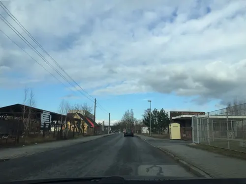
MyVi Asia Spezialitäten & Döner
Restaurant · Asian · 0.8 km
2b Gaswerkstraße, Ottendorf-Okrilla
Mo-Fr 10:30-19:30
Brot- und Feinbäckerei Roland Krafczyk
Bakery
3 Bäckergasse, Ottendorf-Okrilla
Mo-Fr 06:00-12:30; Tu 15:00-17:30; We-Fr 15:00-17:30; Sa 06:00-10:30


19 more on the map.
History
Ottendorf was first mentioned in 1346. The municipality Ottendorf-Okrilla was formed in 1921 by the merger of the former municipalities Ottendorf, Moritzdorf, Großokrilla, Kleinokrilla and Cunnersdorf. In 1994 Grünberg joined the municipality, and in 1999 Hermsdorf and Medingen.
From the History section of Ottendorf-Okrilla on Wikipedia, under CC BY-SA 4.0.
Where to stay7
Pension Schwesinger
Motel and hotel · 1.0 km
51 Dresdner Straße, Ottendorf-Okrilla
Churches and places of worship9
Elf-Gebote-Kirche
Church · Lutheran · 4.6 km
5 Seifersdorfer Straße, Dresden
Evangelisch-Freikirchliche Gemeinde Ottendorf-Okrilla
Church · Evangelical · 1.2 km
3 Bahnhofstraße, Ottendorf-Okrilla
Shopping7
Gas and EV charging6
Schools, colleges and libraries7
Grundschule Ottendorf-Okrilla
School · 0.6 km
23a Radeburger Straße, Ottendorf-Okrilla
Healthcare2
Map of Ottendorf-Okrilla
179 places. The map loads OpenStreetMap tiles when you open it.
Getting there and nearby towns
Dresden Airport (DRS) is the nearest airport with scheduled flights listed in OpenStreetMap, 7 km away.
- Dresden 16 km southwest, about 16 min by car
- Weinböhla 19 km west, about 19 min by car
- Lauchhammer 34 km north, about 34 min by car
- Senftenberg 40 km north, about 40 min by car
- Großräschen 47 km north, about 47 min by car
- Bad Liebenwerda 48 km northwest, about 48 min by car
- Finsterwalde 51 km north, about 51 min by car
- Doberlug-Kirchhain 53 km north, about 53 min by car
- Cottbus 73 km northeast, about 1 h 15 min by car
- Chemnitz 74 km southwest, about 1 h 15 min by car
Drive times are estimates from straight-line distance, not routes.
Local news
Headlines from INDB.
Reviews, tips and questions
Loading what members have shared...
Sources and licences
- GeoNames (CC BY 4.0): population, coordinates, regions and time zone
- Mapillary (see each image): photos
- OpenStreetMap contributors (ODbL 1.0): places, airports, map data
- Wikidata (CC0 1.0): elevation, founding date, time zone, website
- Wikimedia Commons (see each image): photos
- Wikipedia (CC BY-SA 4.0): overview and history text
Photo credits
- Ottendorf-Okrilla-Königsbrücker-Straße-2, SchiDD, CC BY 4.0
- Baumbestand Friedhof Ottendorf-Okrilla 2020-05-09 13, Z thomas, CC BY-SA 4.0
- Baumbestand Friedhof Ottendorf-Okrilla 2020-05-09 12, Z thomas, CC BY-SA 4.0
- Baumbestand Friedhof Ottendorf-Okrilla 2020-05-09 3, Z thomas, CC BY-SA 4.0
- Baumbestand Friedhof Ottendorf-Okrilla 2020-05-09 9, Z thomas, CC BY-SA 4.0
- Baumbestand Friedhof Ottendorf-Okrilla 2020-05-09 6, Z thomas, CC BY-SA 4.0
- Baumbestand Friedhof Ottendorf-Okrilla 2020-05-09, Z thomas, CC BY-SA 4.0
- Baumbestand Friedhof Ottendorf-Okrilla 2020-05-09 8, Z thomas, CC BY-SA 4.0
- Baumbestand Friedhof Ottendorf-Okrilla 2020-05-09 7, Z thomas, CC BY-SA 4.0
- Baumbestand Friedhof Ottendorf-Okrilla 2020-05-09 5, Z thomas, CC BY-SA 4.0
- Baumbestand Friedhof Ottendorf-Okrilla 2020-05-09 4, Z thomas, CC BY-SA 4.0
- Baumbestand Friedhof Ottendorf-Okrilla 2020-05-09 11, Z thomas, CC BY-SA 4.0
- Baumbestand Friedhof Ottendorf-Okrilla 2020-05-09 2, Z thomas, CC BY-SA 4.0
- Baumbestand Friedhof Ottendorf-Okrilla 2020-05-09 10, Z thomas, CC BY-SA 4.0
- Kirche Ottendorf-Okrilla 2020-05-09 3, Z thomas, CC BY-SA 4.0
- Kirche Ottendorf-Okrilla 2020-05-09 4, Z thomas, CC BY-SA 4.0
- Kirche Ottendorf-Okrilla 2020-05-09, Z thomas, CC BY-SA 4.0
- Baumbestand Kirchhof Ottendorf-Okrilla 2020-05-09 2, Z thomas, CC BY-SA 4.0
- An der Schule 1 Ottendorf-Okrilla 2020-05-09 5, Z thomas, CC BY-SA 4.0
- Baumbestand Kirchhof Ottendorf-Okrilla 2020-05-09, Z thomas, CC BY-SA 4.0
- An der Schule 1 Ottendorf-Okrilla 2020-05-09 6, Z thomas, CC BY-SA 4.0
- An der Schule 1 Ottendorf-Okrilla 2020-05-09, Z thomas, CC BY-SA 4.0
- An der Schule 1 Ottendorf-Okrilla 2020-05-09 3, Z thomas, CC BY-SA 4.0
- An der Schule 1 Ottendorf-Okrilla 2020-05-09 4, Z thomas, CC BY-SA 4.0
- Baumbestand Kirchhof Ottendorf-Okrilla 2020-05-09 3, Z thomas, CC BY-SA 4.0
- Kirche Ottendorf-Okrilla AB 2011 03, Paulis, CC BY-SA 3.0
- Kirche Ottendorf-Okrilla AB 2011 06, Paulis, CC BY-SA 3.0
- Kirche Ottendorf-Okrilla AB 2011 09, Paulis, CC BY-SA 3.0
- Kirche Ottendorf-Okrilla AB 2011 02, Paulis, CC BY-SA 3.0
- Kirche Ottendorf-Okrilla AB 2011 07, Paulis, CC BY-SA 3.0
- Kirche Ottendorf-Okrilla AB 2011 11, Paulis, CC BY-SA 3.0
- Kirche Ottendorf-Okrilla AB 2011 05, Paulis, CC BY-SA 3.0
- Kirche Ottendorf-Okrilla AB 2011 10, Paulis, CC BY-SA 3.0
- Kirche Ottendorf-Okrilla AB 2011 01, Paulis, CC BY-SA 3.0
- Kirche Ottendorf-Okrilla AB 2011 08, Paulis, CC BY-SA 3.0
- Kirche Ottendorf-Okrilla AB 2011 04, Paulis, CC BY-SA 3.0
- Radeberger Straße 4 Ottendorf-Okrilla 2020-05-09, Z thomas, CC BY-SA 4.0
- Gedenkstätte 13. Februar 1945 Ottendorf-Okrilla 2020-05-09 3, Z thomas, CC BY-SA 4.0
- Orla Ottendorf-Okrilla 2020-05-09 2, Z thomas, CC BY-SA 4.0
- Steinberg bei Seifersdorf, Himmelfahrtsflieger, CC BY-SA 3.0
- Ottendorf-Okrilla Evangelische Kirche 2, X-Weinzar, CC BY-SA 2.5
- Ottendorf-Okrilla-Kath-Kirche-4, SchiDD, CC BY 4.0
- Kirche Großdittmannsdorf AB 2011 01, Paulis, CC BY-SA 3.0
- Gasthof hermsdorf 2022-03-20 2, Z thomas, CC BY-SA 4.0
- Seifersdorf Steinkreuz-1678 20231013 104458, Rigorius, CC BY-SA 4.0
- Seifersdorfer Kirche 1, Anaximander ( Anaximander ), CC BY 3.0
- Seifersdorf Steinkreuz-Siedlung 20231013 111717, Rigorius, CC BY-SA 4.0
- Seifersdorfer Tal 11, Brücke-Osteuropa, CC0
- Schönborn-Kirche-1, SchiDD, CC BY-SA 4.0
- 20051010095DR Grünberg (Ottendorf-Okrilla) Ev Dorfkirche, Jörg Blobelt, CC BY-SA 4.0
- SeifTal-N12-Amor-4, SchiDD, CC BY-SA 4.0
- SeifTal-S15-Ach-wie-schön-2, SchiDD, CC BY-SA 4.0
- 20080913245DR Seifersdorfer Tal - MEMORABILI OBLITO, Jörg Blobelt, CC BY-SA 4.0
- SeifTal-Herderbrücke, SchiDD, CC BY-SA 4.0
- SeifTal-S13-Alpenhirtin, SchiDD, CC BY-SA 4.0
- Seifersdorf Schlosspark Teich 20221112 135252, Rigorius, CC BY-SA 4.0
- Gärtnerhaus im Schlosspark (Einzeldenkmal zu ID-Nr. 09301961) Wachauer Straße 1, Conny, CC BY-SA 3.0
- Stolperstein für Kurt Degenkolb, Alte Moritzburger Strasse 43, Dresden, Dr. Bernd Gross, Public domain
- Stolperstein für Otto Degenkolb, Alte Moritzburger Strasse 43, Dresden, Dr. Bernd Gross, Public domain
- Schloss Hermsdorf-Park 20220412 132138, Rigorius, CC BY-SA 4.0
- Moorwald am Pechfluss bei Medingen (3), Staubi59, CC BY-SA 4.0
- Schloss Hermsdorf - Kapelle innen, Derbrauni, CC BY-SA 4.0
- Kirche Lausa Juli 2017 (1), Frank Lehmann, CC BY-SA 4.0
- Dresden, Pastor-Roller-Straße, Hofladen Weixdorf, Stadtteil Weixdorf, 17.6.2.40-160169, Albrecht Voß, CC BY-SA 4.0
- Street-level photo, sp8962de, CC BY-SA 4.0
- Street-level photo, marcosaxonia, CC BY-SA 4.0
- Street-level photo, emil_d, CC BY-SA 4.0
- Street-level photo, vst, CC BY-SA 4.0
- Street-level photo, thomersch, CC BY-SA 4.0
- Street-level photo, moenk, CC BY-SA 4.0
- Street-level photo, marcosaxonia, CC BY-SA 4.0
- Street-level photo, sp8962de, CC BY-SA 4.0
- Street-level photo, atze777, CC BY-SA 4.0
- Street-level photo, konafets, CC BY-SA 4.0
- Street-level photo, sp8962de, CC BY-SA 4.0
- Street-level photo, thomersch, CC BY-SA 4.0
- Street-level photo, kopra, CC BY-SA 4.0
- Street-level photo, vst, CC BY-SA 4.0
- Street-level photo, konafets, CC BY-SA 4.0


Page built November 8, 2026. Spotted a mistake? Tell us or suggest a place.