


Why visit Metzingen
Townapedia lists 36 museums and landmarks, 65 parks and trails, 177 places to eat, 17 places to stay and 31 attractions in and around town.
Highlights include Luna, Auhof, Friedenskirche and Schmiededom.
Weather in Metzingen
Forecast from MET Norway (CC BY 4.0). Full forecast
About Metzingen
Metzingen (German: [ˈmɛt͡sɪŋən] ) is a Swabian city with about 22,000 inhabitants, in Reutlingen county, Baden-Württemberg, Germany, 30 km (19 mi) south of Stuttgart. The city of Metzingen is known internationally for its outlets of all kinds of famous companies, centered around Hugo Boss who was one of the first companies that opened a store back in the 1970s. The former quarter of textile factories which was changed to a quarter of outlets is called 'Outlet City', and people from all over the world come here for a shopping experience.
From the Wikipedia article Metzingen (this version), under CC BY-SA 4.0.
Things to do31


Hohe Warte
Monument and historic site · 6.1 km
Mountain in Baden-Württemberg, Germany
Städtischer Obstbaubetrieb
Farm and orchard · 2.0 km
Sep-Jan Th 15:00-17:00; Sep-Jan Fr 12:00-17:00; Feb-Aug Th...



Henzler Früchte
Farm and orchard · 1.4 km
Verkaufsstand mit überwiegend regionalen Früchten, Spargel und Kartoffeln von Henzlers Rammerthof
Apr-Oct Mo-Sa 09:00-18:00; Sa 09:00-14:00; PH closed
Henzler Früchte
Farm and orchard · 3.0 km
Verkaufsstand mit überwiegend regionalen Früchten, Spargel und Kartoffeln von Henzlers Rammerthof
Apr-Oct Mo-Sa 09:00-18:00; Sa 09:00-14:00; PH closed
19 more on the map.
Museums and landmarks36

Friedenskirche
Monument and historic site · Evangelical · 1.1 km
3 Bettlinger Weg, Metzingen


Bindhof
Monument and historic site · 1.9 km
Ehemaliger Zwiefalter Klosterhof. Rechtwinklig angeordneter Gebäudekomplex, bestehend aus der ehemaligen Scheune mit dem nördlich...

Festkelter Neuhausen
Monument and historic site · 1.8 km
38 Kelternstraße, Metzingen





24 more on the map.
Parks, trails and playgrounds65

Wunderkind
Playground · 0.6 km
Indoorspielplatz mit Cafeteria
Tu-Su 09:00-18:00; Mo open "für private Feiern"

Karussell
Playground
Das Piratenschiff wurde leider durch phantasielose Drehgeräte ersetzt
08:00-20:00; open "zusätzlich während der Öffnungszeiten der Outletcity"


53 more on the map.
Restaurants and cafes177
Achtender
Restaurant · International
34 Stuttgarter Straße, Metzingen
Mo-Sa 12:00-14:00,17:30-21:30; PH,Su off

Stausee-Hotel
Restaurant · German · 3.4 km
Room from 88 €, free Wifi
3 Unterer Hof, Metzingen
Mo-Sa 07:00-23:00; Su,PH 07:00-21:00
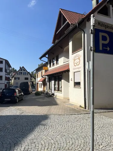
Gasthaus Hirsch
Restaurant · Regional · 3.7 km
Treffpunkt für Musiker aus Rock, Folk, Jazz und anderen Richtungen
11 Eninger Straße, Metzingen
Mo-Sa 19:00-02:00
Namaste Metzingen
Restaurant · Indian
Indisches Restaurant & Cocktailbar & Eiscafé
1 Christophstraße, Metzingen
Mo 17:30-23:00; Tu-Th 11:30-14:30,17:30-23:00; Fr,Sa...

Sportheim Kappishäusern
Restaurant · Greek · 3.0 km
Warme Küche ab 11:30 durchgehend
Am Sportplatz, Neuffen
Tu 17:00-22:30; We-Sa 11:30-22:30; Su,PH 11:30-22:00

BeckaBeck
Bakery · 2.0 km
Im ehemaligen Nahkauf
39 Uracher Straße, Neuhausen
Mo-Fr 07:00-19:00; Sa 07:00-17:00; Su,PH 08:00-11:00
BeckaBeck `Zum Becki`
Bakery · 4.8 km
Im Sommer können Sie bei uns ein leckeres Frühstück im Außenbereich genießen.
13 Uracher Straße, Dettingen an der Erms
Mo-Fr 06:00-18:30; Sa 06:00-17:30; Su,PH 07:30-17:30


Café Bäcker Mayer
Cafe
47 Hindenburgstraße, Metzingen
Mo-Fr 06:30-18:00; Sa 06:30-13:00; Su 07:30-13:00 closed
Gasthaus Linde
Restaurant · German, Soup · 5.3 km
6 Friedrich-Ebert-Straße, Dettingen an der Erms
Mo,Fr,Sa 11:45-13:30,17:30-20:00; Su 11:30-14:00,17:30-19:30
165 more on the map.
History
Metzingen was first mentioned in documents from 1075. The cultivation of wine led to a spread of wealth around 1600.
From the early 1600s it was under the jurisdiction of Oberamt Urach.
During the Thirty Years' War, Metzingen suffered considerable destruction, and two thirds of the population died in a plague epidemic soon after.
From the 1800s Metzingen was under the joint jurisdictions of Urach and Schwarzwald county; and finally under the jurisdiction of just Schwarzwald county from the abolition of the Oberamt to the end of World War II, when it was reassigned to the jurisdiction of Reutlingen (district).
Following industrialization, different textile factories were built in Metzingen. In 1859, Metzingen was connected to the railline from Tübingen to Stuttgart.
From the History section of Metzingen on Wikipedia, under CC BY-SA 4.0.
Where to stay17
Churches and places of worship30
Kirche der Entschlafung der Gottesmutter und des Hl. Johannes des Vorläufers zu Reutlingen
Church · Greek Orthodox · 4.7 km
148 Am Heilbrunnen, Reutlingen
Evangelische Kirche und Gemeindehaus
Church · Protestant · 4.1 km
21 Alte Dorfstraße, Reutlingen
Evangelische Stephanuskirche
Church · Protestant · 4.0 km
9 Oben Am Berg, Bempflingen
Shopping44
Wado Werkzeug-Vertriebsgruppe, "Black-Cat"- Generalvertrieb
Hardware store · 2.5 km
36 Industriestraße, Riederich
Gas and EV charging13
Schools, colleges and libraries27
Freie Evangelische Grundschule Glems
School · Evangelical · 3.6 km
48 Neuhauser Straße, Metzingen-Glems
Healthcare12
Neuwiesen Apotheke
Clinic and pharmacy · 5.2 km
66 Hülbener Straße, Dettingen an der Erms
Map of Metzingen
250 places. The map loads OpenStreetMap tiles when you open it.
Getting there and nearby towns
Manfred Rommel Airport Stuttgart (STR) is the nearest airport with scheduled flights listed in OpenStreetMap, 17 km away.
- Reutlingen 8 km southwest, about 8 min by car
- Pfullingen 9 km southwest, about 9 min by car
- Bad Urach 10 km southeast, about 10 min by car
- Nürtingen 11 km northeast, about 11 min by car
- Wendlingen am Neckar 16 km northeast, about 16 min by car
- Neuhausen auf den Fildern 16 km north, about 16 min by car
- Tübingen 17 km west, about 17 min by car
- Weil im Schönbuch 19 km northwest, about 19 min by car
- Wernau 20 km northeast, about 20 min by car
- Münsingen 21 km southeast, about 21 min by car
Drive times are estimates from straight-line distance, not routes.
Local news
Headlines from INDB.
Reviews, tips and questions
Loading what members have shared...
Sources and licences
- GeoNames (CC BY 4.0): population, coordinates, regions and time zone
- Mapillary (see each image): photos
- OpenStreetMap contributors (ODbL 1.0): places, airports, map data
- Wikidata (CC0 1.0): elevation, founding date, time zone, website, landmarks and historic places
- Wikimedia Commons (see each image): photos
- Wikipedia (CC BY-SA 4.0): overview and history text
Photo credits
- Metzingen vom Weinberg aus, RudolfSimon, CC BY-SA 3.0
- HoheWarteAussichtsturm, Ssch, CC BY-SA 3.0
- Reutlingen Marienkirche 2012-04, Helmlechner, CC BY-SA 3.0
- Metzingen, 7K - Herrschaftskelter von Süd-Osten, Vux, CC BY-SA 3.0
- Kleinbettlingen Grafenberg, JüloMai, Public domain
- Blick aus Norden auf den Jusi (NSG 1.192), CatalpaSpirit, CC BY-SA 4.0
- Calverbühl, Johannes Baier, CC BY 3.0
- Stadtbücherei Metzingen 3 (Front), Windharp, CC BY-SA 4.0
- Floriansberg von Bempflingen 01, Giftzwerg 88, CC BY-SA 3.0
- Metzingen Luna-Filmtheater Front, Windharp, CC BY-SA 4.0
- Metzingen, Glems, Kirchstraße 8, Kirche (01), John Mz, CC BY-SA 3.0
- Metzingen Martinskirche, User:MarkusHagenlocher, CC BY-SA 3.0
- Dorfkirche Reicheneck 01, Vux, CC BY-SA 3.0
- Griechisch-Orthodoxe Kirche der Entschlafung der Gottesmutter und des Hl. Johannes des Vorläufers zu Reutlingen 03, Vux, CC BY-SA 4.0
- Martinskirche Mittelstadt 03, Giftzwerg 88, CC BY-SA 3.0
- Evangelische Stephanuskirche mit dreiseitiger Empore, erbaut 1827 durch den Stuttgarter Hochbaurat Roth. - panoramio (1), qwesy qwesy, CC BY 3.0
- Motorworld Metzingen 06, Giftzwerg 88, CC BY-SA 3.0
- Hotel-Restaurant Schwanen Metzingen Frontansicht, Windharp, CC BY-SA 4.0
- Metzingen, Friedenskirche (03), John Mz, CC BY-SA 3.0
- Kath. Kirche - Maria zum guten Stein (Dettingen an der Erms), Vux, CC BY 3.0
- St. Bonifatius Metzingen 02, Giftzwerg 88, CC BY-SA 3.0
- Mittelstadt Eben Ezer Kapelle (1), Windharp, CC BY-SA 4.0
- Neuhausen Innere Kelter 1, Windharp, CC BY-SA 4.0
- Mittelstadt St.Gebhard (2), Windharp, CC BY-SA 4.0
- Spielplatz Friedrich-Münzinger-Straße (Spdwestblick), RealMetzor, CC0
- Playground Jeep Willy (Nordwestblick), RealMetzor, CC0
- Schild Spiel- und Bolzplatz Hermann-Löns-Platz, RealMetzor, CC0
- 2008MetzingenHenning, Thanachvil, CC BY-SA 4.0
- Neuhausen an der Erms Bindhof 01, Vux, CC BY-SA 4.0
- Metzingen, Am Klosterhof 6, Herrschaftskelter (02), John Mz, CC BY-SA 3.0
- Metzingen, Mühlwiesenstraße 2-1, Friedhof (07), John Mz, CC BY-SA 3.0
- Keltern Metzingen 006, Wamito, Public domain
- Spielplatzschild Pappelweg, RealMetzor, CC0
- Metzingen, Schillerhalle (03), John Mz, CC BY-SA 3.0
- Spielplatz Wirbel (Westblick), RealMetzor, CC0
- Spielplatz Bettlinger Weg in Metzingen (Nordwestblick), RealMetzor, CC0
- Spielplatz Dürerweg in Metzingen (Nordostblick Röhre), RealMetzor, CC0
- Spielplatz Friedrich-Münzinger-Straße (Ostblick), RealMetzor, CC0
- Metzingen, Martinskirche (15) zoomed, Johannes Munz, CC BY-SA 3.0
- Bempflingen02, Schwäbin, CC BY-SA 3.0 de
- Gebäude der Volksschule Metzingen-Ermstal (Innere Heerstraße 6, Südwestblick) 2, RealMetzor, CC0
- Bahnhof-Apotheke Metzingen Außenansicht, RealMetzor, CC0
- Stadtapotheke Metzingen Außenansicht, RealMetzor, CC0
- Obstbaumuseum Glems, Windharp, CC BY 4.0
- Spielplatzschild Karussell, RealMetzor, CC0
- Spielplatzschild Lembergerweg (Metzingen-Neuhausen), RealMetzor, CC0
- Street-level photo, merlin2539, CC BY-SA 4.0
- Street-level photo, KrebsRap, CC BY-SA 4.0
- Street-level photo, mfa, CC BY-SA 4.0
- Street-level photo, tobi7524, CC BY-SA 4.0
- Street-level photo, mcliquid, CC BY-SA 4.0
- Street-level photo, plexi32, CC BY-SA 4.0
- Street-level photo, nvbwseifert, CC BY-SA 4.0
- Street-level photo, nvbwseifert, CC BY-SA 4.0
- Street-level photo, plexi32, CC BY-SA 4.0
- Street-level photo, wizonede, CC BY-SA 4.0
- Street-level photo, KrebsRap, CC BY-SA 4.0
- Street-level photo, mfa, CC BY-SA 4.0
- Street-level photo, mfa, CC BY-SA 4.0
- Street-level photo, plexi32, CC BY-SA 4.0
- Street-level photo, mfa, CC BY-SA 4.0


Page built November 8, 2026. Spotted a mistake? Tell us or suggest a place.