


Mutterstadt, Germany
Mutterstadt is a town of 12,383 people in Rheinland-Pfalz, Germany.
Why visit Mutterstadt
Townapedia lists 58 museums and landmarks, 19 parks and trails, 99 places to eat, 6 places to stay and 10 attractions in and around town.
Highlights include Capitol Lichtspiele, Bernd und Bärbel Treiter, ehemalige Synagoge und Judenschule and Grabdenkmal.
Weather in Mutterstadt
Forecast from MET Norway (CC BY 4.0). Full forecast
About Mutterstadt
Mutterstadt (German pronunciation: [ˈmʊtɐʃtat]) is a municipality in the Rhein-Pfalz-Kreis, in Rhineland-Palatinate, Germany. Though classified as rural the municipality does contain urbanized areas.
From the Wikipedia article Mutterstadt (this version), under CC BY-SA 4.0.
Things to do10

Capitol Lichtspiele
Cinema and theater · 3.3 km
Einschließlich der Ausstattung insbesondere des Foyers im Originalzustand erhaltenes Kino von 1954; seltenes Beispiel eines noch in...
107 A Speyerer Straße, Limburgerhof

Casa Verdura - Edith's Hofladen
Farm and orchard · 4.2 km
59 Fußgönheimer Straße, Ludwigshafen am Rhein
Solawi Große Erde
Farm and orchard · 3.3 km
8 Große Erde, Schifferstadt
Fr 14:00-18:00; Sa 09:00-12:30
Fischers Hofladen
Farm and orchard · 4.3 km
Mo-Fr 09:00-13:00; Mo,Tu,Th,Fr 14:30-18:00; Sa 08:30-13:00


Museums and landmarks58

ehemalige Synagoge und Judenschule
Monument and historic site · 4.2 km
Seit 1953 Gemeindehaus der ev. Gemeinde
52 Fußgönheimer Straße, Ludwigshafen am Rhein
Grabdenkmal
Monument and historic site
Lorenz Trapp († 1868), Obelisk mit Marmorbüste

Schloss Ruchheim
Monument and historic site · 3.9 km
Ehemaliges Schloss der Freiherren von Hallberg; Walmdachbau mit Fachwerkobergeschoss, Dachreiter, erstes Viertel des 18. Jahrhunderts,...
1 Schloßstraße, Ludwigshafen am Rhein


Dreiseithof
Monument and historic site · 3.2 km
Dreiseithof, erstes Viertel des 19. Jahrhunderts; eineinhalbgeschossiges Wohnhaus, bezeichnet 1824; Nebengebäude, teilweise Fachwerk;...
39 Raiffeisenstraße, Dannstadt-Schauernheim

ehemalige Johannes-Hoffmann-Schule
Monument and historic site
Dreigeschossiger klassizistischer Walmdachbau, 1831/32, Architekt Bernhard Spatz, Speyer, Aufstockung 1884
8 Schulstraße, Mutterstadt

ehemaliges katholisches Schulhaus
Monument and historic site · 3.3 km
Ehemaliges katholisches Schulhaus mit Lehrerwohnung; eingeschossiger Krüppelwalmdachbau, 1791/92
6 Friedhofstraße, Dannstadt-Schauernheim

ehemaliges Postamt
Monument and historic site
Klar gegliederter Putzbau, 1927/29, Architekt Heinrich Müller; straßen- und platzbildprägend

Grabdenkmal J. A. Cron
Monument and historic site
Antikisierender reliefierter Sarkophag, signiert Joanni L(udwigs)hafen

Grabmahl Bernd
Monument and historic site · 3.3 km
Grabstätte Familie Ph. Bernd, Hochrelief, Terrakotta, signiert A. Bernd

Grabmahl Hemke
Monument and historic site · 3.2 km
Grabmäler: Dr. med. R. Hemke († 1971), Bronzehohlguss im Art-déco-Stil von A. Bernd
Katholisches Pfarrhaus
Monument and historic site · 3.3 km
6 Kirchenstraße, Dannstadt-Schauernheim
Mo-Fr 09:00-11:00, Mo,Tu 14:00-16:00, Th 16:00-18:00
46 more on the map.
Parks, trails and playgrounds19






7 more on the map.
Restaurants and cafes99
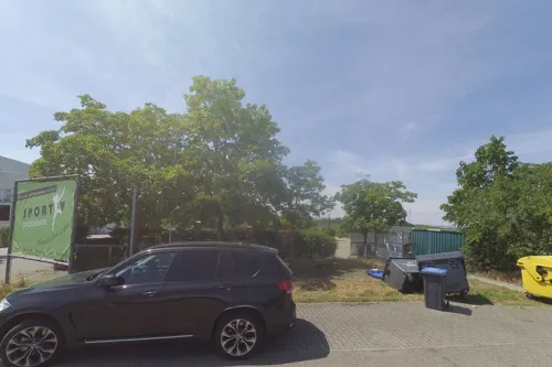
El Greco
Restaurant · Italian · 2.8 km
Griechische Küche
16 Mutterstadter Weg, Limburgerhof
Mo-Su 11:30-14:30; Mo-Su 17:00-23:00
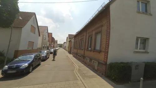
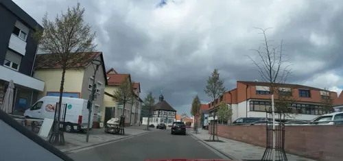
Il Mulino
Restaurant · Italian, Pizza
2 Oggersheimer Straße, Mutterstadt
Tu-Fr 11:30-15:00,17:00-23:00; Sa 16:30-23:00; PH,Su 14:00+; Mo off

Ristorante Da Lillo & Nicola
Restaurant · Italian · 2.9 km
5 Obere Weide, Dannstadt-Schauernheim
Tu-Su 11:30-14:00,17:00-23:00
Zum Feldblick
Restaurant · German, Italian · 1.7 km
1 Im Grund, Mutterstadt
Mo off; Tu-Fr 16:00-22:00; Sa,Su 11:00-23:00
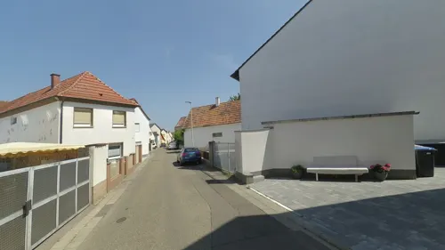
Zur Linde
Restaurant · Greek
1 Lindenstraße, Mutterstadt
Mo,We-Fr 17:00-23:00; Sa,Su,PH 11:30-14:30,17:00-23:00
Bella Nina
Restaurant · Italian · 3.4 km
Italienisches Restaurant
1 Burgunder Platz, Limburgerhof
Tu-Sa 11:30-14:30,17:30-22:00; Su 11:30-14:30,17:30-21:00
Bäcker Görtz
Cafe · 3.4 km
47 Hauptstraße, Dannstadt-Schauernheim
Mo-Fr 05:30-18:00; Sa 05:30-13:00; Su 07:30-12:00

C'est la vie
Cafe · 3.2 km
15 Friedensau, Limburgerhof
Mo off; Tu-Th,Su 10:00-24:00; Fr,Sa 10:00-01:00

Dorfcafe und Bäckerei Otto Schall
Bakery · 2.2 km
25a Hindenburgstraße, Ludwigshafen am Rhein
Mo-Sa 05:30-18:00; PH,Su 07:00-17:00


Gasthaus zur Pfalz
Restaurant · German · 3.2 km
Tu-Fr 17:00-22:30; Sa 15:00-22:30; Su 11:00-20:00; Mo off
87 more on the map.
History
Mutterstadt was first mentioned in the Lorsch codex in the year 767 as mutherstather marca. The name Mutterstadt is derived from the medieval personal name Muothari (or Muther) and not from the German word Mutter.
From the History section of Mutterstadt on Wikipedia, under CC BY-SA 4.0.
Where to stay6
Hotel+Restaurant Jägerhof Mutterstadt
Motel and hotel · 2.3 km
29 An der Fohlenweide, Mutterstadt
Churches and places of worship23
Evangelische Kirche
Church · Lutheran · 4.0 km
22 Fußgönheimer Straße, Ludwigshafen am Rhein
Katholische St. Cyriakuskirche
Church · Catholic · 4.2 km
11 Pfalzgartenstraße, Ludwigshafen am Rhein
Martinskirche
Church · Protestant · 2.3 km
1 Martinskirchplatz, Ludwigshafen am Rhein
Pfarrkirche St. Michael
Church · Catholic · 2.6 km
14a Von-Sturmfeder-Straße, Ludwigshafen am Rhein
Protestantische Pfarrkirche
Church · Protestant · 3.3 km
22 Kirchenstraße, Dannstadt-Schauernheim
Sankt-Joseph-Kirche
Church · Roman Catholic · 4.3 km
25 Carolistraße, Ludwigshafen am Rhein
D.I.T.I.B. Islamischer Kulturverein
Place of worship · 4.2 km
5 Maxdorfer Straße, Ludwigshafen am Rhein
Shopping22
Gas and EV charging11
Schools, colleges and libraries17
Stadtteil-Bibliothek im Paul-Münch-Haus
Library · 4.0 km
13 Fußgönheimer Straße, Ludwigshafen am Rhein
Katholische öffentliche Bücherei St. Michael
Library · 3.3 km
4 Kirchenstraße, Dannstadt-Schauernheim
Gemeindebücherei Dannstadt
Library · 3.2 km
17 Kirchenstraße, Dannstadt-Schauernheim
Healthcare19
Apotheke im Haus der Gesundheit
Clinic and pharmacy · 3.9 km
51-53 Leininger Straße, Ludwigshafen am Rhein
Haus der Gesundheit (HDG) - Haus 1
Clinic and pharmacy · 3.9 km
51-53 Leininger Straße, Ludwigshafen am Rhein
Map of Mutterstadt
250 places. The map loads OpenStreetMap tiles when you open it.
Getting there and nearby towns
City-Airport Mannheim (MHG) is the nearest airport with scheduled flights listed in OpenStreetMap, 12 km away.
- Schifferstadt 7 km south, about 7 min by car
- Ludwigshafen am Rhein 8 km northeast, about 8 min by car
- Mannheim 10 km northeast, about 10 min by car
- Speyer 14 km south, about 14 min by car
- Brühl 14 km east, about 14 min by car
- Ketsch 15 km southeast, about 15 min by car
- Schwetzingen 18 km east, about 18 min by car
- Edingen-Neckarhausen 18 km east, about 18 min by car
- Neustadt an der Weinstraße 19 km southwest, about 19 min by car
- Lampertheim 19 km northeast, about 19 min by car
Drive times are estimates from straight-line distance, not routes.
Local news
Headlines from INDB.
Reviews, tips and questions
Loading what members have shared...
Sources and licences
- GeoNames (CC BY 4.0): population, coordinates, regions and time zone
- Mapillary (see each image): photos
- OpenStreetMap contributors (ODbL 1.0): places, airports, map data
- Wikidata (CC0 1.0): elevation, founding date, time zone, website
- Wikimedia Commons (see each image): photos
- Wikipedia (CC BY-SA 4.0): overview and history text
Photo credits
- Mutterstadt von oben 02, Immanuel Giel, Public domain
- Mutterstadt Grabdenkmal Traßß, Wegavision, CC0
- Mutterstadt Alte Schule, Wegavision, CC0
- Mutterstadt Schulstraße 11, Oliver Orschiedt, CC BY-SA 3.0
- Mutterstadt Speyerer Strasse 15-17, Oliver Orschiedt, CC BY-SA 3.0
- Mutterstadt, Germany - panoramio, Immanuel Giel, CC BY 3.0
- Mutterstadt LudwigshafenerStraße12, Wegavision, CC0
- Mutterstadt, Germany - panoramio (1), Immanuel Giel, CC BY 3.0
- Mutterstadt Ludwigshafener Straße 13 und 15, Oliver Orschiedt, CC BY-SA 3.0
- Mutterstadt untere Kirchstr 1 Toranlage von 1773, Oliver Orschiedt, CC BY-SA 3.0
- Mutterstadt Luitpoldstrasse 13, Oliver Orschiedt, CC BY-SA 3.0
- Linde ND-7338-327 Mutterstadt 2018a, Oliver Orschiedt, CC BY-SA 4.0
- Linde ND-7338-327 Mutterstadt 2018b, Oliver Orschiedt, CC BY-SA 4.0
- Mutterstadt Luitpoldstrasse 29, Oliver Orschiedt, CC BY-SA 3.0
- Mutterstadt Kriegerdenkmal 1914, Wegavision, CC0
- Ludwigshafen Erlöserkirche 20120307, Rudolf Stricker, Attribution
- Ludwigshafen-Maudach-St Michael-102-West-2025-gje, Gerd Eichmann, CC BY 4.0
- Sankt Bonifaz Ludwigshafen, Immanuel Giel, Public domain
- Martinskirche Ludwigshafen 02, Immanuel Giel, Public domain
- Capitol Limburgerhof 02, Immanuel Giel, CC BY-SA 4.0
- Limburgerhof, Schlösschen 20121226, P170, CC BY-SA 4.0
- Capitol Lichtspiele Limburgerhof 2011, 4028mdk09, CC BY-SA 3.0
- Synagoge Ruchheim, Immanuel Giel, Public domain
- Ludwigshafen-Ruchheim Rathaus, Immanuel Giel, CC BY-SA 3.0
- DannstadtFriedhofstr6a, Wegavision, CC0
- Postgebaeude Mutterstadt, -- Immanuel Giel 12:36, 21 May 2008 (UTC), Public domain
- Mutterstadt Grabdenkmal Cron, Wegavision, CC0
- DannstadtGrabmalBernd, Wegavision, CC0
- DannstadtGrabmalHemke, Wegavision, CC0
- Dannstadt Gräberfeld, Altera levatur, CC BY-SA 4.0
- Ludwigshafen-Ruchheim-Evangelische-Kirche, Immanuel Giel, Public domain
- Limburgerhof Kirche, -- Immanuel Giel 08:16, 23 September 2005 (UTC), CC BY-SA 3.0
- Katholische Kirche Ruchheim 01, Immanuel Giel, Public domain
- Katholische Kirche in Dannstadt 01, -- Immanuel Giel 12:42, 21 May 2008 (UTC), Public domain
- Protestanische Kirche in Dannstadt 02, -- Immanuel Giel 12:36, 21 May 2008 (UTC), Public domain
- Ludwigshafen-Rheingoenheim-St-Joseph-Kirche-02, Immanuel Giel, Public domain
- Ruchheim PaulMünchHaus, Wegavision, CC0
- Ludwigshafen-Gartenstadt-Erloeserkirche, Immanuel Giel, Public domain
- Speyrer Straße Richtung Ortsmitte - panoramio, Immanuel Giel, CC BY 3.0
- Haus der Vereine, ehemals Schule - panoramio, Immanuel Giel, CC BY 3.0
- Ludwigshafen-Maudach-Michaelsberg-22-Blick nach Ludwigshafen-2025-gje, Gerd Eichmann, CC BY 4.0
- Street-level photo, wegavision, CC BY-SA 4.0
- Street-level photo, teddy73, CC BY-SA 4.0
- Street-level photo, wegavision, CC BY-SA 4.0
- Street-level photo, wegatest, CC BY-SA 4.0
- Street-level photo, wegavision, CC BY-SA 4.0
- Street-level photo, wegatest, CC BY-SA 4.0
- Street-level photo, wegavision, CC BY-SA 4.0
- Street-level photo, changchun1, CC BY-SA 4.0
- Street-level photo, teddy73, CC BY-SA 4.0
- Street-level photo, changchun1, CC BY-SA 4.0
- Street-level photo, mfa, CC BY-SA 4.0
- Street-level photo, wegavision, CC BY-SA 4.0
- Street-level photo, wegavision, CC BY-SA 4.0
- Street-level photo, ramap, CC BY-SA 4.0
- Street-level photo, wegatest, CC BY-SA 4.0
- Street-level photo, atze02, CC BY-SA 4.0
- Street-level photo, changchun1, CC BY-SA 4.0
- Street-level photo, wegavision, CC BY-SA 4.0
- Street-level photo, wegavision, CC BY-SA 4.0
- Street-level photo, teddy73, CC BY-SA 4.0


Page built November 8, 2026. Spotted a mistake? Tell us or suggest a place.