


Neustadt an der Weinstraße, Germany
Neustadt an der Weinstraße is a town of 53,984 people in Rheinland-Pfalz, Germany.
Why visit Neustadt an der Weinstraße
Townapedia lists 135 museums and landmarks, 31 parks and trails, 245 places to eat, 32 places to stay and 31 attractions in and around town.
Highlights include Saalbau, Weinbietturm, Hambacher Schloss and Eisenbahnmuseum der Pfalz.
Weather in Neustadt an der Weinstraße
Forecast from MET Norway (CC BY 4.0). Full forecast
About Neustadt an der Weinstraße
Neustadt an der Weinstraße (German: [ˈnɔʏʃtat ʔan deːɐ̯ ˈvaɪnˌʃtʁaːsə]; lit. 'New City on the Wine Route'; Palatine German: Naischdadt an de Woischdrooß), formerly known as Neustadt an der Haardt, is a town in Rhineland-Palatinate, Germany. With 53,300 inhabitants as of 2020, it is the largest town called Neustadt.
From the Wikipedia article Neustadt an der Weinstraße (this version), under CC BY-SA 4.0.
Travel tips from other travellers: Neustadt an der Weinstraße on Wikivoyage (CC BY-SA 4.0).
Photos of Neustadt an der Weinstraße


Things to do31


Eckkopf Tower
Monument and historic site · 7.3 km
Observation tower on Eckkopf mountain near Deidesheim

Plopsaland Deutschland
Monument and historic site · 11.8 km
Amusement park in Haßloch, Rhineland-Pflaz, Germany

Schänzel Tower
Monument and historic site · 9.9 km
Observation tower near Edenkoben, Germany



Cineplex
Cinema and theater · 2.5 km
32 Louis-Escande-Straße, Neustadt an der Weinstraße
Mo-Fr 14:00-24:00; Sa 13:00-24:00; Su 12:00-24:00

19 more on the map.
Museums and landmarks135

Hambacher Schloss
Monument and historic site · 3.2 km
Hambacher Schloss, Neustadt an der Weinstraße
Mar-Nov 10:00-18:00; Dec-Feb 10:00-17:00; Jan 01,Dec 24-26,Dec 31 off

Eisenbahnmuseum der Pfalz
Museum
3 Schillerstraße, Neustadt an der Weinstraße
We-Fr 10:00-13:00; Sa-Su,PH 10:00-16:00; "Termine für Gruppen...


Gedenkstätte für NS-Opfer in Neustadt
Monument and historic site · 2.2 km
Gedenkstätte für NS-Opfer

Haardter Schloss
Monument and historic site · 1.3 km
35 Mandelring, Neustadt an der Weinstraße

Ritterstein 248 "Speyerheld"
Monument and historic site · 2.4 km
Westlich Neustadt-Hambach, am Wanderweg vom Nollensattel zum Hohe-Loog-Haus des Pfälzerwald-Vereins. Hinweis auf die Speierheld, eine...

Ritterstein 249 "Dr. Karl Bäßler Weg"
Monument and historic site · 2.5 km
Westlich Neustadt, hinter der Königsmühle, am Weg ins Kaltenbrunner Tal. Benannt zu Ehren von Dr. Karl Bäßler, langjähriger Vorsitzender...

Ritterstein 250 "Dr. Karl Bäßler Weg"
Monument and historic site · 3.9 km
Westlich Neustadt, im Kaltenbrunner Tal bei der Kaltenbrunner Hütte. Wie Ritterstein 249.

Ritterstein 252 "Ringwall-Bergfestung"
Monument and historic site · 3.2 km
Westlich Neustadt, auf dem Kamm des Königsberges. Ringwall des 9. und 8. Jahrhunderts vor Christus am Königsberg westlich von Neustadt...

Ritterstein 257 "Heidenburg"
Monument and historic site · 2.7 km
Ringwall Heidenburg westlich von Gimmeldingen.

Schloss
Monument and historic site · 3.2 km
1832 Hambacher Schloss, Neustadt an der Weinstraße
Apr-Oct Mo-Su 11:00-18:00; Nov-Mar Mo-Su 11:00-17:00
123 more on the map.
Parks, trails and playgrounds31



Dr.-Welsch-Terrasse
Park · 1.0 km
21 Haardter Treppenweg, Neustadt an der Weinstraße

Freibad Hambach
Sports field and stadium · 2.1 km
88 Diedesfelder Weg, Neustadt an der Weinstraße
Mo-Fr 13:00-19:00; Sa-Su,PH,SH 10:00-19:00 "during season"

19 more on the map.
Restaurants and cafes245
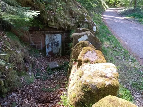
Kaltenbrunner Hütte
Restaurant · Regional · 4.0 km
1 Kaltenbrunner Hütte, Neustadt an der Weinstraße
Nov-Feb: Mo,Tu,We,Sa,Su,PH 11:00-17:00; Mar-Oct: Mo,Tu,We,Sa,Su,PH...

Altes Jagdhaus - Looganlage
Restaurant · German · 4.1 km
50 Im Tal, Neustadt an der Weinstraße
We-Su 10:00-17:00; Mo,Tu off

Hohe Loog Haus
Restaurant · Regional · 3.7 km
In den Winteremonaten (November bis März) nur bis 17 Uhr geöffnet
PH,We,Sa,Su 10:30-18:00
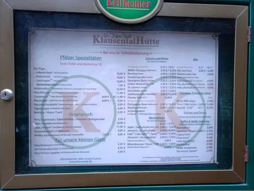
Klausentalhütte
Restaurant · Regional · 4.3 km
1 Weißkreuzstraße, Neustadt an der Weinstraße
Nov-Mar We, Sa, Su 10:30+; Apr-Aug Tu-Th, Sa, Su 10:30+; Sep-Oct...
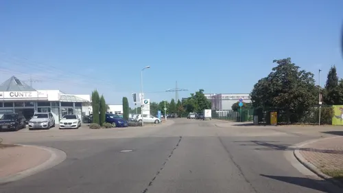
Asia Palast
Restaurant · Chinese · 2.8 km
43 Nachtweide, Neustadt an der Weinstraße
Mo-Su 11:30-15:00,17:30-23:30

Naturfreundehaus Heidenbrunnental
Restaurant · 4.1 km
100 Siedlerstraße, Neustadt an der Weinstraße
We-Su 10:00-18:00; Mo,Tu off

Liebstöckel
Restaurant · Regional
Weinlokal
22 Mittelgasse, Neustadt an der Weinstraße
Tu-Sa 17:00-23:00
Am Rosengarten
Restaurant · Pizza, Italian · 1.1 km
1 Mußbacher Landstraße, Neustadt an der Weinstraße
PH,Tu-Su 11:30-14:00,17:30-23:30; Mo off
Ambiente Pizzeria
Restaurant · Italian
2 Talstraße, Neustadt an der Weinstraße
Tu-Fr 11:00-14:00,17:00-22:45; Sa,Su,PH 11:00-22:45
Asia Gourmet
Restaurant · Asian
110 Hauptstraße, Neustadt an der Weinstraße
Sep-Mar: Mo-Su,PH 11:00-22:30; Apr-Aug: We-Mo,PH 11:00-22:30
Brunos Burger
Restaurant · Burger
17 Zwerchgasse, Neustadt an der Weinstraße
Tu 12:00-15:00; We-Fr 12:00-15:00,17:30-21:00; Sa 14:00-21:00; Mo,Su,PH off
233 more on the map.
History
The oldest traces of settlement and archaeological finds indicate that Celts used to live in the area of the present town. They have left behind ringworks, clay pots, coins and weapons that date to the time around 150 B.C. The Romans probably took possession of the land around 20 A.D. Around 400 it was taken by the Alemanni who were superseded in turn around 500 A.D. by the Germanic Franks.
There are no precise details for the centuries after the end of Roman rule, but it is known that villages already existed before the actual town of Neustadt was founded: Winzingen, today a town quarter, was already mentioned in 774. The subdistricts of Mußbach, Lachen-Speyerdorf, Geinsheim, Duttweiler and Hambach are also considerably older than the main town. In general it is fair to say that the history of Neustadt is closely linked to that of the Palatinate region.
Just a few decades after its foundation in the early 13th century, Neustadt was granted town rights on 6 April 1275 based on those given to Speyer.
In the Late Middle Ages Neustadt was divided into four town quarters, whose names indicate the status and occupations of their inhabitants or give important local information:
Read more of the history
In the Lauerviertel (from Loheviertel = "Tanbark Quarter") next to the Speyerbach worked the tanners. The Kesselringviertel was named after an influential family of the 14th century. In the Frauenviertel ("Women's Quarter") were ecclesiastical possessions under the patronage of Saint Mary's. The Jewish community lived in the Judenviertel ("Jewish Quarter").
Towards the end of the 15th century, other quarters were established outside the town fortifications: the Stadtgasserviertel, the Kirschgartenviertel and the Ägyptenvorstadt.
In the Peasants' Uprising, rebellious peasant bands entered the town unopposed on 6 May 1525. During the Reformation, Louis the Pacific ruled the Palatinate until 1544 and strove for reconciliation. His 1538 religion edict allowed Lutherans to preach and take communion. Equally even-handed was his brother and successor, Frederick the Wise. Not until his successor were there strict Protestant rulers. When Frederick III died in 1576, he left a clause in his will that his Lutheran son, Louis VI should not inherit the Ämter of Kaiserslautern and Neustadt, but that they should go instead to his Calvinist brother, John Casimir.
In 1578, Count Palatine John Casimir founded the Neustadt College that was named after him, the Casimirianum, because his Lutheran brother, Louis V, had cleared the university in Heidelberg of Calvinists; John Casimir was active as an advocate of the reformed faith and offered the exiled professors and students asylum. When he moved to Heidelberg in 1583 in order to take over the regency for his still under-age son there after the death of the brother's reign, Neustadt's short time as a university seat ended.
Denominational disputes over the following century were no longer pursued purely by argument, but with weapons, and the Palatinate was invaded by one campaign after another. Neustadt was conquered six times during the Thirty Years' War; in 1622 by the Spaniards, in 1631 by Sweden, in 1635 by Imperial troops, in 1638 by troops of Duke Bernard of Saxe-Weimar, in 1639 by the French under Field Marshal Henri II d'Orléans, Duke of Longueville and 1644 again by the French. After each occasion, the occupying forces attempted to enforce their confession.
Unlike other Palatine towns, Neustadt survived the War of the Palatine Succession (1689–1697) almost unscathed.
In 1744 of the town population of 2,496; 1,676 were reformed, 620 were Roman Catholics and 200 were Lutherans. Jews were not included in these statistics.
In the 18th century, the town lost its medieval appearance, because its militarily obsolete and superfluous town walls were demolished. When, in 1722, the state road to Mannheim, the new residence of the Elector had been built (today the B 38), in 1723 the northern town wall was pierced.
Following the seizure of the Left Bank of the Rhine during the French Revolution in 1797–98, Neustadt became just an insignificant administrative centre, the canton capital of the département of Donnersberg. Napoleon passed through the town on his retreat from Erfurt to Paris and its official celebrated his visit. When, five years later, parts of the emperor's army, defeated near Leipzig, marched through the town the sentiment was, however, quite the opposite.
In 1815, Neustadt became part of the Kingdom of Bavaria until 1945, along with the rest of the Palatinate which was one of 8 Bavarian districts (Rhine District). As of 1837, the district was renamed as Pfalz. As a result of this resubordination, in 1818 the town became the seat of a Landkommissariat (called a Bezirksamt from 1862 and a Landkreis from 1939). In 1832, the Hambach Festival took place near the town. In 1847, Neustadt was connected to the railway network by the Palatine Ludwig Railway.
A Workers and Soldiers Council was established during the German Revolution of 1918. Three delegates were sent to see Kurt Eisner, the premier of newly founded People's State of Bavaria. These delegates consisted of a member of the Majority Social Democratic Party of Germany, a member of the emergent German People's Party and a third linked to the interests of the local wine trade. However, Eisner failed to take notice of their concerns and despite his subsequent assertion that the Pfalz was an integral part of Bavaria, this indifference helped fuel separatist sentiment in the area.
According to the Armistice Agreement the Pfalz region fell within the French zone during the occupation of the Rhineland. The Siamese Expeditionary Forces occupied Neustadt following the end of World War I.
In 1920, Neustadt, like six others in the Palatinate, separated from its Bezirksamt and became an independent town.
From the History section of Neustadt an der Weinstraße on Wikipedia, under CC BY-SA 4.0.
More about Neustadt an der Weinstraße
Geography
The town itself lies in the western part of the Rhine-Neckar Metropolitan Region between the Haardt mountains, the eastern edge of the Palatinate Forest, and the western edge of the Upper Rhine Plain in the middle of the Palatinate wine region, an area that is around 10 km wide and 85 km long. The Speyerbach river flows through the town from west to east as does the Rehbach, which separates from the Speyerbach within the town at the Winzinger Wassergescheid before emptying into the River Rhine several kilometres further north than the Speyerbach.
The borough, with its incorporated parishes, measures 22.5 km (14.0 mi) from west to east and 9.5 km (5.9 mi) from north to south. Its highest point is 619 m above sea level (NN) at the Hohe Loog House at the top of the Hohe Loog mountain and its lowest is 108 m above NN in the village of Geinsheim.
Arts and culture
The following venues are available for cultural events: the Saalbau as a theatre and concert hall, the restored Herrenhof Mußbach as a cultural centre, the open air stage in the grounds of Villa Böhm, the Kleinkunstbühne, die reblaus in the Catacombe Theatre, the Theater in der Kurve in Hambach and the historic Steinhäuser Hof as the home venue of Jazzclub NW.
Neustadt's borough extends from the Rhine Plain into the Palatine Forest Nature Park, the largest contiguous forest region in Germany and part of the Palatine Forest-North Vosges Biosphere Reserve. There is a total of twelve nature reserves in the borough: Naturschutzgebiet am Wolfsberg, Lochbusch-Königswiesen, Mußbacher Baggerweiher, Haardtrand–Am Häuselberg, Haardtrand–Berggewanne, Haardtrand–Am Wetterkreuz, Haardtrand–Im Erb, Haardtrand–Am Klausental, Haardtrand–Schloßberg, Haardtrand–Am Heidelberg, Haardtrand–Am Sonnenweg und Rehbachwiesen-Langwiesen.
Neustadt's main attraction is its historic Altstadt or Old Town. Notable buildings include its 14th century collegiate church, the former university of Casimirianum and the Steinhäuser Hof. More recently the Elwetritsche Fountain by Gernot Rumpf and the murals by Werner Holz have been added.
From the Wikipedia article Neustadt an der Weinstraße, under CC BY-SA 4.0.
Notable people from Neustadt an der Weinstraße
 Hans GeigerGerman physicist (1882–1945)Photo: Unknown author Unknown author, Public domain
 Mario BaslerGerman footballerPhoto: Superbass, CC BY-SA 4.0
 Malu DreyerGerman politicianPhoto: Scottish Government, CC BY 2.0
 Sin With SebastianGerman musician/singer/songwriterPhoto: _Collection, CC BY-SA 2.0
 Heiner GoebbelsGerman composer and theatre directorPhoto: Joe Mabel, CC BY-SA 3.0
 Uwe WolfGerman footballerPhoto: Günther Pöpperl-- BICYCLE 16:26, 21...., CC BY-SA 3.0 de
 Luca SchulerGerman association football playerPhoto: Steffen Prößdorf, CC BY-SA 4.0
- Dominique HeintzGerman footballer
- Karl Theodor HelfferichGerman politician, diplomat and banker (1872-1924)
- Walter BruchGerman electrical engineer (1908–1990)
- Gregor BraunGerman racing cyclist
- Ludwig WolffGerman chemist (1857-1919)
Born in Neustadt an der Weinstraße, according to Wikidata (CC0). Each name links to its Wikipedia article.
Where to stay32
Wohnmobilstellplatz Hambacher Schloss Kellerei
Campground · 1.5 km
110 Weinstraße, Neustadt an der Weinstraße
Gästehaus an der Weinstraßenmitte
Motel and hotel · 3.7 km
612 Weinstraße, Neustadt an der Weinstraße
Churches and places of worship22
alte St.-Johannes-Kirche
Church · Protestant · 3.1 km
3 Lutwitzistraße, Neustadt an der Weinstraße
Alte Winzinger Kirche
Church · Protestant · 0.9 km
94 Hindenburgstraße, Neustadt an der Weinstraße
Martin-Luther-Kirche
Church · Protestant · 1.1 km
44 Martin-Luther-Straße, Neustadt an der Weinstraße
St. Laurentius
Church · Protestant · 3.1 km
6 Kirchplatz, Neustadt an der Weinstraße
St.-Nikolaus-Kapelle
Church · Catholic · 3.0 km
32 Loblocherstraße, Neustadt an der Weinstraße
Stiftskirche
Church · Protestant, Catholic
97 Hauptstraße, Neustadt an der Weinstraße
Pfarrkirche St. Johannes
Church · Roman Catholic · 4.3 km
50 Hirschhornring, Neustadt an der Weinstraße
Shopping37
Gas and EV charging7
Schools, colleges and libraries24
Healthcare17
Rochus Vital - Apotheke
Clinic and pharmacy · 2.0 km
173 Adolf-Kolping-Straße, Neustadt an der Weinstraße
Map of Neustadt an der Weinstraße
250 places. The map loads OpenStreetMap tiles when you open it.
Getting there and nearby towns
City-Airport Mannheim (MHG) is the nearest airport with scheduled flights listed in OpenStreetMap, 30 km away.
- Lachen-Speyerdorf 5 km southeast, about 5 min by car
- Edenkoben 7 km south, about 7 min by car
- Haßloch 9 km east, about 9 min by car
- Bad Dürkheim 13 km north, about 13 min by car
- Böhl-Iggelheim 12 km east, about 12 min by car
- Lustadt 15 km southeast, about 15 min by car
- Dannstadt-Schauernheim 16 km northeast, about 16 min by car
- Landau in der Pfalz 17 km south, about 17 min by car
- Schifferstadt 18 km east, about 18 min by car
- Herxheim am Berg 18 km north, about 18 min by car
Drive times are estimates from straight-line distance, not routes.
Towns near Neustadt an der Weinstraße


Keep exploring
Local news
Headlines from INDB.
Reviews, tips and questions
Loading what members have shared...
Sources and licences
- GeoNames (CC BY 4.0): population, coordinates, regions and time zone
- Mapillary (see each image): photos
- OpenStreetMap contributors (ODbL 1.0): places, airports, map data
- Wikidata (CC0 1.0): elevation, founding date, time zone, website, landmarks and historic places
- Wikimedia Commons (see each image): photos
- Wikipedia (CC BY-SA 4.0): overview and history text
Photo credits
- Neustadt an der Weinstrasse BW 2017-09-28 12-18-52, Berthold Werner, CC BY-SA 3.0
- Neustadt an der Weinstraße - panoramio, qwesy qwesy, CC BY 3.0
- Eckkopfturm, Kallistratos, Public domain
- Schaenzelturm, myself, CC BY-SA 3.0
- Stiftskirche NW, Südweite, Joachim Specht, Public domain
- Mussbach Kirchturm Tor, Immanuel Giel, Public domain
- Casimirianum, Fusslkopp at German Wikipedia, CC BY-SA 3.0
- LudwigsbahnNeustadtum1900, Unknown author Unknown author, Public domain
- 150308-Neustadt-adW-17, BlueBreezeWiki, CC BY-SA 3.0
- HaardterSchloss, Kallistratos, Public domain
- 2009-KRG-NW, Mundartpoet, CC0
- HoheLoog Luftbild, Dominik Lott, CC BY-SA 3.0
- Neustadt-Mußbach Neue Johanneskirche 20130604, Rudolf Stricker, CC BY-SA 2.0 de
- Nikolauskirche gimmeldingen027, The original uploader was Mundartpoet at German Wikipedia ., CC BY-SA 3.0
- Saalbau, Kallistratos, Public domain
- Kollwitz Gymnasium Neustadt Weinstrasse, Immanuel Giel, Public domain
- Gedenkstätte für NS-Opfer in Neustadt, Ňuchí, CC BY-SA 4.0
- 2010 Pfälzer Wald 103a Hohe-Loog-Haus, Steffen 962, Public domain
- Kleine Wege, Roland hauck, CC BY 4.0
- Diedesfeld Katholische Kirche St. Remigius 2016407, Rudolf Stricker, Attribution
- B Lernstraße Bibelwelt, PR218, CC BY-SA 4.0
- Gimmeldingen Weinbiet 4 002 2017 08 23, Friedrich Haag, CC BY-SA 4.0
- Alte Winzinger Kirche neustadt adw 2018-11-05 (2), Z thomas, CC BY-SA 4.0
- Martin-Luther-Kirche Neustadt 03, Immanuel Giel, CC BY-SA 3.0
- Kirche Gimmeldingen, Anna16, CC BY-SA 3.0
- Altes Jagdhaus Looganlage 2019, Oliver Orschiedt, CC BY-SA 4.0
- Horstweg 3118, Fischer.H, CC BY-SA 4.0
- Protestantische Pauluskirche, 1958 - IMG 6818, Fischer.H, CC BY-SA 4.0
- Ritterstein 248 Speyerheld, Pfalz39, CC BY-SA 3.0
- Ritterstein 249 Dr Karl Baessler Weg, pfalz39, CC BY-SA 3.0
- Ritterstein 250 Dr Karl Baessler Weg, pfalz39, CC BY-SA 3.0
- Ritterstein 252 Ringwall-Bergfestung, pfalz39, CC BY-SA 3.0
- Ritterstein 257 Heidenburg, pfalz39, CC BY-SA 3.0
- Wolfsburg2, No machine-readable author provided. Palatinatian assumed (based on copyright claims)., CC BY-SA 2.5
- IMG Hambacher Schloss 8284, Fischer.H, CC BY-SA 4.0
- Casimirianum in Neustadt, Immanuel Giel, Public domain
- Kirchtuerme Stiftskirche Neustadt Weinstraße, Immanuel Giel, Public domain
- Johanneskirche Mußbach JS, Altera levatur, CC BY-SA 4.0
- Neustadt an der Weinstraße Karolinenstraße 103 001 2012 11 01, Friedrich Haag, CC BY-SA 4.0
- Haardtrand-Am Sonnenweg - panoramio, qwesy qwesy, CC BY 3.0
- Plopsaland Deutschland Splash Battle, Freak-Line-Community, CC BY-SA 4.0
- 2024 Pfälzerwald 013 Hambach Heidelberg Gipfel, Steffen 962, CC BY-SA 4.0
- Hambacher Schloss von Süd-West, Kuroczynski, CC BY-SA 4.0
- Street-level photo, NorMan61, CC BY-SA 4.0
- Street-level photo, NorMan61, CC BY-SA 4.0
- Street-level photo, teddy73, CC BY-SA 4.0
- Street-level photo, cello, CC BY-SA 4.0
- Street-level photo, changchun1, CC BY-SA 4.0
- Street-level photo, atze02, CC BY-SA 4.0
- Street-level photo, changchun1, CC BY-SA 4.0
- Street-level photo, ValhallaUser, CC BY-SA 4.0
- Street-level photo, derzornigemarkus, CC BY-SA 4.0
- Street-level photo, Bulld0z3r, CC BY-SA 4.0
- Street-level photo, wegavision, CC BY-SA 4.0
- Street-level photo, changchun1, CC BY-SA 4.0
- Street-level photo, teddy73, CC BY-SA 4.0
- Street-level photo, wegavision, CC BY-SA 4.0
- Street-level photo, atze02, CC BY-SA 4.0
- Street-level photo, wegavision, CC BY-SA 4.0
- Street-level photo, ramap, CC BY-SA 4.0
- Street-level photo, gpermant, CC BY-SA 4.0
- Street-level photo, Bulld0z3r, CC BY-SA 4.0
- Street-level photo, Bulld0z3r, CC BY-SA 4.0
- Street-level photo, changchun1, CC BY-SA 4.0


Page built November 9, 2026. Spotted a mistake? Tell us or suggest a place.