


Why visit Lampertheim
Townapedia lists 80 museums and landmarks, 42 parks and trails, 173 places to eat, 12 places to stay and 18 attractions in and around town.
Highlights include Rhine Bridge (Worms), Theodor Heuss Bridge, Zeitgeschichtliches Museum Mannheim and KZ-Gedenkstätte Sandhofen.
Weather in Lampertheim
Forecast from MET Norway (CC BY 4.0). Full forecast
About Lampertheim
Lampertheim (German pronunciation: [ˈlampɛʁtˌhaɪm] ) is a town in the Bergstraße district in Hesse, Germany. In 1984, the town hosted the 24th Hessentag state festival.
From the Wikipedia article Lampertheim (this version), under CC BY-SA 4.0.
Photos of Lampertheim


Things to do18



Bauernladen Steinmetz
Farm and orchard · 0.6 km
48 Römerstraße, Lampertheim
Mo-Fr 08:00-18:30; Sa 08:00-13:00
Guckerts Hofladen
Farm and orchard · 3.5 km
36 Alter Frankfurter Weg, Mannheim
Tu,We 14:00-18:30; Th,Fr 09:00-12:00,14:00-18:30; Sa 09:00-12:00; PH off
Hofladen Billau
Farm and orchard · 0.6 km
58 Römerstraße, Lampertheim
Tu 10:00-12:00; Th 16:00-18:00; Sa 09:00-12:00


6 more on the map.
Museums and landmarks80
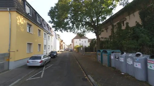
Zeitgeschichtliches Museum Mannheim
Museum · 6.0 km
Ausstellung von der Zeit der fliegenden Zigarren über den 1.Weltkrieg, hin zur Machtübernahme des NS Regimes bis zum katastrophalen...
Birnbaumstraße, Mannheim
Su[1],Su[3] 14:00-17:00
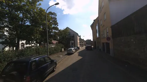

Abbey and Altenmünster of Lorsch
Museum · 9.3 km
UNESCO World Heritage Abbey of Lorsch in Germany


Jüdisches Museum Worms
Museum · 8.6 km
Historical building in Worms, Germany

Luther monument Worms
Monument and historic site · 9.0 km
Large group monument for Martin Luther in Worms, often copied



Heimatmuseum Sandhofen
Museum · 6.0 km
Bartholomäusstraße, Mannheim
Su[1],Su[3] 14:00-17:00 || "während der Sommerferien geschlossen"
68 more on the map.
Parks, trails and playgrounds42



Vorderer Roxheimer Altrhein-Krumbeeräcker
Hiking and trails · 7.0 km


30 more on the map.
Restaurants and cafes173
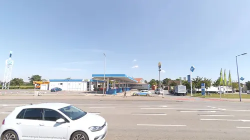
Bäcker Görtz
Bakery · 5.6 km
85 Frankenthaler Straße, Mannheim
Mo-Fr 05:00-18:30; Sa 06:00-18:00; Su 07:30-18:00
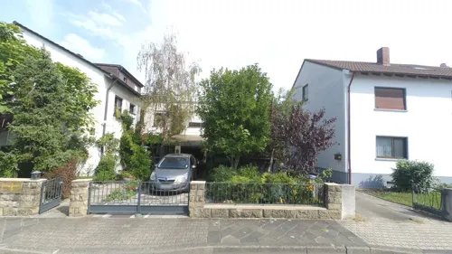
Bäckerei Grimminger
Cafe · 6.0 km
Einfache Bäckerei mit kleinem Cafe-Bereich
17 Memeler Straße, Mannheim
Mo-Fr 06:00-18:00; Sa 06:00-13:00; Su,PH 08:00-11:00
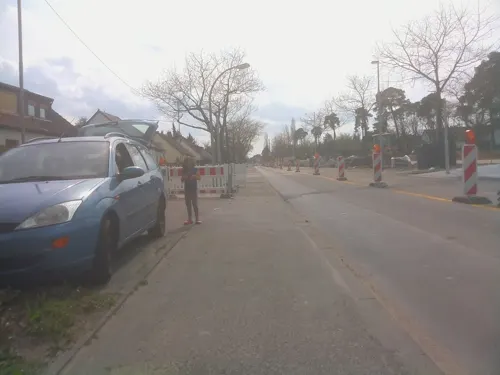
Café Wolfsbau
Cafe · Coffee, Tea, Cake, Breakfast, Snack · 7.0 km
81 Waldpforte, Mannheim
We-Su 09:00-17:00
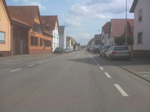
Edde im Schankhaus Linde
Restaurant · Regional, German · 0.8 km
26 Alte Viernheimer Straße, Lampertheim
We,Th,Sa 17:00-23:00; Fr 11:30-14:00,17:00-23:00; Su,PH...
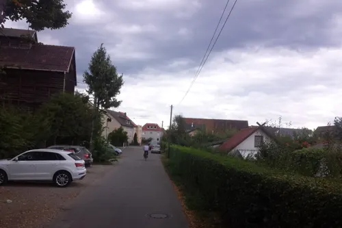
Vereinsheim Aurelia
Restaurant · Greek · 6.3 km
22 Wilhelmswörthstraße, Mannheim
Mo,Tu,Th,Fr,Sa,Su 11:30-14:13,17:00-24:00
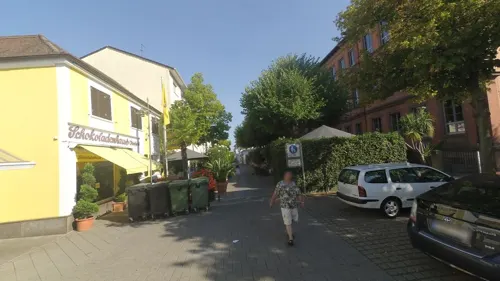
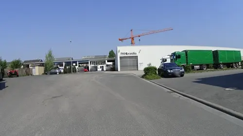
Biergarten Zur Schwarzen Tränke
Bar and pub · 0.6 km
13 Industriestraße, Lampertheim
Mo-Th 17:00-23:00;Fr-Su 15:00-23:00
Bäcker Görtz
Cafe · 0.9 km
2 Andreasstraße, Lampertheim
Mo-Fr 05:30-18:00; Sa 06:00-17:00; Su 07:30-17:00


161 more on the map.
History
The earliest forms of the town’s name handed down from 832 were Langobardonheim or Langbardheim, which led to the conclusion that the town was founded by the Lombards (Langobarden in German). There is however today no further doubt that Lampertheim arose at the time of Frankish settlement and that the name is to be taken as meaning “Lantberths’ Home”, the name “Lantberth” – also “Lampert” or “Lambert” – meaning “Land-brightening ones”. In 1716, the town was granted market rights, and on 4 August 1951 town rights.
The Stadtteil of Rosengarten was originally part of the city of Worms; however, with the post-WWII division of Germany, Worms became part of Rhineland-Palatinate in the French occupation zone, so Rosengarten was incorporated into Hesse in the American occupation zone. In 1971, it became part of Lampertheim.
From the History section of Lampertheim on Wikipedia, under CC BY-SA 4.0.
More about Lampertheim
Geography
Lampertheim lies in the southwest corner of Hesse in the Rhine rift at the Biedensand Conservation Area (an old arm of the Rhine) and borders on Baden-Württemberg and Rhineland-Palatinate. It is on the right bank of the Rhine across from Worms (Rhineland-Palatinate), roughly 15 kilometres (9 miles) north of Mannheim (Baden-Württemberg). The town is broadly, but visibly surrounded by the Odenwald and the Palatinate Forest.
Lampertheim is one of Hesse’s southernmost towns and borders on Bürstadt, Lorsch, Viernheim and Mannheim (Baden-Württemberg).
Lampertheim has the outlying centres of Hofheim, Hüttenfeld, Neuschloß and Rosengarten, which are all Stadtteile. Furthermore, there are residential neighbourhoods named Heide, Oberlach-Rosenau, Am Küblinger Damm, Lache, An der Wormser Straße, In den Böllenruthen, In den Ruthen, Wehrzollhaus, Wildbahn and Seehof.
Economy
Lampertheim is on Bundesstraße 47, the Nibelungenstraße, which leads from Worms to Michelstadt in the Odenwald.
Lampterheim is also on Bundesstraße 44, which runs from Mannheim towards Biblis and further.
Near Lampertheim, the American foreign broadcasting service Radio Free Europe runs a shortwave transmission facility, and US troops run a United States Army and USAF base, Coleman Barracks, in neighbouring Mannheim-Sandhofen. Furthermore, American soldiers also train at a shooting range in the Lampertheim woods.
In Lampertheim itself are four secondary schools, the Lessing Gymnasium Lampertheim, a Gymnasium that also received a certificate for “Promotion of the Gifted”. There are also the Alfred-Delp-Schule, a joint Hauptschule-Realschule, and the Biedensandschule, a special school for special-needs pupils. There is also the district vocational school.
Arts and culture
Stadtmuseum Lampertheim is the town museum. It is found in an old house and there are guided tours.
At the Musikschule Lampertheim is a children’s choir led by Sabine Nicolai. One can also learn to play various instruments at the music school, such as violin, piano, flute, trumpet, and others. There is also singing instruction there, either singly or in groups of 3 or 4 pupils.
Worth mentioning is the Schloss Rennhof built by Baron Rothschild in 1853 and the old schoolhouse built in 1906 and 1907, both in Hüttenfeld. In the Schloss Rennhof is found the Litauisches Gymnasium Hüttenfeld (“Lithuanian Gymnasium”), originally established as a school for Lithuanian émigrés’ children after their homeland was overrun by the Soviet Union in the Second World War. It is the only recognized Lithuanian school in Western Europe.
The many transmission masts of the shortwave broadcaster Radio Free Europe Lampertheim, one of the biggest shortwave transmission facilities in Germany, are up to 125 m tall. They are guyed steel-lattice masts, set in pairs in a row, bearing dipole antennae. Some of these transmission masts are linked to each other by crossbeams furnished with catwalks.
Wassersportverein Lampertheim 1929 e.V. (watersports, among others canoeing)
From the Wikipedia article Lampertheim, under CC BY-SA 4.0.
Notable people from Lampertheim
 Nicole ReinhardtGerman olympic canoeistPhoto: Kanuoli, CC BY-SA 3.0
 Carolin LeonhardtGerman canoeistPhoto: Oliver Strubel, CC BY-SA 3.0
 Constantin BraunGerman ice hockey playerPhoto: Sandro Halank , Wikimedia Commons, CC BY-SA 4.0
 Laurin BraunGerman ice hockey playerPhoto: Sandro Halank, Wikimedia Commons, CC BY-SA 4.0
 Manfred HerwehGerman motorcycle racerPhoto: Jo Atmon /Elmar J. Lordemann, GFDL 1.2
 Alexander BauerGerman politicianPhoto: CDU-Fraktion im Hessischen Landtag, CC BY-SA 4.0
- Klaus SchlappnerGerman association football player and manager
- Wilhelm HerzGerman motorcycle racer (1912–1998)
- Carl HelfrichGerman journalist (1906–1960)
- Elke VoelkerGerman organist
Born in Lampertheim, according to Wikidata (CC0). Each name links to its Wikipedia article.
Where to stay12
Churches and places of worship34
St. Michael
Church · Roman Catholic · 5.1 km
10-14 Peterstraße, Bürstadt
Shopping45
Gas and EV charging18
Schools, colleges and libraries25
Healthcare14
Map of Lampertheim
250 places. The map loads OpenStreetMap tiles when you open it.
Getting there and nearby towns
City-Airport Mannheim (MHG) is the nearest airport with scheduled flights listed in OpenStreetMap, 14 km away.
- Bürstadt 5 km north, about 5 min by car
- Bobenheim-Roxheim 8 km west, about 8 min by car
- Worms 9 km northwest, about 9 min by car
- Lorsch 9 km northeast, about 9 min by car
- Viernheim 10 km southeast, about 10 min by car
- Einhausen 10 km northeast, about 10 min by car
- Frankenthal 11 km southwest, about 11 min by car
- Biblis 10 km north, about 10 min by car
- Mannheim 12 km south, about 12 min by car
- Ludwigshafen am Rhein 13 km south, about 13 min by car
Drive times are estimates from straight-line distance, not routes.
Towns near Lampertheim


Keep exploring
Local news
Headlines from INDB.
Reviews, tips and questions
Loading what members have shared...
Sources and licences
- GeoNames (CC BY 4.0): population, coordinates, regions and time zone
- Mapillary (see each image): photos
- OpenStreetMap contributors (ODbL 1.0): places, airports, map data
- Wikidata (CC0 1.0): elevation, founding date, time zone, website, landmarks and historic places
- Wikimedia Commons (see each image): photos
- Wikipedia (CC BY-SA 4.0): overview and history text
Photo credits
- Lampertheim Rathaus 01, Kuebi = Armin Kübelbeck, CC BY-SA 3.0
- Lampertheim, Ernst-Ludwig-Straße 14, Muck, CC BY-SA 4.0
- Stolperstein Lampertheim Ernst-Ludwig-Straße 16a Ferdinand Guggenheim, Alfrejg, CC BY-SA 4.0
- Stolperstein Lampertheim Ernst-Ludwig-Straße 16a Ernst Kirchheimer, Alfrejg, CC BY-SA 4.0
- Stolpersteine Lampertheim Ernst-Ludwig-Straße 16a, Alfrejg, CC BY-SA 4.0
- Stolperstein Lampertheim Ernst-Ludwig-Straße 16a Friedrich Kirchheimer, Alfrejg, CC BY-SA 4.0
- Stolperstein Lampertheim Ernst-Ludwig-Straße 16a Lina Kirchheimer, Alfrejg, CC BY-SA 4.0
- Lampertheim, Ernst-Ludwig-Straße 4, Muck, CC BY-SA 4.0
- Lampertheim, Ernst-Ludwig-Straße 2, Muck, CC BY-SA 4.0
- 2026-03-10 D500-2018 Achim-Lammerts Lampertheim-Amtsgericht, Achim Lammerts (Syntaxys), CC BY-SA 4.0
- Lampertheim, Bürstädter Straße 6, Muck, CC BY-SA 4.0
- Lampertheim, Bürstädter Straße 3, Muck, CC BY-SA 4.0
- Lampertheim, Bürstädter Straße 8, Muck, CC BY-SA 4.0
- Amtsgericht Lampertheim-01, Muck, CC BY-SA 4.0
- Lampertheim, Kaiserstraße 43, Muck, CC BY-SA 4.0
- Lampertheim, Ernst-Ludwig-Straße 22, Muck, CC BY-SA 4.0
- Lampertheim, Kaiserstraße 45, Muck, CC BY-SA 4.0
- Amtsgericht Lampertheim-Gebäude D, Muck, CC BY-SA 4.0
- Lampertheim, Ernst-Ludwig-Straße 24, Muck, CC BY-SA 4.0
- Lampertheim, Martin-Kärcher-Straße 40, Muck, CC BY-SA 4.0
- Lampertheim, Weltkriegsehrenmal Stadtpark, Muck, CC BY-SA 4.0
- Lampertheim, Kriegerdenkmal 1870-71, Muck, CC BY-SA 4.0
- Lampertheim, Karlstraße 16, Muck, CC BY-SA 4.0
- Lampertheim, Ernst-Ludwig-Straße 34, Muck, CC BY-SA 4.0
- Lampertheim, Kaiserstraße 33, Muck, CC BY-SA 4.0
- Lampertheim, Karlstraße 17, Muck, CC BY-SA 4.0
- Lampertheim, Karlstraße 11a, Muck, CC BY-SA 4.0
- 2026-03-10 D500-2021 Achim-Lammerts Lampertheim-Schillerschule, Achim Lammerts (Syntaxys), CC BY-SA 4.0
- Lampertheim, Ernst-Ludwig-Straße 40, Muck, CC BY-SA 4.0
- Lampertheim, Ernst-Ludwig-Straße 44, Muck, CC BY-SA 4.0
- Lampertheim, Ernst-Ludwig-Straße 44a, Muck, CC BY-SA 4.0
- Lampertheim, Ernst-Ludwig-Straße 42, Muck, CC BY-SA 4.0
- Lampertheim, Erste Neugasse 15, Muck, CC BY-SA 4.0
- Lampertheim, Ernst-Ludwig-Straße 48, Muck, CC BY-SA 4.0
- RE70 Twindexx im Bahnhof Lampertheim 2024, Tohma ( talk ), CC BY-SA 4.0
- Ernst-Ludwig-Straße, 1, Lampertheim, Landkreis Bergstraße, GeorgDerReisende, CC BY-SA 4.0
- Bahnhof Lampertheim Empfangsgebäude, Tohma ( talk ), CC BY-SA 4.0
- Stolperstein Lampertheim Wilhelmstraße 46 Julius Bär, Alfrejg, CC BY-SA 4.0
- Stolperstein Lampertheim Wilhelmstraße 46 Inge Bär, Alfrejg, CC BY-SA 4.0
- Stolperstein Lampertheim Wilhelmstraße 46 Edgar Bär, Alfrejg, CC BY-SA 4.0
- Worms Bruecke 02, Armin Kübelbeck -- Kuebi 16:55, 27 May 2007 (UTC), CC BY-SA 3.0
- 2026-04-08 Achim-Lammerts D500-97379M Theodor-Heuss-Brücke, Achim Lammerts (Syntaxys), CC BY-SA 4.0
- Lorsch, Elswhs at Dutch Wikipedia ( Original text: Els Slots ), CC BY-SA 3.0
- Raschi-Haus, Buercky, CC BY-SA 3.0
- Lutherdenkmal Worms 01, Immanuel Giel, Public domain
- St. Andreas Worms 4, Altera levatur, CC BY-SA 4.0
- Worms sarcophagi, Fourdee at English Wikipedia, Public domain
- Worms Magnuskirche1, Chris06, Public domain
- Hochschule Worms Campus mit A-Gebäude, HochschuleWorms, CC0
- 20120512 NSG Lampertheimer Altrhein - Biedensand - Blumenwiese, Aquatoney, CC BY-SA 4.0
- Buerstadt-St-Michael-04, Immanuel Giel, CC BY-SA 3.0
- Mannheim-Schoenau-Stephanuskirche, Frank, CC BY-SA 3.0
- NSG Ballauf-Wilhelmswörth, Hubert Berberich ( HubiB ), CC BY-SA 3.0
- Lampertheim Domkirche 01, Kuebi = Armin Kübelbeck, CC BY-SA 3.0
- Lampertheim-Kirche-bei-Rathaus, Peter Schmelzle, CC BY-SA 3.0
- Hinterer Roxheimer Altrhein DSC 0173 Lachmöwen, Bernd Herd, CC BY-SA 4.0
- Rheinland-Pfalz, Worms, Wormser Ried 7319-019 82944, Herdsoft, CC BY-SA 4.0
- Tankstelle Hafenstraße Lampertheim, Emilius123, CC BY 4.0
- Mannheim-Sandhofen-Dreifaltigkeitskirche, Frank, CC BY-SA 3.0
- Neuschloß (Lampertheim), Hausenkreuz, Muck, CC BY-SA 4.0
- Heimatmuseum Lampertheim-01, Muck, CC BY-SA 4.0
- Street-level photo, wegavision, CC BY-SA 4.0
- Street-level photo, wegavision, CC BY-SA 4.0
- Street-level photo, chuck, CC BY-SA 4.0
- Street-level photo, ramap, CC BY-SA 4.0
- Street-level photo, ramap, CC BY-SA 4.0
- Street-level photo, wegavision, CC BY-SA 4.0
- Street-level photo, MirDochEga1, CC BY-SA 4.0
- Street-level photo, wegavision, CC BY-SA 4.0
- Street-level photo, wegavision, CC BY-SA 4.0
- Street-level photo, wegavision, CC BY-SA 4.0
- Street-level photo, wegavision, CC BY-SA 4.0
- Street-level photo, ramap, CC BY-SA 4.0
- Street-level photo, wegavision, CC BY-SA 4.0
- Street-level photo, wegavision, CC BY-SA 4.0
- Street-level photo, wegavision, CC BY-SA 4.0
- Street-level photo, ramap, CC BY-SA 4.0
- Street-level photo, ramap, CC BY-SA 4.0
- Street-level photo, wegavision, CC BY-SA 4.0
- Street-level photo, wegatest, CC BY-SA 4.0
- Street-level photo, wegavision, CC BY-SA 4.0
- Street-level photo, wegavision, CC BY-SA 4.0
- Street-level photo, wegavision, CC BY-SA 4.0
- Street-level photo, Eraoniel, CC BY-SA 4.0
- Street-level photo, wegavision, CC BY-SA 4.0
- Street-level photo, Eraoniel, CC BY-SA 4.0
- Street-level photo, bigbug21, CC BY-SA 4.0


Page built November 9, 2026. Spotted a mistake? Tell us or suggest a place.