


Ostfildern, Germany
Ostfildern is a town of 33,598 people in Baden-Wurttemberg, Germany, founded in January 1, 1975.
Why visit Ostfildern
Townapedia lists 46 museums and landmarks, 43 parks and trails, 240 places to eat, 24 places to stay and 25 attractions in and around town.
Highlights include Hagenauer Hof, Hofladen Champagnestraße, Deutsches Landwirtschaftsmuseum and Heimatmuseum Plieningen.
Weather in Ostfildern
Forecast from MET Norway (CC BY 4.0). Full forecast
About Ostfildern
Ostfildern (German pronunciation: [ˈɔstˌfɪldɐn] ; Swabian: Oschtfilder) is a town in the district of Esslingen in Baden-Württemberg in southern Germany. It is located approximately 8 km southeast of Stuttgart. It was formed in 1975 out of a fusion of the previously separate boroughs of Nellingen (including Parksiedlung), Ruit, Kemnat and Scharnhausen and currently has approximately 37,000 inhabitants.
From the Wikipedia article Ostfildern (this version), under CC BY-SA 4.0.
Things to do25

Hagenauer Hof
Farm and orchard · 4.0 km
1, Neuhausen auf den Fildern
Mo-Fr 07:30-12:30, 13:30-18:00; Sa 07:30-12:30
Hofladen Champagnestraße
Farm and orchard · 2.8 km
1 Champagnestraße, Esslingen am Neckar
Mo,Tu,Th,Fr 08:30-18:00; Sa 08:30-15:00; Su,PH off
Honigstube
Farm and orchard · 4.1 km
Honig, Milch, Gemüse, Getreide.
Filderhauptstraße, Stuttgart
Tu,Th,Fr 09:00-13:00,14:00-18:00

Hof am Eichenhain
Farm and orchard · 2.9 km
2 Eichenparkstraße, Stuttgart
Mo-Th 18:00-19:00; Fr 15:00-19:00; Sa 09:00-12:00

Theater am Olgaeck
Cinema and theater · 6.9 km
Building in Stuttgart, Stuttgart Government Region, Bade-Württemberg, Germany

Theater tri-bühne
Cinema and theater · 7.4 km
Building in Stuttgart, Stuttgart Government Region, Bade-Württemberg, Germany
Traumpalast
Cinema and theater · 3.9 km
Mo-Fr 14:30-18:00+; Sa,Su,PH 12:30-18:00+
Württembergische Landesbühne Esslingen
Cinema and theater · 4.6 km
Building in Esslingen am Neckar, Stuttgart Government Region, Bade-Württemberg, Germany
13 more on the map.
Museums and landmarks46

Deutsches Landwirtschaftsmuseum
Museum · 3.7 km
179 Filderhauptstraße, Stuttgart
Apr-Oct: Tu-Fr 10:00-13:00,14:00-17:00; Apr-Oct: Sa,Su,PH...


Backhaus Mettingen
Monument and historic site · 3.0 km
1865 von der Weilergenossenschaft Mettingen als Brenn- und Backhaus erbaut. Gemäß den württembergischen Feuerschutzverordnungen...
Schenkenbergstraße, Esslingen am Neckar


34 more on the map.
Parks, trails and playgrounds43


Freibad Sillenbuch
Sports field and stadium · 3.6 km
2 Trossinger Straße, Stuttgart
Mo-Fr 07:00-20:30; Sa,Su 09:00-20:30



Breslauer Straße
Playground · 2.1 km
Apr-Sep: 08:00-12:00,14:00-21:00; Oct-Mar: 08:00-12:00, 14:00-19:00
Rossert
Playground · 0.8 km
Apr-Sep: 08:00-12:00,14:00-21:00; Oct-Mar: 08:00-12:00, 14:00-19:00

31 more on the map.
Restaurants and cafes240
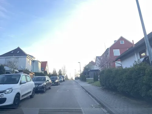
Hotel Kelter
Restaurant · Regional · 3.9 km
Schwäbisch-gutbürgerliche Küche, sommers auch mit Balkon-Terrasse und Gartenwirtschaft
104 Kelterstraße, Esslingen am Neckar
We-Su 11:00-14:00, 17:00-22:00

Alte Dorfschule
Restaurant · Regional
41 Scharnhauser Straße, Ostfildern
Tu 17:30-23:00; We-Sa 11:30-14:00,17:30-23:00; Su 11:30-14:30
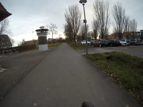

Art – Gallery Café
Cafe · Coffee Shop · 3.7 km
8 Eichendorffstraße, Esslingen am Neckar
Tu-Sa 09:30-21:00; Su 09:00-16:00
CQ Flavour
Restaurant · Chinese · 2.7 km
126 Kirchheimer Straße, Stuttgart
Mo-Sa 11:30-14:30,17:30-22:00; Su 11:30-22:00; PH 11:30-22:00
Café Pause
Restaurant · Regional · 4.0 km
26 Esslinger Straße, Ostfildern
Mo-Th 09:30-23:00; Fr 09:30-24:00; Sa 17:00-24:00; Su 10:00-17:00
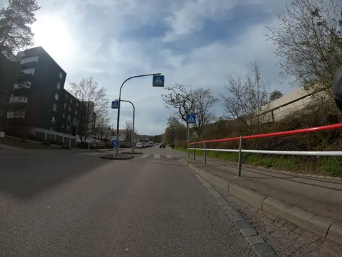
Da Salvo
Restaurant · Italian · 3.9 km
66b Tiefenbachstraße, Stuttgart
Mo,Th-Sa 17:30-22:30; Su 11:30-14:30,17:30-22:30
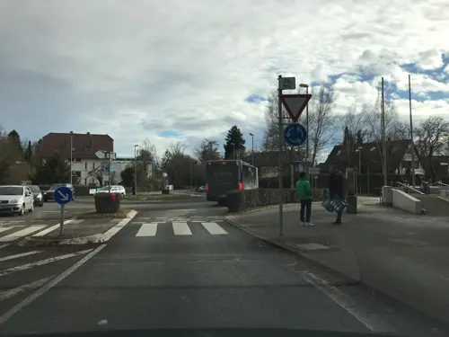
Danis Eule
Bakery · 3.9 km
Fresh Backery & Snacks
155 Filderhauptstraße, Stuttgart
Mo-Fr 07:00-18:00; Sa 07:00-15:00; Su off
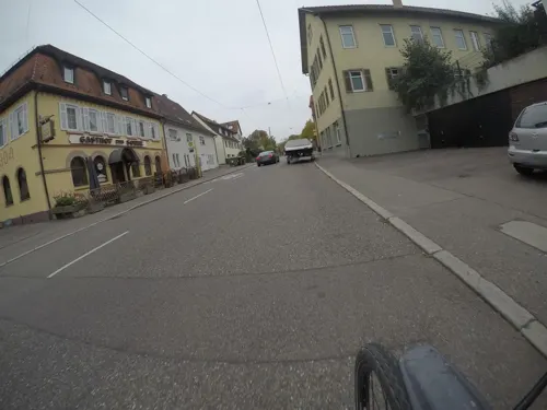
Gasthof zur Sonne
Restaurant · German · 3.9 km
9 Bernhauser Straße, Stuttgart
Mo-Fr 11:00-14:00,17:00-23:30
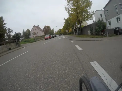


Hermes
Restaurant · Greek · 1.7 km
26 Hauptstraße, Ostfildern
Mo 11:30-14:00,17:30-23:00, Tu 17:39-23:00, We...
Knausbira Stüble
Restaurant · Regional, Swabian · 3.4 km
15 Heumadener Straße, Stuttgart
Mo off; Tu-Fr 11:30-14:00,18:00-23:00; Sa 17:00-23:00; Su off
228 more on the map.
History
The town of Ostfildern was formed on 1 January 1975 from the fusion of the formerly independent boroughs of Nellingen, Ruit, Kemnat and Scharnhausen.
From 1945 to 1992 the U.S. Army operated Nellingen Kaserne as a barracks and airfield. The site has since been redeveloped as Scharnhauser Park.
A well-known inhabitant of Ostfildern is Abdul Ahad Momand, who was the first Afghan in space and who got asylum in Germany following the withdrawal of Soviet forces from Afghanistan.
From the History section of Ostfildern on Wikipedia, under CC BY-SA 4.0.
Where to stay24
Churches and places of worship46
Südkirche
Church · Protestant · 3.5 km
1 Spitalsteige, Esslingen am Neckar
Alte Kirche
Church · Protestant · 3.6 km
7 Amstetter Straße, Stuttgart
Alte Kirche Heumaden
Church · Protestant · 2.2 km
1 Schwendestraße, Stuttgart
Bernhardskirche
Church · Protestant · 3.6 km
257 Rohrackerstraße, Stuttgart
Kreuzkirche
Church · Protestant · 3.5 km
25 Amstetter Straße, Stuttgart
Liebfrauenkirche
Church · Protestant · 3.1 km
68 Schenkenbergstraße, Esslingen am Neckar
Shopping63
Gas and EV charging16
Schools, colleges and libraries52
State University of Music and Performing Arts Stuttgart
School · 7.4 km
Healthcare20
Map of Ostfildern
250 places. The map loads OpenStreetMap tiles when you open it.
Getting there and nearby towns
Manfred Rommel Airport Stuttgart (STR) is the nearest airport with scheduled flights listed in OpenStreetMap, 5 km away.
- Esslingen 4 km east, about 4 min by car
- Neuhausen auf den Fildern 5 km southeast, about 5 min by car
- Denkendorf 6 km southeast, about 6 min by car
- Leinfelden-Echterdingen 7 km southwest, about 7 min by car
- Stuttgart 8 km northwest, about 8 min by car
- Filderstadt 8 km south, about 8 min by car
- Fellbach 9 km north, about 9 min by car
- Wendlingen am Neckar 11 km southeast, about 11 min by car
- Waiblingen 13 km northeast, about 13 min by car
- Nürtingen 13 km southeast, about 13 min by car
Drive times are estimates from straight-line distance, not routes.
Local news
Headlines from INDB.
Reviews, tips and questions
Loading what members have shared...
Sources and licences
- GeoNames (CC BY 4.0): population, coordinates, regions and time zone
- Mapillary (see each image): photos
- OpenStreetMap contributors (ODbL 1.0): places, airports, map data
- Wikidata (CC0 1.0): elevation, founding date, time zone, website, landmarks and historic places
- Wikimedia Commons (see each image): photos
- Wikipedia (CC BY-SA 4.0): overview and history text
Photo credits
- Landappbw 933759 1817 Ehem. Klosterhof der Probstei Nellingen des Klosters St. Blasien Ostfildern-Nellingen, Willi Bautz, CC0
- Körschtalviadukt, Paul-Gerhard Gruhler, CC BY-SA 3.0 de
- Theater tri-bühne, Mussklprozz, CC BY-SA 3.0
- WLB Esslingen, Unknown author, CC BY-SA 3.0
- StadtmuseumStuttgart, Silesia711, CC BY-SA 4.0
- Stuttgart-Hegel-Birthplace-2006-04-09a, ReqEngineer, Public domain
- Stuttgart-haus-der-geschichte-bw, user:Enslin, CC BY 2.5
- HohenheimGardens-pjt2, pjt56 --- If you use the picture outside Wikipedia I would appreciate a short e-mail to [email protected], CC BY-SA 3.0
- Universität Hohenheim R0010108, Stephan Klage, CC0
- HZE Hochschule Esslingen, Erickubitschek, CC BY 3.0
- Stuttgart HochschuleFuerMusikUndDarstellendeKunst, Unknown author, CC BY-SA 3.0
- Alte evangelische Kirche Stuttgart Heumaden 2015 01, Julian Herzog ( Website ), CC BY 4.0
- Deutsches Landwirtschaftsmuseum Plieningen 20060730, Johannes Fasolt, Public domain
- Birkach Franziska 2006-06-15, Johannes Fasolt, Public domain
- Plieningen Martin Church 2006-06-15, Johannes Fasolt, Public domain
- Nellingen-kirche2, Peter Schmelzle, CC BY-SA 3.0
- StuttgartEichenhain-pjt, pjt56 ---, CC BY-SA 3.0
- ES Südkirche, -- Xocolatl ( talk ) 15:52, 27 October 2009 (UTC), Public domain
- Naturschutzgebiet Häslachwald 02, Blub1990, CC BY-SA 3.0
- Ehemalige Zehntscheuer, Mönchhof 7, Stuttgart, Fyrtaarn, CC BY-SA 4.0
- Alte Pfarrkirche Stuttgart-Hedelfingen 2015 01, Julian Herzog ( Website ), CC BY 4.0
- Evang. Bernhardskirche Stuttgart-Rohracker - panoramio, qwesy qwesy, CC BY 3.0
- Stuttgart-Hedelfingen Evang. Kreuzkirche 1, Bear62, CC BY 3.0
- Stuttgart-Hohenheim, St. Antonius (21), Subbass1, CC BY-SA 4.0
- Esslingen aN Mettingen kosciol mariacki 1, Andrzej Otrębski, CC BY-SA 4.0
- Stolperstein S-Sillenbuch Daniel Hauser 20200819 175505, rolf_acker, CC BY-SA 4.0
- Stolperstein für Alexander Talaew (Esslingen am Neckar), Stolpersteineuploader, CC0
- Stolperstein für Auguste Stern (Esslingen am Neckar), Stolpersteineuploader, CC0
- Stolperstein Stuttgart - Corneliusstraße 4 - Daniel Hauser 2025, Stolpersteineuploader, CC0
- Stolperstein für Edith Stern (Esslingen am Neckar), Stolpersteineuploader, CC0
- Stolperstein S-Sillenbuch Elsa Wormser 20200819 174830, rolf_acker, CC BY-SA 4.0
- Stolperstein für Heinrich Stern (Esslingen am Neckar), Stolpersteineuploader, CC0
- Wais 1955.2, 146, NN, erwähnt 1860, Public domain
- Aladdin Model 12 Hängelampe, Vg123huepf, CC BY-SA 4.0
- Anwendungsbeispiel, Tobias Lienhard, CC BY-SA 4.0
- Ruit, 5R-MFT, CC BY-SA 4.0
- OFRuit07, Ziegler175, CC0
- OFRuit06, Ziegler175, CC0
- Feuchtwiesen im Gewann Horber Wiesen, Ursus minor, CC BY-SA 3.0
- OFRuit05, Ziegler175, CC0
- Fernsehturm Stuttgart amk, AngMoKio, CC BY-SA 3.0
- Street-level photo, baldur80, CC BY-SA 4.0
- Street-level photo, mfa, CC BY-SA 4.0
- Street-level photo, mfa, CC BY-SA 4.0
- Street-level photo, vk_s, CC BY-SA 4.0
- Street-level photo, mfa, CC BY-SA 4.0
- Street-level photo, pharris0n, CC BY-SA 4.0
- Street-level photo, mfa, CC BY-SA 4.0
- Street-level photo, mfa, CC BY-SA 4.0
- Street-level photo, mfa, CC BY-SA 4.0
- Street-level photo, mfa, CC BY-SA 4.0
- Street-level photo, thesoult, CC BY-SA 4.0
- Street-level photo, thesoult, CC BY-SA 4.0
- Street-level photo, mfa, CC BY-SA 4.0
- Street-level photo, changchun1, CC BY-SA 4.0
- Street-level photo, mfa, CC BY-SA 4.0
- Street-level photo, derzornigemarkus, CC BY-SA 4.0
- Street-level photo, mfa, CC BY-SA 4.0
- Street-level photo, pharris0n, CC BY-SA 4.0
- Street-level photo, mfa, CC BY-SA 4.0
- Street-level photo, mfa, CC BY-SA 4.0
- Street-level photo, plexi32, CC BY-SA 4.0
- Street-level photo, mfa, CC BY-SA 4.0
- Street-level photo, derzornigemarkus, CC BY-SA 4.0


Page built November 8, 2026. Spotted a mistake? Tell us or suggest a place.