


Why visit Pegnitz
Townapedia lists 60 museums and landmarks, 7 parks and trails, 90 places to eat, 9 places to stay and 75 attractions in and around town.
Highlights include Wildpark Hufeisen Veldensteiner Forst, Devil's Cave, Wohnstallhaus and 1878.
Weather in Pegnitz
Forecast from MET Norway (CC BY 4.0). Full forecast
About Pegnitz
Pegnitz (German: [ˈpeːɡnɪts] ) is a town in the Bayreuth district in Upper Franconia, Bavaria, Germany, with a population of approximately 15,000 inhabitants. It is also the source of the river Pegnitz. The city Bayreuth is about 27 km to the north.
From the Wikipedia article Pegnitz (town) (this version), under CC BY-SA 4.0.
Travel tips from other travellers: Pegnitz on Wikivoyage (CC BY-SA 4.0).
Things to do75

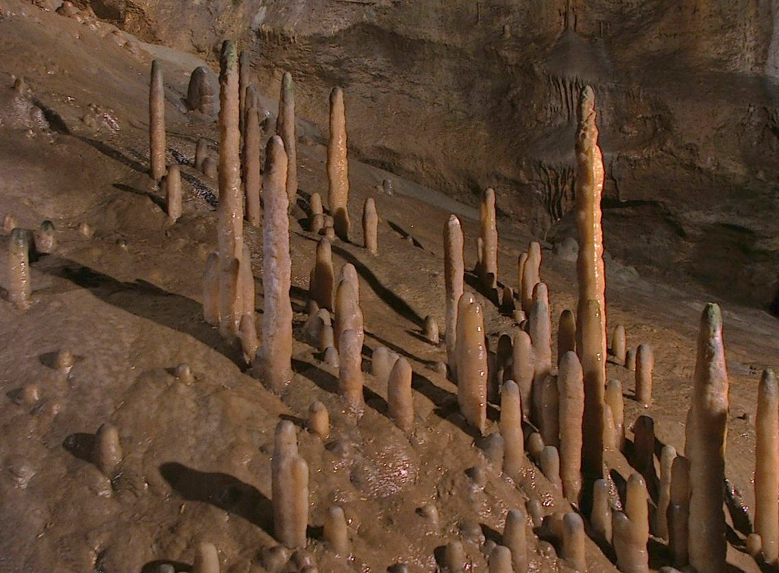
Wildpark Hufeisen Veldensteiner Forst
Zoo and aquarium · 7.2 km
1 Forsthaus Hufeisen, Pegnitz
09:00-17:00






63 more on the map.
Museums and landmarks60



Wegkreuz
Monument and historic site · 4.9 km
Kalksteinsockel mit Gusseisenkreuz, bez. 1908


Burgstall Gernotenstein (Huwenstein)
Monument and historic site · 6.4 km


48 more on the map.
Parks, trails and playgrounds7
CabrioSol
Sports field and stadium · 0.9 km
4 Badstraße, Pegnitz
Sep 16-Jun 14: Mo-Fr 11:00-21:00, Sa,Su,PH,SH 09:00-21:00; Jun...

Eisstadion Pegnitz
Sports field and stadium · 0.8 km
Tu 15:00-17:00,18:15-20:15; We,Fr 15:00-17:00,19:00-21:00; Th...


Restaurants and cafes90


Zur frischen Quelle
Restaurant · Regional · 5.2 km
6 Steinamwasser, Auerbach in der Oberpfalz
Mo off; Tu off; We,Fr 17:00-23:00; Th off; Sa off; Su 16:00-23:00

Ponfick Schlapp'nwirt
Restaurant · Regional
2 Hauptstraße, Pegnitz
Tu-Fr 09:00-23:00; Sa,Su 09:00-14:00
Gasthaus Pension Persau
Restaurant · Regional · 7.7 km
24 Püttlach, Pottenstein
Mo-Su 12:00-14:00,17:00-20:00; Th off


Maharani
Restaurant · Indian · 0.8 km
5 Bahnhofstraße, Pegnitz
Mo-Sa 11:00-14:00,17:00-23:00; Su 11:00-23:00

Pegnitzer Biergarten am Schlossberg
Bar and pub · 0.7 km
Ernst-Böhm-Weg, Pegnitz
Th-Fr 17:00-22:00, Sa 15:00-22:00, Su 11:00-22:00



78 more on the map.
Where to stay9
Churches and places of worship37
Maria-Magdalena-Kirche
Church · Protestant · 7.3 km
1 Kirchplatz, Schnabelwaid
Kath. Friedhofskirche St. Leonhard
Church · Roman Catholic · 6.0 km
4 Veldensteiner Forstweg, Auerbach in der Oberpfalz
Shopping16
Gas and EV charging6
Schools, colleges and libraries10
Healthcare6
Map of Pegnitz
250 places. The map loads OpenStreetMap tiles when you open it.
Getting there and nearby towns
Verkehrslandeplatz Bayreuth (BYU) is the nearest airport with scheduled flights listed in OpenStreetMap, 27 km away.
- Sulzbach-Rosenberg 32 km southeast, about 32 min by car
- Röthenbach an der Pegnitz 37 km southwest, about 37 min by car
- Erlangen 42 km southwest, about 42 min by car
- Nuremberg 47 km southwest, about 47 min by car
- Wunsiedel 46 km northeast, about 46 min by car
- Fürth 50 km southwest, about 50 min by car
- Wendelstein 53 km southwest, about 53 min by car
- Zirndorf 55 km southwest, about 55 min by car
- Bad Staffelstein 55 km northwest, about 55 min by car
- Schwabach 60 km southwest, about 1 h by car
Drive times are estimates from straight-line distance, not routes.
Local news
Headlines from INDB.
Reviews, tips and questions
Loading what members have shared...
Sources and licences
- GeoNames (CC BY 4.0): population, coordinates, regions and time zone
- Mapillary (see each image): photos
- OpenStreetMap contributors (ODbL 1.0): places, airports, map data
- Wikidata (CC0 1.0): elevation, founding date, time zone, website, landmarks and historic places
- Wikimedia Commons (see each image): photos
- Wikipedia (CC BY-SA 4.0): overview and history text
Photo credits
- Pegnitz Marktplatz, Benreis, CC BY-SA 3.0
- Pegnitz Altstadt Mai 2021 13, Kasa Fue, CC BY-SA 4.0
- Pegnitz Altstadt Mai 2021 6, Kasa Fue, CC BY-SA 4.0
- Kneipp-Anlage in Pegnitz, Padd y, CC BY-SA 4.0
- Kneipp-Anlage in Pegnitz in der Pegnitz - panoramio, Siegmar S., CC BY-SA 3.0
- Düker Bachkreuzung Pegnitz 1, Freak-Line-Community, CC BY-SA 3.0
- Bachkreuzung der Pegnitz - panoramio, Siegmar S., CC BY-SA 3.0
- Düker Bachkreuzung Pegnitz, Freak-Line-Community, CC BY-SA 3.0
- Pegnitz Altstadt Mai 2021 7, Kasa Fue, CC BY-SA 4.0
- Rosengasse 27 in Pegnitz (1), Krzysztof Golik, CC BY-SA 4.0
- St Bartholomew church in Pegnitz (11), Krzysztof Golik, CC BY-SA 4.0
- Rosengasse 27 in Pegnitz (2), Krzysztof Golik, CC BY-SA 4.0
- Eintrittsstelle in den Wasserberg Pegnitz, Freak-Line-Community, CC BY-SA 3.0
- St Bartholomew church in Pegnitz (12), Krzysztof Golik, CC BY-SA 4.0
- St Bartholomew church in Pegnitz (13), Krzysztof Golik, CC BY-SA 4.0
- St Bartholomew church in Pegnitz (14), Krzysztof Golik, CC BY-SA 4.0
- Rosengasse 43 in Pegnitz, Krzysztof Golik, CC BY-SA 4.0
- St Bartholomew church in Pegnitz (3), Krzysztof Golik, CC BY-SA 4.0
- Old town hall of Pegnitz (6), Krzysztof Golik, CC BY-SA 4.0
- Old town hall of Pegnitz (7), Krzysztof Golik, CC BY-SA 4.0
- Hauptstrasse 1 in Pegnitz, Krzysztof Golik, CC BY-SA 4.0
- Hauptstrasse 14 in Pegnitz, Krzysztof Golik, CC BY-SA 4.0
- Hauptstrasse 22 in Pegnitz, Krzysztof Golik, CC BY-SA 4.0
- St Bartholomew church in Pegnitz (9), Krzysztof Golik, CC BY-SA 4.0
- St Bartholomew church in Pegnitz (10), Krzysztof Golik, CC BY-SA 4.0
- Hauptstrasse 16 in Pegnitz, Krzysztof Golik, CC BY-SA 4.0
- Old town hall of Pegnitz (8), Krzysztof Golik, CC BY-SA 4.0
- Pegnitz-St-Bartholomäus-Innen-Mitte-IMG 9339-10x3B-360x180G-PanoS-22-09-2023, Joachim Köhler, CC BY-SA 4.0
- St Bartholomew church in Pegnitz (2), Krzysztof Golik, CC BY-SA 4.0
- Old town hall of Pegnitz (10), Krzysztof Golik, CC BY-SA 4.0
- Hauptstrasse 43 in Pegnitz, Krzysztof Golik, CC BY-SA 4.0
- Hauptstrasse 32 in Pegnitz, Krzysztof Golik, CC BY-SA 4.0
- Pegnitz Altstadt Mai 2021 2, Kasa Fue, CC BY-SA 4.0
- Pegnitz town hall, Doris Antony , Berlin, CC BY-SA 4.0
- Hauptstrasse 7 in Pegnitz, Krzysztof Golik, CC BY-SA 4.0
- Pegnitz-St-Mariä-Namen-Innen-Mitte-IMG 9285-10x3B-360x180G-PanoS-22-09-2023, Joachim Köhler, CC BY-SA 4.0
- Teufelshoehle, Magnus Gertkemper, CC BY-SA 2.0 de
- Benediktinerkloster Michelfeld 04, Derzno, CC BY 3.0
- Burgberg Pottenstein, 2, Rainer Lippert , bearbeitet durch Alchemist-hp This image was created with Hugin ., CC0
- Pegnitz, -- Xocolatl ( talk ) 20:30, 13 June 2008 (UTC), Public domain
- 20120428 Kleiner Kulm-Berg, Wiki4Wikinger, CC BY-SA 3.0
- Burgruine Hollenberg, Oberburg, Sven-121 at de.wikipedia, Public domain
- Burgstall Gernotenstein02, Sven-121, CC0
- Burgstall-Wartberg,Ansicht-von-Osten1, Sven-121, Public domain
- Gymnasium Pegnitz Mai 2021 4, Kasa Fue, CC BY-SA 4.0
- Am Schloßberg 19 (Pegnitz), Gliwi, CC BY-SA 3.0
- Rosengasse 51 (Pegnitz), Gliwi, CC BY-SA 3.0
- D-4-72-175-45 01, Derzno, CC BY-SA 3.0
- Feldkapelle D-4-72-179-64 01, Derzno, CC BY 3.0
- Wohnstallhaus (Mandlau) 01, Kd6=dra, CC0
- Pinzigkapelle, Gerosm, CC BY-SA 4.0
- Bauernhaus (Steinamwasser) 01, Derzno, CC BY 3.0
- Marienkapelle (Steinamwasser) 01, Derzno, CC BY 3.0
- Wallfahrtskirche St. Laurentius, Gerosm, CC BY-SA 4.0
- Michelfeld Friedhofskirche St. Leonhard 8151526, Ermell, CC BY-SA 4.0
- 2020-09-05 bildstock nasnitzer hauptstrasse, Stromrichter, CC BY-SA 4.0
- Hauptstraße 2 (Pegnitz), Gliwi, CC BY-SA 3.0
- Hauptstraße 70 (Pegnitz), Gliwi, CC BY-SA 3.0
- Schnabelwaid, Maria-Magdalena-Kirche (01), Subbass1, CC BY-SA 4.0
- Pfarrkirche St. Ägidius im Herbst 1, Meinskh, CC BY 4.0
- Hauptstraße 74 (Pegnitz), Gliwi, CC BY-SA 3.0
- Burgstall Gunzendorf 01, Sven-121, CC0
- Am Breitenstein - panoramio, G. Zapf, CC BY 3.0
- "Hoher Stein" - panoramio, G. Zapf, CC BY 3.0
- Street-level photo, chhe, CC BY-SA 4.0
- Street-level photo, chhe, CC BY-SA 4.0
- Street-level photo, SuedOstLink, CC BY-SA 4.0
- Street-level photo, geo, CC BY-SA 4.0
- Street-level photo, geo, CC BY-SA 4.0
- Street-level photo, chhe, CC BY-SA 4.0
- Street-level photo, chhe, CC BY-SA 4.0
- Street-level photo, r66, CC BY-SA 4.0
- Street-level photo, chhe, CC BY-SA 4.0
- Street-level photo, geo, CC BY-SA 4.0
- Street-level photo, geo, CC BY-SA 4.0
- Street-level photo, mapcreator, CC BY-SA 4.0
- Street-level photo, chhe, CC BY-SA 4.0
- Street-level photo, chhe, CC BY-SA 4.0


Page built November 8, 2026. Spotted a mistake? Tell us or suggest a place.