


Why visit Pirna
Townapedia lists 116 museums and landmarks, 39 parks and trails, 190 places to eat, 35 places to stay and 37 attractions in and around town.
Highlights include Kohlberg, Feistenberg, Gedenkstätte Sonnenstein and Schloss Weesenstein.
Weather in Pirna
Forecast from MET Norway (CC BY 4.0). Full forecast
About Pirna
Pirna (German: [ˈpɪʁna] ; Upper Sorbian: Pěrno, pronounced [ˈpʲɪʁnɔ]) is a town in Saxony, Germany and capital of the administrative district Sächsische Schweiz-Osterzgebirge. The town's population is over 37,000. Pirna is located near Dresden and is an important district town as well as a Große Kreisstadt.
From the Wikipedia article Pirna (this version), under CC BY-SA 4.0.
Photos of Pirna


Things to do37

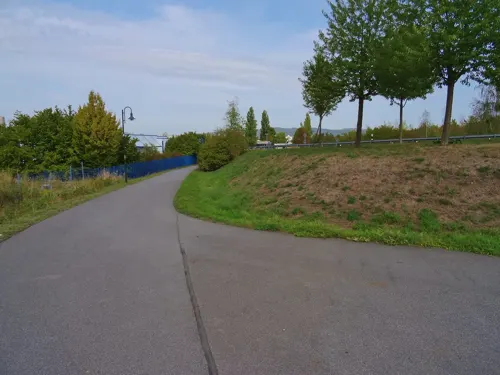
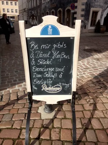


Milchhof Fiedler
Farm and orchard · 4.6 km
19 Pirnaer Straße, Stadt Wehlen
Fr 18:00-20:00; Sa 09:00-12:00; Mo-Fr,Su,PH off

Aussichtspunkt Pilz
Scenic view · 6.0 km
Aussicht auf Dohna, die Müglitztalstraße und die ehem. Flurwerke
25 more on the map.
Museums and landmarks116

Gedenkstätte Sonnenstein
Museum · 1.0 km
11 Schloßpark, Pirna
Mo-Fr 09:00-16:00; Sa, Su 11:00-17:00; PH 11:00-17:00

Schloss Weesenstein
Monument and historic site · 6.2 km
1 Am Schlossberg, Müglitztal
Apr-Oct Mo-Su 10:00-18:00; Sep-Mar Tu-Su 10:00-16:00; Dec 24-25 off

Heimatmuseum Dohna
Museum · 5.5 km
2 Am Markt, Dohna
Tu 13:00-16:00, Th 09:00-12:00; Sa[1],Sa[1] +1 day 14:00-17:00,...

Landschloß Zuschendorf
Monument and historic site · 3.2 km
Schloss (Herrenhaus) mit Brücken-Gang zur Kirche
6 Am Landschloß, Pirna


Standesamt
Monument and historic site · 0.6 km
1-2 Am Markt, Pirna
Tu 08:00-12:00,13:00-16:00; Th 08:00-12:00,13:00-18:00

Canalettohaus
Monument and historic site · 0.6 km
7 Am Markt, Pirna

Elektrizitätswerk Copitz
Monument and historic site · 4.8 km
Ehem. 2 Turbinen von 80 und 120 PS, Generatoren von 220V / 50Hz – 100 kVA, als Einphasen-Wechselstrom. Stahlbetonrohr mit 1,5m...
Liebethaler Grund, Lohmen

Kursächsische Postmeilensäule
Monument and historic site · 5.3 km
Kursächsische Postmeilensäule-Viertelmeilenstein


104 more on the map.
Parks, trails and playgrounds39




Miniaturpark "Die Kleine Sächsische Schweiz"
Sports field and stadium · 4.9 km
8 Schustergasse, Stadt Wehlen


Wesenitzhang und -aue zwischen Pirna-Liebethal und Pirna-Copitz
Hiking and trails · 3.4 km
27 more on the map.
Restaurants and cafes190

Gasthof zum Lindental
Restaurant · Regional · 3.3 km
1 Seidewitzer Straße, Pirna
Su,Mo-Th 11:30-22:00; Fr-Sa 11:00-24:00

Pension und Gasthaus "Zur Alten Säge"
Restaurant · 4.9 km
8a Schustergasse, Stadt Wehlen
Mo,Tu 11:30-16:00; Th-Su,PH 11:30-21:00; We off
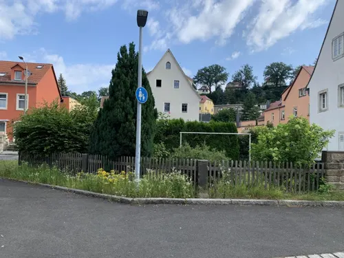
Ranunkelhof
Restaurant · German · 0.9 km
12 Hauptplatz, Pirna
Mo,Th,Fr 14:00-22:00; Sa,Su,PH 11:00-22:00
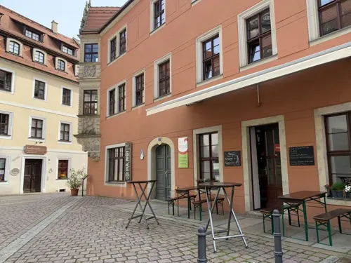
Bella Ciao
Restaurant · Italian · 0.6 km
3 Obere Burgstraße, Pirna
Mo-Tu 11:30-14:00,17:30-22:00; Th-Fr 11:30-14:00,17:30-22:00; Sa...
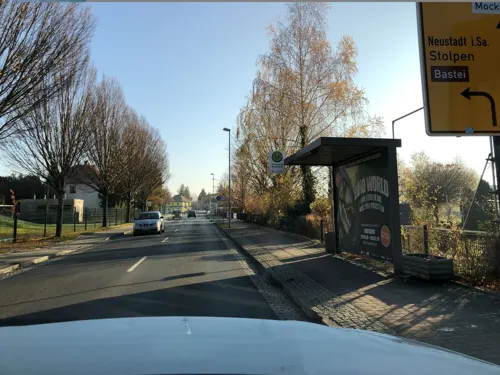
Brauhaus Pirna „Zum Giesser“
Restaurant · German, Regional · 2.4 km
60 b Basteistraße, Pirna
Mo-Su,PH 11:30-22:00
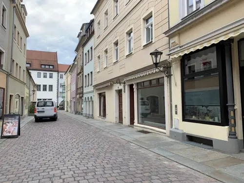
Cafe Central
Cafe · Coffee Shop, Ice Cream, Cake · 0.6 km
16 Barbiergasse, Pirna
Mo off; Tu-Sa 11:00-16:00; Su 13:00-17:00
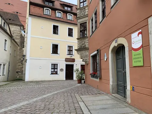
Koschis Suppenladen & Catering
Restaurant · Soup · 0.6 km
1 Obere Burgstraße, Pirna
Mo-Th 10:00-14:00; PH off

Babička
Restaurant · German, Regional, Czech · 0.6 km
20 Am Markt, Pirna
Sa-Su,PH 12:00-22:00; Mo-Fr 11:30-22:00

Felsenbirne
Restaurant · German · 0.7 km
34 Lange Straße, Pirna
Mo-Sa 17:30-22:30, Mo,Fr,Sa 12:00-14:00
Gastwirtschaft Ziegelscheune im Waldpark
Restaurant · Regional · 1.1 km
4 Ziegelstraße, Pirna
Tu-Fr 17:00+; Sa 12:00+; Su 12:00-17:00; Mo off
178 more on the map.
History
Tools made of flint from the late Paleolithic (about 12,000-8000 BC), at the end of the last ice age, are evidence for the earliest human settlement in the area. Later on, people belonging to the Linear Pottery culture, who farmed grain and cattle, lived here during the Neolithic (5500-4000 BC) because of a good climate and Loess soil. Around 600 AD a Slavic group called the Sorbs, who were fishermen and farmers, succeeded the Germanic tribes in the Elbe Valley, who had lived in the area for a couple of centuries from the 4th century BC on. The name Pirna derives from the Sorbian phrase, na pernem, meaning on the hard (stone) and is also related to the Slavic deity Perun, whose cult was present in all Slavic and Baltic territories. The representation of a pear tree in the coat of arms was a later cryptic representation of the Perun cult, covered up by a fanciful, German-language notion about the town's name ("pear" is Birne in German, which sounds rather like "Pirna" Latin: "Pyrus").
Read more of the history
With the conquest of the Slavic communities and the founding of the Mark by the Germans (Henry the Fowler founded the castle of Meissen in 929), settlement in the Pirna area is again verifiable. The castle in Pirna, which was mentioned for the first time in 1269, probably already existed in the 11th century. In the context of the second Eastern German colonization the town was founded by Henry III, Margrave of Meissen.
The streets are aligned from east to west and north to south forming a chessboard-like system. Only the streets east of the church are not aligned in this form, caused by the nearby Burgberg. In 1233, Pirna was mentioned officially for the first time in a document. In 1293, King Wenceslaus II of Bohemia acquired both town and castle from the Bishop of Meissen. Therefore Pirna belonged to Bohemia until 1405.
In 1502, the construction of the new church was begun under Meister Peter Ulrich von Pirna.
With the introduction of the Reformation into Saxony in 1539, Anton Lauterbach, a friend of Martin Luther, became pastor and superintendent. In 1544, the strategically important castle was upgraded to a fortress by Maurice, Elector of Saxony. Three years later, it withstood the siege by elector John Frederick, Elector of Saxony in the Schmalkaldic War.
On 23 April 1639 the town was invaded by Swedish troops under the commander in chief of the Swedish army, Johan Banér. During the five-month long siege of the fortress, which was in the end futile, the town was greatly devastated. About 600 people were killed in the "Misery of Pirna" (Pirnaisches Elend). In around 1670, based upon recent military developments, the Sonnenstein fortress was built. Only the powerful stonework still exists today. In 1707, Pirna had debts related to the Great Northern War of more than 100,000 Thalers.
On 29 August 1756 the small Saxon army fled before the Prussians, who had invaded without declaring war, to the levels between Königstein Fortress and Sonnenstein Castle and capitulated there on 16 October, two days after Sonnenstein surrendered. In 1758, Austrian troops and the Imperial Army besieged the fortress.
A Kattundruck manufactory for cotton printing opened as the first of its kind in 1774. In 1811, the physician Ernst Gottlob Pienitz opened a very large mental hospital in Castle Sonnenstein. But on 14 September 1813, when French troops occupied the Sonnenstein, they forced the evacuation of 275 patients, seized supplies and tore the roof trusses out to remove a fire threat. In September 1813, emperor Napoleon temporarily lived at the Marienhaus, located at the market. Until Dresden's surrender on 11 November the French defended the fortress. Only in February 1814 the hospital for the mentally ill was able to open again.
In 1837, steamship travel began on the upper Elbe. A few years later, in 1848, a railway line connecting Dresden and Pirna opened. In 1880, the first section of the Sekundärbahn-type railway line from Pirna to Gottleuba, the Gottleuba Valley railway was opened. The line was closed in 1976. In 1894, another railway line opened was the Pirna–Großcotta railway, connecting Pirna with the Lohmgrund, a major location of Saxonian sandstone quarries. It closed in 1999.
Pirna became an industrial town in 1862 with the building of factories. Mechanical engineering, glass, cellulose and rayon production also expanded. In 1875, the sandstone Elbbrücke was completed. During the First World War Pirna became a garrison and the engineer battalions 12 and 5 of the Royal Saxon field artillery regiment No. 64 were billeted on Rottwerndorfer Straße. In 1922/23, the town incorporated several municipalities including Posta, Niedervogelgesang, Obervogelgesang, Copitz, Hinterjessen, Neundorf, Zuschendorf, Rottwerndorf and Zehista. The population totaled about 30,000 inhabitants.
From early 1940 until end of June 1942, a part of the large mental asylum within Sonnenstein Castle was converted into a euthanasia killing center: the Sonnenstein Nazi Death Institute. It was a testing ground for initial development of certain methods, later generally adopted and refined for usage associated with the Final Solution. A gas chamber and crematorium were installed in the cellar of the former men's sanitary (building C 16). A high brick-wall on two sides of the complex shielded it from outside view. Four buildings were located inside this brick-wall shielding. They were used as offices, living rooms for the personnel, etc. Sleeping quarters for the men responsible for incinerating the bodies were provided in the attic of building C 16. It is possible that other sections of the buildings were also used by Action T4.
From the History section of Pirna on Wikipedia, under CC BY-SA 4.0.
More about Pirna
Geography
Pirna is located in the vicinity of the Sandstone Mountains in the upper Elbe valley, where two nearby tributaries, Wesenitz from the north and Gottleuba from the south, flow into the Elbe. It is also called the "gate to the Saxon Switzerland" (Ger: Tor zur Sächsischen Schweiz). The Saxon wine region (Ger: Sächsische Weinstraße), which was established in 1992, stretches from Pirna via Pillnitz, Dresden, and Meissen to Diesbar-Seußlitz.
Pirna is located southeast of Dresden. Neighboring municipalities
are Bad Gottleuba-Berggießhübel (town), Bahretal, Dohma, Dohna (town),
Dürrröhrsdorf-Dittersbach, Heidenau (town), Königstein (town), Lohmen,
Arts and culture
Botanischen Sammlungen Landschloß Zuschendorf - botanical collections
DDR Museum Pirna - museum devoted to East Germany memorabilia
Richard-Wagner-Stätten, Jagdschloss Graupa - museum dedicated to the German composer Richard Wagner
Neue Elbland Philharmonie – 60 musicians and about 160 concerts every year
From the Wikipedia article Pirna, under CC BY-SA 4.0.
Notable people from Pirna
 Johann TetzelGerman Dominican friar and seller of indulgences (1460–1519)Photo: Unknown author Unknown author, Public domain
 Francesco FriedrichGerman bobsledder (born 1990)Photo: Sandro Halank , Wikimedia Commons, CC BY-SA 4.0
 Gertrud EysoldtGerman actress (1870–1950)Photo: Photo: Hanna Schwarz; Publisher:..., Public domain
 Martin HellingerGerman dentist and SS officer in several concentration camps (1904-1988)Photo: Anonymous Unknown author, Public domain
 Hermann FinckGerman composerPhoto: Hermann Finck, Public domain
 Johann Christian FiedlerGerman painter (1697-1765)Photo: Daderot, Public domain
 Emmy von EgidyGerman sculptor (1872-1946)Photo: Unknown author Unknown author, Public domain
- Michael RöschGerman biathlete
- Ramona NeubertEast German heptathlete
- Peggy WaleskaGerman rower
- Sybille ReinhardtEast German rower
- Eva Schulze-KnabeGerman artist (1907-1976)
Born in Pirna, according to Wikidata (CC0). Each name links to its Wikipedia article.
Where to stay35
Churches and places of worship25
Shopping61
Gas and EV charging13
Schools, colleges and libraries39
Berufliches Schulzentrum "Friedrich Siemens" Pirna, Nebenstelle Wirtschaft
School
13 Siegfried-Rädel-Straße, Pirna
Healthcare14
Schubert-Apotheke
Clinic and pharmacy · 4.6 km
14 Franz-Schubert-Straße, Heidenau
Klinik für Psychiatrie und Psychotherapie
Clinic and pharmacy · 0.9 km
28-32 Hohe Straße, Pirna
Map of Pirna
250 places. The map loads OpenStreetMap tiles when you open it.
Getting there and nearby towns
Dresden Airport (DRS) is the nearest airport with scheduled flights listed in OpenStreetMap, 23 km away.
- Personenschiffahrt Oberelbe map
- Heidenau 5 km west, about 5 min by car
- Bannewitz 16 km west, about 16 min by car
- Dresden 17 km northwest, about 17 min by car
- Radeberg 17 km north, about 17 min by car
- Löbtau 19 km northwest, about 19 min by car
- Dippoldiswalde 20 km west, about 20 min by car
- Freital 21 km west, about 21 min by car
- Klotzsche 21 km northwest, about 21 min by car
- Gorbitz 22 km northwest, about 22 min by car
- Mickten 21 km northwest, about 21 min by car
Drive times are estimates from straight-line distance, not routes.
Towns near Pirna


Keep exploring
Local news
Headlines from INDB.
Reviews, tips and questions
Loading what members have shared...
Sources and licences
- GeoNames (CC BY 4.0): population, coordinates, regions and time zone
- Mapillary (see each image): photos
- OpenStreetMap contributors (ODbL 1.0): places, airports, map data
- Openverse (see each image): photos
- Wikidata (CC0 1.0): elevation, founding date, time zone, website, landmarks and historic places
- Wikimedia Commons (see each image): photos
- Wikipedia (CC BY-SA 4.0): overview and history text
Photo credits
- Robert Koch Straße Pirna (27878441487), Bambizoe from Dresden, Germany, CC0
- Robert Koch Straße Pirna (41847497435), Bambizoe from Dresden, Germany, CC0
- Robert Koch Straße Pirna (40936794670), Bambizoe from Dresden, Germany, CC0
- Robert Koch Straße Pirna (27878388827), Bambizoe from Dresden, Germany, CC0
- Robert Koch Straße Pirna (42698267542), Bambizoe from Dresden, Germany, CC0
- Robert Koch Straße Pirna (42030187914), Bambizoe from Dresden, Germany, CC0
- Robert Koch Straße Pirna (28317702247), Bambizoe from Dresden, Germany, CC0
- Königsteiner Straße Pirna (41743690504), Bambizoe from Dresden, Germany, CC0
- Robert Koch Straße Pirna (27878407247), Bambizoe from Dresden, Germany, CC0
- Robert Koch Straße Pirna (42030171694), Bambizoe from Dresden, Germany, CC0
- Robert Koch Straße Pirna (42747857931), Bambizoe from Dresden, Germany, CC0
- Königsteiner Straße, Pirna 123649931, Kalispera Dell, CC BY 3.0
- Königsteiner Straße Pirna (28594269818), Bambizoe from Dresden, Germany, CC0
- Königsteiner Straße, Pirna 123649916, Kalispera Dell, CC BY 3.0
- Königsteiner Straße Pirna (42465811811), Bambizoe from Dresden, Germany, CC0
- Königsteiner Straße Pirna (42465796331), Bambizoe from Dresden, Germany, CC0
- Königsteiner Straße Pirna (27595215777), Bambizoe from Dresden, Germany, CC0
- Königsteiner Straße, Pirna 123649945, Kalispera Dell, CC BY 3.0
- Königsteiner Straße Pirna (42465828461), Bambizoe from Dresden, Germany, CC0
- Ernst Thälmann Straße Pirna (40658029460), Bambizoe from Dresden, Germany, CC0
- Königsteiner Straße, Pirna 123649939, Kalispera Dell, CC BY 3.0
- Königsteiner Straße 25, Pirna 122477449, Kalispera Dell, CC BY 3.0
- Ernst Thälmann Platz, Pirna 123963583, Kalispera Dell, CC BY 3.0
- Königsteiner Straße Pirna (40657066200), Bambizoe from Dresden, Germany, CC0
- Robert Koch Straße Pirna (42030145174), Bambizoe from Dresden, Germany, CC0
- Königsteiner Straße, Pirna 123649914, Kalispera Dell, CC BY 3.0
- Ernst Thälmann Platz Pirna (43084449804), Bambizoe from Dresden, Germany, CC0
- Königsteiner Straße Pirna (41742669334), Bambizoe from Dresden, Germany, CC0
- Ernst Thälmann Platz, Pirna 123963585, Kalispera Dell, CC BY 3.0
- Ernst Thälmann Platz Pirna (41992085130), Bambizoe from Dresden, Germany, CC0
- Königsteiner Straße Pirna (42282573835), Bambizoe from Dresden, Germany, CC0
- Ernst Thälmann Platz Pirna (43084446454), Bambizoe from Dresden, Germany, CC0
- Königsteiner Straße Pirna (42282596835), Bambizoe from Dresden, Germany, CC0
- Robert Koch Straße Pirna (43137282442), Bambizoe from Dresden, Germany, CC0
- Hochschule für Technik und Wirtschaft (HTW) Dresden - Zentralgebäude, Campus Friedrich List Platz, HTW Dresden (Fotograf: Peter Sebb), CC BY-SA 3.0
- Human rights memorial Castle-Fortress Sonnenstein 118149137, Kalispera Dell, CC BY 3.0
- 0 236 Barockgarten Großsedlitz - Heidenau, Deutschland, W. Bulach, CC BY-SA 4.0
- DDR-Museum Pirna Eingang 2015-01-17, Toffel, CC BY-SA 4.0
- Geibeltbad Pirna 2015 Filled 121265977, Kalispera Dell, CC BY 3.0
- Dohna, Marienkirche 032, Weners, CC BY-SA 3.0
- PIR Marienkirche (04) 2006-03, Norbert Kaiser, CC BY-SA 2.5
- Jan Eric Schwarzer Radrennbahn Heidenau, Nicola at de.wikipedia, CC BY-SA 2.0 de
- 00 0320 Schloss Weesenstein - Müglitztal-Weesenstein, W. Bulach, CC BY-SA 4.0
- PIR Stadtbibliothek (08) 2008-01-08, Norbert Kaiser, CC BY-SA 2.5
- PIR Klosterkirche (01) 2006-09-10, Norbert Kaiser, CC BY-SA 2.5
- Kirche Dorf Wehlen 2, Brücke-Osteuropa, CC0
- Schustergasse 8 Dorf Wehlen, Brücke-Osteuropa, CC0
- Lohmen-Kirche-1, SchiDD, CC BY-SA 4.0
- Klosterhof 2 Pirna, Brücke-Osteuropa, CC0
- Pirna - Am Markt 1-2 Rathaus (01-2), Norbert Kaiser, CC BY-SA 3.0
- Feldbahnmuseum Herrenleite 11, Brücke-Osteuropa, CC0
- Dohna-Markt-02, SchiDD, CC BY-SA 4.0
- Dr. Wilhelm Külz Straße, Pirna 121190581 (cropped), Kalispera Dell, CC BY 3.0
- Pfarrkirche Graupa Pirna 1, Brücke-Osteuropa, CC0
- 20081004275DR Pirna Am Markt 7 Canalettohaus, Jörg Blobelt, CC BY-SA 4.0
- GMZ Pirna-Sonnenstein 03, Gumideck, CC BY-SA 4.0
- Seidewitzer Straße 1 Pirna 3, Brücke-Osteuropa, CC0
- Zuschendorf Landschloß 20250404 134429, Rigorius, CC BY-SA 4.0
- Heidenau-Christuskirche, SchiDD, CC BY-SA 4.0
- Pirna Sonnenstein, Unknown author, CC BY-SA 3.0
- Liebethaler-grund wesenitz-1, Raspunicum, CC BY-SA 2.5
- Dohna VM-Stein (2) 2006-06, Norbert Kaiser, CC BY-SA 3.0
- Barockgarten-Grosssedlitz Friedrichsschlösschen 2017-06-24-0030, Rigorius, CC BY-SA 4.0
- Struppen Kirche (02), Norbert Kaiser, CC BY-SA 3.0
- Kirche Liebethal AB2012 01, Paulis, CC BY-SA 3.0
- Kohlberg Pirna (43906761405), Bambizoe from Dresden, Germany, CC0
- Lohmen-Koordinatenstein-1, SchiDD, CC BY-SA 4.0
- Feistenberg Pirna, Bambizoe, CC0 1.0
- Tom-Pauls Theater Pirna, FrauSchütze, CC BY-SA 2.0
- Street-level photo, hasienda, CC BY-SA 4.0
- Street-level photo, dsmm, CC BY-SA 4.0
- Street-level photo, hasienda, CC BY-SA 4.0
- Street-level photo, hasienda, CC BY-SA 4.0
- Street-level photo, hasienda, CC BY-SA 4.0
- Street-level photo, hasienda, CC BY-SA 4.0
- Street-level photo, hasienda, CC BY-SA 4.0
- Street-level photo, hasienda, CC BY-SA 4.0
- Street-level photo, hasienda, CC BY-SA 4.0
- Street-level photo, ubahnverleih, CC BY-SA 4.0
- Street-level photo, hasienda, CC BY-SA 4.0
- Street-level photo, hasienda, CC BY-SA 4.0
- Street-level photo, derzornigemarkus, CC BY-SA 4.0
- Street-level photo, hasienda, CC BY-SA 4.0
- Street-level photo, hasienda, CC BY-SA 4.0
- Street-level photo, lvl5, CC BY-SA 4.0
- Street-level photo, hasienda, CC BY-SA 4.0
- Street-level photo, hasienda, CC BY-SA 4.0
- Street-level photo, bufonto, CC BY-SA 4.0
- Street-level photo, lvl5, CC BY-SA 4.0
- Street-level photo, lvl5, CC BY-SA 4.0
- Street-level photo, ubahnverleih, CC BY-SA 4.0
- Street-level photo, dsmm, CC BY-SA 4.0


Page built November 9, 2026. Spotted a mistake? Tell us or suggest a place.