


Why visit Rehau
Townapedia lists 21 museums and landmarks, 20 parks and trails, 78 places to eat, 11 places to stay and 13 attractions in and around town.
Highlights include Großer Kornberg, Hauknock, Museum am Maxplatz and Schloß Döhlau.
Weather in Rehau
Forecast from MET Norway (CC BY 4.0). Full forecast
About Rehau
Rehau (German pronunciation: [ˈʁeːaʊ] ) is a town in the district of Hof, in Bavaria, Germany. Rehau is situated in the Fichtel Mountains, 12 km southeast of Hof, and 12 km west of Aš.
From the Wikipedia article Rehau (this version), under CC BY-SA 4.0.
Things to do13



Hofladen Franz Ludwigsbrunn
Farm and orchard · 6.5 km
Fr 09:00-17:00; Sa 08:00-13:00


1 more on the map.
Museums and landmarks21
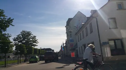

Schloß Döhlau
Monument and historic site · 7.1 km
1 Am Schloss, Döhlau





Grosser Stein
Monument and historic site · 5.9 km
Markierungsstein der Verainung (Grenzvermessung) zwischen Staatswald, Hofer Hospital- und Schönwalder Rittergutswaldungen mit...
9 more on the map.
Parks, trails and playgrounds20
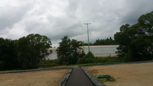





8 more on the map.
Restaurants and cafes78

da Pippo
Restaurant · Italian · 1.0 km
73 Unlitzstraße, Rehau
Tu-Su 11:30-14:00,17:00-22:30; Sa 17:00-22:30
Erbschänke Draisendorf
Restaurant · 4.0 km
25 Draisendorf, Regnitzlosau
Th 18:00-23:00; Su 17:00-22:00
Gasthof Raitschin
Restaurant · 4.9 km
4 Raitschin, Regnitzlosau
Mo-We 15:30-21:30; Th 11:00-21:30; Fr-Sa 11:00-23:00; Su 11:00-21:30
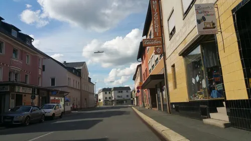
Reinel Bäckerei Oberkotzau
Bakery · 7.4 km
10 Hofer Straße, Oberkotzau
We-Fr 06:30-12:00; Sa 06:00-12:00; PH off
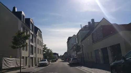
Ihr Beck ums Eck
Bakery
17 Wallstraße, Rehau
Mo-Fr 05:30-18:00; Sa 05:30-12:00; Su 07:30-10:30
Landgasthof Grüner Baum
Restaurant · Regional, Breakfast · 6.1 km


Landgasthof Ploss
Restaurant · 6.2 km
1 Grünhaid, Schönwald
Mo-Sa 17:00-18:00+
66 more on the map.
History
The first documented name of Rehau was "Resawe" in the year 1234.
From the History section of Rehau on Wikipedia, under CC BY-SA 4.0.
Where to stay11
Churches and places of worship18
Shopping19
Gas and EV charging7
Schools, colleges and libraries9
Gutenberg-Grund-/Mittelschule Rehau
School · 0.8 km
36 Pilgramsreuther Straße, Rehau
Healthcare6
Ambulante Augenklinik Dr. Paschke / Dres. Gamringer und Kollegen
Clinic and pharmacy
Map of Rehau
202 places. The map loads OpenStreetMap tiles when you open it.
Getting there and nearby towns
Verkehrslandeplatz Hof-Plauen (HOQ) is the nearest airport with scheduled flights listed in OpenStreetMap, 14 km away.
- Regnitzlosau 6 km north, about 6 min by car
- Schönwald 7 km southeast, about 7 min by car
- Oberkotzau 7 km west, about 7 min by car
- Schwarzenbach an der Saale 8 km southwest, about 8 min by car
- Selb 11 km southeast, about 11 min by car
- Wunsiedel 23 km south, about 23 min by car
- Gera 70 km north, about 1 h 15 min by car
- Bad Staffelstein 75 km west, about 1 h 15 min by car
- Jena 82 km north, about 1 h 15 min by car
- Sulzbach-Rosenberg 86 km south, about 1 h 30 min by car
Drive times are estimates from straight-line distance, not routes.
Local news
Headlines from INDB.
Reviews, tips and questions
Loading what members have shared...
Sources and licences
- GeoNames (CC BY 4.0): population, coordinates, regions and time zone
- Mapillary (see each image): photos
- OpenStreetMap contributors (ODbL 1.0): places, airports, map data
- Wikidata (CC0 1.0): elevation, founding date, time zone, website, landmarks and historic places
- Wikimedia Commons (see each image): photos
- Wikipedia (CC BY-SA 4.0): overview and history text
Photo credits
- Rehau Pfarrkirche, me, Public domain
- Rehau, St. Jobst (23), Subbass1, CC BY 3.0
- Rehau, St. Jobst (24), Subbass1, CC BY 3.0
- Rehau, St. Jobst (13), Subbass1, CC BY 3.0
- Rehau, St. Josef (13), Subbass1, CC BY 3.0
- Selb Porzellanikon, Corradox, CC BY-SA 3.0
- Reconnaissance tower, Mr.checker, CC BY-SA 3.0
- Oberkotzau Schwesnitz, TPO, CC BY-SA 3.0
- Regnitzlosau, St. Aegidien (01), Subbass1, CC BY-SA 4.0
- Schloss Oberkotzau, Aagnverglaser, CC0
- Wojaleite Ansicht, Adrian Michael, CC BY-SA 3.0
- Schilderberg II, Stadt Rehau, CC BY-SA 3.0
- Schönwald Monuments 2020 xy11, PeterBraun74, CC BY-SA 4.0
- Pomník obětem války v zaniklé osadě Újezd (2), Lubor Ferenc, CC BY-SA 4.0
- Rehau, St. Josef (01), Subbass1, CC BY 3.0
- Schwarzenbach (Saale), St. Franziskus (01), Subbass1, CC BY-SA 4.0
- DoehlauSchloss, PeterBraun74, CC BY-SA 3.0
- Historisches Flurdenkmal Grosser Stein, Navajoa, CC BY-SA 4.0
- Südliche Regnitz Dreiländereck, TPO, CC BY-SA 3.0
- Schönwald Monuments 2020 xy10, PeterBraun74, CC BY-SA 4.0
- Pfarrkirche Rehau, Mr.checker, CC BY-SA 3.0
- Kirche Regnitzlosau von Osten, Grencler, CC BY-SA 3.0
- Pilgramsreuth, St. Erhard (05), Subbass1, CC BY-SA 4.0
- Kautendorf Kirche 060, PeterBraun74, CC BY-SA 3.0
- Mapillary (b4sti4n) 2017-06-08 13H22M33S882 (942863639883007 at fzk9 w6R1mKhxfcaO71-Jg with SM-N910F), b4sti4n, CC BY-SA 4.0
- Mapillary (b4sti4n) 2017-06-08 13H22M36S053 (1018658098669955 at fzk9 w6R1mKhxfcaO71-Jg with SM-N910F), b4sti4n, CC BY-SA 4.0
- Mapillary (b4sti4n) 2017-06-08 13H22M31S972 (206682261004832 at fzk9 w6R1mKhxfcaO71-Jg with SM-N910F), b4sti4n, CC BY-SA 4.0
- Mapillary (b4sti4n) 2017-06-08 13H22M38S142 (215888653265433 at fzk9 w6R1mKhxfcaO71-Jg with SM-N910F), b4sti4n, CC BY-SA 4.0
- Mapillary (b4sti4n) 2017-06-08 13H22M29S938 (364130931772933 at fzk9 w6R1mKhxfcaO71-Jg with SM-N910F), b4sti4n, CC BY-SA 4.0
- Mapillary (b4sti4n) 2017-06-08 13H22M39S846 (1888614404638117 at fzk9 w6R1mKhxfcaO71-Jg with SM-N910F), b4sti4n, CC BY-SA 4.0
- Mapillary (b4sti4n) 2017-06-08 13H22M41S773 (276311367486824 at fzk9 w6R1mKhxfcaO71-Jg with SM-N910F), b4sti4n, CC BY-SA 4.0
- Mapillary (b4sti4n) 2017-07-01 10H52M28S470 (528030281554928 at Zbg2UXErYiXp8401CqBfUg with SM-N910F), b4sti4n, CC BY-SA 4.0
- Mapillary (b4sti4n) 2017-07-01 10H52M30S301 (572551023719714 at Zbg2UXErYiXp8401CqBfUg with SM-N910F), b4sti4n, CC BY-SA 4.0
- Mapillary (b4sti4n) 2017-06-08 13H22M19S764 (6205502556142124 at fzk9 w6R1mKhxfcaO71-Jg with SM-N910F), b4sti4n, CC BY-SA 4.0
- Mapillary (b4sti4n) 2017-06-08 13H22M26S465 (763146974572077 at fzk9 w6R1mKhxfcaO71-Jg with SM-N910F), b4sti4n, CC BY-SA 4.0
- Mapillary (b4sti4n) 2017-06-08 13H20M36S752 (236296664911489 at fzk9 w6R1mKhxfcaO71-Jg with SM-N910F), b4sti4n, CC BY-SA 4.0
- Mapillary (b4sti4n) 2017-07-01 10H52M26S444 (661847074663026 at Zbg2UXErYiXp8401CqBfUg with SM-N910F), b4sti4n, CC BY-SA 4.0
- Mapillary (b4sti4n) 2017-06-08 13H23M36S931 (508982803464955 at fzk9 w6R1mKhxfcaO71-Jg with SM-N910F), b4sti4n, CC BY-SA 4.0
- Mapillary (b4sti4n) 2017-07-01 10H52M32S297 (174445454568091 at Zbg2UXErYiXp8401CqBfUg with SM-N910F), b4sti4n, CC BY-SA 4.0
- Mapillary (b4sti4n) 2017-06-08 13H22M45S798 (907448016722837 at fzk9 w6R1mKhxfcaO71-Jg with SM-N910F), b4sti4n, CC BY-SA 4.0
- 1997-03-14-03 Blick von der Schönburgwarte auf dem Kornberg zum Funkturm (1), Stephan van Helden, CC BY-SA 4.0
- Street-level photo, b4sti4n, CC BY-SA 4.0
- Street-level photo, b4sti4n, CC BY-SA 4.0
- Street-level photo, b4sti4n, CC BY-SA 4.0
- Street-level photo, b4sti4n, CC BY-SA 4.0
- Street-level photo, Patrick937, CC BY-SA 4.0
- Street-level photo, b4sti4n, CC BY-SA 4.0
- Street-level photo, SuedOstLink, CC BY-SA 4.0
- Street-level photo, SuedOstLink, CC BY-SA 4.0
- Street-level photo, b4sti4n, CC BY-SA 4.0
- Street-level photo, b4sti4n, CC BY-SA 4.0
- Street-level photo, hkb, CC BY-SA 4.0
- Street-level photo, hkb, CC BY-SA 4.0
- Street-level photo, b4sti4n, CC BY-SA 4.0
- Street-level photo, hkb, CC BY-SA 4.0
- Street-level photo, b4sti4n, CC BY-SA 4.0
- Street-level photo, b4sti4n, CC BY-SA 4.0


Page built November 8, 2026. Spotted a mistake? Tell us or suggest a place.