


Why visit Templin
Townapedia lists 59 museums and landmarks, 45 parks and trails, 75 places to eat, 48 places to stay and 30 attractions in and around town.
Highlights include Hofladen Staudenmüller, Multikulturelles Centrum, Museum für Stadtgeschichte Templin and Minol.
Weather in Templin
Forecast from MET Norway (CC BY 4.0). Full forecast
About Templin
Templin (German: [tɛmˈpliːn] ) is a small town in the Uckermark district of Brandenburg, Germany. Though it has a population of only 17,127 (2006), in terms of area it is, with 377.01 km2 (145.56 sq mi), the second largest town in Brandenburg (after Wittstock) and the seventh largest town in Germany. The town is located in the south of the rural Uckermark region and its capital Prenzlau, north of the Schorfheide-Chorin Biosphere Reserve. The municipality comprises the villages of Ahrensdorf, Bebersee, Beutel, Densow, Gandenitz, Gollin, Gross Dölln, Gross Väter, Grunewald, Hammelspring, Herzfelde, Hindenburg, Klosterwalde, Petznick, Röddelin, Storkow and Vietmannsdorf.
From the Wikipedia article Templin (this version), under CC BY-SA 4.0.
Things to do30

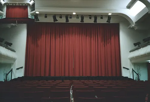


Uckermärkisches Nationaltheater Kulturgut Metzelthin
Cinema and theater · 6.7 km
10 Metzelthin, Templin
18 more on the map.
Museums and landmarks59

Museum für Stadtgeschichte Templin
Museum
1 Prenzlauer Tor, Templin
May-Sep Tu-Fr 10:00-17:00; Sa,Su,PH 13:00-17:00, Oct-Apr Tu-Fr...





Denkmal der Vereinigung der Verfolgten des Naziregimes (VVN)
Monument and historic site
Zwei gläserne Informationsstelen und eine Opferschale auf einem hohen Steinsockel.



47 more on the map.
Parks, trails and playgrounds45



NaturTherme Templin
Sports field and stadium · 2.4 km
121 Dargersdorfer Straße, Templin
Mo-Su 09:00-21:00


Schorfheide-Chorin Biosphere Reserve
Park · 14.9 km
Biosphere reserve in Brandenburg, Germany

Stadion der Freundschaft
Sports field and stadium · 0.8 km
62 Prenzlauer Allee, Templin




33 more on the map.
Restaurants and cafes75

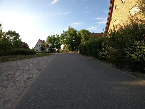
Weinberg 19
Restaurant · Cake, Breakfast, Ice Cream · 0.7 km
19 Weinbergstraße, Templin
Mo-Sa 08:00-18:00; PH,Su 08:00-18:00
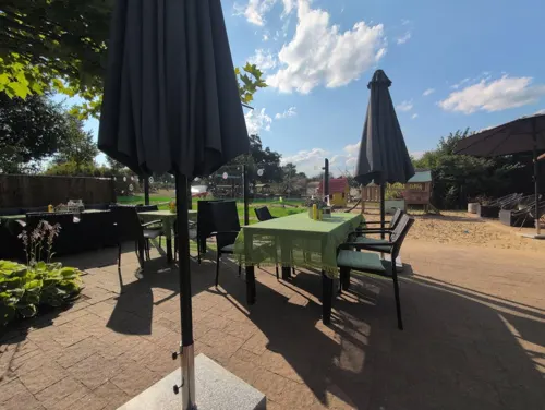
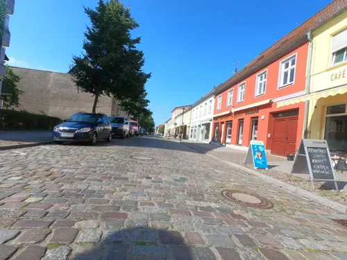
Eiscafe Nico
Cafe · Ice Cream
1a Ernst-Thälmann-Straße, Templin
Mo,Tu,Th,Fr,Sa,Su 14:00-18:00; We,PH off

Grünling
Restaurant · German
20 Pestalozzistraße, Templin
Mo-Fr 10:30-23:00; Sa 11:00-24:00; Su,PH 11:00-21:30
Kreta
Restaurant · Greek · 0.9 km
24 Prenzlauer Allee, Templin
Tu-Th 11:30-14:30,17:00-22:00; Fr 11:30-14:30,17:00-23:00; Sa...
Pizzeria Blaue Grotte
Restaurant · Italian
11 Werderstraße, Templin
Tu-Sa 11:00-13:00,17:00-21:00,PH off


63 more on the map.
History
The town was first mentioned in a 1270 deed issued by Henry of Ostheeren, Bishop of Brandenburg. Then a possession of the Ascanian margraves of Brandenburg, it appeared as a town in 1314 under Margrave Waldemar, who in 1317 concluded the Treaty of Templin here, ending the war against Denmark, Mecklenburg and the Duchy of Pomerania. Heavily devastated by Danish troops in the Thirty Years' War, Templin from 1816 on belonged to the Prussian province of Brandenburg near the border with Mecklenburg-Strelitz.
From 1912 on, Templin was the seat of the Electoral Brandenburgian boarding school (Joachimsthalsches Gymnasium) established in 1601 by Elector Joachim III Frederick of Hohenzollern at nearby Joachimsthal. The school was finally dissolved in 1953. Today, Templin has a modern grammar school built in 1997.
From the History section of Templin on Wikipedia, under CC BY-SA 4.0.
Where to stay48
Churches and places of worship28
Dorfkirche Hammelspring
Church · Protestant · 7.0 km
1 Am Bahndamm, Templin
Dorfkirche Milmersdorf
Church · Protestant · 9.3 km
18a Alte Templiner Straße, Milmersdorf
Dorfkirche Klosterwalde
Church · Protestant · 7.1 km
17 Klosterwalder Dorfstraße, Templin
Dorfkirche Mittenwalde
Church · Protestant · 13.0 km
24 Dorfstraße, Mittenwalde
Dorfkirche Vietmannsdorf
Church · Protestant · 7.7 km
1 Storkower Straße, Templin
Dorfkirche Warthe
Church · Protestant · 10.6 km
65 Warther Dorfstraße, Boitzenburger Land
Shopping27
Gas and EV charging3
Schools, colleges and libraries12
Healthcare6
Map of Templin
250 places. The map loads OpenStreetMap tiles when you open it.
Getting there and nearby towns
Müritz Airpark (REB) is the nearest airport with scheduled flights listed in OpenStreetMap, 54 km away.
- Milmersdorf 9 km east, about 9 min by car
- Mittenwalde 13 km northeast, about 13 min by car
- Lychen 16 km northwest, about 16 min by car
- Gerswalde 17 km east, about 17 min by car
- Zehdenick 19 km southwest, about 19 min by car
- Wandlitz 42 km south, about 42 min by car
- Velten 53 km southwest, about 53 min by car
- Berlin 66 km south, about 1 h by car
- Potsdam 85 km south, about 1 h 30 min by car
- Zeuthen 86 km south, about 1 h 30 min by car
Drive times are estimates from straight-line distance, not routes.
Local news
Headlines from INDB.
Reviews, tips and questions
Loading what members have shared...
Sources and licences
- GeoNames (CC BY 4.0): population, coordinates, regions and time zone
- Mapillary (see each image): photos
- OpenStreetMap contributors (ODbL 1.0): places, airports, map data
- Openverse (see each image): photos
- Wikidata (CC0 1.0): elevation, founding date, time zone, website, landmarks and historic places
- Wikimedia Commons (see each image): photos
- Wikipedia (CC BY-SA 4.0): overview and history text
Photo credits
- Templin-rathaus, Father of de:User:Oktaeder, Public domain
- RK 0907 3667 Pulverturm Templin, Reinhard Kraasch, CC BY-SA 4.0
- Fachwerkhäuser in der Rühlstraße, Templin, 2025-11-03, Nylki, CC0
- Fachwerkhaus, Rühlstraße 5, Templin, 2025-11-03, Nylki, CC0
- Rühlstraße - Ecke Fischerstraße, Templin, Brandenburg, Nylki, CC0
- Fußgängerweg Rühlstraße, Templin, Nylki, CC0
- Templin Eulenturm, Lichterfelder, CC BY-SA 3.0
- Eulenturm Templin (27605524124), Steffen Zahn from Berlin, Germany, CC BY 2.0
- Wandmalerei Obere Mühlenstr 4a (Templin) Blick über den Kanal, OTFW , Berlin, CC BY-SA 3.0
- 20250809 xl 1201-Zwillingssteine (gespaltener Findling bzw. nebeneinander liegende Halbsteine) in der Stadtmauer von Templin am Eulenturm, Molgreen, CC BY-SA 4.0
- Wandmalerei Obere Mühlenstr 5 (Templin) Königstraße mit Martplatz und Berliner Tor, OTFW , Berlin, CC BY-SA 3.0
- Templin, das Rathaus, Dguendel, CC BY 4.0
- Skulptur Obere Mühlenstr 1 (Templin) Familie&Karl Rätsch&20094, OTFW , Berlin, CC BY-SA 3.0
- Skulptur Obere Mühlenstr 1 (Templin) Familie&Karl Rätsch&20092, OTFW , Berlin, CC BY-SA 3.0
- Skulptur Obere Mühlenstr 1 (Templin) Familie&Karl Rätsch&20095, OTFW , Berlin, CC BY-SA 3.0
- Skulptur Obere Mühlenstr 1 (Templin) Familie&Karl Rätsch&20093, OTFW , Berlin, CC BY-SA 3.0
- Skulptur Obere Mühlenstr 1 (Templin) Familie&Karl Rätsch&2009, OTFW , Berlin, CC BY-SA 3.0
- Skulptur Obere Mühlenstr 1 (Templin) Familie&Karl Rätsch&20096, OTFW , Berlin, CC BY-SA 3.0
- Wandmalerei Ernst-Thälmann-Str 10A (Templin) Markt und Mühlenstraße, OTFW , Berlin, CC BY-SA 3.0
- Templin, die Ernst-Thälmann-Straße, Dguendel, CC BY 4.0
- Stadtmauer in Templin, 2025-11-03, Nylki, CC0
- Templin, an der Stadtmauer, Dguendel, CC BY 4.0
- Akzisehaus, Templin, 2025-11-03, Nylki, CC0
- 2016-09-23 Rathaus Templin 002, Brunhilde Schaefer, CC BY-SA 3.0
- 2016-09-23 Rathaus Templin 006, Brunhilde Schaefer, CC BY-SA 3.0
- Templin, das Akzisehaus, Dguendel, CC BY 4.0
- Rathaus Templin 2018CF, Clemensfranz, CC BY-SA 4.0
- Templin, die Häuser Am Markt 9 und 10, Dguendel, CC BY 4.0
- Templin, das Kriegerdenkmal Deutsch Französischer Krieg, Dguendel, CC BY 4.0
- Historisches Rathaus Templin (28186910796), Steffen Zahn from Berlin, Germany, CC BY 2.0
- Templin, die Häuser Am Markt 14 und 15, Dguendel, CC BY 4.0
- Templin, Pulverturm und Prenzlauer Tor, Dguendel, CC BY 4.0
- Gedenktafel Ernst-Thälmann-Str 2 (Templin) Akzisehaus, OTFW , Berlin, CC BY-SA 3.0
- Wandmalerei Ernst-Thälmann-Str 2 (Templin) Akzisehaus, OTFW , Berlin, CC BY-SA 3.0
- Templin, Pumpe auf dem Marktplatz, Dguendel, CC BY 4.0
- 20250807 xl 1858-begrünter Pulverturm (Templin), Molgreen, CC BY-SA 4.0
- Templin, Haus Berliner Straße 12, Dguendel, CC BY 4.0
- Templin towers and walls 03, Sirleonidas, CC BY-SA 4.0
- Templin towers and walls 04, Sirleonidas, CC BY-SA 4.0
- Templin, Haus Schinkelstraße 1, Dguendel, CC BY 4.0
- Mildenberg Ziegeleipark 08-13 img1, A.Savin, CC BY-SA 3.0
- Plagefenn-wp-001, Ralf Roletschek, GFDL 1.2
- Templin botanical garden lehmanngarten 02, de:User:Sebastian Wallroth, Public domain
- Templin Eldorado Mainstreet, Olaf Meister, CC BY-SA 3.0
- 20010902320AR Alt Placht (Templin) Kirchlein im Grünen, Jörg Blobelt, CC BY-SA 4.0
- 20230707 xl 1734-Stadion der Freundschaft, Molgreen, CC BY-SA 4.0
- 2018 02 Templin DSCF1272, Daniela Kloth, GFDL 1.2
- Templin Mühlentor Außenseite, Olaf Meister, CC BY-SA 3.0
- Templin Akzisehaus, Olaf Meister, CC BY-SA 3.0
- 20230707 xl 1729-Stadtbibliothek Templin, Molgreen, CC BY-SA 4.0
- Biberbaustelle im Naturschutzgebiet Kleine Schorfheide in Brandenburg, Gerryknips, CC BY-SA 4.0
- NSG Brüsenwalde 2021-05-29 50, Leonhard Lenz, CC0
- Dorfkirche Storkow (Templin) 2017 SE, Hans G. Oberlack, CC BY-SA 4.0
- Dorfkirche Vietmannsdorf 2020 SE, Hans G. Oberlack, CC BY-SA 4.0
- Kirche in Warthe, MSpringborn, CC BY-SA 3.0
- Dorfkirche Hindenburg (Uckermark) 2017 SE, Hans G. Oberlack, CC BY-SA 4.0
- Dorfkirche Klosterwalde 2017 E, Hans G. Oberlack, CC BY-SA 4.0
- Milmersdorf 10 14 02, Uckermaerker, CC BY-SA 4.0
- Dorfkirche Mittenwalde (Uckermark) 2017 NE, Hans G. Oberlack, CC BY-SA 4.0
- Alte Tankstelle Templin, 2025-11-03, Nylki, CC0
- 20230707 xl 1756-Museum für Stadtgeschichte Templin, Molgreen, CC BY-SA 4.0
- Berliner Tor Templin, Nikolas Becker, CC BY-SA 2.5
- Templin Bahnhofstr VVN, Michael Richmann, CC BY-SA 4.0
- Prenzlauer Tor Templin, Nikolas Becker (foto/at/nikolasbecker.de), CC BY-SA 3.0
- Templin Pulverturm, Olaf Meister, CC BY-SA 3.0
- 20250807 xl 1120-Bio-Deli-Café "3 Haselnüsse", Molgreen, CC BY-SA 4.0
- Sankt-Maria-Magdalena-Kirche (Templin), Olaf Meister, CC BY-SA 3.0
- Dorfkirche Jakobshagen 2017 S, Hans G. Oberlack, CC BY-SA 4.0
- Dorfkirche Hammelspring 2020 S, Hans G. Oberlack, CC BY-SA 4.0
- 20230707 xl 1712-Herz-Jesu Kirche, Molgreen, CC BY-SA 4.0
- Heilanstalten Hohenlychen, Gabor Fischer, Public domain
- Reihenstraße (Groß Dölln), Gliwi, CC BY-SA 4.0
- Multikulturelles Centrum Templin e.V, dalailimba department of imagination, CC BY-SA 2.0
- Street-level photo, masterofnoroad, CC BY-SA 4.0
- Street-level photo, rausk, CC BY-SA 4.0
- Street-level photo, carlheinz, CC BY-SA 4.0
- Street-level photo, reneklatt, CC BY-SA 4.0
- Street-level photo, zoegglmeyr, CC BY-SA 4.0
- Street-level photo, wentus, CC BY-SA 4.0
- Street-level photo, adiplth, CC BY-SA 4.0
- Street-level photo, carlheinz, CC BY-SA 4.0
- Street-level photo, wentus, CC BY-SA 4.0
- Street-level photo, zoegglmeyr, CC BY-SA 4.0
- Street-level photo, carlheinz, CC BY-SA 4.0
- Street-level photo, reneklatt, CC BY-SA 4.0
- Street-level photo, reneklatt, CC BY-SA 4.0
- Street-level photo, moenk, CC BY-SA 4.0
- Street-level photo, reneklatt, CC BY-SA 4.0
- Street-level photo, rausk, CC BY-SA 4.0
- Street-level photo, carlheinz, CC BY-SA 4.0
- Street-level photo, ber319, CC BY-SA 4.0
- Street-level photo, carlheinz, CC BY-SA 4.0
- Street-level photo, carlheinz, CC BY-SA 4.0
- Street-level photo, reneklatt, CC BY-SA 4.0
- Street-level photo, rausk, CC BY-SA 4.0
- Street-level photo, carlheinz, CC BY-SA 4.0
- Street-level photo, schulf, CC BY-SA 4.0


Page built November 8, 2026. Spotted a mistake? Tell us or suggest a place.