


Why visit Waldkraiburg
Townapedia lists 25 museums and landmarks, 18 parks and trails, 53 places to eat, 7 places to stay and 4 attractions in and around town.
Highlights include Cineplex Waldkraiburg, Pollers-Fruechtegarten, Feuerwehrmuseum Bayern and Saalgebäude.
Weather in Waldkraiburg
Forecast from MET Norway (CC BY 4.0). Full forecast
About Waldkraiburg
Waldkraiburg (German pronunciation: [valtˈkʁaɪbʊʁk] ; Central Bavarian: Woidkroaburg) is a town in the district of Mühldorf, in Bavaria, Germany with a population of about 24,000. It is the biggest town in the district of Mühldorf. It is located on the river Inn, approximately ten kilometers southwest of Mühldorf and sixty kilometers east of Munich.
From the Wikipedia article Waldkraiburg (this version), under CC BY-SA 4.0.
Things to do4
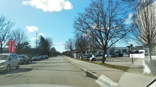
Cineplex Waldkraiburg
Cinema and theater · 1.7 km
55 Daimlerstraße, Waldkraiburg
Mo off; Tu-We 16:30-20:30; Fr 15:30-22:30; Sa 12:15-22:30; Su,PH...
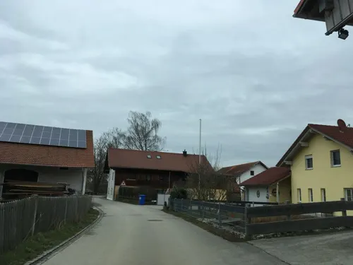

Museums and landmarks25


Saalgebäude
Monument and historic site · 2.4 km
Zentraler Bereich des ehemaligen Frauenlagers
1 Meisenweg, Waldkraiburg


Heimatmuseum Kraiburg am Inn
Museum · 3.5 km
"April bis Oktober: Jeder erste Sonntag im Monat von 14:00 -...



Forest Camp Boundary
Monument and historic site · 3.4 km
Gedenkorte Mühldorfer Hart

ehem. Monte Carlo
Monument and historic site · 1.0 km
4 Ritter-von-Gluck-Weg, Waldkraiburg
13 more on the map.
Parks, trails and playgrounds18



6 more on the map.
Restaurants and cafes53


Asia Stars
Restaurant · Chinese, Japanese, Mongolian · 0.6 km
4-8 Teplitzer Straße
Mo-Su 11:30-14:30,22:00-22:00
Va Bene
Restaurant · Italian · 2.9 km
24 Johannesstraße
Tu-Sa 11:30-14:00,17:30-24:00; Su 11:30-14:00,17:00-24:00

Scheuerer Alm
Restaurant · Regional · 4.2 km
1 Scheuern, Aschau am Inn
Fr-Sa 16:00-23:00; Su 11:00-23:00
HQ-Wok&Sushi
Restaurant · Asian, Sushi
39 Stadtplatz, Waldkraiburg
Mo-Su 11:00-14:00,17:00-22:00
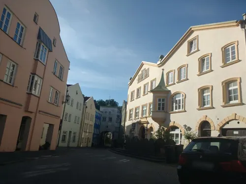
Il Salento
Restaurant · Italian · 3.8 km
15 Marktplatz, Kraiburg
We-Fr,Su 11:30-21:00; Sa 17:00-22:00; Mo,Tu off
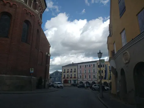
Perfetto by Giuseppe
Restaurant · Italian · 3.7 km
Mo off; Tu-Fr, Su 11:30-14:00,17:30-22:00; Sa 17:30-22:00
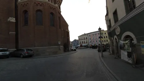


Pötsch
Bakery · 3.7 km
18 Marktplatz, Kraiburg
Mo-Sa 06:30-12:30, Fr 14:00-18:00
41 more on the map.
Where to stay7
Churches and places of worship26
Mariä Himmelfahrt
Church · Roman Catholic · 4.1 km
9 Kirchenstraße, Aschau am Inn
St. Bartholomäus
Church · Roman Catholic · 3.7 km
36 Marktplatz, Kraiburg
St. Erasmus
Church · Roman Catholic · 2.0 km
10 Trenbachstraße, Waldkraiburg
St. Nikolaus
Church · Roman Catholic · 3.4 km
18 Bahnhofstraße, Kraiburg
Shopping24
Gas and EV charging4
Freie Tankstelle Harald Rösler
Gas station · 3.0 km
1 Mozartstraße, Aschau am Inn
Schools, colleges and libraries13
Healthcare7
Map of Waldkraiburg
181 places. The map loads OpenStreetMap tiles when you open it.
Getting there and nearby towns
Munich International Airport (MUC) is the nearest airport with scheduled flights listed in OpenStreetMap, 48 km away.
- Kraiburg am Inn 4 km southeast, about 4 min by car
- Aschau am Inn 4 km west, about 4 min by car
- Ampfing 5 km north, about 5 min by car
- Jettenbach 5 km south, about 5 min by car
- Neufahrn 6 km northeast, about 6 min by car
- Rattenkirchen 7 km northwest, about 7 min by car
- Taufkirchen 8 km southeast, about 8 min by car
- Munich 62 km west, about 1 h by car
- Wolnzach 72 km northwest, about 1 h 15 min by car
- Wolfratshausen 80 km southwest, about 1 h 15 min by car
Drive times are estimates from straight-line distance, not routes.
Local news
Headlines from INDB.
Reviews, tips and questions
Loading what members have shared...
Sources and licences
- GeoNames (CC BY 4.0): population, coordinates, regions and time zone
- Mapillary (see each image): photos
- OpenStreetMap contributors (ODbL 1.0): places, airports, map data
- Wikidata (CC0 1.0): elevation, founding date, time zone, website
- Wikimedia Commons (see each image): photos
- Wikipedia (CC BY-SA 4.0): overview and history text
Photo credits
- Waldkraiburg, Neustädtler, CC BY-SA 3.0
- Stadtmuseum Waldkraiburg, Stefan Karl, CC BY-SA 4.0
- Bunker 29 Waldkraiburg, Stefan Karl, CC BY-SA 4.0
- Sammlung Peter Schmidt Waldkraiburg, Stefan Karl, CC BY-SA 4.0
- Haus der Kultur Waldkraiburg, Stefan Karl, CC BY-SA 4.0
- St. Maximilian Maximilian Kraiburg-1, Rufus46, CC BY-SA 3.0
- Pürten, Wallfahrtskirche Mariä Himmelfahrt (101), Mattana, CC BY-SA 3.0
- Pfarrkirche Maria Himmelfahrt, Aschau a.Inn ^1 - panoramio, Johannes Schlund, CC BY-SA 3.0
- St. Nikolaus und Sebastian Kraiburg-1, Rufus46, CC BY-SA 3.0
- Vom Schlossberg St. Bartholomaeus Kraiburg-1, Rufus46, CC BY-SA 3.0
- Wegkapelle Maximilian Kraiburg-1, Rufus46, CC BY-SA 3.0
- Föhrenwinkel, Amselweg 6 (1), JoeGue, CC BY-SA 4.0
- St. Erasmus, Erasmuskirche, 2, Renardo la vulpo, CC0
- Schuster-Schleif Kraiburg am Inn (1), Stefan Karl, CC BY-SA 4.0
- Heimatmuseum Kraiburg am Inn, Stefan Karl, CC BY-SA 4.0
- Hammerschmiede Maximilian Kraiburg am Inn (1), Stefan Karl, CC BY-SA 4.0
- St. Nikolaus und Sebastian Kraiburg-1 (bearb Sp), Rufus46, CC BY-SA 3.0
- Fire-fighting-facility node-6380460908, Stone112, CC BY 4.0
- HW-group Ares12, Markus Huber, CC BY-SA 3.0
- HW-group Ares12 GSM SMS, Markus Huber, CC BY-SA 3.0
- Fire-fighting-facility node-6381185427, Stone112, CC BY 4.0
- Fire-fighting-facility node-6381199618, Stone112, CC BY 4.0
- Fire-fighting-facility node-6381371341, Stone112, CC BY 4.0
- Fire-fighting-facility node-6381382760, Stone112, CC BY 4.0
- Fire-fighting-facility node-6381377888, Stone112, CC BY 4.0
- ISS053-E-89270 - View of Earth, Earth Science and Remote Sensing Unit , Lyndon B. Johnson Space Center, Public domain
- ISS034-E-11180 - View of Earth, Earth Science and Remote Sensing Unit , Lyndon B. Johnson Space Center, Public domain
- ISS038-E-69217 - View of Earth, Earth Science and Remote Sensing Unit , Lyndon B. Johnson Space Center, Public domain
- ISS056-E-153191 - View of Earth, Earth Science and Remote Sensing Unit, NASA Johnson Space Center, Public domain
- ISS050-E-51785 - View of Earth, Earth Science and Remote Sensing Unit , Lyndon B. Johnson Space Center, Public domain
- ISS038-E-68534 - View of Earth, Earth Science and Remote Sensing Unit , Lyndon B. Johnson Space Center, Public domain
- ISS038-E-68535 - View of Earth, Earth Science and Remote Sensing Unit , Lyndon B. Johnson Space Center, Public domain
- ISS050-E-51784 - View of Earth, Earth Science and Remote Sensing Unit , Lyndon B. Johnson Space Center, Public domain
- ISS038-E-68533 - View of Earth, Earth Science and Remote Sensing Unit , Lyndon B. Johnson Space Center, Public domain
- ISS053-E-86795 - View of Earth, Earth Science and Remote Sensing Unit , Lyndon B. Johnson Space Center, Public domain
- Street-level photo, umap, CC BY-SA 4.0
- Street-level photo, thetornado76, CC BY-SA 4.0
- Street-level photo, thetornado76, CC BY-SA 4.0
- Street-level photo, czmrtn, CC BY-SA 4.0
- Street-level photo, thetornado76, CC BY-SA 4.0
- Street-level photo, natebus, CC BY-SA 4.0
- Street-level photo, joehil, CC BY-SA 4.0
- Street-level photo, chicc0, CC BY-SA 4.0
- Street-level photo, rockd, CC BY-SA 4.0
- Street-level photo, joehil, CC BY-SA 4.0


Page built November 8, 2026. Spotted a mistake? Tell us or suggest a place.