


Waldshut-Tiengen, Germany
Waldshut-Tiengen is a town of 22,404 people in Baden-Wurttemberg, Germany.
Why visit Waldshut-Tiengen
Townapedia lists 88 museums and landmarks, 29 parks and trails, 144 places to eat, 20 places to stay and 32 attractions in and around town.
Highlights include Albrecht Kino Center, Biomeier, Schweizerisches Militärmuseum Full and Oberer Bürgli.
Weather in Waldshut-Tiengen
Forecast from MET Norway (CC BY 4.0). Full forecast
About Waldshut-Tiengen
Waldshut-Tiengen (German pronunciation: [ˈvaltshuːt ˈtiːŋən] ; Alemannic: Waldshuet-Düenge), commonly known as Waldshut, is a city in southwestern Baden-Württemberg right at the Swiss border. It is the district seat and at the same time the biggest city in Waldshut district and a "middle centre" in the area of the "high centre" Lörrach/Weil am Rhein to whose middle area most towns and communities in Waldshut district belong (with the exception of seven communities that belong to Bad Säckingen's area). There are furthermore complexities arising from cross-border traffic between this area and the Swiss cantons of Aargau, Schaffhausen and Zürich. This classification relates to Walter Christaller's Central Place Theory, however, and not to any official administrative scheme.
From the Wikipedia article Waldshut-Tiengen (this version), under CC BY-SA 4.0.
Things to do32

Albrecht Kino Center
Cinema and theater
3;1 Mühlegasse;Bernhalde, Waldshut-Tiengen
"Je nach Vorstellung. Kino öffnet 30 min vor Vorstellung"

Biomeier
Farm and orchard · 0.6 km
103 Hauptstrasse-Jüppen, Full-Reuenthal
Mo 13:00-18:00; Fr 16:00-19:00
Bohland Alpakas
Farm and orchard · 4.3 km
9 Bohlander Straße, Albbruck
We 14:00-18:00; Sa 10:00-17:00; PH off

railroad viaduct Koblenz-Felsenau
Bridge · 2.9 km
Railroad viaduct over the Aare between Leuggern and Koblenz in the canton of Aargau, Switzerland

railroad viaduct Koblenz-Waldshut
Bridge · 2.0 km
Railroad bridge over the Rhine between Waldshut in Germany and Koblenz in the canton of Aargau, Switzerland



20 more on the map.
Museums and landmarks88


Oberer Bürgli
Monument and historic site · 6.3 km
An einem alten Rheinarm nordöstl. von Schwaderloch. Spätrömischer Wachtturm, erbaut 360 n.Chr., erweitert 369; konserviert 1978....

Warte Jüppen
Monument and historic site · 0.6 km
Bei Farhüser Fundamentreste eines spätröm. Wachtturmes; nicht konserviert. (Quelle: Burgenverein.ch)
Warte Summa Rapida
Monument and historic site · 3.0 km
Fundamentreste eines spätrömischen Wachtturmes, 1922 ausgegraben; nicht konserviert. (Quelle: Burgenverein.ch)


Mahnmal für die deportierten Juden
Monument and historic site · 4.3 km
Mahnmal für die nach Gurs deportierten Tiengener Juden. Ein Duplikat des Mahnmals wurde am zentralen Mahnmal in Neckarzimmern aufgestellt.
Mahnmal für die deportierten Juden
Monument and historic site
Mahnmal für die nach Gurs deportierten Waldshuter Juden. Ein Duplikat des Mahnmals wurde am zentralen Mahnmal in Neckarzimmern aufgestellt.

76 more on the map.
Parks, trails and playgrounds29







17 more on the map.
Restaurants and cafes144
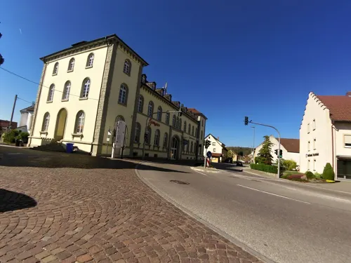
Gasthof zum Ochsen
Restaurant · Regional, Mediterranean · 6.1 km
Der Gasthof zum Ochsen gehört zu den ältesten Restaurants in Küssaberg Ortsteil Kadelburg. Nur einige Schritte entfernt verläuft der...
5 Oberdorf, Küssaberg
Tu-Fr 11:00-14:00,17:00-22:00; Sa 11:00-23:00; Su 11:00-22:00

Mekan Gusto
Restaurant · Turkish · 7.1 km
Kein alkohol
5a, Lauchringen
Mo-We 09:00-21:30; Th-Sa 08:30-22:00
Bahnhöfle
Restaurant · Italian, Pizza · 7.2 km
1 Bahnhofstraße, Albbruck
Mo-Sa 11:00-14:00,17:00-23:00, Su 11:00-23:00
Eiscafe Pinocchio
Cafe · Ice Cream · 6.5 km
3 Schulstraße, Lauchringen
Mo-Sa 09:00-24:00, Su 09:00-23:00
Fuya Waldshut
Restaurant · Japanese, Chinese, Sushi, Thai
23 Eisenbahnstraße, Waldshut-Tiengen
Mo 11:30-14:30,18:00-23:00; We-Su 11:30-14:30,18:00-23:00
Landgasthof Hirschen
Restaurant · Regional · 6.2 km
38 Einungsstraße, Albbruck
Mo-Sa 11:00-14:30 17:00-23:00, Su 10:00-21:00, Th closed
ReisStyle
Restaurant · Japanese · 1.9 km
6 Rheinbrückenstraße, Waldshut-Tiengen
Mo-Fr 11:30-14:30, 17:00-20:30; Sa 11:30-23:00; Su 17:00-22:30



132 more on the map.
History
Until 1803, Waldshut belonged with the Hotzenwald to Further Austria. Tiengen/Hochrhein (until 2 September 1964 Tiengen (Oberrhein)) was the residence of the Landgraves of Klettgau who belonged in early modern times first to the Counts of Sulz, and after their line died out, to the Fürsten of Schwarzenberg. Gurtweil belonged first to the Abbey of St. Gall, and later to the Rheinau Monastery, but after the Thirty Years' War to Saint Blaise's Benedictine Monastery the St. Blaise Abbey, Black Forest.
In the Waldshut War of 1468 – a localized conflict over hegemony in the south Black Forest region – Tiengen was absorbed by the Old Swiss Confederacy, while the town of Waldshut was besieged and partly destroyed.
In 1805, Waldshut went to Baden and became the seat of an Amt, which over the years was changed many times, and in 1939 was turned into the Kreis (District) of Waldshut. In 1973, the district's area was increased under the municipal reform.
Tiengen likewise went to Baden in 1806 and belonged to the Amt of Klettgau, and in 1812 to the regional Amt of Tiengen, which was abolished in 1819. Thereafter the town belonged to the regional Amt of Waldshut.
From the History section of Waldshut-Tiengen on Wikipedia, under CC BY-SA 4.0.
Where to stay20
Churches and places of worship44
Evangelische Kirche Waldshut
Church · Protestant
10a Waldtorstraße, Waldshut-Tiengen
Shopping55
Ritz GmbH Elektromaschinen- und Apparatebau
Hardware store · 3.1 km
33 Carl-Zeiss-Straße, Waldshut-Tiengen
Gas and EV charging16
Schools, colleges and libraries28
Healthcare16
Map of Waldshut-Tiengen
250 places. The map loads OpenStreetMap tiles when you open it.
Getting there and nearby towns
Lahr Airport (LHA) is the nearest airport with scheduled flights listed in OpenStreetMap, 88 km away.
- Dogern 4 km west, about 4 min by car
- Weilheim 5 km north, about 5 min by car
- Lauchringen 7 km east, about 7 min by car
- Albbruck 7 km southwest, about 7 min by car
- Görwihl 11 km west, about 11 min by car
- Wutöschingen 12 km east, about 12 min by car
- Ühlingen-Birkendorf 13 km northeast, about 13 min by car
- Laufenburg 13 km southwest, about 13 min by car
- Wehr 23 km west, about 23 min by car
- Weil am Rhein 45 km west, about 45 min by car
Drive times are estimates from straight-line distance, not routes.
Local news
Headlines from INDB.
Reviews, tips and questions
Loading what members have shared...
Sources and licences
- GeoNames (CC BY 4.0): population, coordinates, regions and time zone
- Mapillary (see each image): photos
- OpenStreetMap contributors (ODbL 1.0): places, airports, map data
- Wikidata (CC0 1.0): elevation, founding date, time zone, website, landmarks and historic places
- Wikimedia Commons (see each image): photos
- Wikipedia (CC BY-SA 4.0): overview and history text
Photo credits
- 2010-05-21 16-33-51 Germany Baden-Württemberg Detzeln, Hansueli Krapf, CC BY-SA 3.0
- SBB Aarebruecke Koblenz (AG) 04 09, Хрюша, CC BY-SA 3.0
- Rheinbruecke Waldshut–Koblenz 01 09, Хрюша, CC BY-SA 3.0
- Menhir Tiengen(2), 11:52, 20 June 2015 (UTC) GerhardSchuhmacher ( talk ), CC BY-SA 4.0
- Gutenburg-Hochrhein, G. Boll. The original uploader was G-Boll at German Wikipedia ., CC BY-SA 3.0
- Hgwt-gebaeude, Jor rud, Public domain
- Waldshut Judenäule 5604, Badener, CC BY 3.0
- Waldshut-Tiengen Naturschutzgebiet Eibenkopf Bild 7, PantaRhei, CC BY-SA 4.0
- Koblenz RefKirche 2012-07-17 14.38.49, Lutz Fischer-Lamprecht, CC BY-SA 4.0
- Ölmühle Tiengen, Buchstapler, CC BY-SA 4.0
- Waldshut rk Kirche, Baden er, CC BY-SA 3.0
- Dogern, Kirche St. Clemens 1, Rauenstein, CC BY-SA 3.0
- Koblenz Naturschutzgebiet Giriz, Arkelin, CC BY-SA 4.0
- Beobachtungsturm Chly Rhy Auen, Tschubby, CC BY-SA 3.0
- Tiengen Hochrhein Seidenhof, Lwt europa, CC BY-SA 4.0
- Weilheim (Baden) Naturschutzgebiet Samlischbuck Bild 2, PantaRhei, CC BY-SA 4.0
- Waldshut-Tiengen Gurtweil katholische Kirche Westseite, PantaRhei, CC BY-SA 4.0
- LN Ev. Matthäuskirche UL, GerhardSchuhmacher ( talk ) 13:39, 2 May 2019 (UTC), CC BY-SA 4.0
- Spitalkapelle "Zum Heiliggeist" - panoramio - Andy Mendyk, Andy Mendyk, CC BY-SA 3.0
- 20250430 123813 Gottesackerkapelle Waldshut, Buchstapler, CC BY-SA 4.0
- Weilheim Dietlinger Wasserfall, PantaRhei, CC BY-SA 4.0
- Stolperstein Athanasius Gerster Dogern, Ryukia, CC BY-SA 4.0
- Noggenschwiel01, Tschumi von www.erratiker.ch, CC BY-SA 2.0
- WT Hochrhein-Gymnasium Leitmotiv, GerhardSchuhmacher ( talk ) 16:32, 3 February 2020 (UTC), CC BY-SA 4.0
- Menhir-Tiengen(1), GerhardSchuhmacher ( talk ) 13:22, 24 June 2015 (UTC), CC BY-SA 4.0
- Schweiz Militärmuseum, Paebi, CC BY-SA 4.0
- KH Klinikum Hochrhein Waldshut Eingangsbereich, GerhardSchuhmacher ( talk ) 09:04, 19 May 2020 (UTC), CC BY-SA 4.0
- Street-level photo, likesopenstreetmap, CC BY-SA 4.0
- Street-level photo, sp8962de, CC BY-SA 4.0
- Street-level photo, changchun1, CC BY-SA 4.0
- Street-level photo, changchun1, CC BY-SA 4.0
- Street-level photo, nvbwseifert, CC BY-SA 4.0
- Street-level photo, kleinbrunnadern, CC BY-SA 4.0
- Street-level photo, nvbwseifert, CC BY-SA 4.0
- Street-level photo, changchun1, CC BY-SA 4.0
- Street-level photo, stefan005, CC BY-SA 4.0
- Street-level photo, kino, CC BY-SA 4.0
- Street-level photo, changchun1, CC BY-SA 4.0


Page built November 8, 2026. Spotted a mistake? Tell us or suggest a place.