


Why visit Walldorf
Townapedia lists 46 museums and landmarks, 42 parks and trails, 136 places to eat, 14 places to stay and 9 attractions in and around town.
Highlights include Luxor Filmpalast Walldorf-Wiesloch, Bauernladen Mayer, Heimatmuseum im alten Rathaus and Hospiz Agape.
Weather in Walldorf
Forecast from MET Norway (CC BY 4.0). Full forecast
About Walldorf
Walldorf (German pronunciation: [ˈvalˌdɔʁf] ; South Franconian: Walldoaf) is a town in the Rhein-Neckar-Kreis district in the state of Baden-Württemberg in Germany.
From the Wikipedia article Walldorf (this version), under CC BY-SA 4.0.
Things to do9


Bauernladen Mayer
Farm and orchard
Hofladen Spargelhof Mayer
Mo-Sa 08:00-13:00; Fr 15:00-18:00; Apr-Jun Mo-Su 08:00-13:00, 15:00-18:00


Museums and landmarks46



Alte Synagoge
Monument and historic site · 4.3 km
115 Hauptstraße, Sandhausen

Stadtapotheke
Monument and historic site · 4.3 km
96 Hauptstraße, Wiesloch


Minnesänger von Wissenlo
Monument and historic site · 4.3 km
Standbild des Heinrich I. Swendinger v. Wissenloch
34 more on the map.
Parks, trails and playgrounds42




Brühlwegdüne
Hiking and trails · 2.3 km
Hier werden in den nächsten Jahren große Freiflächen entstehen. Siehe...

WieTalBad
Sports field and stadium · 4.0 km
May,Sep: Mo-Su,PH 09:00-19:00, Jun-Aug: Mo-Su,PH 09:00-20:00,...



30 more on the map.
Restaurants and cafes136

Rutz
Bakery · 4.2 km
Café und Bäckerei
128 Hauptstraße, Wiesloch
Mo-Fr 06:00-19:00; Sa 06:00-16:00; Su 07:00-17:00

Eiscafé Venezia
Cafe · Ice Cream · 4.2 km
124 Hauptstraße, Wiesloch
Mo-Sa 09:00-22:00; Su,PH 10:00-22:00; Nov-Feb off
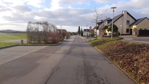
Kiki's Tante Ju
Restaurant · Italian, Mediterranean, German · 1.0 km
10 Lilienthalstraße, Walldorf
Mo off; Tu-Fr 17:00-22:30; Sa-Su,PH 11:00-22:30
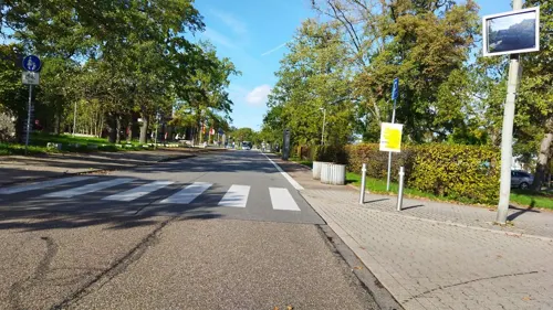

Okami
Restaurant · Vietnamese, Japanese, Sushi · 4.2 km
5-7 Schloßstraße, Wiesloch
Mo-Su 11:00-15:00, 17:00-23:00
Phoenix Palast
Restaurant · Chinese · 2.5 km
13-15 In den Weinäckern, Wiesloch
Mo,We-Sa 11:30-15:00,17:30-22:30, Su,PH 11:30-22:30
TSG Gaststätte Wiesloch
Restaurant · Austrian, German, International · 3.5 km
5/1 Parkstraße, Wiesloch
Mo-Sa 17:00-23:00; Tu off; Su 11:00-14:00,17:00-23:00
Bäckerei Breiter
Bakery · 4.2 km
12 Bahnhofstraße, Sandhausen
We 06:00-13:00; Sa 06:00-13:00; Su 08:00-11:00; Mo,Tu,Th,Fr 06:00-18:30


124 more on the map.
History
Hallstatt-culture barrows are preserved in the Hochholz woods, near the offices of SAP Deutschland. The earliest documentary mention of the settlement occurs as Waltorf in a 770 deed issued by the Abbey of Lorsch. The Electorate of the Palatinate received Walldorf as an Imperial fief in 1230. The town suffered much during the Thirty Years' War of 1618–1648, and in 1689 was completely destroyed in the course of the French invasion during Nine Years' War. The area was settled anew by religious refugees, among them the predecessors of John Jacob Astor, Waldensians from Piedmont.
During the German Mediatisation, Walldorf fell to Baden. In 1843 the Rheintalbahn was built: this railway decisively promoted economic development. In 1901 Grand Duke Frederick I of Baden granted Walldorf town privileges. After World War II the companies Heidelberger Druckmaschinen (founded 1850) and SAP (founded 1972; moved to Walldorf in 1977) were established in Walldorf.
From the History section of Walldorf on Wikipedia, under CC BY-SA 4.0.
Where to stay14
Churches and places of worship23
St.-Bartholomäus-Kirche - alte Katholische Kirche
Church · Catholic · 4.1 km
5 Waldstraße, Sandhausen
Shopping30
EDEKA Kissel SBK Markt - Walldorf Ost
Grocery · 0.8 km
34 Bahnhofstraße, Walldorf
Gas and EV charging13
Schools, colleges and libraries28
Healthcare15
Map of Walldorf
250 places. The map loads OpenStreetMap tiles when you open it.
Getting there and nearby towns
City-Airport Mannheim (MHG) is the nearest airport with scheduled flights listed in OpenStreetMap, 21 km away.
- Wiesloch 4 km east, about 4 min by car
- Heidelberg 12 km north, about 12 min by car
- Mannheim 24 km northwest, about 24 min by car
- Ludwigshafen am Rhein 24 km northwest, about 24 min by car
- Weinheim 27 km north, about 27 min by car
- Karlsruhe 37 km southwest, about 37 min by car
- Heilbronn 46 km southeast, about 46 min by car
- Pforzheim 47 km south, about 47 min by car
- Weinsberg 50 km east, about 50 min by car
- Darmstadt 63 km north, about 1 h by car
Drive times are estimates from straight-line distance, not routes.
Local news
Headlines from INDB.
Reviews, tips and questions
Loading what members have shared...
Sources and licences
- GeoNames (CC BY 4.0): population, coordinates, regions and time zone
- Mapillary (see each image): photos
- OpenStreetMap contributors (ODbL 1.0): places, airports, map data
- Wikidata (CC0 1.0): elevation, founding date, time zone, website
- Wikimedia Commons (see each image): photos
- Wikipedia (CC BY-SA 4.0): overview and history text
Photo credits
- Walldorf Rathaus 20100707, Rudolf Stricker, Attribution
- 20161114Pfaelzer Hof Walldorf1, AnRo0002, CC0
- 20161114Pfaelzer Hof Walldorf2, AnRo0002, CC0
- 20161114Pfaelzer Hof Walldorf3, AnRo0002, CC0
- Walldorf Evangelische Kirche 20100707, Rudolf Stricker, Attribution
- Walldorf (BW)-Alte Schule (1), Oliver Abels, CC BY-SA 3.0
- Walldorf Bahnhofstraße 5 Ehemalige Volksschule2, Oliver Abels ( SBT ), CC BY-SA 3.0
- Walldorf (BW)-Alte Schule (2), Oliver Abels, CC BY-SA 3.0
- Walldorf Bahnhofstraße 5 Ehemalige Volksschule1, Oliver Abels ( SBT ), CC BY-SA 3.0
- Buecherschrank Walldorf, Braads, CC BY-SA 4.0
- Astor-Garten Walldorf2009, VollwertBIT, CC BY-SA 3.0
- Walldorf (BW)-Alte Schule (4), Oliver Abels, CC BY-SA 3.0
- Walldorf (BW)-Alte Schule (3), Oliver Abels, CC BY-SA 3.0
- Walldorf Hauptstraße 17 2, Oliver Abels ( SBT ), CC BY-SA 3.0
- Walldorf Hauptstraße 17, Oliver Abels ( SBT ), CC BY-SA 3.0
- Walldorf Bahnhofstraße 5 Ehemalige Volksschule3, Oliver Abels ( SBT ), CC BY-SA 3.0
- Walldorf Katholische Kirche2, Oliver Abels ( SBT ), CC BY-SA 3.0
- Walldorf Hauptstraße 19, Oliver Abels ( SBT ), CC BY-SA 3.0
- Walldorf Katholische Kirche1, Oliver Abels ( SBT ), CC BY-SA 3.0
- Walldorf Hauptstraße 23, Oliver Abels ( SBT ), CC BY-SA 3.0
- Walldorf Hauptstraße 25, Oliver Abels ( SBT ), CC BY-SA 3.0
- Walldorf Astorhaus Rückseite, Oliver Abels ( SBT ), CC BY-SA 3.0
- Walldorf Stadtbücherei, Oliver Abels ( SBT ), CC BY-SA 3.0
- Walldorf (BW)-Waldklassenzimmer Waldlupe (2), Oliver Abels, CC BY-SA 3.0
- Walldorf (BW)-Waldklassenzimmer Waldlupe (1), Oliver Abels, CC BY-SA 3.0
- Walldorf (BW)-Stadtbücherei, Oliver Abels, CC BY-SA 3.0
- Walldorf Hirschstraße 11 Dörnsches Haus, Oliver Abels ( SBT ), CC BY-SA 3.0
- Walldorf (BW)-Dörnersches Haus (2), Oliver Abels, CC BY-SA 3.0
- Walldorf (BW)-Dörnersches Haus (1), Oliver Abels, CC BY-SA 3.0
- Hardtwaldstadion, KatB, CC BY-SA 3.0
- Wiesloch-Hospiz, Peter Schmelzle, CC BY-SA 3.0
- Wiesloch Evangelische Stadtkirche 20070327, Rudolf Stricker, Public domain
- Ev stadtkirche walldorf1, Andreas Ockert, CC BY-SA 3.0
- Bronner Headline, Johann Philipp Bronner Schule (BeSt), CC BY-SA 4.0
- Ottheinrich Gymnasium Wiesloch, BeSt, CC BY-SA 4.0
- Schlossturm-Wiesloch-2012, Peter Schmelzle, CC BY-SA 3.0
- Wiesloch Stadtapotheke Erste Tankstelle 20100620, Rudolf Stricker, Attribution
- Sandhausen Synagoge, Pitichinaccio, Public domain
- Alte Synagoge, Neuapostolische Kirche Walldorf 20170316 001, Tilman2007, CC BY-SA 4.0
- NSG Zugmantel, Emmy Sophie, CC BY-SA 3.0
- NSG 2168 Nußlocher Wiesen-Feld, Deepbluesea70, CC BY-SA 3.0
- Sandhausen Bartholomae, 4028mdk09, CC BY-SA 3.0
- 20110424St Peter Walldorf1, AnRo0002, CC0
- Degreif Welle Wiesloch, 4028mdk09, CC BY-SA 3.0
- Brühlwegdüne, Michael Linnenbach, CC BY-SA 4.0
- Eingang Tierpark Walldorf 2015, 4028mdk09, CC BY-SA 3.0
- Sandhausen Evangelische Christuskirche 20130602, Rudolf Stricker, CC BY-SA 2.0 de
- Wiesloch Katholische Kirche St.Laurentius 20100620, Rudolf Stricker, Attribution
- 20160401-leimbach-park-neues-leimbachbett, Paul Sladen, CC0
- Street-level photo, poxonline, CC BY-SA 4.0
- Street-level photo, poxonline, CC BY-SA 4.0
- Street-level photo, changchun1, CC BY-SA 4.0
- Street-level photo, changchun1, CC BY-SA 4.0
- Street-level photo, mappy123, CC BY-SA 4.0
- Street-level photo, c0rnsnake, CC BY-SA 4.0
- Street-level photo, changchun1, CC BY-SA 4.0
- Street-level photo, wegavision, CC BY-SA 4.0
- Street-level photo, mfa, CC BY-SA 4.0
- Street-level photo, dns_vlpt, CC BY-SA 4.0
- Street-level photo, ramap, CC BY-SA 4.0
- Street-level photo, joker234, CC BY-SA 4.0
- Street-level photo, joker234, CC BY-SA 4.0
- Street-level photo, nvbwseifert, CC BY-SA 4.0
- Street-level photo, hdvalentin, CC BY-SA 4.0
- Street-level photo, changchun1, CC BY-SA 4.0
- Street-level photo, knistertoni, CC BY-SA 4.0
- Street-level photo, dns_vlpt, CC BY-SA 4.0
- Street-level photo, wegavision, CC BY-SA 4.0


Page built November 8, 2026. Spotted a mistake? Tell us or suggest a place.