


Why visit Weilburg
Townapedia lists 86 museums and landmarks, 21 parks and trails, 78 places to eat, 10 places to stay and 16 attractions in and around town.
Highlights include Wildpark Tiergarten Weilburg, Hofladen Wagener, Grube Schottenbach and Bergbau- und Stadtmuseum.
Weather in Weilburg
Forecast from MET Norway (CC BY 4.0). Full forecast
About Weilburg
Weilburg (German pronunciation: [ˈvaɪlbʊʁk] ) is, with just under 13,000 inhabitants, the third biggest town in Limburg-Weilburg district in Hesse, Germany, after Limburg an der Lahn and Bad Camberg.
From the Wikipedia article Weilburg (this version), under CC BY-SA 4.0.
Things to do16

Wildpark Tiergarten Weilburg
Zoo and aquarium · 5.0 km
Mar-Oct Mo-Su,PH 09:00-18:00; Nov-Feb Mo-Su,PH 09:00-16:30



Aussichtsfelsen
Scenic view · 3.1 km
Aussichtspunkt auf Felsen oberhalb der Lahn, nicht ungefährlich, aber sehr schöne Aussicht auf die Lahn, den Grävenecker Zeltplatz


4 more on the map.
Museums and landmarks86


Bergbau- und Stadtmuseum
Museum
1 Schloßplatz, Weilburg
Apr 01-Oct 31 Tu-Su,PH 10:00-17:00; Nov 01-Dec 23 Tu-Su,PH...

Kubacher Kristallhöhle
Monument and historic site · 3.3 km
Mar 30-Nov 10: Mo-Fr 15:00-17:00; Sa-Su 10:00-17:00
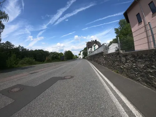
Rosenhang Galerie
Museum · 0.6 km
Kunst für alle - zeitgenössische moderne Kunst im Rahmen des Industriebaus der ehemaligen Brauerei Helbig.
8-10 Ahäuser Weg, Weilburg
Tu-Su 10:00-18:00


Ehemalige Erzaufbereitung der Grube Georg Joseph
Monument and historic site · 3.5 km



74 more on the map.
Parks, trails and playgrounds21

Modellbau-Park 1:8
Sports field and stadium
7 Im Bangert, Weilburg
"Mai - Oktober an 1 Wochenende pro Monat"


Schwimmbad Odersbach
Sports field and stadium · 1.8 km
Mo-Fr 14:00-19:00; Sa,Su 10:00-12:00,14:00-19:00

Kirschhöfer Kies
Beach · 2.2 km
Kirschhöfer Kies, Bootsanlandungen nicht gestattet, um Jungfischhabitat nicht zu stören

9 more on the map.
Restaurants and cafes78
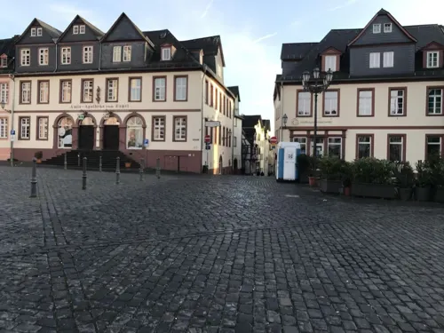
Joseph's Restaurant
Restaurant · Mediterranean
Mediterrane Küche
10 Marktplatz, Weilburg
Mo 18:00-24:00; Tu-Su 12:00-15:00,18:00-24:00
Frühstück's Lounge
Restaurant · Turkish
19 Bahnhofstraße, Weilburg
Mo-Fr 07:00-14:00; Sa,Su 09:00-14:00

Kubacher Hof
Restaurant · German · 3.2 km
58 Hauptstraße, Weilburg
Tu-Sa 17:00+; Su 11:30-14:00,17:00+; Mo off
Landgasthof "Zum Lahnfelsen"
Restaurant · German · 4.2 km
38a Lahnstraße, Weinbach
Tu-Sa 17:00-01:00, Su 11:00-01:00, PH 11:00+
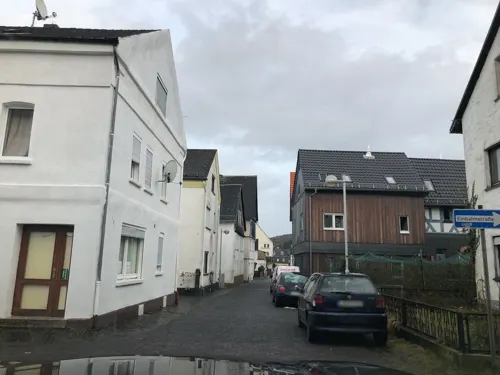
Landgasthof Bei Kleins
Restaurant · Regional · 3.1 km
7 Vorderstraße, Löhnberg
Mo,We-Fr 17:00-23:00, Sa-Su 17:30-23:00, Su 12:00-14:00
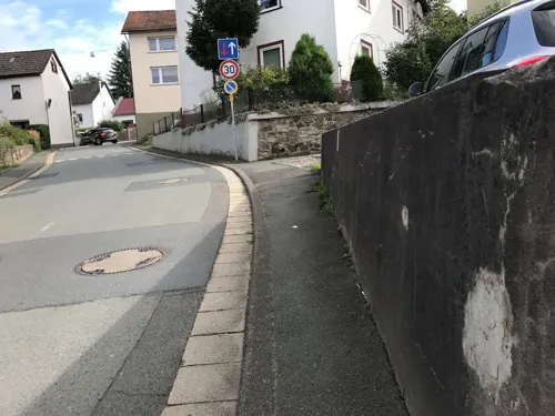
Pizzeria La Familia
Restaurant · Italian, Pizza · 1.7 km
2 Weilburger Straße, Weilburg
Tu-Sa 17:00-22:00; Su,PH 11:30-14:00,17:00-22:30
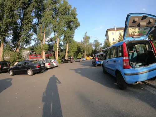
Pizzeria Michelangelo
Restaurant · Pizza, Pasta, International, Ice Cream
6 Hainallee, Weilburg
Mo-Sa 11:00-14:30,17:00-23:30; Su,PH 11:00-23:30
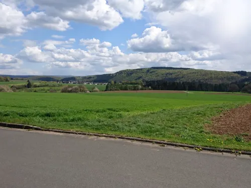
Pizzeria Vesuvio
Restaurant · Italian, Pizza, Noodle · 3.3 km
1 Auf dem Kalk, Weilburg
Tu-Fr 14:00-22:00; Sa-Su 11:30-22:00


Restaurant Jimmy
Restaurant · Italian · 1.2 km
4 Weilstraße, Weilburg
Mo-Sa 11:45-14:15,17:00-22:30; Su,PH 11:30-15:00,17:00-21:00
66 more on the map.
History
It is believed that the earliest traces of settlers in the area around Weilburg are attested by finds from La Tène times from the Scheuernberger Kopf (mountain) near Kirschhofen.
Weilburg was first mentioned in 906 in a chronicle by Abbot Regino of Prüm as a fortification under the name of Wilineburch. Six years later King Conrad I, whose father had been buried in the fortification after having fallen in battle while fighting the Babenbergers near Fritzlar in 906, founded a church and an abbey. In 912, the St. Walpurgis-Chorherrenstift (monastery) was founded. The building, which was built on high ground, afforded the monastery control over the Lahn as well as the Hohe Straße ("High Road") running from Frankfurt to Cologne and the Via Publica from Flanders to Bohemia, which ran nearby.
In 918, the Wilineburg (castle) gained special historic importance when King Conrad I, lying on his deathbed, recommended to his brother Eberhard that he deliver the Imperial insignia to his bitterest rival, the Saxon duke Heinrich (Weilburger Testament).
From the History section of Weilburg on Wikipedia, under CC BY-SA 4.0.
Where to stay10
Churches and places of worship28
Evangelische Kapelle Gaudernbach
Church · Protestant · 4.7 km
7 Kapellenweg, Weilburg
Evangelische Kirche
Church · Protestant · 6.2 km
2a Theodor-Fliedner-Straße, Löhnberg
St. Antonius Kirche Merenberg
Church · Protestant · 5.8 km
18 Kirchstraße, Merenberg
Shopping18
Gas and EV charging10
Schools, colleges and libraries14
Healthcare11
Map of Weilburg
250 places. The map loads OpenStreetMap tiles when you open it.
Getting there and nearby towns
Siegerlandflughafen (SGE) is the nearest airport with scheduled flights listed in OpenStreetMap, 28 km away.
- Löhnberg 3 km north, about 3 min by car
- Selters 4 km northeast, about 4 min by car
- Wiesbaden 44 km south, about 44 min by car
- Siegen 47 km north, about 47 min by car
- Koblenz 51 km west, about 51 min by car
- Frankfurt am Main 51 km southeast, about 51 min by car
- Mainz 56 km south, about 56 min by car
- Offenbach 56 km southeast, about 56 min by car
- Darmstadt 74 km south, about 1 h 15 min by car
- Bonn 87 km west, about 1 h 30 min by car
Drive times are estimates from straight-line distance, not routes.
Local news
Headlines from INDB.
Reviews, tips and questions
Loading what members have shared...
Sources and licences
- GeoNames (CC BY 4.0): population, coordinates, regions and time zone
- Mapillary (see each image): photos
- OpenStreetMap contributors (ODbL 1.0): places, airports, map data
- Wikidata (CC0 1.0): elevation, founding date, time zone, website, landmarks and historic places
- Wikimedia Commons (see each image): photos
- Wikipedia (CC BY-SA 4.0): overview and history text
Photo credits
- Aerial image of Schloss Weilburg (view from the southeast), Carsten Steger, CC BY-SA 4.0
- Weilburg-Pfarrgasse 6-CTH, CTHOE, CC BY-SA 4.0
- Weilburg-Schlosspark-2-CTH, CTHOE, CC BY-SA 4.0
- Weilburg (DerHexer) WLMMH 52314 2011-09-19 19, DerHexer , Wikimedia Commons, CC BY-SA 4.0
- Weilburg (DerHexer) WLMMH 52314 2011-09-19 20, DerHexer , Wikimedia Commons, CC BY-SA 4.0
- Weilburg (DerHexer) WLMMH 52314 2011-09-19 18, DerHexer , Wikimedia Commons, CC BY-SA 4.0
- Weilburg (DerHexer) WLMMH 52378 2011-09-19 03, DerHexer , Wikimedia Commons, CC BY-SA 4.0
- Weilburg (DerHexer) WLMMH 52314 2011-09-19 17, DerHexer , Wikimedia Commons, CC BY-SA 4.0
- Weilburg-Schlosspark-1-CTH, CTHOE, CC BY-SA 4.0
- Weilburg (DerHexer) WLMMH 52378 2011-09-19 02, DerHexer , Wikimedia Commons, CC BY-SA 4.0
- Weilburg (DerHexer) WLMMH 52314 2011-09-19 21, DerHexer , Wikimedia Commons, CC BY-SA 4.0
- Weilburg (DerHexer) WLMMH 52378 2011-09-19 04, DerHexer , Wikimedia Commons, CC BY-SA 4.0
- Weilburg (DerHexer) WLMMH 52378 2011-09-19 01, DerHexer , Wikimedia Commons, CC BY-SA 4.0
- Weilburg (DerHexer) WLMMH 52378 2011-09-19 07, DerHexer , Wikimedia Commons, CC BY-SA 4.0
- Weilburg-Pfarrgasse 2-CTH, CTHOE, CC BY-SA 4.0
- Schloss Weilburg (29968411398), salomon10 from Germany, CC BY 2.0
- Weilburg (DerHexer) WLMMH 52378 2011-09-19 08, DerHexer , Wikimedia Commons, CC BY-SA 4.0
- Weilburg (DerHexer) WLMMH 52378 2011-09-19 05, DerHexer , Wikimedia Commons, CC BY-SA 4.0
- Weilburg (DerHexer) WLMMH 52378 2011-09-19 06, DerHexer , Wikimedia Commons, CC BY-SA 4.0
- Weilburg, auf der unteren Orangerie, Haus Pfarrgasse 1, Dguendel, CC BY 3.0
- Weilburg Schlossgarten2, Beckstet, CC BY-SA 3.0
- Weilburg Aussicht - panoramio, tommotec - Bike Part…, CC BY-SA 3.0
- Weilburg, unterer Schlossgarten und Stadtmauerturm, Dguendel, CC BY 3.0
- Schloss Weilburg (42934737935), salomon10 from Germany, CC BY 2.0
- Weilburg, an der unteren Orangerie, Dguendel, CC BY 3.0
- Weilburg, Birnen als Spalierobst, Dguendel, CC BY 3.0
- Weilburg, Vasen im Schlosspark, Dguendel, CC BY 3.0
- Weilburg, Schlosskirche, Dguendel, CC BY 3.0
- Weilburg (DerHexer) WLMMH 52315 2011-09-19 18, DerHexer , Wikimedia Commons, CC BY-SA 4.0
- Schloss Weilburg - panoramio, tommotec - Bike Part…, CC BY-SA 3.0
- Weilburg (DerHexer) WLMMH 52314 2011-09-19 16, DerHexer , Wikimedia Commons, CC BY-SA 4.0
- Weilburg (DerHexer) WLMMH 52314 2011-09-19 15, DerHexer , Wikimedia Commons, CC BY-SA 4.0
- Weilburg, Park hinter der Schlosskirche, Dguendel, CC BY 3.0
- Weilburg Stadtmauerturm-01, Radler59 ( talk ), CC BY-SA 4.0
- 2020-07-06 Untere Orangerie in Schloss Weilburg (Hessen), Yvonne Bentele, CC BY-SA 4.0
- Weilburg (DerHexer) WLMMH 52312 2011-09-19 06, DerHexer , Wikimedia Commons, CC BY-SA 4.0
- Weilburg, Blick zur Sparkasse, Dguendel, CC BY 3.0
- Ernsthausen, Kirche, Karsten Ratzke, CC0
- Merenberg Burg, Oliver Abels ( SBT ), CC BY 2.5
- Weilburg WilhelmKnappSchule, Melanie Stoll FA2006, CC BY-SA 3.0
- Weilburg Heilig-Kreuz-Kirche (52453), Oliver Abels ( SBT ), CC BY-SA 3.0
- Weilburg Schlosskirche10, Beckstet, CC BY-SA 3.0
- Weilburg kubach kristallhoehle wikipedianer 20100821, Emha /Manuel Heinrich, CC BY-SA 3.0
- Weilburg-Drommershausen WLMMH 52479 by Stepro IMG 1101, Steffen Prößdorf, CC BY-SA 3.0 de
- Weilburg-Gaudernbach (DerHexer) WLMMH 52488 2011-09-20 01, DerHexer , Wikimedia Commons, CC BY-SA 4.0
- Hirschhausen - Evang. Kirche, Santiago2000, CC BY-SA 3.0
- Löhnberg LMMH 51375 by Stepro IMG 1355, Steffen Prößdorf, CC BY-SA 3.0 de
- Merenberg Kirche, Oliver Abels ( SBT ), CC BY 2.5
- Essershausen, Kirche, Karsten Ratzke, CC0
- Erzaufbereitungsanlage Gräveneck, Hydro, CC BY-SA 4.0
- Bergbau- und Stadtmuseum Weilburg, H.redling, CC BY-SA 4.0
- Weilburg (DerHexer) WLMMH 52312 2011-09-19 03, DerHexer , Wikimedia Commons, CC BY-SA 4.0
- Weilburg, Landtor, ehemalige katholische Kirche und Stadtmauerturm, Dguendel, CC BY 3.0
- Windhof Weilburg, Gabriele Feuerstein, CC BY-SA 4.0
- Weilburg - Tiergarten - Dillhäuser Bauernhaus, Oliver Abels ( SBT ), CC BY-SA 3.0
- Barig-Selbenhausen Almerskopf Steinbruch 1, Oliver Abels ( SBT ), CC BY-SA 3.0
- Weilburg - Schlosskirche vom Kanapee (001), Gerold Rosenberg ( talk ) 20:11, 3 March 2015 (UTC), CC BY-SA 3.0
- Street-level photo, troher15, CC BY-SA 4.0
- Street-level photo, lllooommm, CC BY-SA 4.0
- Street-level photo, troher15, CC BY-SA 4.0
- Street-level photo, troher15, CC BY-SA 4.0
- Street-level photo, troher15, CC BY-SA 4.0
- Street-level photo, troher15, CC BY-SA 4.0
- Street-level photo, grinninghamster, CC BY-SA 4.0
- Street-level photo, grinninghamster, CC BY-SA 4.0
- Street-level photo, tmka, CC BY-SA 4.0
- Street-level photo, miguel_andrade, CC BY-SA 4.0
- Street-level photo, miguel_andrade, CC BY-SA 4.0
- Street-level photo, derzornigemarkus, CC BY-SA 4.0
- Street-level photo, cantece, CC BY-SA 4.0
- Street-level photo, Jeykey90, CC BY-SA 4.0
- Street-level photo, troher15, CC BY-SA 4.0
- Street-level photo, troher15, CC BY-SA 4.0
- Street-level photo, miguel_andrade, CC BY-SA 4.0
- Street-level photo, miguel_andrade, CC BY-SA 4.0
- Street-level photo, Jeykey90, CC BY-SA 4.0
- Street-level photo, Jeykey90, CC BY-SA 4.0
- Street-level photo, Jeykey90, CC BY-SA 4.0
- Street-level photo, troher15, CC BY-SA 4.0
- Street-level photo, grinninghamster, CC BY-SA 4.0
- Street-level photo, lllooommm, CC BY-SA 4.0
- Street-level photo, grinninghamster, CC BY-SA 4.0


Page built November 8, 2026. Spotted a mistake? Tell us or suggest a place.