


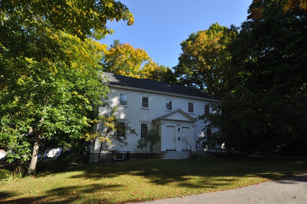


Dover, New Hampshire
Dover is a city of 33,364 people in Strafford County, New Hampshire, founded in 1623.
Why visit Dover
Townapedia lists 48 museums and landmarks, 68 parks and trails, 141 places to eat, 9 places to stay and 26 attractions in and around town.
Highlights include County Farm Bridge, Little Bay Bridge, Hamilton House and Durham Historic District.
July is the warmest month, with average highs of 80°F; January lows average 15°F.
Weather in Dover
Forecast from the National Weather Service. Full forecast
About Dover
Dover is a city in Strafford County, New Hampshire, United States. The population was 32,741 at the 2020 census, making it the most populous city in the New Hampshire Seacoast region and the fifth most populous city in New Hampshire.
From the Wikipedia article Dover, New Hampshire (this version), under CC BY-SA 4.0.
Things to do26

County Farm Bridge
Bridge · National Register of Historic Places · 3.8 mi
Bridge in Dover, New Hampshire


University of New Hampshire
School · 4.2 mi
Public research university in New Hampshire, United States


14 more on the map.
Museums and landmarks48

Hamilton House
Monument and historic site · National Register of Historic Places · 3.9 mi
Historic house in South Berwick, Maine, United States

Durham Historic District
Monument and historic site · National Register of Historic Places · 4.3 mi
Historic district in Durham, New Hampshire

Back River Farm
Monument and historic site · National Register of Historic Places · 3.4 mi
Human settlement in Dover, New Hampshire, United States of America

Berwick Academy
Monument and historic site · National Register of Historic Places · 5.0 mi
College preparatory school in South Berwick, Maine, United States

Conway Junction Railroad Turntable Site
Monument and historic site · National Register of Historic Places · 5.0 mi
Historic site in Maine, USA
First Parish Church Site-Dover Point
Monument and historic site · National Register of Historic Places · 3.9 mi
Church building in New Hampshire, United States of America

Forest Glade Cemetery
Monument and historic site · National Register of Historic Places · 4.5 mi
Cemetery in Somersworth, Strafford County, New Hampshire, USA

Green Street School
Monument and historic site · National Register of Historic Places · 4.9 mi
School building in Somersworth, United States of America

Jenness Farm
Monument and historic site · National Register of Historic Places · 4.8 mi
Historic house in New Hampshire, United States

Jewett-Eastman House
Monument and historic site · National Register of Historic Places · 5.0 mi
House in South Berwick, Maine
John Sullivan House
Monument and historic site · National Register of Historic Places · 4.3 mi
House in Durham, New Hampshire


Lehoullier Building
Monument and historic site · National Register of Historic Places · 5.1 mi
Building in Somersworth, United States of America
36 more on the map.
Parks, trails and playgrounds68

Garrison Hill Park and Tower
Park · National Register of Historic Places · 1.7 mi
United States historic place



The Joe B Parks Riverwalk Public Gardens
Park · 0.8 mi
Apr 1 - Sep 30 07:00-21:30; Oct 1 -Mar 31 07:00-20:00
56 more on the map.
Restaurants and cafes141


Breakaway Cafe
Cafe · Coffee Shop, Sandwich · 0.9 mi
478 Central Avenue, Dover
Mo-Fr 07:30-16:00; Sa-Su 08:00-16:00
Clark's American Bistro
Restaurant · Sandwich, Coffee Shop, Burger, American, Grill, Breakfast, Fish And Chips, Fries · 4.2 mi
48 Main Street, Durham
Mo-Sa 11:30-21:00; Su 10:00-20:00

JP's Grill
Diner · American · 4.2 mi
38 Main Street, Durham
Mo-Th 11:00-20:00; Fr-Sa 11:00-21:00; Su 12:00-17:00
La Festa Brick & Brew
Restaurant · Pizza · 0.7 mi
300 Central Avenue, Dover
Mo-Th 11:00-22:00;Fr-Sa 11:00-23:00;Su 12:00-22:00
Papa Jay's Pizzeria
Restaurant · Pizza · 1.0 mi
18 Broadway, Dover
Mo-Fr 09:30-23:00; Sa-Su 10:00-23:00
Taste of India
Restaurant · Indian · 0.9 mi
55 Main Street, Dover
Tu-Th 11:00-14:30,16:30-21:30; Fr 11:00-14:30,16:30-22:30; Sa...
The Freedom Café
Cafe · Sandwich, Coffee Shop, Dessert, Breakfast, Bagel · 4.2 mi
37 Main Street, Durham
Mo-Fr 07:30-16:00; Sa off; Su 08:00-14:00
129 more on the map.
Where to stay9
Churches and places of worship30
First Parish Church
Church · National Register of Historic Places · 0.6 mi
St. Thomas Episcopal Church
Church · National Register of Historic Places · 0.6 mi
Saint Thomas More Parish Church
Church · Catholic · 4.1 mi
4 Madbury Road, Durham
First Parish Congregational Church
Church · United Church Of Christ · 0.6 mi
218 Central Avenue, Dover
Shopping22
Gas and EV charging19
Schools, colleges and libraries34
Healthcare13
Adult & Children's Medicine of Dover
Clinic and pharmacy · 2.2 mi
10 Member's Way
Wentworth-Douglass Express Care
Clinic and pharmacy · 1.6 mi
701 Central Avenue, Dover
Map of Dover
250 places. The map loads OpenStreetMap tiles when you open it.
Climate by month
Monthly table
| Month | High | Low | Rain |
|---|---|---|---|
| Jan | 32°F | 15°F | 3.4 in |
| Feb | 36°F | 16°F | 3.5 in |
| Mar | 43°F | 24°F | 4.4 in |
| Apr | 55°F | 34°F | 4.2 in |
| May | 66°F | 44°F | 3.8 in |
| Jun | 75°F | 53°F | 4.3 in |
| Jul | 80°F | 59°F | 3.8 in |
| Aug | 80°F | 57°F | 3.4 in |
| Sep | 72°F | 50°F | 3.9 in |
| Oct | 60°F | 39°F | 4.8 in |
| Nov | 48°F | 30°F | 4.0 in |
| Dec | 38°F | 22°F | 4.5 in |
U.S. Climate Normals 1991-2020 for Durham 2 N 72609 (2 mi away), NOAA NCEI.
People and cost of living
American Community Survey 5-year estimates, 2020-2024, U.S. Census Bureau. Estimates have margins of error, larger for small towns.
Disaster history
Strafford County has had 19 federal disaster declarations since 2000, most often for severe storms.
- 2020-04-03: Covid-19 Pandemic (Biological)
- 2020-03-13: Covid-19 (Biological)
- 2018-06-08: Severe Winter Storm And Snowstorm (Snowstorm)
- 2015-03-25: Severe Winter Storm And Snowstorm (Severe Storm)
- 2013-03-19: Severe Winter Storm And Snowstorm (Severe Storm)
- 2012-10-30: Hurricane Sandy (Hurricane)
OpenFEMA disaster declarations summaries.
Getting there and nearby towns
Portsmouth International Airport (PSM) is the nearest airport with scheduled flights listed in OpenStreetMap, 8 miles away.
- Sanford 18 mi north, about 28 min by car
- Amesbury 23 mi south, about 38 min by car
- Newburyport 26 mi south, about 42 min by car
- Derry 29 mi southwest, about 46 min by car
- Haverhill 30 mi south, about 48 min by car
- Biddeford 30 mi northeast, about 49 min by car
- Manchester 32 mi southwest, about 51 min by car
- Saco 33 mi northeast, about 53 min by car
- Methuen 34 mi southwest, about 55 min by car
- Concord 34 mi west, about 55 min by car
Drive times are estimates from straight-line distance, not routes.
Local news
Headlines from INDB, the NEMICO news database.
Reviews, tips and questions
Loading what members have shared...
Sources and licences
- NCES EDGE (Public domain): public schools
- NOAA NCEI U.S. Climate Normals 1991-2020 (Public domain): climate by month
- OpenFEMA (Public domain): disaster declarations
- OpenStreetMap contributors (ODbL 1.0): places, airports, map data
- U.S. Census Bureau (Public domain): population, income, housing, education, commute
- Wikidata (CC0 1.0): elevation, founding date, time zone, website, landmarks and historic places
- Wikimedia Commons (see each image): photos
- Wikipedia (CC BY-SA 4.0): overview and history text
Photo credits
- Dover City Hall 5, AlexiusHoratius, CC BY-SA 3.0
- DoverNH WoodmanMuseum, Magicpiano, CC BY-SA 3.0
- DoverNH FriendsMeetingHouse, Magicpiano, CC BY-SA 3.0
- Last B&M steam run leaving Dover, April 1956 - postcard, Unknown author Unknown author, Public domain
- John P. Hale house (Dover, NH), Dmoore5556, CC BY-SA 4.0
- First Parish Church, Dover, New Hampshire, Jillian C. York, CC BY-SA 3.0
- Samuel Wyatt House, Dover, NH, Jillian C. York, CC BY-SA 3.0
- Sarah Palin Dover NH 2, Roger H. Goun from Brentwood, NH, USA, CC BY 2.0
- Sarah Palin Dover NH 4, Roger H. Goun from Brentwood, NH, USA, CC BY 2.0
- Sarah Palin Dover NH 3, Roger H. Goun from Brentwood, NH, USA, CC BY 2.0
- Gov. Sarah Palin in Dover, NH (2944709147), Roger H. Goun from Brentwood, NH, USA, CC BY 2.0
- Sarah Palin Dover NH, Roger H. Goun from Brentwood, NH, USA, CC BY 2.0
- SouthBerwickME HamiltonHouse, User:Magicpiano, CC BY-SA 4.0
- Durham-court-house, Bill.Costa, CC BY-SA 3.0
- Salmon Falls Mills, Rollinsford, New Hampshire, Doug Kerr from Albany, NY, United States, CC BY-SA 2.0
- SouthBerwickME JewettEastmanHouse, User:Magicpiano, CC BY-SA 4.0
- SomersworthNH OldHighSchool, Magicpiano, CC BY-SA 3.0
- 104 Green Street, Somersworth NH, John Phelan, CC BY-SA 3.0
- Michael Reade House, Jillian C. York, CC BY-SA 3.0
- Queensbury Mill, Somersworth NH, John Phelan, CC BY-SA 3.0
- William Hale House, Dover, NH, Jillian C. York, CC BY-SA 3.0
- Town Hall, Rollinsford, New Hampshire, Doug Kerr from Albany, NY, United States, CC BY-SA 2.0
- NewingtonNH RRDepot, Magicpiano, CC BY-SA 3.0
- EliotME PaulFamilyFarm, Magicpiano, CC BY-SA 4.0
- Post Office, Somersworth NH, John Phelan, CC BY-SA 3.0
- SomersworthNH ForestGladeCemetery 4, Magicpiano, CC BY-SA 4.0
- DoverNH StraffordCountyFarm AlmshouseAndJail, Magicpiano, CC BY-SA 3.0
- RochesterNH JennessFarm, Magicpiano, CC BY-SA 3.0
- US Post Office, Dover, Jillian C. York, CC BY-SA 3.0
- 163 Main Street, Somersworth NH, John Phelan, CC BY-SA 3.0
- Sawyer Building, Dover, NH, Jillian C. York, CC BY-SA 3.0
- SouthBerwickME VillageCenter, User:Magicpiano, CC BY-SA 4.0
- DoverNH BackRiverFarm, Magicpiano, CC BY-SA 3.0
- SouthBerwickME ConwayJunctionTurntableFoundation, User:Magicpiano, CC BY-SA 4.0
- Durham NH 005, Olivier Aumage, CC BY-SA 2.0 fr
- Woodman Institute, Jillian C. York, CC BY-SA 3.0
- Woodman Museum Building, Jillian C. York, CC BY-SA 3.0
- Upper Sawyer Mill Dam site, downstream aerial, 2020-04-19, Alexandra Evans, Kevin Gardner, CC BY 4.0
- Upper Sawyer Mill Dam site, downstream aerial 2, 2020-04-19, Alexandra Evans, Kevin Gardner, CC BY 4.0
- Samuel Wyatt House, Lisa McGunnigle Tapp, CC BY-SA 4.0


Page built October 30, 2026. Spotted a mistake? Tell us or suggest a place.