


East Los Angeles, California
East Los Angeles is a community of 111,647 people in Los Angeles County, California.
Why visit East Los Angeles
Townapedia lists 35 museums and landmarks, 14 parks and trails, 54 places to eat and 5 attractions in and around town.
Highlights include Company of Angels, Merced Theatre, 300 North Los Angeles Street Federal Building and Atchison, Topeka and Santa Fe Railway 3751.
August is the warmest month, with average highs of 84°F; December lows average 48°F.
Weather in East Los Angeles
Forecast from the National Weather Service. Full forecast
About East Los Angeles
East Los Angeles, or East L.A., (El Este de Los Angeles in Spanish) is an unincorporated community on the Eastside of Los Angeles County, California, United States. It borders Monterey Park to the northeast; the City of Los Angeles to the north, west, and a small portion to the south. Commerce to the south, and Montebello to the southeast. California State Route 60 and Interstate 710 intersect through the community.
From the Wikipedia article East Los Angeles, California (this version), under CC BY-SA 4.0.
Things to do5

Merced Theatre
Cinema and theater · 4.4 mi
First theatre built in Los Angeles, California

Sixth Street Viaduct
Bridge · 3.4 mi
Viaduct in Los Angeles, California, United States of America

Southern California Institute of Architecture
School · 3.8 mi
Private university in Los Angeles, California, United States
Museums and landmarks35

300 North Los Angeles Street Federal Building
Monument and historic site · National Register of Historic Places · 4.4 mi
Government office building opened 1965

Atchison, Topeka and Santa Fe Railway 3751
Monument and historic site · National Register of Historic Places · 3.4 mi
Preserved American 4-8-4 locomotive (ATSF 3751 class)

Breed Street Shul
Monument and historic site · National Register of Historic Places · 2.5 mi
Building in California, United States

Golden Gate Theater
Monument and historic site · National Register of Historic Places · 1.0 mi
Former movie theater in East Los Angeles, California, United States, now a drugstore

House at 530 S. Marengo Avenue
Monument and historic site · National Register of Historic Places · 2.8 mi
Historic house in California, United States

Lincoln Heights Branch
Monument and historic site · National Register of Historic Places · 4.0 mi
Public library in Los Angeles, California, USA

Linda Vista Community Hospital
Monument and historic site · National Register of Historic Places · 2.8 mi
Former hospital in California, United States
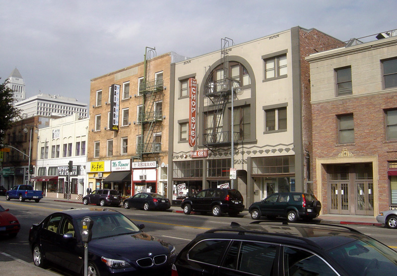
Little Tokyo
Monument and historic site · National Register of Historic Places · 4.3 mi
Neighborhood of Los Angeles, California, USA

Los Angeles Plaza Historic District
Monument and historic site · National Register of Historic Places · 4.3 mi
Park in Los Angeles County, California, United States of America

Los Angeles Union Station
Monument and historic site · National Register of Historic Places · 4.1 mi
Main railway station in Los Angeles, California, United States

Malabar Branch
Monument and historic site · National Register of Historic Places · 2.1 mi
Public library in Los Angeles, California, USA

Robert Louis Stevenson Branch
Monument and historic site · National Register of Historic Places · 1.7 mi
Public library in Los Angeles, California, USA
23 more on the map.
Parks, trails and playgrounds14

Plaza Substation
Park · National Register of Historic Places · 4.4 mi
Park in California, United States of America

Elephant Hill Open Space
Park · 4.4 mi
Park in El Sereno, Los Angeles County, California


Selig Zoo
Park · 3.1 mi
Animal collection in Los Angeles (~1911–~1940)
2 more on the map.
Restaurants and cafes54

East Los Tacos
Restaurant · Mexican · 0.6 mi
4500 East Cesar E Chavez Avenue
Su-Th 07:00-23:00; Fr-Sa 07:00-00:00

Taqueria La Que Si Llena
Restaurant · Mexican · 1.2 mi
3630 Cesar E Chavez Avenue, Los Angeles
Mo-Su 09:00-22:00

La Canasta
Restaurant · 0.9 mi
4112 Whittier Boulevard, Los Angeles
Mo-Su 08:00-18:00

Denny's
Diner · American · 0.7 mi
4760 Cesar E Chavez Avenue, Los Angeles
Tamales Lilianas
Restaurant · Mexican · 0.7 mi
4619 Cesar E Chavez Avenue, Los Angeles
Tokyo Express: Chinese Food to Go
Restaurant · Chinese · 0.7 mi
4770 Cesar E Chavez Avenue, Los Angeles
42 more on the map.
Churches and places of worship50
Kingdom Hall of Jehovah's Witnesses
Church · Jehovahs Witness · 1.9 mi
3853 City Terrace Drive, Los Angeles
Our Lady of Lourdes Roman Catholic Church
Church · Catholic · 1.1 mi
3772 East 3rd Street, Los Angeles
Saint Lucy's Catholic Church
Church · Catholic · 1.8 mi
1419 North Hazard Avenue, Los Angeles
Shopping5
Brooklyn Hardware
Hardware store · 1.1 mi
3734 Cesar E Chavez Avenue, Los Angeles
Gas and EV charging9
Schools, colleges and libraries81
Esteban E. Torres High School
School · 0.8 mi
4211 Dozier Street, Los Angeles
Healthcare9
Kaiser Permanente East Los Angeles Medical Offices
Clinic and pharmacy · 0.8 mi
5119 Pomona Boulevard, Los Angeles
Clinica Juan Pablo Medical Group
Clinic and pharmacy · 1.2 mi
3968 Whittier Boulevard, Los Angeles
Sunrise Pharmacy
Clinic and pharmacy · 1.1 mi
3706 Cesar E Chavez Avenue, Los Angeles
Map of East Los Angeles
250 places. The map loads OpenStreetMap tiles when you open it.
Climate by month
Monthly table
| Month | High | Low | Rain |
|---|---|---|---|
| Jan | 68°F | 49°F | 3.3 in |
| Feb | 68°F | 50°F | 3.6 in |
| Mar | 70°F | 52°F | 2.2 in |
| Apr | 72°F | 55°F | 0.7 in |
| May | 74°F | 58°F | 0.3 in |
| Jun | 77°F | 61°F | 0.1 in |
| Jul | 82°F | 65°F | 0.0 in |
| Aug | 84°F | 65°F | 0.0 in |
| Sep | 83°F | 64°F | 0.1 in |
| Oct | 79°F | 60°F | 0.6 in |
| Nov | 73°F | 53°F | 0.8 in |
| Dec | 67°F | 48°F | 2.5 in |
U.S. Climate Normals 1991-2020 for Los Angeles Dwtn Usc Campus (4 mi away), NOAA NCEI.
People and cost of living
American Community Survey 5-year estimates, 2020-2024, U.S. Census Bureau. Estimates have margins of error, larger for small towns.
Disaster history
Los Angeles County has had 67 federal disaster declarations since 2000, most often for fires.
- 2025-08-08: Canyon Fire (Fire)
- 2025-01-08: Wildfires And Straight-Line Winds (Fire)
- 2025-01-08: Eaton Fire (Fire)
- 2025-01-08: Hurst Fire (Fire)
- 2025-01-07: Palisades Fire (Fire)
- 2024-12-10: Franklin Fire (Fire)
OpenFEMA disaster declarations summaries.
Getting there and nearby towns
San Gabriel Valley Airport (EMT) is the nearest airport with scheduled flights listed in OpenStreetMap, 9 miles away.
- Monterey Park 2 mi northeast, about 4 min by car
- Commerce 3 mi southeast, about 4 min by car
- Maywood 3 mi south, about 5 min by car
- Montebello 3 mi east, about 6 min by car
- Bell 4 mi south, about 6 min by car
- Alhambra 4 mi northeast, about 7 min by car
- Huntington Park 5 mi southwest, about 7 min by car
- Bell Gardens 5 mi south, about 8 min by car
- Cudahy 5 mi south, about 8 min by car
- Pico Rivera 5 mi southeast, about 9 min by car
Drive times are estimates from straight-line distance, not routes.
Local news
Headlines from INDB, the NEMICO news database.
Reviews, tips and questions
Loading what members have shared...
Sources and licences
- NCES EDGE (Public domain): public schools
- NOAA NCEI U.S. Climate Normals 1991-2020 (Public domain): climate by month
- OpenFEMA (Public domain): disaster declarations
- OpenStreetMap contributors (ODbL 1.0): places, airports, map data
- U.S. Census Bureau (Public domain): population, income, housing, education, commute
- Wikidata (CC0 1.0): elevation, founding date, time zone, website, landmarks and historic places
- Wikimedia Commons (see each image): photos
- Wikipedia (CC BY-SA 4.0): overview and history text
Photo credits
- Los Angeles River, Flickr user kla4067, CC BY 2.0
- Higgins Mausoleum, Calvary Cemetery, East Los Angeles (front), Z4UM41, CC BY 4.0
- Anthony Quinn at the rededication of East Los Angeles Public Library, Los Angeles Times, CC BY 4.0
- Higgins Mausoleum, Calvary Cemetery, East Los Angeles (three-quarter view), Z4UM41, CC BY 4.0
- New housing on Whittier Blvd, East Los Angeles, Downtowngal, CC BY-SA 4.0
- Old Theater, 5190 Whittier Blvd., Los Angeles, Los Angeles, CC BY-SA 4.0
- U.S. Post Office - Los Angeles Terminal Annex, Los Angeles, CC BY-SA 3.0
- Santa Fe Freight Depot, Los Angeles, Los Angeles, CC BY-SA 3.0
- Malabar Branch Library, Los Angeles, California, Los Angeles, CC BY-SA 3.0
- La Placita Parish 2007, Matthew D. Herrera ( User:Dataproducts ), Public domain
- 11-11-06-FarEastCafe-LittleTokyo, The original uploader was Bobak at English Wikipedia ., CC BY-SA 2.5
- 20140830 50 Los Angeles Union Station (15360153108), David Wilson from Oak Park, Illinois, USA, CC BY 2.0
- Lincoln Heights Branch Library, Los Angeles, Los Angeles, CC BY-SA 3.0
- Santa Fe Coast Lines Hospital, Los Angeles, Los Angeles, CC BY-SA 3.0
- Congregation Talmud Torah (Breed Street Shul), Boyle Heights, Los Angeles, Los Angeles, CC BY-SA 4.0
- Plaza Substation, Los Angeles, Downtowngal, CC BY-SA 3.0
- 3751 in the yard July 2017, Fanlon verdoe, CC BY-SA 4.0
- Robert Louis Stevenson Branch Library, Los Angeles, Los Angeles, CC BY-SA 3.0
- House at 530 S. Marengo Avenue, Brianyoungramirez, CC BY-SA 3.0
- Sears, Roebuck & Company Mail Order Building, Los Angeles, Los Angeles, CC BY-SA 3.0
- U.S. Court House, Los Angeles, Los Angeles, CC BY-SA 3.0
- Cal State University, Los Angeles, Justefrain, CC BY 3.0
- BoyleHotel, Bruce Boehner, CC BY-SA 3.0
- National Japanese American Veterans Memorial Court, DocFreeman24, CC BY-SA 4.0
- Italian American museum, Dgatto, CC BY 3.0
- Lincoln Park, Los Angeles, Los Angeles, CC BY-SA 4.0
- LA Plaza de Cultura y Artes, Los Angeles, California (14523832122), Ken Lund from Reno, Nevada, USA, CC BY-SA 2.0
- Hazard Park Los Angeles California, Tedder, CC BY 3.0
- Interstate 710 East LA, Chevy111, CC BY-SA 4.0
- Parked-Mazda, Accord14, CC BY-SA 4.0
- Volare-WAGON, Accord14, CC BY-SA 4.0
- Aksdiew, Accord14, CC BY-SA 4.0
- Làpida Pares Escolapis LA, EloiPratP, CC0
- GEO STORM, Accord14, CC BY-SA 4.0
- Crypt plates of Thomas Higgins and Mary Riordan, Higgins Mausoleum, Z4UM41, CC BY 4.0
- Insulated semi-trailer - rear, Eric Polk, CC BY-SA 4.0
- Mini Van, Accord14, CC BY-SA 4.0
- 710 North from Chavez in East LA, Downtowngal, CC BY-SA 4.0
- 710 South from Chavez in East LA 1, Downtowngal, CC BY-SA 4.0
- 710 South from Chavez in East LA 2, Downtowngal, CC BY-SA 4.0


Page built October 30, 2026. Spotted a mistake? Tell us or suggest a place.