


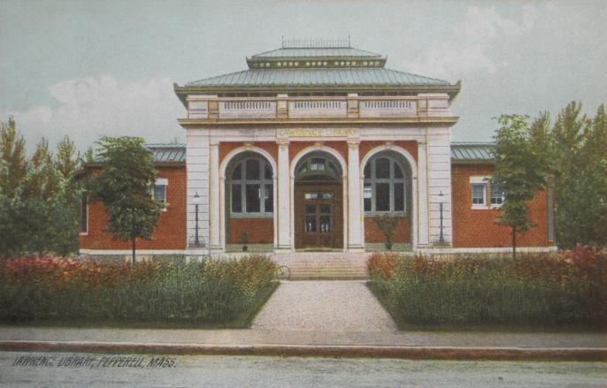
East Pepperell, Massachusetts
East Pepperell is a community of 1,949 people in Middlesex County, Massachusetts.
Why visit East Pepperell
Townapedia lists 5 museums and landmarks, 23 parks and trails and 7 places to eat in and around town.
Highlights include Bennett-Shattuck House and District 7 School.
July is the warmest month, with average highs of 85°F; January lows average 14°F.
Weather in East Pepperell
Forecast from the National Weather Service. Full forecast
About East Pepperell
East Pepperell is a village and census-designated place (CDP) in the town of Pepperell in Middlesex County, Massachusetts, United States. The population was 2,120 at the 2020 census.
From the Wikipedia article East Pepperell, Massachusetts (this version), under CC BY-SA 4.0.
Museums and landmarks5
Bennett-Shattuck House
Monument and historic site · National Register of Historic Places · 3.1 mi
Groton, Massachusetts
District 7 School
Monument and historic site · National Register of Historic Places · 2.3 mi
School building in Groton, United States of America
Pepperell Center Historic District
Monument and historic site · National Register of Historic Places · 1.9 mi
Historic district in Massachusetts, United States


Parks, trails and playgrounds23



11 more on the map.
Restaurants and cafes7






Churches and places of worship3

History
Like the town of Pepperell, East Pepperell is named for Sir William Pepperrell, a Massachusetts colonial soldier who led the Siege of Louisbourg during King George's War.
On the night of Monday, July 4, 1921, a chauffeur by the name of Percy England was returning to his boarding place in East Pepperell, Massachusetts accompanied by the daughter of his landlady, Mrs. Loretta Lavender. Suddenly, he was grabbed by two masked men and forced him into an automobile as the men shot a from a revolver and threatened to kill England if he escaped. They took him to a pasture on the property of Meredith where a third man appeared with a whip, a pail of hot tar (most likely pine tar) and feathers. The men stripped England to the waist, whipped, and tarred and feathered him. He was ordered to leave town and warned that if he did not, his treatment would be repeated. England suffered from welts, sears, and burns on his back and head, showing his wounds while in court to support his case.
From the History section of East Pepperell, Massachusetts on Wikipedia, under CC BY-SA 4.0.
Gas and EV charging2
Schools, colleges and libraries18
Healthcare1
Map of East Pepperell
59 places. The map loads OpenStreetMap tiles when you open it.
Climate by month
Monthly table
| Month | High | Low | Rain |
|---|---|---|---|
| Jan | 34°F | 14°F | 3.0 in |
| Feb | 38°F | 16°F | 3.1 in |
| Mar | 45°F | 24°F | 4.1 in |
| Apr | 58°F | 35°F | 3.9 in |
| May | 69°F | 46°F | 3.6 in |
| Jun | 79°F | 56°F | 4.2 in |
| Jul | 85°F | 62°F | 3.6 in |
| Aug | 83°F | 60°F | 3.7 in |
| Sep | 75°F | 52°F | 4.2 in |
| Oct | 62°F | 39°F | 4.7 in |
| Nov | 50°F | 29°F | 3.7 in |
| Dec | 40°F | 20°F | 4.5 in |
U.S. Climate Normals 1991-2020 for Nashua Cwsu (6 mi away), NOAA NCEI.
People and cost of living
American Community Survey 5-year estimates, 2020-2024, U.S. Census Bureau. Estimates have margins of error, larger for small towns.
Disaster history
Middlesex County has had 26 federal disaster declarations since 2000, most often for severe storms.
- 2023-09-15: Hurricane Lee (Hurricane)
- 2020-03-27: Covid-19 Pandemic (Biological)
- 2020-03-13: Covid-19 (Biological)
- 2018-07-19: Severe Winter Storm And Snowstorm (Snowstorm)
- 2015-04-13: Severe Winter Storm, Snowstorm, And Flooding (Severe Storm)
- 2013-04-19: Severe Winter Storm, Snowstorm, And Flooding (Severe Storm)
OpenFEMA disaster declarations summaries.
Getting there and nearby towns
Nashua Airport (ASH) is the nearest airport with scheduled flights listed in OpenStreetMap, 9 miles away.
- Nashua 7 mi northeast, about 11 min by car
- Ayer 7 mi south, about 11 min by car
- Devens 9 mi south, about 14 min by car
- Lowell 12 mi east, about 20 min by car
- Fitchburg 14 mi west, about 22 min by car
- Leominster 14 mi southwest, about 23 min by car
- Londonderry 17 mi northeast, about 27 min by car
- Maynard 17 mi south, about 28 min by car
- Hudson 19 mi south, about 30 min by car
- Lawrence 21 mi east, about 33 min by car
Drive times are estimates from straight-line distance, not routes.
Local news
Headlines from INDB, the NEMICO news database.
Reviews, tips and questions
Loading what members have shared...
Sources and licences
- NCES EDGE (Public domain): public schools
- NOAA NCEI U.S. Climate Normals 1991-2020 (Public domain): climate by month
- OpenFEMA (Public domain): disaster declarations
- OpenStreetMap contributors (ODbL 1.0): places, airports, map data
- U.S. Census Bureau (Public domain): population, income, housing, education, commute
- Wikidata (CC0 1.0): elevation, founding date, time zone, website, landmarks and historic places
- Wikimedia Commons (see each image): photos
- Wikipedia (CC BY-SA 4.0): overview and history text
Photo credits
- Pepperell Covered Bridge, East Pepperell MA, John Phelan, CC BY 3.0
- East Pepperell freight house, December 2022, Pi.1415926535, CC BY-SA 4.0
- Penstock and powerhouse, East Pepperell MA, John Phelan, CC BY-SA 4.0
- GrotonMA BennettShattuckHouse, User:Magicpiano, CC BY-SA 4.0
- GrotonMA District7School, User:Magicpiano, CC BY-SA 4.0
- Lawrence Library, Pepperell, MA, Unknown photographer, Public domain
- Nashua River Fallfish, Jay Guarneri, CC BY-SA 4.0
- Pepperell covered bridge, Hollis1138 at English Wikipedia, CC BY-SA 3.0
- Groton Dunstable Regional High School, Groton MA, John Phelan, CC BY-SA 4.0


Page built October 30, 2026. Spotted a mistake? Tell us or suggest a place.