


Devens, Massachusetts
Devens is a community of 1,723 people in Middlesex County, Massachusetts.
Why visit Devens
Townapedia lists 27 museums and landmarks, 36 parks and trails, 31 places to eat, 2 places to stay and 7 attractions in and around town.
Highlights include Benjamin Hill, Hazen Hill, Community Memorial Hospital and Ayer Main Street Historic District.
July is the warmest month, with average highs of 83°F; January lows average 16°F.
Weather in Devens
Forecast from the National Weather Service. Full forecast
About Devens
Devens is a regional enterprise zone and census-designated place in the towns of Ayer and Shirley (in Middlesex County) and Harvard (in Worcester County) in the U.S. state of Massachusetts. It is the successor to Fort Devens, a military post that operated from 1917 to 1996. The population was 1,697 at the 2020 census, down from 1,840 in 2010.
From the Wikipedia article Devens, Massachusetts (this version), under CC BY-SA 4.0.
Things to do7

Museums and landmarks27

Community Memorial Hospital
Monument and historic site · National Register of Historic Places · 2.0 mi
Hospital in Ayer, Massachusetts, United States
15 Winthrop Avenue, Ayer

Ayer Main Street Historic District
Monument and historic site · National Register of Historic Places · 1.7 mi
Historic district in Massachusetts, United States

Fort Devens Historic District
Monument and historic site · National Register of Historic Places
Historic district in Massachusetts, United States

Frederick Fiske and Gretchen Osgood Warren House
Monument and historic site · National Register of Historic Places · 4.0 mi
Historic house in Harvard, Massachusetts

Fruitlands
Monument and historic site · National Register of Historic Places · 2.3 mi
Commune in Massachusetts

Fruitlands Museum
Museum · National Register of Historic Places · 2.4 mi
Museum in Massachusetts

Harvard Center Historic District
Monument and historic site · National Register of Historic Places · 3.5 mi
Historic district in Massachusetts, United States

Harvard Shaker Village Historic District
Monument and historic site · National Register of Historic Places · 2.9 mi
Historic district in Massachusetts, United States
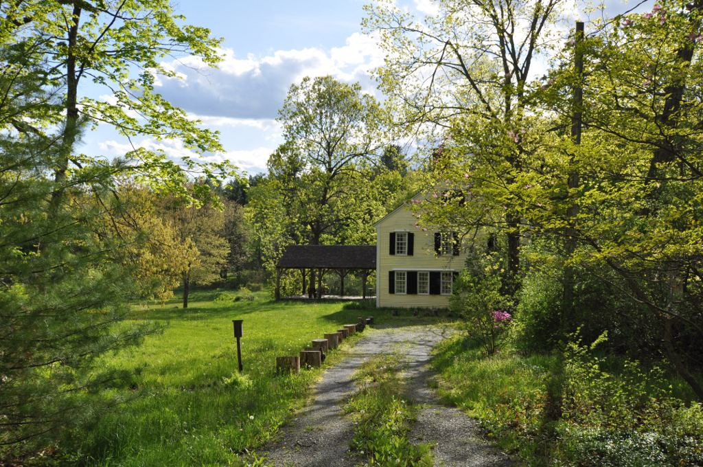
James Parker House
Monument and historic site · National Register of Historic Places · 2.6 mi
Building in Massachusetts, United States

Pleasant Street School
Monument and historic site · National Register of Historic Places · 2.0 mi
Listed on the NRHP in Massachusetts

Sandy Pond School
Monument and historic site · National Register of Historic Places · 3.9 mi
Historic school building at 150 Sandy Pond Road in Ayer, Massachusetts

Shirley Center Historic District
Monument and historic site · National Register of Historic Places · 2.7 mi
Historic district in Massachusetts, United States
15 more on the map.
Parks, trails and playgrounds36





24 more on the map.
Restaurants and cafes31

Two Brothers
Restaurant · Diner, Pancake · 0.9 mi
200 West Main Street, Ayer
Mo-Fr 05:00-14:00; Sa-Su 06:00-13:00
The Phoenix Bar and Grill
Restaurant · 2.0 mi
4 Ayer Road, Shirley
Tu-We 14:00-21:00; Th-Sa 11:00-21:00
Woo Jung
Restaurant · Korean · 1.1 mi
174 West Main Street, Ayer
We-Fr 11:00-21:00; Sa-Su 12:00-21:00

19 more on the map.
History
The area itself is named after jurist and Civil War general Charles Devens. In 2011, the CDP tried to secede from Ayer, Shirley, and Harvard and become the 352nd town in the state but failed the vote. Some residents are still looking to secede to become a town.
From the History section of Devens, Massachusetts on Wikipedia, under CC BY-SA 4.0.
Where to stay2
Churches and places of worship10
Still River Baptist Church
Church · National Register of Historic Places · 3.6 mi
Shopping7
Gas and EV charging5
Schools, colleges and libraries22
Healthcare1
Map of Devens
148 places. The map loads OpenStreetMap tiles when you open it.
Climate by month
Monthly table
| Month | High | Low | Rain |
|---|---|---|---|
| Jan | 34°F | 16°F | 2.6 in |
| Feb | 37°F | 17°F | 2.8 in |
| Mar | 45°F | 25°F | 3.8 in |
| Apr | 58°F | 35°F | 3.8 in |
| May | 70°F | 46°F | 3.6 in |
| Jun | 78°F | 56°F | 4.1 in |
| Jul | 83°F | 62°F | 3.5 in |
| Aug | 82°F | 60°F | 3.4 in |
| Sep | 74°F | 51°F | 4.0 in |
| Oct | 62°F | 40°F | 4.5 in |
| Nov | 50°F | 30°F | 3.6 in |
| Dec | 40°F | 22°F | 3.7 in |
U.S. Climate Normals 1991-2020 for Fitchburg Muni Ap (7 mi away), NOAA NCEI.
People and cost of living
American Community Survey 5-year estimates, 2020-2024, U.S. Census Bureau. Estimates have margins of error, larger for small towns.
Disaster history
Middlesex County has had 26 federal disaster declarations since 2000, most often for severe storms.
- 2023-09-15: Hurricane Lee (Hurricane)
- 2020-03-27: Covid-19 Pandemic (Biological)
- 2020-03-13: Covid-19 (Biological)
- 2018-07-19: Severe Winter Storm And Snowstorm (Snowstorm)
- 2015-04-13: Severe Winter Storm, Snowstorm, And Flooding (Severe Storm)
- 2013-04-19: Severe Winter Storm, Snowstorm, And Flooding (Severe Storm)
OpenFEMA disaster declarations summaries.
Getting there and nearby towns
Minute Man Airfield (MMN) is the nearest airport with scheduled flights listed in OpenStreetMap, 7 miles away.
- Ayer 2 mi northeast, about 3 min by car
- Leominster 8 mi west, about 13 min by car
- Fitchburg 11 mi west, about 18 min by car
- Hudson 11 mi south, about 17 min by car
- Maynard 11 mi southeast, about 18 min by car
- Marlborough 14 mi south, about 22 min by car
- Nashua 16 mi northeast, about 25 min by car
- Lowell 16 mi northeast, about 26 min by car
- Framingham 19 mi southeast, about 30 min by car
- Worcester 21 mi southwest, about 34 min by car
Drive times are estimates from straight-line distance, not routes.
Local news
Headlines from INDB, the NEMICO news database.
Reviews, tips and questions
Loading what members have shared...
Sources and licences
- NCES EDGE (Public domain): public schools
- NOAA NCEI U.S. Climate Normals 1991-2020 (Public domain): climate by month
- OpenFEMA (Public domain): disaster declarations
- OpenStreetMap contributors (ODbL 1.0): places, airports, map data
- U.S. Census Bureau (Public domain): population, income, housing, education, commute
- Wikidata (CC0 1.0): landmarks and historic places
- Wikimedia Commons (see each image): photos
- Wikipedia (CC BY-SA 4.0): overview and history text
Photo credits
- Devens Charity Chili Cookoff, Devens MA, John Phelan, CC BY-SA 3.0
- Greetings from Fort Devens, Massachusetts - Large Letter Postcard (7745734186), Steve Shook from Moscow, Idaho, USA, CC BY 2.0
- Devens 43.jpg - panoramio, talllguy, CC BY-SA 3.0
- Commonwealth Fusion Systems headquarters, Devens, MA July 2026 1, 4300streetcar, CC BY 4.0
- Commonwealth Fusion Systems headquarters, Devens, MA July 2026 2, 4300streetcar, CC BY 4.0
- Community Memorial Hospital, Ayer MA, John Phelan, CC BY 3.0
- Ayer historic district, Marcbela (Marc N. Belanger), Public domain
- Pleasant Street School, Ayer MA, John Phelan, CC BY 3.0
- Still River Baptist Church, Harvard MA, John Phelan, CC BY 3.0
- HarvardMA FrederickFiskeAndGretchenOsgoodWarrenHouse, User:Magicpiano, CC BY-SA 4.0
- Sandy Pond School, Ayer MA, John Phelan, CC BY-SA 4.0
- Fruitlands Museum - buildings 1, Daderot, Public domain
- Harvard Town Hall, Harvard MA, John Phelan, CC BY 3.0
- Old Shirley Common, Marcbela (Marc N. Belanger), Public domain
- ShirleyMA JamesParkerHouse, User:Magicpiano, CC BY-SA 4.0
- Fruit lands Alcott house, 2015 2, victorgrigas, CC BY-SA 3.0
- South Family Building, Harvard Shaker Village MA, John Phelan, CC BY 3.0
- DevensMA 01, User:Magicpiano, CC BY-SA 4.0
- Ministry Shop, Shirley Shaker Village MA, John Phelan, CC BY-SA 3.0
- GrotonMA LeatherboardCompany 1, User:Magicpiano, CC BY-SA 4.0
- Tankers.jpg - panoramio, talllguy, CC BY-SA 3.0
- Snow at the Motorpool.jpg - panoramio, talllguy, CC BY-SA 3.0
- HUMMWV (1).jpg - panoramio, talllguy, CC BY-SA 3.0
- Ground Guide.jpg - panoramio, talllguy, CC BY-SA 3.0
- HUMMWV.jpg - panoramio, talllguy, CC BY-SA 3.0
- Tank.jpg - panoramio, talllguy, CC BY-SA 3.0
- Superstorm9301, Thelmadatter, CC BY-SA 3.0
- Grady Research building, July 2021, Pi.1415926535, CC BY-SA 4.0
- Former Nashua River bridge in Ayer, July 2021, Pi.1415926535, CC BY-SA 4.0
- Turbine housing at former F&L powerhouse, July 2021, Pi.1415926535, CC BY-SA 4.0
- Oxbow Nwr Spring Reflection, Bryan Donovan, CC0
- 2009-05-13-09-P1010059 (4295212987), Massachusetts Dept. of Environmental Protection, CC BY 2.0
- 2009-05-13-09-P1010062 (4295958932), Massachusetts Dept. of Environmental Protection, CC BY 2.0
- 2009-05-13-09-P1010060 (4295959000), Massachusetts Dept. of Environmental Protection, CC BY 2.0
- 2009-05-13-09-P1010081 (4295212857), Massachusetts Dept. of Environmental Protection, CC BY 2.0
- 2009-05-13-09-P1010061 (4295212891), Massachusetts Dept. of Environmental Protection, CC BY 2.0
- 2009-05-13-09-P1010086 (4295958886), Massachusetts Dept. of Environmental Protection, CC BY 2.0
- Day one with the HET.jpg - panoramio, talllguy, CC BY-SA 3.0
- Culvert under Greenville Branch track in Ayer, July 2021, Pi.1415926535, CC BY-SA 4.0
- Greenville Branch bridge over Mill Street in Ayer, July 2021, Pi.1415926535, CC BY-SA 4.0


Page built October 30, 2026. Spotted a mistake? Tell us or suggest a place.