


East Providence, Rhode Island
East Providence is a city of 47,281 people in Providence County, Rhode Island, founded in 1862.
Why visit East Providence
Townapedia lists 125 museums and landmarks, 76 parks and trails, 201 places to eat, 5 places to stay and 13 attractions in and around town.
Highlights include Pomham Rocks Light, Roger Williams Park Zoo, Rhodes Street Historic District and Roger Williams Park.
July is the warmest month, with average highs of 84°F; January lows average 22°F, and about 37 inches of snow fall in a normal year.
Weather in East Providence
Forecast from the National Weather Service. Full forecast
About East Providence
East Providence is a city in Providence County, Rhode Island, United States. The population was 47,139 at the 2020 census, making it the fifth-largest city in the state.
From the Wikipedia article East Providence, Rhode Island (this version), under CC BY-SA 4.0.
Things to do13

Pomham Rocks Light
Lighthouse · National Register of Historic Places · 1.7 mi
Lighthouse in Rhode Island, United States

Roger Williams Park Zoo
Zoo and aquarium · 3.0 mi
3rd Oldest Zoo in the United States
1000 Elmwood Ave, Providence

The Zoo In Forest Park
Zoo and aquarium · 3.0 mi
Zoo in Massachusetts, USA

1 more on the map.
Museums and landmarks125

Rhodes Street Historic District
Monument and historic site · National Register of Historic Places · 2.6 mi
Historic district in Rhode Island, United States

Roger Williams Park
Monument and historic site · National Register of Historic Places · 2.9 mi
Historic park in Rhode Island, United States
Alfred Drowne Road Historic District
Monument and historic site · National Register of Historic Places · 4.1 mi
Historic district in Barrington, Rhode Island
All Saints Memorial Church
Monument and historic site · National Register of Historic Places · 3.3 mi
Church building in Providence, Rhode Island

American Street School
Monument and historic site · National Register of Historic Places · 3.9 mi
Historic school in Providence, Rhode Island
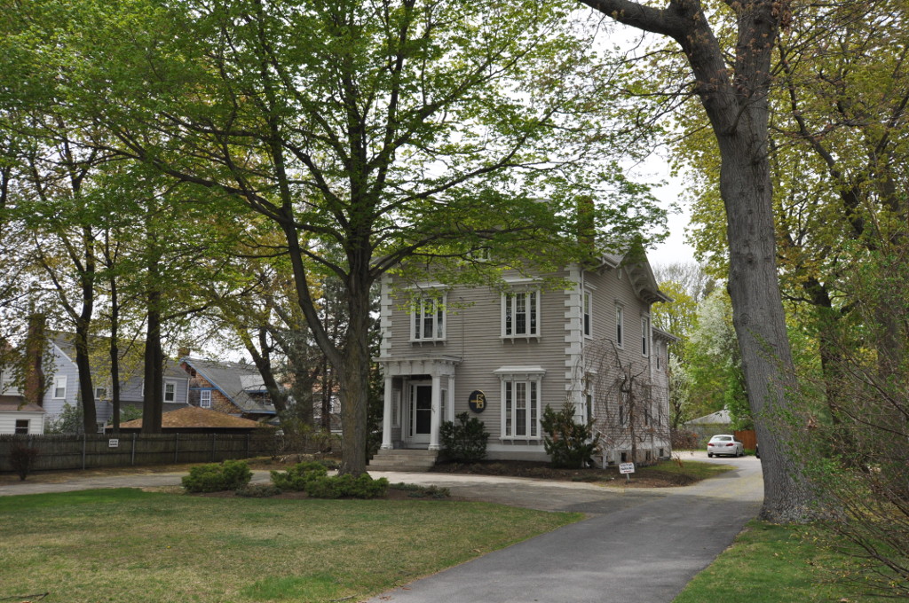
Arad Wood House
Monument and historic site · National Register of Historic Places · 4.4 mi
Historic house in Cranston, Rhode Island
Arnold–Palmer House
Monument and historic site · National Register of Historic Places · 3.1 mi
House in Providence, Rhode Island
Beaman and Smith Company Mill
Monument and historic site · National Register of Historic Places · 2.9 mi
Historic industrial building in Providence, Rhode Island, USA
Bell Street Chapel
Monument and historic site · National Register of Historic Places · 4.2 mi
Historic church in Rhode Island, United States

Belton Court
Monument and historic site · National Register of Historic Places · 3.0 mi
Historic estate in Barrington, Rhode Island
Beneficent Congregational Church
Monument and historic site · National Register of Historic Places · 3.1 mi
Church building in Rhode Island, United States of America

Bicknell-Armington Lightning Splitter House
Monument and historic site · National Register of Historic Places · 1.7 mi
Historic house in Rhode Island, United States
113 more on the map.
Parks, trails and playgrounds76




64 more on the map.
Restaurants and cafes201

Baja's Taqueria
Restaurant · Mexican · 2.8 mi
223 Thayer Street, Providence
Mo-Th,Su 10:00-24:00; Fr-Sa 10:00-26:00
Abu Yarub Al-Shami
Restaurant · Middle Eastern · 2.8 mi
225 Thayer Street, Providence
Su 12:00-20:30; Mo-Th 11:30-20:30; Fr-Sa 11:30-21:30
Boulevard Pizzeria
Restaurant · Pizza Restaurant · 2.1 mi
1031 Narragansett Blvd, Cranston
Mo-Th,Su 11:00-24:00,Fr-Sa 11:00-01:00

Campus Fine Wines
Brewery and winery · 2.4 mi
In-store, curbside, and delivery sales
127 Brook Street, Providence
Mo-We 11:00-22:00; Th-Sa 10:00-22:00; Su 12:00-18:00


Davenport's Bar and Grille
Diner · American · 1.5 mi
1925 Pawtucket Avenue, East Providence
Mo-Th 11:00-21:30; Fr-Sa 11:00-22:30; Su 11:00-21:30
Dolores
Restaurant · Mexican · 2.4 mi
100 Hope Street, Providence
Mo,We 16:00-22:00; Th-Sa 16:00-23:30; Su 11:00-15:00
East Side Pockets
Restaurant · Middle Eastern · 2.9 mi
278 Thayer Street, Providence
Mo-Sa 10:00-02:00, Su 10:00-22:00
Fish Co.
Restaurant · Seafood · 2.5 mi
15 Bridge Street, Providence
Tu-We 16:00-23:00; Th 16:00-01:00; Fr-Sa 16:00-02:00; Su 13:00-01:00
Flatbread Company
Restaurant · Pizza · 2.9 mi
161 Cushing Street, Providence
Mo-We, Su 10:30-21:00; Th-Sa 11:30-22:00
Jahunger
Restaurant · Uyghur · 2.3 mi
333 Wickenden Street, Providence
Tu-Fr 17:00-21:30; Sa 12:00-21:30; Su 12:00-19:30
189 more on the map.
Where to stay5
Churches and places of worship68
Christ Episcopal Church
Church · Episcopal · National Register of Historic Places · 2.5 mi
Calvary Baptist Church
Church · National Register of Historic Places · 2.5 mi
St. Michael's Roman Catholic Church, Convent, Rectory, and School
Church · National Register of Historic Places · 2.8 mi
Central Congregational Church
Church · Congregational · 2.7 mi
296 Angell Street
Ephese Seventh-day Adventist French Church
Church · Seventh Day Adventist · 2.5 mi
857 Eddy Street, Providence
Shopping46
Gas and EV charging13
Schools, colleges and libraries132
Healthcare13
Rhode Island School of Design Integrated Health and Wellness
Clinic and pharmacy · 3.0 mi
Map of East Providence
250 places. The map loads OpenStreetMap tiles when you open it.
Climate by month
Monthly table
| Month | High | Low | Rain | Snow |
|---|---|---|---|---|
| Jan | 38°F | 22°F | 4.0 in | 10.3 in |
| Feb | 40°F | 24°F | 3.4 in | 10.5 in |
| Mar | 48°F | 30°F | 4.9 in | 6.4 in |
| Apr | 59°F | 40°F | 4.3 in | 0.6 in |
| May | 69°F | 49°F | 3.4 in | 0.0 in |
| Jun | 78°F | 59°F | 3.8 in | 0.0 in |
| Jul | 84°F | 65°F | 2.9 in | 0.0 in |
| Aug | 82°F | 64°F | 3.6 in | 0.0 in |
| Sep | 75°F | 56°F | 4.2 in | 0.0 in |
| Oct | 64°F | 45°F | 4.2 in | 0.2 in |
| Nov | 53°F | 36°F | 4.3 in | 1.0 in |
| Dec | 43°F | 28°F | 4.7 in | 7.6 in |
U.S. Climate Normals 1991-2020 for Providence T F Green Ap Hcn 72507 (7 mi away), NOAA NCEI.
People and cost of living
American Community Survey 5-year estimates, 2020-2024, U.S. Census Bureau. Estimates have margins of error, larger for small towns.
Disaster history
Providence County has had 17 federal disaster declarations since 2000, most often for severe storms.
- 2024-03-20: Severe Storms And Flooding (Severe Storm)
- 2024-03-20: Severe Storm And Flooding (Severe Storm)
- 2024-01-07: Severe Storms, Flooding, And Tornadoes (Severe Storm)
- 2022-05-12: Severe Winter Storm And Snowstorm (Snowstorm)
- 2021-08-21: Hurricane Henri (Hurricane)
- 2020-03-30: Covid-19 Pandemic (Biological)
OpenFEMA disaster declarations summaries.
Getting there and nearby towns
Rhode Island T. F. Green International Airport (PVD) is the nearest airport with scheduled flights listed in OpenStreetMap, 6 miles away.
- Providence 3 mi northwest, about 6 min by car
- Attleboro 10 mi north, about 16 min by car
- Somerset 11 mi southeast, about 18 min by car
- North Attleborough Town 12 mi north, about 19 min by car
- Fall River 15 mi east, about 24 min by car
- Taunton 15 mi northeast, about 25 min by car
- Franklin Town 20 mi north, about 32 min by car
- Bridgewater Town 23 mi northeast, about 37 min by car
- New Bedford 24 mi southeast, about 38 min by car
- Brockton 26 mi northeast, about 42 min by car
Drive times are estimates from straight-line distance, not routes.
Local news
Headlines from INDB, the NEMICO news database.
Reviews, tips and questions
Loading what members have shared...
Sources and licences
- NCES EDGE (Public domain): public schools
- NOAA NCEI U.S. Climate Normals 1991-2020 (Public domain): climate by month
- OpenFEMA (Public domain): disaster declarations
- OpenStreetMap contributors (ODbL 1.0): places, airports, map data
- U.S. Census Bureau (Public domain): population, income, housing, education, commute
- Wikidata (CC0 1.0): elevation, founding date, time zone, website, landmarks and historic places
- Wikimedia Commons (see each image): photos
- Wikipedia (CC BY-SA 4.0): overview and history text
Photo credits
- World War I Memorial and Taunton Plaza, East Providence RI, John Phelan, CC BY-SA 3.0
- Rhodes House RSHD - Providence Rhode Island, Ian Poellet, CC BY-SA 4.0
- Washington Park Pumping Station, Rob Tucher, Public domain
- Edgewood Manor Inn, Cranston RI, John Phelan, CC BY-SA 3.0
- James Dennis House East Providence RI 2012, Kenneth C. Zirkel, CC BY-SA 3.0
- David Sprague House-Providence RI front, Kenneth C. Zirkel, CC BY-SA 3.0
- Calvary Baptist Church, Providence RI, Kenneth C. Zirkel, CC BY-SA 3.0
- Richard Henry Deming House, Kenneth C. Zirkel, CC BY-SA 3.0
- EastProvidenceRI WhitcombFarm, Magicpiano, CC BY-SA 3.0
- Israel B. Mason House, Providence RI, Kenneth C. Zirkel, CC BY-SA 3.0
- ProvidenceRI GeneralIceCreamCorporationBuilding, Magicpiano, CC BY-SA 3.0
- CranstonRI AradWoodHouse, Magicpiano, CC BY-SA 3.0
- Matthew Lynch House Providence RI, Kenneth C. Zirkel, CC BY-SA 3.0
- Providence Gas Co Purifier House NW qtr - Providence Rhode Island, Ian Poellet, CC BY-SA 4.0
- ProvidenceRI ElmwoodHD MelroseStreet, Magicpiano, CC BY-SA 3.0
- Charles D Richmond House, Cranston RI, John Phelan, CC BY-SA 3.0
- Bicknell—Armington Lightning Splitter House East Providence RI 2012, Kenneth C. Zirkel, CC BY-SA 3.0
- Ernest Street Pumping Station, Rob Tucher, Public domain
- Temple Beth-El, Providence RI 2012, Kenneth C. Zirkel, CC BY-SA 3.0
- Belton Court Barrington RI 2012, Kenneth C. Zirkel, CC BY-SA 3.0
- 57-59 Wesleyan Ave WAHD - Providence Rhode Island, Ian Poellet, CC BY-SA 4.0
- District 6 Schoolhouse East Providence RI 2012, Kenneth C. Zirkel, CC BY-SA 3.0
- CharlesDowlerHouse, Caffeinatedlibrarian, CC BY-SA 3.0
- Downtown Providence 1, Marcbela, Public domain
- First Baptist Church in America from Angell St, Filetime, CC BY-SA 4.0
- ProvidenceRI PerkinsBuildings 102Westfield, Magicpiano, CC BY-SA 4.0
- AmericaStreetSchool, Clifford Renshaw, Public domain
- Cathedral of Saints Peter and Paul, Kenneth C. Zirkel, CC BY-SA 3.0


Page built October 30, 2026. Spotted a mistake? Tell us or suggest a place.