


Why visit Exeter
Townapedia lists 68 museums and landmarks, 71 parks and trails, 152 places to eat, 39 places to stay and 21 attractions in and around town.
Highlights include Old Exe Bridge, Barnfield Theatre, Alphington Road and St Nicholas Priory.
Weather in Exeter
Forecast from MET Norway (CC BY 4.0). Full forecast
About Exeter
Exeter is a cathedral city and the county town of Devon in South West England. It is situated on the River Exe, approximately 36 mi (58 km) northeast of Plymouth and 65 mi (105 km) southwest of Bristol. In 2024, Exeter had a population of 137,894, making it the second largest settlement in Devon after Plymouth. Under local government restructuring plans Exeter will, with the addition of parishes from East Devon, Teignbridge and Mid Devon, become the Exeter unitary authority from 2028.
From the Wikipedia article Exeter (this version), under CC BY-SA 4.0.
Travel tips from other travellers: Exeter on Wikivoyage (CC BY-SA 4.0).
Photos of Exeter

Things to do21


Crealy Theme Park & Resort
Monument and historic site · 5.0 mi
Theme park in Devon, England

Northcott Theatre
Cinema and theater · 0.9 mi
Theatre on Streatham Campus of the University of Exeter, Devon, England

Theatre Royal, Exeter
Cinema and theater
Former theatre and cinema in Exeter, England (1889-1962)
Exeter Northcott Theatre
Cinema and theater · 0.9 mi
Stocker Road, Exeter

Barton Place Farm Shop
Farm and orchard · 1.7 mi
Wrefords Lane, Exeter
Mo-Fr 09:00-18:00; Sa 09:00-17:00; Su 10:00-16:00

9 more on the map.
Museums and landmarks68


St Nicholas Priory
Monument and historic site · 0.4 mi
Grade I listed priory in Exeter, United Kingdom
The Mint, Exeter
Mo 10:00-16:00; Su 13:00-16:00

The Bill Douglas Cinema Museum
Museum · 0.7 mi
Prince of Wales Road, Exeter
Mo-Su 10:00-17:00; Dec 25-Jan 01 off

Exeter city walls
Monument and historic site
Scheduled monument in Exeter, Devon, England, UK

Exeter War Memorial
Monument and historic site
War memorial in Exeter, Devon, England


Spacex
Museum · 0.4 mi
Contemporary art gallery in Devon, England
45 Preston Street, Exeter

Bill Douglas Cinema Museum
Museum · 0.7 mi
Museum and research facility at the University of Exeter


Cricklepit Mill With Secondary Wheel Attached
Museum · 0.4 mi
Visitor centre in Exeter, Devon, England, UK
56 more on the map.
Parks, trails and playgrounds71




Bowling Green Marsh RSPB reserve
Park · 4.4 mi
RSPB nature reserve in the United Kingdom

Arena Park
Park · 2.0 mi
Grass park on a slope with childrens playground at the bottom
59 more on the map.
Restaurants and cafes152


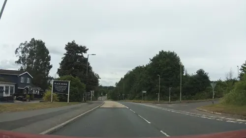
The Black Horse Inn
Bar and pub · Regional · 3.7 mi
Old Honiton Road, Exeter
Mo-Th 12:00-15:00, 18:00-23:00; Fr 17:00-23:00; Sa 12:00-23:00; Su...

The Turks Head
Bar and pub · Burger, Fish And Chips
202 High Street, Exeter
Su-Th 10:00-24:00; Fr-Sa 10:00-01:00
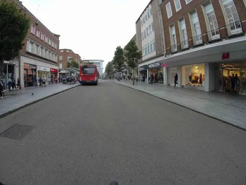
Caffè Nero
Cafe · Coffee Shop
241 High Street, Exeter
Mo-Fr 07:00-18:30; Sa 07:30-18:30; Su 08:00-18:00

Royal Oak
Bar and pub · 1.0 mi
78-81 Fore Street, Exeter
Mo-Th 11:30-23:00; Fr-Sa 11:30-00:00; Su 12:00-16:00,19:00-23:00

The Chevalier Inn
Bar and pub
81-82 Fore Street, Exeter
Mo-Th 08:00-00:00; Fr,Sa 08:00-02:00; Su 08:00-24:00



140 more on the map.
History
Exeter began as settlements on a dry ridge ending in a spur overlooking a navigable river teeming with fish, with fertile land nearby. Although there have been no major prehistoric finds, these advantages suggest the site was occupied early. Coins from the Hellenistic kingdoms suggest the existence of a settlement trading with the Mediterranean as early as 250 BC.
In c. AD 55, the Romans established a 42-acre (17 ha) fort (Castrum) named Isca at this site. The fort served as the southwest terminus of the Fosse Way (part of the Antonine Itinerary) and base for the 5,000-man Second Augustan Legion. An unplanned community (vicus) of natives and the soldiers' families grew up around it, which served as the tribal capital of the Dumnonii. When the fortress was abandoned c. AD 75, its grounds were converted to civilian use: its very large bathhouse was replaced by a forum and a basilica, and a smaller-scale bath was erected to the southeast.
Read more of the history
In the late 2nd century, the ditch and rampart defences around the old fortress were replaced by a bank and wall enclosing a much larger area, some 92 acres (37 hectares). The settlement seems to have been most prosperous in the first half of the 4th century: more than a thousand Roman coins have been found around the city and there is evidence for copper and bronze working, a stock-yard, and markets for the livestock, crops, and pottery produced in the surrounding countryside. The absence of coins dated after 380 suggests a rapid decline by this point.
Nothing is certainly known of Exeter from the time of the Roman withdrawal from Britain around 410 until the seventh century, when it was held by the Saxons (to whom it was known as Escanceaster) who had arrived after defeating the British Dumnonians at Peonnum in Somerset in 658. In 876, the city was attacked and briefly captured by Danish Vikings before Alfred the Great drove them out the next summer. Over the next few years, he elevated Exeter to one of the four burhs in Devon, rebuilding its walls on the Roman lines. These permitted the city to repel another attack and siege by the Danes in 893. Æthelstan again strengthened the walls around 928, and at the same time drove out the remaining Britons from the city. After failing again in 1001, the Danes were finally able to plunder it in 1003 when they were let in, for unknown reasons, by the French reeve of Emma of Normandy, who had been given the city as part of her dowry on her marriage to Æthelred the Unready the previous year.
In 1068, Exeter was a stronghold of Anglo-Saxon resistance to the Norman Conquest as the residence of Gytha Thorkelsdóttir, the mother of the late Harold Godwinson. William the Conqueror's siege of the city ended in negotiation and generous terms for the defenders, although William had Rougemont Castle built to strengthen Norman control over the area. Saxon properties were transferred into Norman hands and, on the death of Bishop Leofric in 1072, the Norman Osbern FitzOsbern was appointed his successor. In 1136, early in the Anarchy, Rougemont Castle was held by Baldwin de Redvers for three months against Stephen of Blois, submitting only when supplies had been exhausted. During the siege, Stephen built an earthen fortification at the site now known (erroneously) as Danes Castle.
Exeter was relatively prosperous by the end of the High Middle Ages. The city held a weekly market from at least 1213, and by 1281 Exeter was the only town in the South West to have three market days per week. There are also records of seven annual fairs, the earliest of which dates from 1130, and all of which continued until at least the early 16th century. Until the expulsion of the Jews of England in 1290, Exeter was home to England's most westerly Jewish community. Sophisticated aqueduct systems brought drinking water into the city from springs in the neighbouring parish of St Sidwell's, partially via a network of tunnels, or underground passages.
In 1537, the city was made a county corporate. In 1549, the city successfully withstood a month-long siege by the so-called Prayer Book rebels. The insurgents occupied its suburbs, burnt down two of the city gates and attempted to undermine the city walls, but eventually abandoned the siege after being defeated by the army of Edward VI. From 1555 to 1568, John Hooker was chamberlain of the city and oversaw several schemes, including provisions for orphans.
Exeter was secured for Parliament at the beginning of the English Civil War, but it remained under pressure from the Royalists until, in September 1643, it was captured by the Cornish Royalist Army led by Prince Maurice. Queen Henrietta Maria stayed in Exeter for the birth of her youngest daughter, Henrietta, in 1644. The city was one of the final Royalist cities to fall into Parliamentarian hands, its surrender being negotiated in April 1646 at Poltimore House by Thomas Fairfax.
During this period, Exeter was an economically powerful city, with a strong trade of wool. This was partly due to the surrounding area which was "more fertile and better inhabited than that passed over the preceding day" according to Count Lorenzo Magalotti who visited the city when he was 26 years old. Magalotti writes of over thirty thousand people being employed in the county of Devon as part of the wool and cloth industries, merchandise that was sold to "the West Indies, Spain, France and Italy". Celia Fiennes also visited Exeter during this period, in the early 18th century. She remarked on the "vast trade" and "incredible quantity" in Exeter, recording that "it turns the most money in a week of anything in England", between £10,000 and £15,000.
From the History section of Exeter on Wikipedia, under CC BY-SA 4.0.
More about Exeter
Geography
Exeter was established on the eastern bank of the River Exe on a ridge of land backed by a steep hill. It is at this point that the Exe, having just been joined by the River Creedy, opens onto a wide flood plain and estuary which makes the area flood-prone. Historically this was the lowest bridging point of the Exe, which was tidal and navigable up to the city until the construction of weirs later in its history. The Exe Estuary begins south of the city and runs for approximately eight miles before it reaches the English Channel.
Exeter sits predominantly on sandstone and conglomerate geology, although the structure of the surrounding areas is varied.
The topography of the ridge which forms the backbone of the city includes a volcanic plug, on which the Rougemont Castle is situated. The cathedral is located on the edge of this ridge and is therefore visible for a considerable distance.
Economy
Exeter generated £5.9 billion gross value added (GVA) in 2022, according to the Centre for Cities; the GVA per hour worked was £35.80, placing it 16th of the 63 cities in the United Kingdom ranked by this measure. Based on a group of economic indicators compiled by the Office for National Statistics from 2023 onwards, Exeter belongs to a cluster of areas defined by a high percentage of children in relative poverty, low rate of active businesses, low gross median weekly pay, low employment rate, low gross value added per hour worked and a low rate of housing completions. A Centre for Cities' 2026 report found that Exeter was among the worst performers in the United Kingdom for improving living standards over the ten years from 2013 to 2023.
Exeter ranked fourth out of 50 in PwC's Good Growth for Cities Index (2025), scoring particularly highly for its jobs and skills.
Exeter has been identified among the top ten most profitable locations for a business to be based. As of 2022, 39% of Exeter workers are in professional occupations, much higher than the national average of 26%. However, median pay for full-time workers is below the figure for Great Britain as a whole, though above that for South West England.
Arts and culture
In recognition of its significant contributions to literature and literary culture, Exeter was made a UNESCO City of Literature in 2019. The Exeter Book, a codex of Old English poetry conserved in Exeter Cathedral, is recognised as "the foundation volume of English literature, one of the world's principal cultural artefacts". Writers with links to the city include Charles Dickens, Sabine Baring-Gould, Jean Rhys, Agatha Christie, Daphne du Maurier, Michael Morpurgo, Hilary Mantel and J. K. Rowling.
Exeter has several theatres. The 460-seat Northcott Theatre on the University's Streatham campus runs a mixed programme of events and is one of relatively few provincial English theatres to maintain its own repertory company. The Northcott Theatre also manages the 280-seat Barnfield Theatre in the city centre. The Cygnet Theatre in Friars Walk is the home of the Cygnet Training Theatre and is a member of the Conference of Drama Schools. The 500-capacity Exeter Corn Exchange is the largest venue in the city and hosts other events in addition to its arts programme. Exeter Phoenix hosts a mixed programme of events in a 270 (seated) capacity auditorium, as well as containing studios, galleries and a cinema.
Education
Exeter's sole higher education provider, the University of Exeter, has two campuses in the city: its main campus, Streatham, and St. Luke's, at which Sport and Health Sciences, the Graduate School of Education, and the Medical School are based; its other campus is in Penryn, Cornwall and shared with Falmouth University. The University formally came into existence in 1955 with the receipt of its royal charter, having previously been the University College of the South West, but can trace its origins to predecessor institutions established from 1838 to 1888.
Exeter College offers further education. Established in 1970, it was the first tertiary college in England and Wales.
It was also the sole sixth form for the maintained school sector in the city until 2014, when it was joined by the Exeter Mathematics School, a sixth form free school that is co-sponsored by the College and University. Exeter College merged with PETROC (now North Devon College) in 2026 to form the Exeter and North Devon Colleges Group.
From the Wikipedia article Exeter, under CC BY-SA 4.0.
Notable people from Exeter
 Chris MartinEnglish singer-songwriter (born 1977)Photo: Raph_PH, CC BY 2.0
 Matthew GoodeEnglish actor (born 1978)Photo: gdcgraphics, CC BY-SA 2.0
 Henrietta of EnglandEnglish princess, duchesse of Orléans (1644-1670)Photo: Peter Lely, Public domain
 Ethan AmpaduWelsh association football playerPhoto: Nickb1792, CC BY-SA 4.0
 John Bowring4th Governor of Hong Kong; hymnwriter; translator (1792-1872)Photo: John King (1788-1847), Public domain
 Bradley JamesBritish actorPhoto: Sue Lukenbaugh from Sacramento, USA, CC BY-SA 2.0
 Nicholas HilliardBritish artist (1547-1619)Photo: Nicholas Hilliard, Public domain
 Beth GibbonsBritish singerPhoto: Bill Ebbesen, CC BY-SA 3.0
 Matthew LockeEnglish Baroque composer (1621–1677)Photo: Unknown artist Unknown artist, Public domain
- William Kingdon CliffordEnglish mathematician and philosopher
- Sabine Baring-GouldEnglish hagiographer, antiquarian, novelist, eclectic scholar, folk song collector (1834-1924)
- William TempleArchbishop of Canterbury (1881-1944)


Born in Exeter, according to Wikidata (CC0). Each name links to its Wikipedia article.
Where to stay39
Churches and places of worship53
Mary Harris Memorial Chapel of the Holy Trinity
Church · Anglican · 0.8 mi
Shopping75
Gas and EV charging16
Schools, colleges and libraries37
Healthcare31
Map of Exeter
250 places. The map loads OpenStreetMap tiles when you open it.
Getting there and nearby towns
Exeter Airport (EXT) is the nearest airport with scheduled flights listed in OpenStreetMap, 5 miles away.
- Exminster 3 mi southeast, about 5 min by car
- Stoke Canon 3 mi north, about 6 min by car
- Topsham 4 mi southeast, about 6 min by car
- Clyst St Mary 4 mi east, about 6 min by car
- Kennford 4 mi south, about 6 min by car
- Newton St Cyres 4 mi northwest, about 7 min by car
- Thorverton 6 mi north, about 9 min by car
- Woodbury 6 mi southeast, about 10 min by car
- Crediton 7 mi northwest, about 11 min by car
- Plymouth 36 mi southwest, about 59 min by car
Drive times are estimates from straight-line distance, not routes.
Keep exploring
Local news
Headlines from INDB.
Reviews, tips and questions
Loading what members have shared...
Sources and licences
- GeoNames (CC BY 4.0): population, coordinates, regions and time zone
- Mapillary (see each image): photos
- OpenStreetMap contributors (ODbL 1.0): places, airports, map data
- Wikidata (CC0 1.0): elevation, founding date, time zone, website, landmarks and historic places
- Wikimedia Commons (see each image): photos
- Wikipedia (CC BY-SA 4.0): overview and history text
Photo credits
- Exeter from Haldon, Nilfanion, CC BY-SA 3.0
- Old Exe Bridge, Exeter 04, Simon Burchell, CC BY-SA 4.0
- Barnfield Theatre, Simon Cobb, CC0
- 2021-04-10 Crealy Theme Park 01, Simon Cobb, CC0
- Office block on the site of the former Theatre Royal, Longbrook Street, Exeter, Richard Nevell, CC BY-SA 4.0
- Exeter - St Nicholas Priory 20181027, Pymouss, CC BY-SA 4.0
- Exeter city walls (9270), Nilfanion, CC BY-SA 4.0
- Exeter City War Memorial framed by trees, Smalljim, CC BY-SA 4.0
- Spacex art gallery, Exeter, Instant steve, CC BY-SA 3.0
- Ludwell Valley Park (2020-04-25) 02, Simon Cobb, CC0
- Northernhay Gardens, Simon Cobb, CC0
- Rougemont Gardens, Simon Cobb, CC0
- Mary Harris Memorial Chapel Exeter, Mkwadee, CC BY-SA 4.0
- Northcott theatre, Smalljim, CC BY-SA 3.0
- Bill Douglas Centre, Simon Cobb, CC0
- Exeter Cathedral 2923rw, Rüdiger Wölk This photo was taken by Rüdiger Wölk . Please credit this photo Rüdiger Wölk, Münster . View all photos (large page) of Rüdiger Wölk I would also appreciate an email to..., CC BY-SA 2.5
- SJP20131005, Alonstoter, CC0
- Polsloe Priory 2020-03-07 (3), Simon Cobb, CC0
- Exeter - Royal Albert Memorial Museum 20151024-01, Pymouss, CC BY-SA 4.0
- St Martin's Church, Exeter-2, Smalljim, CC BY-SA 3.0
- St Peter's Church of England Aided School, Simon Cobb, CC0
- St Marys, Stepcote Hill, Exeter, Trevor Sharp, CC BY-SA 3.0
- Imperial Hotel, Exeter (3), Richard Nevell, CC BY-SA 3.0
- Southernhay House, Simon Cobb, CC0
- The Church of the Sacred Heart, South Street, Exeter, Robert Cutts, CC BY 2.0
- 71, Holloway Street, Simon Cobb, CC0
- City Gate Hotel, Simon Cobb, CC0
- High Street, Exeter (2022-07-04) 24, Simon Cobb, CC0
- St Thomas, Exeter (2021-05-19) 04, Simon Cobb, CC0
- Royal Oak Public House, Simon Cobb, CC0
- White Hart Hotel, Simon Cobb, CC0
- Exeter Hospital, Simon Cobb, CC0
- Exeter Cathedral School, Simon Cobb, CC0
- Heavitree, Exeter 2020-06-20 4, Simon Cobb, CC0
- Trinity School, Newcourt 2020-04-25 (2), Simon Cobb, CC0
- St David's CofE Primary School, Simon Cobb, CC0
- St Leonard's (CofE) Primary School (VC), Simon Cobb, CC0
- St Thomas, Exeter (2021-05-15) 11, Simon Cobb, CC0
- St Nicholas Catholic Primary School, Simon Cobb, CC0
- Miller & Carter, Simon Cobb, CC0
- Fore Street, Exeter (2022 07 04) 02, Simon Cobb, CC0
- St Thomas, Exeter (2021-05-15) 47, Simon Cobb, CC0
- Warehouse Vaults, Simon Cobb, CC0
- Brewers Fayre, Simon Cobb, CC0
- Exeter (2021-05-30) 16, Simon Cobb, CC0
- Church Of The Blessed Sacrament, Simon Cobb, CC0
- Denmark Road, St Leonard's, Exeter 2020-06-20 7, Simon Cobb, CC0
- Polsloe, Exeter (2021-05-07) 05, Simon Cobb, CC0
- Exeter-28Ap11-wyrdlight, Antony McCallum, CC BY-SA 3.0
- 6 And 8, Alphington Road, Simon Cobb, CC0
- Poltimore House 01, Derek Harper, CC BY-SA 2.0
- Sandy park stadium exeter, Valerie Huggins, CC BY-SA 2.0
- Heavitree Pleasure Ground, Lee Vilenski, CC BY-SA 4.0
- Street-level photo, southglos, CC BY-SA 4.0
- Street-level photo, jasskurn, CC BY-SA 4.0
- Street-level photo, jasskurn, CC BY-SA 4.0
- Street-level photo, jasskurn, CC BY-SA 4.0
- Street-level photo, jasskurn, CC BY-SA 4.0
- Street-level photo, jasskurn, CC BY-SA 4.0
- Street-level photo, WaggyDog, CC BY-SA 4.0
- Street-level photo, jasskurn, CC BY-SA 4.0
- Street-level photo, jasskurn, CC BY-SA 4.0
- Street-level photo, jasskurn, CC BY-SA 4.0
- Street-level photo, jasskurn, CC BY-SA 4.0
- Street-level photo, jasskurn, CC BY-SA 4.0
- Street-level photo, jasskurn, CC BY-SA 4.0
- Street-level photo, jasskurn, CC BY-SA 4.0
- Street-level photo, jasskurn, CC BY-SA 4.0
- Street-level photo, jasskurn, CC BY-SA 4.0
- Street-level photo, cyclestreets, CC BY-SA 4.0
- Street-level photo, WaggyDog, CC BY-SA 4.0
- Street-level photo, southglos, CC BY-SA 4.0
- Street-level photo, southglos, CC BY-SA 4.0
- Street-level photo, WaggyDog, CC BY-SA 4.0
- Street-level photo, southglos, CC BY-SA 4.0
- Street-level photo, southglos, CC BY-SA 4.0
- Street-level photo, southglos, CC BY-SA 4.0
- Street-level photo, southglos, CC BY-SA 4.0
- Street-level photo, WaggyDog, CC BY-SA 4.0
- Street-level photo, WaggyDog, CC BY-SA 4.0


Page built November 10, 2026. Spotted a mistake? Tell us or suggest a place.