


Inverness, United Kingdom
Inverness is a town of 47,790 people in Scotland, United Kingdom.
Why visit Inverness
Townapedia lists 39 museums and landmarks, 29 parks and trails, 198 places to eat, 149 places to stay and 8 attractions in and around town.
Highlights include Eden Court, Eden Court Theatre, Inverness Museum & Art Gallery and Abertarff House.
Weather in Inverness
Forecast from MET Norway (CC BY 4.0). Full forecast
About Inverness
Inverness is a city in the Scottish Highlands in the north of Scotland. Long regarded as the de facto capital of the Scottish Highlands, it is the administrative centre for The Highland Council region whose headquarters are located close to the city centre. A regional hub for healthcare, education and research, business and economic services, public administration, culture, music and entertainment, media, communications, transport and leisure, the city provides a range of services for the wider Highlands and Islands Region, a large hinterland encompassing a population of around half a million people and an area of some 39,911 km² or 51% of Scotland's total landmass.
From the Wikipedia article Inverness (this version), under CC BY-SA 4.0.
Travel tips from other travellers: Inverness on Wikivoyage (CC BY-SA 4.0).
Photos of Inverness


Things to do8

Eden Court Theatre
Cinema and theater · 0.5 mi
Theatre in Inverness, Scotland

Greig Street Bridge
Bridge
Suspension bridge in Inverness, Highland, Scotland, UK, carries a footpath across River Ness

Kessock Bridge
Bridge · 1.4 mi
Cable-stayed bridge across the Beauly Firth at Inverness, Scotland, UK



Museums and landmarks39


79th Queens Own Cameron Highlanders - Sudan and Egypt Memorial
Monument and historic site



Craig Phadrig
Monument and historic site · 1.7 mi
Archaeological site in Highland, Scotland, UK

Inverness Museum and Art Gallery
Museum
Museum in Highland, Scotland, United Kingdom
North Kessock Community Pier
Monument and historic site · 1.8 mi
Charity operated jetty for free non-commercial public use.
Main Street, North Kessock
27 more on the map.
Parks, trails and playgrounds29



Fairways Loch Ness Golf Club
Golf course · 1.9 mi
18 Hole Par 70 Loch Ness course + 9 hole Par 29 Family course
Castleheather, Inverness


George Street Park
Playground
A childrens play park with a junior swing, a metal and rope webbing climbing frame, surfaced with grass and wood chips.
George Street, Inverness


17 more on the map.
Restaurants and cafes198
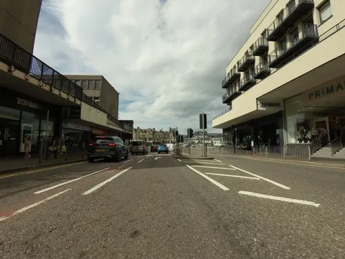
Playback
Restaurant · Burger, Chicken
27-31 Academy Street, Inverness
Su-Th 12:00-22:00; Fr-Sa 12:00-01:00
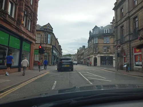
Prime
Restaurant · Regional
4-6 Ness Walk, Inverness
Mo-Th 12:00-21:00; Fr,Sa 12:00-21:30; Su 12:00-21:00
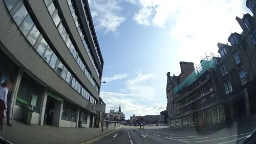
Urquhart's
Restaurant · Regional
2 Young Street, Inverness
Tu-Sa 12:30-14:40, 18:00-21:00; Su 12:00-21:00




Bella Italia
Restaurant · Italian
1 Bridge Street, Inverness
Mo-Th 12:00-21:00; Fr-Sa 12:00-22:00; Su 12:00-21:00
186 more on the map.
History
Inverness was one of the chief strongholds of the Picts. In AD 569, it was visited by St Columba with the intention of converting the Pictish king Brude, who is supposed to have resided in the vitrified fort on Craig Phadrig, on the western edge of the city. A church or a monk's cell is thought to have been established by early Celtic monks on St Michael's Mount, a mound close to the river, now the site of the Old High Church and graveyard.
The first royal charter was granted by Dabíd mac Maíl Choluim (King David I) in the 12th century. The Gaelic king Mac Bethad Mac Findláich (MacBeth) whose 11th-century killing of King Duncan was immortalised in Shakespeare's largely fictionalised play Macbeth, held a castle within the city where he ruled as Mormaer of Moray and Ross.
Inverness Castle is said to have been built by Máel Coluim III (Malcolm III) of Scotland, after he had razed to the ground the castle in which Mac Bethad mac Findláich had, according to much later tradition, murdered Máel Coluim's father Donnchad (Duncan I), and which stood on a hill around 1 km to the north-east.
The strategic location of Inverness has led to many conflicts in the area. Reputedly there was a battle in the early 11th century between Malcolm III and Thorfinn the Mighty at Blar Nam Feinne, to the southwest of the city.
Read more of the history
Inverness had four traditional fairs, including Legavrik or "Leth-Gheamhradh", meaning midwinter, and Faoilleach. William the Lion (d. 1214) granted Inverness four charters, by one of which it was created a royal burgh. Of the Dominican friary founded by Alexander III in 1233, only one pillar and a worn knight's effigy survive in a secluded graveyard near the city centre.
Medieval Inverness suffered regular raids from the Hebrides, particularly by the MacDonald Lords of the Isles in the 15th century. In 1187, one Dòmhnall Bàn (Donald Ban) led islanders in a battle at Torvean against men from Inverness Castle led by the governor's son, Donnchadh Mac an Tòisich (Duncan Mackintosh). Both leaders were killed in the battle, and Dòmhnall Bàn is said to have been buried in a large cairn near the river, close to where the silver chain was found. Local tradition says that the citizens fought off the Clan Donald in 1340 at the Battle of Blairnacoi on Drumderfit Hill, north of Inverness across the Beauly Firth. In the late 14th-early 15 century, Inverness was a symbol of the Duke of Albany's power. On his way to the Battle of Harlaw in 1411, Donald of Islay took the town and burned the bridge over the River Ness. Sixteen years later, James I held a parliament in the castle to which the northern chieftains were summoned, of whom three were arrested for defying the king's command. Clan Munro defeated Clan Mackintosh in 1454 at the Battle of Clachnaharry just west of the city. Clan Donald and their allies stormed the castle during the Raid on Ross in 1491.
In 1562, during the progress undertaken to suppress Huntly's insurrection, Mary, Queen of Scots, was denied admittance into Inverness Castle by the governor, who belonged to the earl's faction, and whom she afterwards caused to be hanged. The Clan Munro and Clan Fraser of Lovat took the castle for her. The house in which she lived meanwhile stood in Bridge Street until the 1970s, when it was demolished to make way for the second Bridge Street development.
Beyond the then northern limits of the town, Oliver Cromwell built a citadel capable of accommodating 1,000 men, but with the exception of a portion of the ramparts it was demolished at the Restoration. A clock tower today called Cromwell's Tower is located in the Citadel area of Inverness but was actually part of a former hemp cloth factory built c. 1765.
Inverness played a role in the Jacobite rising of 1689. In early May, it was besieged by a contingent of Jacobites led by MacDonell of Keppoch. The town was rescued by Viscount Dundee, the overall Jacobite commander, when he arrived with the main Jacobite army, although he required Inverness to profess loyalty to King James VII.
In 1715, the Jacobites occupied the royal fortress as a barracks. In 1727, the government built the first Fort George here but, in 1746, it surrendered to the Jacobites and they blew it up. Culloden Moor lies nearby and was the site of the Battle of Culloden in 1746, which ended the Jacobite rising of 1745–46.
In 1783, the year that saw the end of the American Revolution and the beginning of the Highland Clearances in Inverness-shire, Coinneach MacChoinnich (1758–1837), a poet from Clan MacKenzie who was born at Castle Heather, then known as Castle Leather (Caisteal Leothair), composed the Gaelic poem The Lament of the North. In the poem, MacChionnich mocks the Highland gentry for becoming absentee landlords, evicting their tenants en masse in favour of sheep, and of "spending their wealth uselessly", in London. He accuses King George III both of tyranny and of steering the ship of state into shipwreck. MacChionnich also argues that truth is on the side of George Washington and the Continental Army and that the Scottish Gaels would do well to emigrate to the New World before the King and the landlords take every farthing they have left.
From the History section of Inverness on Wikipedia, under CC BY-SA 4.0.
More about Inverness
Geography
Inverness is situated at the mouth of the River Ness (which flows from nearby Loch Ness) and at the south-western extremity of the Moray Firth. The city lies at the end of the Great Glen with Loch Ness, Loch Ashie and Loch Duntelchaig to the west. Inverness's Caledonian Canal also runs through the Great Glen, connecting Loch Ness, Loch Oich and Loch Lochy.
The Ness Islands, a publicly owned park, consists of two wooded islands connected by footbridges and has been used as a place of recreation since the 1840s. Craig Phadraig, once an ancient Gaelic and Pictish hillfort, is a 240 m (790 ft) hill which offers hikes on a clear pathway through the wooded terrain.
Inverness lies on the Great Glen Fault. There are minor earthquakes, usually unnoticed by locals, about every three years; the last to affect Inverness was in 1934.
Economy
Most of the traditional industries such as distilling have been replaced by high-tech businesses, such as the design and manufacture of diabetes diagnostic kits (by LifeScan). Highlands and Islands Enterprise has principally funded the Centre for Health Science to attract more businesses in the medical and medical devices business to the area. Inverness is home to Scottish Natural Heritage following that body's relocation from Edinburgh under the auspices of the Scottish Government's decentralisation strategy. SNH provides a large number of jobs in the area.
Inverness city centre lies on the east bank of the river and is linked to the west side of the town by three road bridges: Ness Bridge, Friars Bridge and the Black (or Waterloo) Bridge – and by one of the town's suspension foot bridges, the Greig Street Bridge.
The traditional city centre was a triangle bounded by High Street, Church Street and Academy Street, within which Union Street and Queensgate are cross streets parallel to High Street. Between Union Street and Queensgate is the Victorian Market, which contains a large number of small shops.
The main Inverness railway station lies almost directly opposite the Academy Street entrance to the market. From the 1970s, the Eastgate Shopping Centre was developed to the east of High Street, with a substantial extension being completed in 2003.
Arts and culture
The main theatre, cinema and arts centre in Inverness is called Eden Court Theatre. Other venues in the city include Inverness Museum and Art Gallery, The Iron Works, the Northern Meeting Park and Inverness Creative Academy. Inverness is an important centre for bagpipe players and lovers, since every September the city hosts the Northern Meeting. The Inverness cape, a garment worn in the rain by pipers the world over, is not necessarily made in the city.
Education
The city has a number of different education providers. Inverness is catered for by about a dozen primary schools including Bun-sgoil Ghàidhlig Inbhir Nis (Gaelic Primary School), a specialised institution situated at Lochardil. There are five secondary schools: Inverness High School, Inverness Royal Academy, Charleston Academy, Millburn Academy and Culloden Academy. Additionally there is UHI Inverness which offers flexible learning opportunities from access level through to PhD. The city also has a new Centre for Health Sciences, adjacent to Raigmore Hospital.
UHI Inverness is a partner of the University of the Highlands and Islands (UHI), an integrated university encompassing both further and higher education. The university partnership is made up of 12 colleges and research institutions located across the Highlands and Islands, Moray and Perthshire.
In 2015, the college moved to a new location, on the Inverness Campus. The original outline planning application forms a vision for the development over the next thirty years. The application includes:
Associated landscape, open space, outdoor recreation, infrastructure and services necessary to support the development phases
From the Wikipedia article Inverness, under CC BY-SA 4.0.
Notable people from Inverness
 Karen GillanScottish actress and filmmaker (born 1987)Photo: Super Festivals, CC BY 4.0
 Ryan ChristieScottish association football player (born 1995)Photo: Bryan Berlin, CC BY-SA 4.0
 Laura MuirBritish middle- and long-distance runnerPhoto: filip bossuyt from Kortrijk, Belgium, CC BY 2.0
 Charles KennedyBritish politician (1959-2015)Photo: catch21productions from UK, CC BY 2.0
 Stephen CrabbWelsh politician and MP (born 1973)Photo: Richard Townshend, CC BY 3.0
 James MackintoshBritish politician (1765-1832)Photo: Thomas Lawrence, Public domain
 Don CowieScottish association football player (born 1983)Photo: Jon Candy from Cardiff, Wales, CC BY-SA 2.0
 Erik ThomsonAustralian actorPhoto: Eva Rinaldi, CC BY-SA 2.0
- Ali SmithBritish author and journalist
- Yvette CooperBritish politician (born 1969)
- Stuart ArmstrongScottish association football player
- Josephine TeyScottish author (1896–1952)


Born in Inverness, according to Wikidata (CC0). Each name links to its Wikipedia article.
Where to stay149
Churches and places of worship38
St Andrew's Cathedral
Church · Scottish Episcopal · 0.4 mi
Ardross Street, Inverness
Shopping63
Gas and EV charging11
Schools, colleges and libraries29
Healthcare22
Map of Inverness
250 places. The map loads OpenStreetMap tiles when you open it.
Getting there and nearby towns
Inverness Airport (INV) is the nearest airport with scheduled flights listed in OpenStreetMap, 8 miles away.
- North Kessock 2 mi northwest, about 3 min by car
- Westhill 3 mi east, about 5 min by car
- Milton of Leys 3 mi southeast, about 4 min by car
- Smithton 3 mi east, about 4 min by car
- Culloden 3 mi east, about 5 min by car
- Balloch 4 mi east, about 7 min by car
- Avoch 6 mi north, about 10 min by car
- Kirkhill 7 mi west, about 11 min by car
- Fortrose 8 mi northeast, about 13 min by car
- Nairn 15 mi northeast, about 23 min by car
Drive times are estimates from straight-line distance, not routes.
Keep exploring
Local news
Headlines from INDB.
Reviews, tips and questions
Loading what members have shared...
Sources and licences
- GeoNames (CC BY 4.0): population, coordinates, regions and time zone
- Mapillary (see each image): photos
- OpenStreetMap contributors (ODbL 1.0): places, airports, map data
- Wikidata (CC0 1.0): elevation, founding date, time zone, website, landmarks and historic places
- Wikimedia Commons (see each image): photos
- Wikipedia (CC BY-SA 4.0): overview and history text
Photo credits
- Stagecoach Inverness 27914 SN63 VUP (10393184203), Glen Wallace from Inverness, Scotland, CC BY-SA 2.0
- Inverness, Scotland. - panoramio, brian gillman, CC BY 3.0
- Gata i Inverness - panoramio, Tobias Barkskog, CC BY 3.0
- Statue of General Gordon of Khartoum in Inverness - panoramio, Lobster1, CC BY-SA 3.0
- Academy Street, Inverness 01, Braveheart, CC BY-SA 4.0
- 79th Queens Own Cameron Highlanders Monument Station Square Inverness Scotland (11891749166), Dave Conner from Inverness, Scotland, CC BY 2.0
- 79th Queens Own Cameron Highlanders Monument Station Square Inverness Scotland (11891195013), Dave Conner from Inverness, Scotland, CC BY 2.0
- Cameron Highlanders Memorial at Station Square Inverness Scotland (cleaned) (12198083306), Dave Conner from Inverness, Scotland, CC BY 2.0
- Cameron Highlanders Memorial at Station Square Inverness Scotland (cleaned) (12197462385), Dave Conner from Inverness, Scotland, CC BY 2.0
- Cameron Highlanders Memorial at Station Square Inverness Scotland (cleaned) (12198079986), Dave Conner from Inverness, Scotland, CC BY 2.0
- Inverness - Inverness, Bank Street, Free North Church Of Scotland - 20140424185046, Enric, CC BY-SA 4.0
- East Church, Inverness, Andrewrabbott, CC BY-SA 3.0
- UHI Millennium Institute, John Allan, CC BY-SA 2.0
- Eden Court Theatre (4860116209), John Lord from Edinburgh, Scotland, CC BY 2.0
- Old High St Stephen's of Inverness, Christian David, CC BY-SA 4.0
- Inverness Cathedral, Lucas Kendall, CC BY-SA 4.0
- Bught Park Inverness Side, Sologoal, CC BY-SA 3.0
- Charleston Academy, Torvean3, CC BY-SA 3.0
- Eastgate Shopping Centre, Inverness, TheBritinator, CC BY-SA 4.0
- Inverness Castle, Scotland - Diliff, Diliff, CC BY-SA 3.0
- Raigmore Hospital, Inverness, Scotland, Richard Dorrell, CC BY-SA 2.0
- Cameron monument, Peter Van den Bossche from Mechelen, Belgium, CC BY-SA 2.0
- Inverness Library 2022, Victuallers, CC BY-SA 4.0
- Inverness Youth Hostel? Now Men's Shed, Victuallers, CC BY-SA 4.0
- Highland - Statue Of Flora Macdonald, Castle Hill, Castle Wynd, Inverness - 20140424174211, Enric, CC BY-SA 4.0
- Caledonian Stadium, Jack Waddington, CC BY-SA 4.0
- Eden court empire theatre, Dmacle2179, CC BY-SA 3.0
- Mapillary (1058570000396539, hpyRaZ1P3gl9tn8HE0uSfK) (xdTAGCLAN) 2026-08-08 11H07M53S000, xdTAGCLAN, CC BY-SA 4.0
- Mapillary (1672998370827463, rMxEtDhv7WuKTXbqJZozlV) (coetserw) 2026-09-18 08H14M18S000, coetserw, CC BY-SA 4.0
- Mapillary (1736679191797776, rMxEtDhv7WuKTXbqJZozlV) (coetserw) 2026-09-18 08H14M20S000, coetserw, CC BY-SA 4.0
- Mapillary (1769183680782370, hpyRaZ1P3gl9tn8HE0uSfK) (xdTAGCLAN) 2026-08-08 11H07M55S000, xdTAGCLAN, CC BY-SA 4.0
- Mapillary (1485615590057044, rMxEtDhv7WuKTXbqJZozlV) (coetserw) 2026-09-18 08H14M16S000, coetserw, CC BY-SA 4.0
- Mapillary (1599455771676097, hpyRaZ1P3gl9tn8HE0uSfK) (xdTAGCLAN) 2026-08-08 11H07M32S000, xdTAGCLAN, CC BY-SA 4.0
- Mapillary (1581187387138411, rMxEtDhv7WuKTXbqJZozlV) (coetserw) 2026-09-18 08H14M22S000, coetserw, CC BY-SA 4.0
- Mapillary (1074702402221686, rMxEtDhv7WuKTXbqJZozlV) (coetserw) 2026-09-18 08H14M14S000, coetserw, CC BY-SA 4.0
- Mapillary (832005619939036, hpyRaZ1P3gl9tn8HE0uSfK) (xdTAGCLAN) 2026-08-08 11H07M57S000, xdTAGCLAN, CC BY-SA 4.0
- Mapillary (2073125973411530, hpyRaZ1P3gl9tn8HE0uSfK) (xdTAGCLAN) 2026-08-08 11H07M30S000, xdTAGCLAN, CC BY-SA 4.0
- Mapillary (1575537127166569, rMxEtDhv7WuKTXbqJZozlV) (coetserw) 2026-09-18 08H14M24S000, coetserw, CC BY-SA 4.0
- Kessock Bridge surfacing (13922089659), Glen Wallace from Inverness, Scotland, CC BY-SA 2.0
- Tomnahurich panorama from the hilltop background Kessock Bridge, Pampuco, CC BY-SA 4.0
- 179 Teulades a Church Street, a l'esquerra Abertarff House, Enric, CC BY-SA 4.0
- Broad Stone, Inverness (46583304885), Tom Parnell from Scottish Borders, Scotland, CC BY-SA 2.0
- Street-level photo, tallguy, CC BY-SA 4.0
- Street-level photo, xdTAGCLAN, CC BY-SA 4.0
- Street-level photo, panieravide, CC BY-SA 4.0
- Street-level photo, jerome_pietri, CC BY-SA 4.0
- Street-level photo, panieravide, CC BY-SA 4.0
- Street-level photo, panieravide, CC BY-SA 4.0
- Street-level photo, tallguy, CC BY-SA 4.0
- Street-level photo, tallguy, CC BY-SA 4.0
- Street-level photo, tallguy, CC BY-SA 4.0
- Street-level photo, tallguy, CC BY-SA 4.0
- Street-level photo, tallguy, CC BY-SA 4.0
- Street-level photo, rudolfmayer, CC BY-SA 4.0
- Street-level photo, rudolfmayer, CC BY-SA 4.0
- Street-level photo, tallguy, CC BY-SA 4.0
- Street-level photo, jerome_pietri, CC BY-SA 4.0
- Street-level photo, tallguy, CC BY-SA 4.0


Page built November 10, 2026. Spotted a mistake? Tell us or suggest a place.