

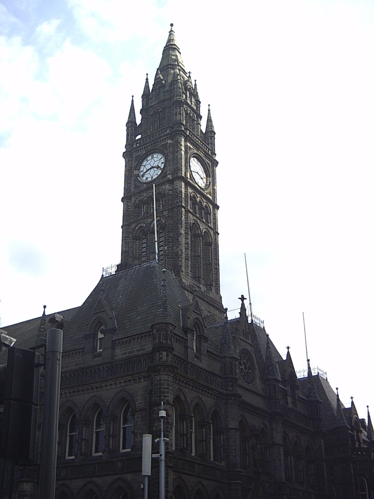


Middlesbrough, United Kingdom
Middlesbrough is a city of 142,707 people in England, United Kingdom, founded in 1830.
Why visit Middlesbrough
Townapedia lists 24 museums and landmarks, 20 parks and trails, 182 places to eat, 9 places to stay and 15 attractions in and around town.
Highlights include ARC Theatre & Arts Centre, Georgian Theatre, Middlesbrough Institute of Modern Art and Dorman Museum.
Weather in Middlesbrough
Forecast from MET Norway (CC BY 4.0). Full forecast
About Middlesbrough
Middlesbrough, colloquially known as Boro, is a port town and unitary authority of North Yorkshire, located in North East England. Situated on the southern bank of the River Tees, Middlesbrough forms part of the Borough of Middlesbrough, the Teesside built-up area and the Tees Valley. The town is governed by the Middlesbrough Council unitary authority, which is divided into twenty wards, as part of the Tees Valley Combined Authority along with Darlington, Hartlepool, Redcar and Cleveland, and Stockton-on-Tees. In 2021, it had a population of 148,215.
From the Wikipedia article Middlesbrough (this version), under CC BY-SA 4.0.
Travel tips from other travellers: Middlesbrough on Wikivoyage (CC BY-SA 4.0).
Photos of Middlesbrough


Things to do15

ARC Theatre & Arts Centre
Cinema and theater · 3.3 mi
Arts centre and theatre in Stockton-on-Tees, England

Georgian Theatre
Cinema and theater · 3.2 mi
Theatre in Stockton-on-Tees, England

Infinity Bridge
Bridge · 2.7 mi
Footbridge in Stockton-on-Tees, England
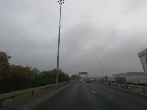


Surtees Rail Bridge
Bridge · 3.4 mi
Rail-bridge over the River Tees, Northern England



Middlesbrough Theatre
Cinema and theater · 1.5 mi
Theatre in Middlesbrough, England
Globe Theatre
Cinema and theater · 3.2 mi
Theatre and cinema in Stockton-on-Tees, England
3 more on the map.
Museums and landmarks24

Middlesbrough Institute of Modern Art
Museum
Art Museum in Middlesbrough, England
Centre Square, Middlesbrough
Mo-Sa 10:00-16:30; Su 12:00-16:00

Dorman Museum
Museum · 0.9 mi
Museum in Middlesbrough, England, United Kingdom
Linthorpe Road, Middlesbrough

Tees Transporter Bridge
Monument and historic site · 0.6 mi
Mo-Fr 07:15-12:00,13:00-18:15; Sa 09:30-12:00,13:00-15:00; Dec...

Captain Cook Birthplace Museum
Museum · 2.9 mi
Museum in Marton, North Yorkshire, England, United Kingdom

The Cenotaph, Middlesbrough
Monument and historic site · 0.8 mi
Grade II listed war memorial in Middlesbrough, United Kingdom


Stockton-on-Tees War Memorial
Monument and historic site · 3.2 mi
War memorial in Stockton-on-Tees, County Durham, England, UK

12 more on the map.
Parks, trails and playgrounds20

Albert Park
Park · 0.8 mi
Park in Middlesbrough, North Yorkshire, England, UK
Maze Park Nature Reserve
Park · 1.8 mi
Park in Middlesbrough, United Kingdom

Portrack Incinerator
Park · 1.3 mi
Former waste and power plant in England
RSPB Salthome
Park · 1.9 mi
Saltholme RSPB managed nature reserve near Middlesborough, UK



Teessaurus Park
Park · 1.0 mi
Sculpture park in North Yorkshire, England
Stewart Park, Middlesbrough
Park · 2.8 mi
Public park in North Yorkshire, England
Teesdale Business Park
Park · 2.9 mi
Business park in Thornaby-on-Tees, England, UK

8 more on the map.
Restaurants and cafes182





The Yellow Rose
Bar and pub · 1.2 mi
Roman Road, Middlesbrough
Mo-Fr 11:00-23:30; Sa-Su 11:00-24:00
170 more on the map.
History
Middlesbrough started as a Benedictine priory on the south bank of the river Tees; its name was possibly derived from it being midway between the holy sites of Durham and Whitby. The earliest recorded form of Middlesbrough's name is "Mydilsburgh". Some believe the name means 'middle fortress', since it was midway between the two religious houses of Durham and Whitby; others state that it is an Old English personal name (Midele or Myhailf) combined with burgh, meaning town.
In 686, a monastic cell was consecrated by St Cuthbert at the request of St Hilda, Abbess of Whitby. The cell evolved into Middlesbrough Priory. The manor of Middlesburgh belonged to Whitby Abbey and Gisborough Priory. Robert Bruce, Lord of Cleveland and Annandale, granted and confirmed, in 1119, the church of St. Hilda of Middleburg to Whitby. Up until its closure on the Dissolution of the Monasteries by Henry VIII in 1537, the church was maintained by 12 Benedictine monks, many of whom became vicars, or rectors, of various places in Cleveland.
After settlement by the Angles, the area became home to Viking settlers. Names of Viking origin (with the suffix by, meaning village) are abundant; for example, Ormesby, Stainsby and Tollesby. These were once separate villages named after Vikings called Orm, Steinn and Toll; they are now areas of Middlesbrough that were recorded in Domesday Book, of 1086.
Read more of the history
In 1801, Middlesbrough was a small farming township with a population of just 25. From 1829 onwards, it experienced rapid growth. In 1828, the influential Quaker banker, coal-mine owner and Stockton and Darlington Railway shareholder Joseph Pease sailed up the River Tees to find a suitable new site downriver of Stockton on which to place new coal staithes. As a result, in 1829, he and a group of Quaker businessmen bought the Middlesbrough farmstead and associated estate, some 527 acres (213 ha) of land and established the Middlesbrough Estate Company.
Through the company, the investors set about a new coal port development (designed by John Harris) on the southern banks of the Tees. The first coal shipping staithes at the port (known as "Port Darlington") were constructed with a settlement to the east established on the site of Middlesbrough farm as labour for the port, taking on the farm's name as it developed into a village.
The port was linked to the S&DR on 27 December 1830 via a branch that extended to an area just north of the current Middlesbrough railway station.
The success of the port meant it soon became overwhelmed by the volume of imports and exports; in 1839, work started on a dock to the east of Middlesbrough. The first water for the dock was let in on 19 March 1842, while the formal opening took place on 12 May 1842.
Iron dominated the Tees area since 1841, when Henry Bolckow in partnership with John Vaughan, founded the Vulcan iron foundry and rolling mill. Vaughan introduced the new 'Bell Hopper' system of closed blast furnaces developed at the Ebbw Vale works. The new system and nearby abundant supply of Ironstone in the Eston Hills in 1850, made the works a success with the area becoming known as the "Iron-smelting centre of the world" and Bolckow, Vaughan & Co., Ltd the largest company in existence at the time.
Middlesbrough's population grew quickly from 40 people in 1829 to 7,600 by 1851. Pig iron production rose tenfold between 1851 and 1856 and, by the mid-1870s, Middlesbrough was producing one third of the nation's pig iron output. During this time, the town earned the nickname Ironopolis.
On 21 January 1853, Middlesbrough received its Royal Charter of Incorporation, giving the town the right to have a mayor, aldermen and councillors. Henry Bolckow became mayor, in 1853.
In the latter half of the 19th century, Old Middlesbrough was starting to decline and was overshadowed by developments built around the new town hall, south of the original town hall.
On 15 August 1867, a Reform Bill was passed, making Middlesbrough a new parliamentary borough; Bolckow was elected member for Middlesbrough the following year.
The town's rapid expansion continued throughout the second half of the 19th century, fuelled by the iron and steel industry, and the population reached 90,000 by the dawn of the 20th century.
Middlesbrough was the first major British town and industrial target to be bombed during the Second World War, although the official date of the Blitz is a few months later. The steel-making capacity and railways for carrying steel products were obvious targets. The Luftwaffe first bombed the town on 25 May 1940, when a lone bomber dropped 13 bombs between South Bank Road and the South Steel plant. More bombing occurred throughout the course of the war, with the railway station put out of action for two weeks in 1942.
By the end of the war, more than 200 buildings had been damaged or destroyed in the Middlesbrough area. Areas of early- and mid-Victorian housing were demolished and much of central Middlesbrough was redeveloped. Heavy industry was relocated to areas of land better suited to the needs of modern technology. Middlesbrough itself began to take on a completely different look.
The transition from post-war industrial to modern non-industrial Middlesbrough changed the town; many buildings were replaced and roads built. The A66 road was built through the town in the 1980s and the Royal Exchange was demolished to make way for it.
Middlesbrough F.C.'s modern Riverside Stadium opened on 26 August 1995, next to Middlesbrough Dock. The club moved from Ayresome Park, which had been its home for 92 years.
From the History section of Middlesbrough on Wikipedia, under CC BY-SA 4.0.
More about Middlesbrough
Geography
The following 20 wards comprise the Middlesbrough built-up area:
Middlesbrough has an oceanic climate typical for the United Kingdom. Being sheltered from prevailing south-westerly winds by the Lake District and Pennines to the west, and the Cleveland Hills to the south, it is in one of the relatively dry parts of the country, receiving on average 596 millimetres (23.5 inches) of rain per year. Temperatures range from mild summer highs in July and August typically around 21 °C (70 °F), to winter lows in December and January falling to around 1 °C (34 °F).
Seasonal variations are small and both the mild summers and cool winters are far removed from the average climates of the latitude (54.5°N). This is mainly due to the British Isles being a relatively small land mass surrounded by water, the mild south-westerly Gulf Stream air that dominates the British Isles, and the propensity for cloud cover to limit temperature extremes. In nearby Scandinavia, more than ten degrees further north, there are coastal Bothnian climates with warmer summers than Middlesbrough; winters in Middlesbrough can be less cold than those at lower latitudes in mainland Europe.
Arts and culture
The Middlesbrough Mela is an annual, multi-cultural festival attracting an audience of up to 40,000 to enjoy a mix of live music, food, craft and fashion stalls. It began in Middlesbrough's Central Gardens, now Centre Square, and is either held there or in Albert Park.
Middlesbrough also has a healthy musical heritage. A number of bands and musicians hail from the area, including Chris Rea, Paul Rodgers and Micky Moody.
Middlesbrough Town Hall is the pre-eminent theatre venue. It has two concert halls: a classic Victorian concert hall with a proscenium stage and seating 1,190; the other, under the main hall, is called the Middlesbrough Crypt and has a capacity of up to 600. The venue is run by Middlesbrough Council and is funded, in part, by Arts Council England as a National Portfolio Organisation specialising in music. It was refurbished with the assistance of the National Lottery Heritage Fund and reopened in 2018.
The Middlesbrough Theatre (formerly the Little Theatre) is in the suburb of Linthorpe. It was designed by architects Elder & De Pierro and was the first purpose designed theatre to be erected in post-war England, when it was opened on 22 October 1957 by Sir John Gielgud.
The Dorman Memorial Museum, which was founded by Sir Arthur Dorman and specialises in social and local history.
Education
Teesside University traces back to 1930 at the opening of Constantine Technical College, located on Borough Road, in the town centre. The then college expanded through acquiring adjacent buildings, such as Middlesbrough High School, and by building Middlesbrough Tower. It became Teesside Polytechnic in 1969.
In 1992, the polytechnic gained university status, becoming the University of Teesside. Extramural classes had previously been provided by the University of Leeds Adult Education Centre on Harrow Road, from 1958 to 2001. It was rebranded in 2009 to Teesside University. It further expanded in size and courses available, with student numbers increasing to approximately 20,000 studying at the university in 2018.
The university is a major presence in the town. It has a growing reputation for developing digital businesses particularly in the field of digital animation and for hosting the Animex festival.
The Boho zone in the town now houses a large number of these start-up digital businesses. The university has 18,000 students, 2,400 staff and operates a campus in Middlesbrough town-centre; it has benefited from around £250 million of investment in recent years, including the £30 million Campus Heart scheme.
From the Wikipedia article Middlesbrough, under CC BY-SA 4.0.
Notable people from Middlesbrough
 Stewart DowningEnglish association football player (born 1984)Photo: Egghead06, CC BY-SA 4.0
 Brian CloughEnglish football player and manager (1935–2004)Photo: Hans van Dijk for Anefo, CC0
 James ArthurBritish singer (born 1988)Photo: Harald Krichel, CC BY-SA 3.0
 Paul RodgersBritish-Canadian musicianPhoto: Thomas Steffan by using Olympus Camedia C700, CC BY-SA 3.0
 Jonathan WoodgateEnglish footballer and managerPhoto: Timmy96, CC0
 Faye MarsayBritish actressPhoto: Gage Skidmore, CC BY-SA 3.0
 Wilf MannionEnglish footballer (1918-2000)Photo: Chemical Engineer, Public domain
 Chris TomlinsonBritish athletePhoto: Yann Caradec from Paris, France, CC BY-SA 2.0
- Chris ReaEnglish male singer-songwriter and guitarist (1951–2025)
- Don RevieEnglish footballer and manager (1927-1989)
- Matt JarvisEnglish association football player (born 1986)
- Wendy RichardBritish actress (1943–2009)
Born in Middlesbrough, according to Wikidata (CC0). Each name links to its Wikipedia article.
Where to stay9
Churches and places of worship31
Parish Church of Saint John the Evangelist
Church · Anglican · 0.4 mi
61 North Ormesby Road, Middlesbrough
Saint Alphonsus Church
Church · Catholic · 1.1 mi
95 Westbourne Grove, Middlesbrough
Shopping30
Gas and EV charging6
Schools, colleges and libraries19
Healthcare15
Oakfield Medical Centre
Clinic and pharmacy · 0.8 mi
1 Trinity Mews, Middlesbrough
Resolution Medical Centre
Clinic and pharmacy · 0.8 mi
11 Trinity Mews, Middlesbrough
Westbourne Medical Centre
Clinic and pharmacy · 0.8 mi
7 Trinity Mews, Middlesbrough
Map of Middlesbrough
250 places. The map loads OpenStreetMap tiles when you open it.
Getting there and nearby towns
Teesside International Airport (MME) is the nearest airport with scheduled flights listed in OpenStreetMap, 9 miles away.
- Billingham 2 mi west, about 4 min by car
- Stockton-on-Tees 3 mi west, about 5 min by car
- Thornaby-on-Tees 4 mi southwest, about 6 min by car
- Eston 4 mi east, about 6 min by car
- Greatham 5 mi north, about 7 min by car
- Eaglescliffe 6 mi southwest, about 9 min by car
- Kirkleatham 6 mi east, about 10 min by car
- Sunderland 23 mi north, about 38 min by car
- Newcastle upon Tyne 31 mi northwest, about 50 min by car
- York 43 mi south, about 1 h 15 min by car
Drive times are estimates from straight-line distance, not routes.
Towns near Middlesbrough


Keep exploring
Local news
Headlines from INDB.
Reviews, tips and questions
Loading what members have shared...
Sources and licences
- GeoNames (CC BY 4.0): population, coordinates, regions and time zone
- Mapillary (see each image): photos
- OpenStreetMap contributors (ODbL 1.0): places, airports, map data
- Wikidata (CC0 1.0): elevation, founding date, time zone, website, landmarks and historic places
- Wikimedia Commons (see each image): photos
- Wikipedia (CC BY-SA 4.0): overview and history text
Photo credits
- Middlesbrough Town Hall, Yorkshire, Originally uploaded by MarcusBritish (Transferred by Hogweard ), CC BY-SA 3.0
- Town hall middlesbrough - panoramio, Neil Gray, CC BY-SA 3.0
- Middlesbrough Town Hall (49498291996), Reading Tom from Reading, UK, CC BY 2.0
- Newport Road, Middlesbrough - panoramio, Neil Gray, CC BY-SA 3.0
- ARC Theatre & Arts Centre, Stockton on Tees, Petegal-half, CC BY-SA 3.0
- Georgian Theatre, Stockton on Tees, Petegal-half, CC BY-SA 3.0
- Infinity Bridge from the Tees Barrage-1200, JohnYeadon, CC0
- Princess of Wales Bridge from south bank upriver, John Yeadon, CC BY 3.0
- Surtees Bridge-from West bank-1-1200, JohnYeadon, CC BY 3.0
- Tees Bridge (Rail), John Yeadon, CC BY-SA 4.0
- Tees Barrage - downstream view-1080, JohnYeadon, CC BY 3.0
- Christmas Walk Newport Bridge (31102933304) (cropped), Paul Hudson from United Kingdom, CC BY 2.0
- A19 Tees Viaduct rom Maze Park viewing hill-2-1088, JohnYeadon, CC BY 3.0
- Middlesbrough Institute of Modern Art - MIMA, Francis Hannaway, CC BY-SA 3.0
- Dorman museum angled view, Geni, CC BY-SA 4.0
- Captain Cook Museum, JohnYeadon, CC BY-SA 3.0
- Albert Park 2011, MarcusBritish at English Wikipedia, CC BY-SA 3.0
- Portrack meadows-800, JohnYeadon, CC BY 3.0
- St Mary's Church, Stockton-on-Tees, Simon, CC BY-SA 2.0 uk
- County Durham, STOCKTON ON TEES, Stockton Parish Church (36006280105), The National Churches Trust, CC BY 2.0
- The Cenotaph in Middlesbrough, Anthony Winward, CC BY 3.0
- Middlesbrough riverside stadium, Arne Müseler, CC BY-SA 3.0 de
- Holy Trinity, NORTH ORMESBY, Nez202 at English Wikipedia, Public domain
- Stanley Hollis memorial statue, CD1965, CC BY-SA 4.0
- River Tees Transporter Bridge 07, The joy of all things, CC BY-SA 4.0
- East Stand, Ayresome Park, Stephen McCulloch, CC BY-SA 2.0
- Trinity Green Stockton, Andrew Duffell ( talk ), CC BY-SA 3.0
- Middlesbrough - Church of St John the Evangelist - 2025-09-01 00-42-32 001, Warofdreams, CC BY-SA 4.0
- Centre north east - panoramio, Neil Gray, CC BY-SA 3.0
- Triads Clothing, Warofdreams, CC BY-SA 4.0
- 58 Albert Road, Warofdreams, CC BY-SA 4.0
- Bar Cuda, Warofdreams, CC BY-SA 4.0
- Street-level photo, l1ndemann, CC BY-SA 4.0
- Street-level photo, l1ndemann, CC BY-SA 4.0
- Street-level photo, l1ndemann, CC BY-SA 4.0
- Street-level photo, floatingboater, CC BY-SA 4.0
- Street-level photo, floatingboater, CC BY-SA 4.0
- Street-level photo, floatingboater, CC BY-SA 4.0
- Street-level photo, southglos, CC BY-SA 4.0


Page built November 10, 2026. Spotted a mistake? Tell us or suggest a place.