
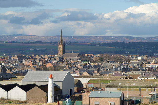


Montrose, United Kingdom
Montrose is a town of 11,730 people in Scotland, United Kingdom.
Why visit Montrose
Townapedia lists 29 museums and landmarks, 14 parks and trails, 50 places to eat, 5 places to stay and 4 attractions in and around town.
Highlights include Scurdie Ness Lighthouse, Lower North Water Bridge, Montrose Museum and Montrose Air Station Heritage Centre.
Weather in Montrose
Forecast from MET Norway (CC BY 4.0). Full forecast
About Montrose
Montrose ( mun-TROHZ; Scottish Gaelic: Mon Rois [mɔn ˈrˠɔʃ]) is an historic coastal town and former royal burgh in Angus, Scotland. It is situated 28 miles (45 kilometres) north of Dundee and 37 miles (60 kilometres) south of Aberdeen, Montrose lies between the mouths of the North and South Esk rivers. It is the northernmost coastal town in Angus and developed as a natural harbour that traded in skins, hides, and cured salmon in medieval times.
From the Wikipedia article Montrose, Angus (this version), under CC BY-SA 4.0.
Travel tips from other travellers: Montrose on Wikivoyage (CC BY-SA 4.0).
Photos of Montrose


Things to do4

Scurdie Ness Lighthouse
Lighthouse · 1.5 mi
Lighthouse in Angus, Scotland, UK

Lower North Water Bridge
Bridge · 2.4 mi
Bridge in Aberdeenshire, Scotland


Museums and landmarks29

Montrose Museum
Museum · 0.5 mi
Museum in Montrose, Angus, Scotland, United Kingdom
Panmure Place, Montrose
Tu-Sa 10:00-17:00

Montrose Air Station Heritage Centre
Museum · 0.7 mi
Aviation museum in Montrose, Angus, Scotland, UK

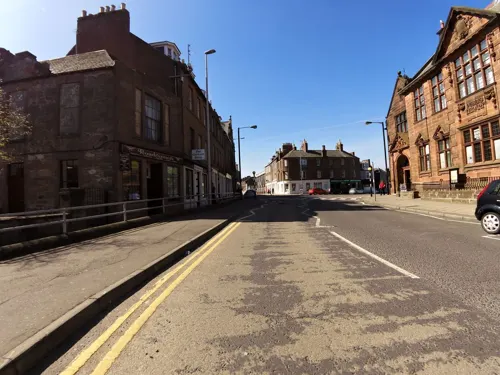


Stone of Morphie
Monument and historic site · 2.7 mi
Standing stone in Aberdeenshire, Scotland, UK
17 more on the map.
Parks, trails and playgrounds14

Montrose Basin
Park · 1.5 mi
River estuary and nature reserve in Angus, Scotland, UK






2 more on the map.
Restaurants and cafes50
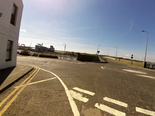
Stroma Bistro
Restaurant · 0.7 mi
1-4 Wharf Street, Montrose
Tu-Fr 12:00-14:00,17:00-21:00; Sa,Su 12:00-15:30,16:00-21:00
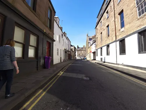

Roo's Leap
Restaurant · Australian · 0.5 mi
2 Traill Drive, Montrose
Mo,We-Fr,PH 12:00-14:30,17:00-21:00; Sa-Su,PH 12:00-21:00

Pavilion Cafe
Cafe · 0.6 mi
Christie's Lane, Montrose
We-Sa 09:30-15:00

Sharkys
Bar and pub · Regional, Burger, Pasta · 0.5 mi
21 George Street, Montrose
Mo-Su 12:00-01:00
Montrose Basin Wildlife Centre Cafe
Cafe · 1.5 mi
Rossie Braes, Montrose
Feb 14-Oct 31 10:30-17:00; Nov 1-Feb 13 10:30-16:00; Nov 1-Feb 13 Tu-Th off
38 more on the map.
History
Prehistoric elements are found in the vicinity of Montrose, including the Stone of Morphie located to the north. One ancient name for Montrose was Celurca. The place-name is formed from the Scottish Gaelic Moine (meaning moor or peat moss) and Ros (meaning peninsula or promontory), perhaps ultimately of Pictish origin. The first documentary evidence of the existence of Montrose is the burgh charter issued by David I, ′who founded the town around 1140 as Sallorch or Sallork. By 1178 the name had taken the form Munross before becoming Montrose. Folk etymology attributes the origin of the town's name as "Mount of Roses". This is reflected by the motto on the town's seal: Mare ditat, rosa decorat. (English: The sea enriches, the rose adorns)
Montrose was visited and plundered in numerous instances by Danes. In 980 it was sacked and razed to the ground. It was once believed that a castle had existed in Montrose in the 10th century and was destroyed by Kenneth III. However the authenticity of this account has been disputed.
Read more of the history
In the two subsequent centuries there are no precise dates in its history. During the 1140s it was an important trading town. The trading revenues received from Montrose as well as Forfar and Dundee were acquired by Malcolm IV and contributed to Restenneth Priory. In 1178 William the Lion built a castle nearby in which he would occasionally reside. The ruins have acquired the name Red Castle. The last record of a charter there was in 1198. A convent dedicated to the Virgin Mary is said to have been founded in 1230 by Alan Durward but the precise location is unknown. In 1244 the town succumbed to fire.
In July 1296 during the Wars of Independence, Edward I of England visited the town with 30,000 of his men and stayed at Munros castle for three nights. Some accounts state that it was there that he humiliated the Scottish king, John de Balliol, by publicly stripping him of his royal insignia and status; other accounts claim that this occurred in Brechin. Twelve burgesses of the town swore allegiance to Edward I to protect themselves and the community of the town. The following year the castle, which was manned by an English garrison, was destroyed by William Wallace who is said to have slain all soldiers in sight. The site of the castle, known as Castlestead, is at the southern end of the High Street. David II visited it towards the end of his reign in 1371. The Dukedom of Montrose was created in 1488.
During the 15th century, the inhabitants of the town found themselves increasingly under heel of the Lairds of Dun who ransacked and took possession of property and cattle. The lairds are said to have arrived in the middle of one night on horseback heavily armed. The burghesses of the town immediately sent out an appeal to the Duke of Montrose for protection but the messenger was purportedly murdered before the appeal arrived. It was then that James IV of Scotland intervened and settled the matter.
From its early inception as a port Montrose had traded in skins, hides and cured salmon, and in the 17th century Montrose also began to export wheat and barley in regular trading transactions with the Hanseatic League. The town imported flax and timber from the Baltic; salt, fruit and wine from France and Portugal. The wealth this brought to the town is demonstrated in the surviving houses built by landowning and merchant families, as well as local street names of "America Street", "California Street", "Baltic Street" and "India Street" evidencing its trading heritage.
The site of the castle, now known as Castlestead, was the birthplace of the famous James Graham, 1st Marquess of Montrose. Graham signed the National Covenant against Charles I's reorganisation of the Kirk in Scotland, fighting in the ensuing Bishops' Wars, but later switched to the king's side, only to be captured and executed in Edinburgh in 1650.
Between 1677 and the summer of 1678, Dronner, a Dutch engineer, began to build a dyke across the Montrose Basin, designed to drain and reclaim the northern half of the basin. However the dyke was destroyed in a storm soon afterwards. One of the most vocal objectors to the scheme was the elderly Meggie Cowie, who was said to have made blasphemous comments to those who were involved. She was tried for witchcraft, found guilty, and burnt at the stake on 14 January 1679.
The final chapter of the ill-fated 1715 Jacobite rebellion was also played out in Montrose. Towards the end of the uprising (which had lasted nearly six months, from September 1715 to February 1716) James Francis Edward Stuart (the Old Pretender; formerly James, Prince of Wales) arrived in Montrose, where he spent his last night in Scotland, on 4 February 1716. He sailed from Montrose to exile in France. The town was held for his son, Charles Edward Stuart (Bonnie Prince Charlie; the Young Pretender), 30 years later and in February 1746 the largest naval battle of the war was fought in Montrose Harbour.
During the 18th century the town was a major smuggling centre. It profited from the slave trade, but only for a brief time. The wealth accrued by trade was substantial. Wealthy merchants in the 18th and 19th centuries dominated the town and built their houses gable to gable. Hence Montrosians have inherited the sobriquet, "gable-enders". A statistical account taken between 1791 and 1799 estimates the population in the 1750s as 4,248; in 1776 as 4,465; in 1784 as 4,866 and in 1790 as 5,194. Contemporaries expected that many would emigrate at the conclusion of the American Revolutionary War, but those who did leave were few.
Samuel Johnson made a tour of the town on his visit to Scotland in the 1770s. He said of it:
From the History section of Montrose, Angus on Wikipedia, under CC BY-SA 4.0.
More about Montrose
Geography
Montrose occupies a position on the north bank of Montrose Basin at the mouth of the River South Esk on the east coast of Scotland, 11 miles (18 km) NNE of Arbroath, 19 miles (31 km) SW of Stonehaven, and 7.2 miles (12 km) ESE of Brechin. The town lies 62.2 miles (100 km) NNE of Edinburgh, and 373.2 miles (601 km) NNW of London. The built-up area occupies a roughly rectangular shape 2 miles (3 km) long by 0.75 miles (1 km) wide, aligned in a north–south orientation. The land is relatively flat, rising gradually to around 15m elevation to the north of the town.
The expanse of the town extends to the villages on its fringes; Hillside and Ferryden. It lies close to the hamlets of Lunan and St Cyrus. The rural location ensures that the air quality is good, with low levels of nitrogen dioxide and PM10.
The Montrose Basin is a shallow estuary approximately three miles in diameter. It is situated where the River South Esk meets the North Sea. During the 16th century, local landowners desiring more arable land considered reducing its size, but their plans were never carried out.
In 1981 the Montrose Basin Nature Reserve was created. The Scottish Wildlife Trust operates a modern, purpose-built wildlife centre at Rossie Braes, which offers good telescopic and televisual views of the area, and of the thousands of migratory birds which pass through the area in all seasons.
Economy
The economy of the town has been expanding since the end of the Second World War. GlaxoSmithKline has been a major source of jobs since the 1950s. Other significant employers include Tesco, Co-operative Group, Petrofac, National Oilwell Varco, Baker Hughes and Argos. The Lochside Distillery, located on Brechin Road north of the town centre, was closed down in the 1990s and the buildings demolished in 2005 after a fire. Four commercial units were built on the site in 2018. BT initially upgraded the local telephone exchange to grant the town access to super fast fibreoptic broadband services, one of only three towns to be chosen in Scotland. The average price of housing in the town is between £106,054 and £131,539, a rise on the 1998 average between £42,640 and £51,200.
Arts and culture
Montrose is regarded as the culture and sculpture capital of Angus, with over 20 statues of note scattered around the town. They are a mix of modern and classical works, with many by the local sculptor, William Lamb ARSA, an artist of exceptional talent. From the 1920s to 1940s local architect George Fairweather's studio provided a forum for lively debate by an artistic community that included Hugh MacDiarmid, Edwin Muir, William Lamb, Helen Cruickshank and Fionn MacColla. The local weekly newspaper, the Montrose Review, was edited by MacDiarmid.
Since 2008 Montrose has hosted the Montrose Music Festival, or Mo Fest, which takes place each year at the end of May. It has become one of Scotland's biggest free live music festivals.
The Montrose Playhouse is a community-led cinema and arts venue, which opened in 2021. Originally a historic swimming pool, the building has been transformed into a multi-purpose space that hosts film screenings, live performances and educational events. With the closing of the Belmont in Aberdeen it has now established itself as a leading cultural hub in the region, especially for independent cinema.
Montrose is also a qualifying course for The Open Championship. Past events hosted on the Montrose Links include:
Scottish Amateur Championship, 1905, 1913, 1919, 1926 and 1925
British Boys Championship, 1991; Scottish Universities Championship
Education
Schools include six primary schools - Lochside, Ferryden, Southesk, Rosemount, Borrowfield and St Margaret's - and one secondary school, Montrose Academy.
From the Wikipedia article Montrose, Angus, under CC BY-SA 4.0.
Notable people from Montrose
 Allan HumeBritish Ornithologist and Founder of the Indian National Congress (1829–1912)Photo: Allan Octavian Hume, Public domain
 Alexander BurnesBritish explorer and political officer in British India (1805-1841)Photo: Print made by: Lowes Cato Dickinson..., Public domain
 William PatersonScottish soldier and botanist in Tasmania (1755-1810)Photo: Unknown author Unknown author, Public domain
 Joseph HumeScottish surgeon and Radical politician (1777-1855)Photo: John Whitehead Walton, Public domain
 Michael Forsyth, Baron Forsyth of DrumleanBritish politician and life peer (born 1954)Photo: ©House of Lords / photography by Roger Harris, CC BY 3.0
- Robert BrownBritish botanist (1773-1858), discoverer of the cell nucleus and of Brownian Motion (1773–1858)
- James Graham, 1st Marquess of MontroseScottish nobleman, poet and soldier of the Wars of the Three Kingdoms (1612-1650)
- Ernie CoplandScottish footballer (1927-1971)
- John McGovernScottish association football player and manager (born 1949)
- George WishartScottish Protestant martyr; (1513-1546)
- Andrew MelvilleScottish scholar, theologian and religious reformer
- John WishartBritish statistician (1898-1956)
Born in Montrose, according to Wikidata (CC0). Each name links to its Wikipedia article.
Where to stay5
Churches and places of worship11
Montrose Old and St Andrew's Church
Church · Church Of Scotland · 0.4 mi
High Street, Montrose
Melville South Church
Church · Church Of Scotland · 0.6 mi
52C Castle Street, Montrose
The Church of Jesus Christ of Latter-day Saints
Church · Latter Day Saints · 0.9 mi
50 Coronation Way, Montrose
Shopping11
Gas and EV charging2
Schools, colleges and libraries8
Dundee and Angus College - Montrose Learning Centre
School
62 North Esk Road, Montrose
Healthcare3
Map of Montrose
137 places. The map loads OpenStreetMap tiles when you open it.
Getting there and nearby towns
Leuchars Station (ADX) is the nearest airport with scheduled flights listed in OpenStreetMap, 28 miles away.
- Ferryden 1 mi south, about 2 min by car
- Hillside 2 mi north, about 3 min by car
- Saint Cyrus 4 mi northeast, about 7 min by car
- Brechin 7 mi west, about 12 min by car
- Laurencekirk 8 mi north, about 13 min by car
- Stonehaven 20 mi northeast, about 32 min by car
- Dundee 26 mi southwest, about 42 min by car
- Saint Andrews 29 mi southwest, about 47 min by car
- Aberdeen 33 mi northeast, about 52 min by car
- Perth 43 mi southwest, about 1 h 15 min by car
Drive times are estimates from straight-line distance, not routes.
Towns near Montrose


Keep exploring
Local news
Headlines from INDB.
Reviews, tips and questions
Loading what members have shared...
Sources and licences
- GeoNames (CC BY 4.0): population, coordinates, regions and time zone
- Mapillary (see each image): photos
- OpenStreetMap contributors (ODbL 1.0): places, airports, map data
- Wikidata (CC0 1.0): elevation, founding date, time zone, website, landmarks and historic places
- Wikimedia Commons (see each image): photos
- Wikipedia (CC BY-SA 4.0): overview and history text
Photo credits
- Viewofmontrose, Alan Morrison, CC BY-SA 2.0
- St Margaret's Primary School, Blackfriars Street, Montrose, Bascharlau, CC BY-SA 4.0
- 31, 33 North Esk Road, Montrose, Bascharlau, CC BY-SA 4.0
- Netherlea, 37 North Esk Road, Montrose, Bascharlau, CC BY-SA 4.0
- 17-19 Murray Street, Montrose, Bascharlau, CC BY-SA 4.0
- Cranes Meadow, 28 The Mall, Montrose, Bascharlau, CC BY-SA 4.0
- 61, 63, 65 Murray Street, Montrose, Bascharlau, CC BY-SA 4.0
- 87-91 Murray Street, Montrose, Bascharlau, CC BY-SA 4.0
- 103 Murray Street, Montrose, Bascharlau, CC BY-SA 4.0
- Sunday School, 38 North Esk Road, Montrose, Bascharlau, CC BY-SA 4.0
- North Signal Box, Montrose Station, Basin View, Montrose, Bascharlau, CC BY-SA 4.0
- Scurdie Ness Lighthouse, Kevan Dickin, CC BY-SA 3.0
- Montrose Museum, Russ Hamer, CC BY-SA 3.0
- Montrose Basin, friedfish, Public domain
- Auldkirk, Dona Robbins, CC BY-SA 2.0
- MASHC, Kevan Dickin, CC BY-SA 3.0
- Montrose Academy front, Ann Harrison, CC BY-SA 2.0
- Montrose, High Street, Statue Of Sir Robert Peel, Bascharlau, CC BY-SA 4.0
- Montroseacademy, Stanley Howe, CC BY-SA 2.0
- Montrose Air Station, Kevan Dickin, CC BY-SA 4.0
- The Montrose Playhouse, The Montrose Playhouse, CC BY-SA 4.0
- The North Water Viaduct and Lower North Water Bridge, Thomas Fuhrmann, CC BY-SA 4.0
- Joseph Hume statue, Montrose closeup, Nick Birse, CC BY-SA 4.0
- Street-level photo, smsm1, CC BY-SA 4.0
- Street-level photo, smsm1, CC BY-SA 4.0
- Street-level photo, smsm1, CC BY-SA 4.0
- Street-level photo, smsm1, CC BY-SA 4.0
- Street-level photo, smsm1, CC BY-SA 4.0
- Street-level photo, smsm1, CC BY-SA 4.0
- Street-level photo, smsm1, CC BY-SA 4.0
- Street-level photo, smsm1, CC BY-SA 4.0
- Street-level photo, smsm1, CC BY-SA 4.0
- Street-level photo, smsm1, CC BY-SA 4.0
- Street-level photo, smsm1, CC BY-SA 4.0
- Street-level photo, drnoble, CC BY-SA 4.0
- Street-level photo, smsm1, CC BY-SA 4.0


Page built November 10, 2026. Spotted a mistake? Tell us or suggest a place.