


Why visit Poole
Townapedia lists 46 museums and landmarks, 89 parks and trails, 171 places to eat, 43 places to stay and 26 attractions in and around town.
Highlights include Bourne Valley Viaducts, Lady Wimborne Bridge, Poole Museum and Baden-Powell First Camp Memorial.
Weather in Poole
Forecast from MET Norway (CC BY 4.0). Full forecast
About Poole
Poole is a coastal seaport town, on the south coast of England and civil parish in the Bournemouth, Christchurch and Poole unitary authority area in Dorset, England. The town is 21 miles (34 km) east of Dorchester and adjoins Bournemouth to the east. The town had an estimated population of 143,418 in 2024, making it the second-largest town in the ceremonial county of Dorset. Together with Bournemouth and Christchurch, the conurbation has a total population of 400,196 as of the 2021 census.
From the Wikipedia article Poole (this version), under CC BY-SA 4.0.
Travel tips from other travellers: Poole on Wikivoyage (CC BY-SA 4.0).
Photos of Poole


Things to do26


Lady Wimborne Bridge
Bridge · 5.3 mi
Bridge in Poole, Dorset, England, UK

Pavilion Theatre
Cinema and theater · 4.8 mi
Theatre in Bournemouth, Dorset, England, UK

The Lighthouse
Cinema and theater · 0.8 mi
Arts centre (concert hall, theatre and cinema) in Poole, Dorset, UK

Bournemouth Little Theatre club
Cinema and theater · 5.2 mi
Community theatre in Bournemouth,England
Bournemouth Winter Gardens
Cinema and theater · 4.6 mi
Former theatre in Bournemouth, England
Brownsea Open Air Theatre
Cinema and theater · 3.6 mi
Theatre in Dorset, England


Tivoli Theatre
Cinema and theater · 6.0 mi
Theatre in Wimborne Minster, England
Vue Poole
Cinema and theater · 2.6 mi
Taken over by Vue which used to be a Cineworld. Located on the Ground floor of Tower Park, which has a shared lift with Lemur Landings...
Tower Retail Park, Poole
14 more on the map.
Museums and landmarks46


Baden-Powell First Camp Memorial
Monument and historic site · 1.8 mi

Bournemouth War Memorial
Monument and historic site · 4.5 mi
War memorial in Bournemouth, Dorset, England, UK

Corfe Castle
Monument and historic site · 6.1 mi
Fortification in Dorset, England, UK

Bournemouth North Cemetery and Bournemouth Crematorium
Monument and historic site · 6.1 mi
Historic cemetery in Dorset, England
Dudsbury Camp
Monument and historic site · 6.1 mi
Hillfort in Dorset, England, UK
Mortar Wreck
Monument and historic site · 4.7 mi
Medieval shipwreck near Dorset, England

Purbeck Mining Museum
Museum · 5.8 mi
Museum near Corfe Castle, Dorset, England, UK
Rempstone Stone Circle
Monument and historic site · 5.4 mi
Stone circle in Corfe Castle, Dorset, England, UK
34 more on the map.
Parks, trails and playgrounds89



Arne RSPB reserve
Park · 3.2 mi
RSPB nature reserve in the United Kingdom

77 more on the map.
Restaurants and cafes171

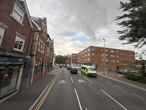




Café Villano
Cafe · Coffee Shop, Sandwich, Ice Cream, Regional · 2.1 mi
Poole Harbour, Poole
10:20-17:00

Hinar Kitchen
Restaurant · International, Mediterranean
22 High Street
Mo-Fr 11:00-21:00; Sa 11:00-22:00; Su 11:00-21:00
159 more on the map.
History
The area around modern Poole has been inhabited for at least the past 2,500 years, with nearby Christchurch Harbour evidencing human activity dating back to the Neolithic period at Hengistbury Head. During the 3rd century BC, Celtic-speaking people known as the Durotriges moved from hilltop settlements at Maiden Castle and Badbury Rings to heathland around the River Frome and Poole Harbour. The Romans landed at Poole during their conquest of Britain in the 1st century and took over an Iron Age settlement at Hamworthy, an area just west of the modern town centre. This was used as a supply base for the fortress at Lake Farm, Ashington and a settlement at Vindocladia (Bradbury Rings).
The town's name may have originated around the post-Roman or Anglo-Saxon periods, and seems to have originally applied to the harbour. It is derived from the late Brittonic or early Old English words pol meaning a pool or creek.
Read more of the history
By the middle to late Anglo-Saxon period, Poole was included in the Kingdom of Wessex. The settlement was used as a base for fishing and the harbour a place for ships to anchor on their way to the River Frome and the important Anglo-Saxon town of Wareham. Poole experienced two large-scale Viking invasions during this era: in 876, Guthrum sailed his fleet through the harbour to attack Wareham, and in 1015, Canute began his conquest of England in Poole Harbour, using it as a base to raid and pillage Wessex.
Following the Norman conquest of England, Poole rapidly grew into a busy port as the importance of Wareham declined. The town was part of the manor of Canford but does not exist as an identifiable entry in the Domesday Book. The earliest written mention of Poole occurred on a document from 1196 describing the newly built St James's Chapel in "La Pole". The Lord of the manor, Sir William Longspée, sold a charter of liberties to the burgesses of Poole in 1248 to raise funds for his participation in the Seventh Crusade. Consequently, Poole gained a small measure of freedom from feudal rule and acquired the right to appoint a mayor and hold a court within the town. Poole's growing importance was recognised in 1433 when it was awarded staple port status by King Henry VI, enabling the port to begin exporting wool and in turn granting a licence for the construction of a town wall. In 1568, Poole gained further autonomy when it was granted legal independence from Dorset and made a county corporate by the Great Charter of Elizabeth I. During the English Civil War, Poole's puritan stance and its merchants' opposition to the ship money tax introduced by King Charles I led to the town declaring for Parliament. Poole escaped any large-scale attack and with the Royalists on the brink of defeat in 1646, the Parliamentary garrison from Poole laid siege to and captured the nearby Royalist stronghold at Corfe Castle.
Poole established successful commerce with the North American colonies in the 16th century, including the important fisheries of Newfoundland. Trade with Newfoundland grew steadily to meet the demand for fish from the Catholic countries of Europe. Poole's share of this trade varied but the most prosperous period started in the early 18th century and lasted until the early 19th century. The trade followed a three-cornered route; ships sailed to Newfoundland with salt and provisions, then carried dried and salted fish to Europe before returning to Poole with wine, olive oil, and salt. By the early 18th century, Poole had more ships trading with North America than any other English port and vast wealth was brought to Poole's merchants. This prosperity supported much of the development which now characterises the Old Town where many of the medieval buildings were replaced with Georgian mansions and terraced housing. The end of the Napoleonic Wars and the conclusion of the War of 1812 ended Britain's monopoly over the Newfoundland fisheries and other nations took over services provided by Poole's merchants at a lower cost. Poole's Newfoundland trade rapidly declined and within a decade most merchants had ceased trading.
The town grew rapidly during the Industrial Revolution as urbanisation took place and the town became an area of mercantile prosperity and overcrowded poverty. At the turn of the 19th century, nine out of ten workers were engaged in harbour activities. On 1 January 1848 the port had 116 registered vessels (13,641 tons) of its own but as the century progressed, ships became too large for the shallow harbour and the port lost business to the deepwater ports at Liverpool, Southampton and Plymouth. Poole's first railway station opened in Hamworthy in 1847 and later extended to the centre of Poole in 1872, effectively ending the port's busy coastal shipping trade. The beaches and landscape of southern Dorset and south-west Hampshire began to attract tourists during the 19th century and the villages to the east of Poole began to grow and merge until the seaside resort of Bournemouth emerged. Although Poole did not become a resort, like many of its neighbours, it continued to prosper as the rapid expansion of Bournemouth created a large demand for goods manufactured in Poole.
From the History section of Poole on Wikipedia, under CC BY-SA 4.0.
More about Poole
Geography
Poole is a complex shore of the English Channel; it lies on the northern and eastern edges of Poole Harbour, 97 miles (156 km) west-southwest of London. The oldest part of the town (including the historic Old Town, Poole Quay and the Dolphin Shopping Centre) lies to the south-east of Holes Bay on a peninsula jutting into the harbour, although much of the land to the east of the peninsula has been reclaimed from the harbour since the mid-20th century. To the west is Upton and Corfe Mullen and across the northern border at the River Stour lies Wimborne Minster. At the eastern edge of Poole, the town abuts Bournemouth and the settlements of Kinson, Winton and Westbourne. To the south of Poole along the coast lies Poole Bay, which has 3 miles (4.8 km) of sandy beaches from Sandbanks in the west to Bournemouth in the east.
Poole is made up of numerous suburbs and neighbourhoods, many of which developed from villages or hamlets that were absorbed into Poole as the town grew.
Alderney – Bearwood – Branksome – Branksome Park – Broadstone – Canford Cliffs – Canford Heath – Creekmoor – Fleetsbridge – Hamworthy – Lilliput – Longfleet – Merley – Oakley – Newtown – Oakdale – Parkstone – Penn Hill – Sandbanks – Sterte – Talbot Village – Wallisdown – Waterloo – Whitecliff
Economy
Poole's economy is more balanced than the rest of Dorset. In the 1960s, prosperity was fuelled by growth in the manufacturing sector, whereas the 1980s and 1990s saw expansion in the service sector as office-based employers relocated to the area. The importance of manufacturing has declined since the 1960s but still employed approximately 17% of the workforce in 2002 and remains more prominent than in the economy of Great Britain as a whole. Sunseeker, the world's largest privately owned builder of motor yachts and the UK's largest manufacturer, is based in Poole and employs over 1,800 people in its Poole shipyards. Other major employers in the local manufacturing industry include Lush, Siemens and Ryvita. Poole has the largest number of industrial estates in South East Dorset, including the Nuffield Industrial estate, Mannings Heath, Arena Business Park, Poole Trade Park and the Branksome Business Centre.
Arts and culture
The 'Beating of the bounds' is an ancient annual custom first carried out in 1612, which revives the traditional checking of the sea boundaries awarded to Poole by the Cinque Port of Winchelsea in 1364. The Admiral of the Port of Poole (the mayor) and other dignitaries, and members of the public sail from the mouth of the River Frome to Old Harry Rocks to confirm the mayor's authority over the water boundaries of the harbour and check for any encroachments. As there are no physical landmarks that can be beaten at sea, traditionally children from Poole were encouraged to remember the bounds of their town by taking part in the 'Pins and Points' ceremony involving the beating of a boy and pricking of a girl's hand with a needle. In modern times, the acts have been symbolically carried out.
Poole's Summertime in the South is an annual programme providing various events on Poole Quay and Sandbanks from May until September. During June and July, live music, street entertainment and a large firework display take place on Poole Quay every Thursday evening. In August, the entertainment moves to the beaches at Sandbanks.
Education
Poole has eleven infant schools, seven junior schools, ten primary schools, nine secondary schools, three special schools, five private schools and one college of further education. Two of Poole's secondary schools are grammar schools which maintain a selective education system, assessed by the eleven-plus exam. Poole High School is the largest secondary school in Poole with 1,859 pupils. The Bournemouth and Poole College attracts over 16,000 students a year and is one of the largest further education colleges in the country and the leading provider of academic and vocational education in Dorset. It has two centrally located main campuses in Poole and Bournemouth.
From the Wikipedia article Poole, under CC BY-SA 4.0.
Notable people from Poole
 John le CarréBritish novelist and spy (1931–2020)Photo: Krimidoedel, CC BY 3.0
 Edgar WrightBritish film director, screenwriter and producerPhoto: John Manard, CC BY-SA 4.0
 Ben WhiteEnglish association football playerPhoto: James Boyes from UK, CC BY 2.0
 Tino AnjorinBritish association football player (born 2001)Photo: Анна Нэсси, CC BY-SA 3.0
 Ann SidneyBritish actress, TV Host and beauty queen, Miss World 1964Photo: Evers, Joost / Anefo, CC BY-SA 3.0 nl
 Andrew MusgraveUK cross-country skierPhoto: Granada, CC BY-SA 4.0
 Matthew AldridgerowerPhoto: Ailura, CC BY-SA 3.0 at
 Roger GaleBritish politician (born 1943)Photo: ©House of Commons, CC BY 3.0
- Greg LakeEnglish bassist, guitarist, vocalist, songwriter and producer (1947–2016)
- Thomas BellEnglish zoologist, surgeon and writer (1792–1880)
- Alicia AmherstEnglish horticulturist, botanist (1865-1941)
- Sarah-Jane HuttMiss World 1983


Born in Poole, according to Wikidata (CC0). Each name links to its Wikipedia article.
Where to stay43
Churches and places of worship79
Shopping85
Gas and EV charging15
Schools, colleges and libraries44
St Michael's Church of England Primary School
School · Anglican · 4.2 mi
Somerville Road, Bournemouth
Healthcare38
Map of Poole
250 places. The map loads OpenStreetMap tiles when you open it.
Getting there and nearby towns
Bournemouth Airport (BOH) is the nearest airport with scheduled flights listed in OpenStreetMap, 8 miles away.
- Parkstone 2 mi northeast, about 3 min by car
- Broadstone 3 mi north, about 5 min by car
- Arne 3 mi southwest, about 5 min by car
- Bournemouth 5 mi east, about 7 min by car
- Wimborne Minster 5 mi north, about 8 min by car
- Oakley 5 mi north, about 8 min by car
- Lytchett Matravers 5 mi northwest, about 8 min by car
- Wareham 6 mi west, about 9 min by car
- Southampton 29 mi northeast, about 46 min by car
- Portsmouth 39 mi east, about 1 h by car
Drive times are estimates from straight-line distance, not routes.
Keep exploring
Local news
Headlines from INDB.
Reviews, tips and questions
Loading what members have shared...
Sources and licences
- GeoNames (CC BY 4.0): population, coordinates, regions and time zone
- Mapillary (see each image): photos
- OpenStreetMap contributors (ODbL 1.0): places, airports, map data
- Wikidata (CC0 1.0): elevation, founding date, time zone, website, landmarks and historic places
- Wikimedia Commons (see each image): photos
- Wikipedia (CC BY-SA 4.0): overview and history text
Photo credits
- Poole - High Street1, Jorge Franganillo, CC BY 4.0
- Poole in 2026 (55566902966), Jorge Franganillo, CC BY 4.0
- Poole in 2026 (55566446808), Jorge Franganillo, CC BY 4.0
- Poole (2021-11-13) 19, Simon Cobb, CC0
- Bournemouth - Pavilion, Tiia Monto, CC BY-SA 3.0
- Poole (2021-11-13) 113, Simon Cobb, CC0
- Bournemouth War Memorial, Ethan Doyle White, CC BY-SA 4.0
- Corfe Castle 57, Chin tin tin, CC BY 3.0
- PooleParkLake2, LordHarris at English Wikipedia, Public domain
- St George's Church Oakdale Poole Dorset, Dave Kelly, CC BY-SA 2.0
- West Cliff Baptist Church, Poole Road, Westbourne, Bournemouth (NHLE Code 1329394) (September 2022) (3), User:Hassocks5489, CC0
- PooleCentrePan1, LordHarris at English Wikipedia, CC BY 2.5
- Compton Acres (04), Derbrauni, CC BY-SA 4.0
- Poole (2021-11-13) 21, Simon Cobb, CC0
- Sandbanks HavenPoint, LordHarris at English Wikipedia, CC BY 2.5
- Poole Hospital 2, Lorraine and Keith Bowdler, CC BY-SA 2.0
- Poole Stadium, BarretBonden, Public domain
- Lower Parkstone, St. Peter's Church, Wulfrunian1, CC BY-SA 3.0
- St Ambrose Church, Westbourne, Bournemouth - west elevation of tower, Ridinghunter, CC BY-SA 3.0
- Brownsea Island, St Mary the Virgin, Wulfrunian1, CC BY-SA 3.0
- Poole (2021-11-13) 27, Simon Cobb, CC0
- Brownsea Island Stone Scout Camp 5, LordHarris, CC BY 2.5
- The Dolphin Shopping Centre, Poole - High Street entrance (9285834111), Elliott Brown from Birmingham, United Kingdom, CC BY 2.0
- St Mary's Church, Brownsea Island, Ashley Smith, CC BY-SA 4.0
- Bourne Valley Viaducts (51277081441), Alex Liivet from Chester, United Kingdom, CC0
- Christ Church, Alumhurst Road, Westbourne, Bournemouth (September 2022) (5), User:Hassocks5489, CC0
- Wiley in the Day Explored 459 feb 2012 (6813156311), pipilongstockings, CC BY 2.0
- Lady Wimborne Bridge, Dorset, JackPeasePhotography, CC BY 2.0
- Street-level photo, southglos, CC BY-SA 4.0
- Street-level photo, iced, CC BY-SA 4.0
- Street-level photo, noid, CC BY-SA 4.0
- Street-level photo, daddymouse, CC BY-SA 4.0
- Street-level photo, noid, CC BY-SA 4.0
- Street-level photo, southglos, CC BY-SA 4.0
- Street-level photo, noid, CC BY-SA 4.0
- Street-level photo, southglos, CC BY-SA 4.0
- Street-level photo, noid, CC BY-SA 4.0
- Street-level photo, southglos, CC BY-SA 4.0
- Street-level photo, daddymouse, CC BY-SA 4.0
- Street-level photo, noid, CC BY-SA 4.0


Page built November 10, 2026. Spotted a mistake? Tell us or suggest a place.