
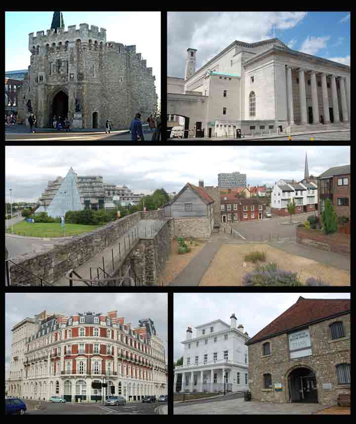




Southampton, United Kingdom
Southampton is a city of 269,781 people in England, United Kingdom.
Why visit Southampton
Townapedia lists 83 museums and landmarks, 84 parks and trails, 141 places to eat, 36 places to stay and 27 attractions in and around town.
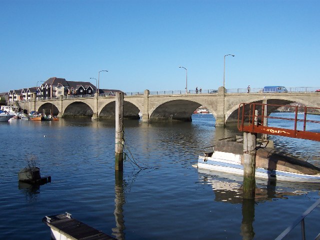
Highlights include Mayflower Theatre, Cobden Bridge, Solent Sky and John Hansard Gallery.
Weather in Southampton
Forecast from MET Norway (CC BY 4.0). Full forecast
About Southampton
Southampton is a port city and unitary authority in Hampshire, England. It is located approximately 80 miles (130 km) southwest of London, 20 miles (32 km) west of Portsmouth, and 20 miles (32 km) southeast of Salisbury. Southampton had a population of 248,922 at the 2021 census, making it one of the most populous cities in southern England.
From the Wikipedia article Southampton (this version), under CC BY-SA 4.0.
Travel tips from other travellers: Southampton on Wikivoyage (CC BY-SA 4.0).
Photos of Southampton


Things to do27

Mayflower Theatre
Cinema and theater · 0.4 mi
Theatre in Southampton, England, a former cinema
22-26 Commercial Road, Southampton


Grand Theatre
Cinema and theater
Former theatre in Southampton, England


Southampton Guildhall
Cinema and theater
Performance venue in Southampton, England

The Point, Eastleigh
Cinema and theater · 5.0 mi
Theatre and dance centre in Eastleigh, Hampshire, England, in the former Town Hall


Theatre Royal, Southampton
Cinema and theater · 0.4 mi
Former theatre in Hampshire, England (1803–1884)
15 more on the map.
Museums and landmarks83

Solent Sky
Museum · 0.6 mi
Aviation museum in Southampton, Hampshire, United Kingdom
Albert Road South, Southampton
Mo-Sa 10:00-17:00; Su 12:00-17:00


Southampton City Art Gallery
Museum
Art gallery in Southampton
Commercial Road, Southampton
Mo-Fr 10:00-15:00; Sa 10:00-17:00


Medieval Merchants House
Museum · 0.4 mi
Grade I listed historic house museum in Southampton, United Kingdom
58 French Street, Southampton


The Cenotaph
Monument and historic site · 0.4 mi
War memorial in Southampton, England

Titanic Engineers' Memorial
Monument and historic site · 0.4 mi
Grade II listed sculpture in Southampton, United Kingdom

71 more on the map.
Parks, trails and playgrounds84

Blechynden Terrace Park
Park · 0.4 mi
Park in Southampton, Hampshire, England

Mayfield Park
Park · 1.9 mi
Recreational area in the suburb of Woolston, Southampton, England, UK


St James' Park
Park · 1.9 mi
Recreational area in Shirley, Southampton, Hampshire, England


Lakeside Country Park
Park · 4.1 mi
Railway park in the United Kingdom

Daisy Dip Park
Park · 2.7 mi
Daisy Dip is a large open space between Swaythling and Bassett and links to Bassett Wood Greenway. At almost eight hectares the open...
Daisy Road, Bluebell Road, Laburnum Road, Southampton
24/7
Riverside Park
Park · 2.5 mi
Public park in Southampton, Hampshire, England
Hamble Common
Park · 5.2 mi
Park in Hamble-le-Rice, Eastleigh, Hampshire, England
72 more on the map.
Restaurants and cafes141

Baboo Ji
Restaurant · Curry, Indian · 1.7 mi
273 Portswood Road, Southampton
Tu-Th 16:30-21:30; Fr,Sa 16:30-22:00
Romano Deli Caffe
Restaurant · Italian, Pizza, Sandwich, Coffee, Pasta, Deli · 0.6 mi
4 Canute Road, Southampton
Mo-Sa 08:00-17:00
Shah Faisal
Restaurant · Indian · 2.2 mi
Bitterne Road East, Southampton
Mo-Sa 17:00-23:00; Su 17:00-22:00
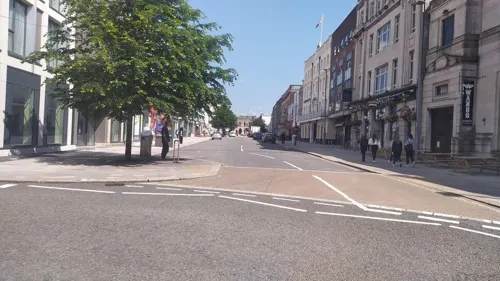
Szechuen Kitchen
Restaurant · Chinese
137a High Street, Southampton
Su-Th 12:00-22:30; Fr,Sa 12:00-23:00
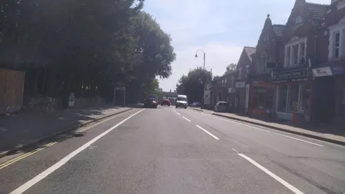
The Eagle Bar Lounge
Restaurant · Mediterranean · 1.2 mi
29-31 Portswood Road, Southampton
Mo-Tu 17:00-22:00, We-Th 12:00-22:00, Fr-Sa 12:00-00:00, Su 12:00-22:00


The Giddy Goose
Restaurant · Burger, American, Hot Dog · 1.1 mi
Empress Park, Southampton
Th-Su 17:00-22:00
129 more on the map.
History
Archaeological finds suggest that the area has been inhabited since the Stone Age. Following the Roman invasion of Britain in AD 43 and the conquering of the local Britons in AD 70 the fortress settlement of Clausentum was established. It was an important trading port and defensive outpost of Winchester, at the site of modern Bitterne Manor. Clausentum was defended by a wall and two ditches and is thought to have contained a bath house. Clausentum was not abandoned until around 410.
The Anglo-Saxons formed a new, larger, settlement across the Itchen centred on what is now the St Mary's area of the city. The settlement was known as Hamwic, which evolved into Hamtun and then Hampton. Archaeological excavations of this site have uncovered one of the best collections of Saxon artefacts in Europe. It is from this town that the county of Hampshire gets its name.
Viking raids contributed to the decline of Hamwic in the late 9th century, and by the 10th century a fortified settlement, which became medieval Southampton, had been established.
Read more of the history
Following the Norman Conquest in 1066, Southampton became the major port of transit between the then capital of England, Winchester, and Normandy. Southampton Castle was built in the 12th century and surviving remains of 12th-century merchants' houses such as King John's House and Canute's Palace are evidence of the wealth that existed in the town at this time. By the 13th century Southampton had become a leading port, particularly involved in the import of French wine in exchange for English cloth and wool.
The Franciscan friary in Southampton was founded circa 1233. The friars constructed a water supply system in 1290, which carried water from Conduit Head (remnants of which survive near Hill Lane, Shirley) some 1.1 mi (1.7 km) to the site of the friary inside the town walls. Further remains can be observed at Conduit House on Commercial Road. The friars granted use of the water to the town in 1310.
Between 1327 and 1330, the King and Council received a petition from the people of Southampton. The community of Southampton claimed that Robert Batail of Winchelsea and other men of the Cinque Ports came to Southampton under the pretence that they were a part of Thomas of Lancaster's rebellion against Edward II. The community thought that they were in conspiracy with Hugh le Despenser the Younger. The petition states that, the supposed rebels in the Despenser War 'came to Southampton harbour, and burnt their ships, and their goods, chattels and merchandise which was in them, and carried off other goods, chattels and merchandise of theirs found there, and took some of the ships with them, to a loss to them of £8000 and more.' For their petition to the King somewhere after 1321 and before 1327 earned some of the people of Southampton a prison sentence at Portchester Castle, possibly for insinuating the king's advisor Hugh le Despenser the Younger acted in conspiracy with the Cinque Port men to damage Southampton, a flourishing port in the fourteenth century. When King Edward III came to the throne, this petition was given to the king and his mother, Queen Isabella, who was in charge of the town, and the country at this stage likely organised the writ of trespass that took any guilt away from the community at Southampton.
The town was sacked in 1338 by French, Genoese and Monegasque ships (under Charles Grimaldi, who used the plunder to help found the principality of Monaco). On visiting Southampton in 1339, Edward III ordered that walls be built to "close the town". The extensive rebuilding — part of the walls dates from 1175 — culminated in the completion of the western walls in 1380. Roughly half of the walls, 13 of the original towers, and six gates survive.
In 1348, the Black Death reached England via merchant vessels calling at Southampton.
Prior to King Henry's departure for the Battle of Agincourt in 1415, the ringleaders of the "Southampton Plot"—Richard, Earl of Cambridge, Henry Scrope, 3rd Baron Scrope of Masham, and Sir Thomas Grey of Heton—were accused of high treason and tried at what is now the Red Lion public house in the High Street. They were found guilty and summarily executed outside the Bargate.
The city walls include God's House Tower, built in 1417, the first purpose-built artillery fortification in England. Over the years it has been used as home to the city's gunner, the Town Gaol and even as storage for the Southampton Harbour Board. Until September 2011, it housed the Museum of Archaeology. The walls were completed in the 15th century, but later development of several new fortifications along Southampton Water and the Solent by Henry VIII meant that Southampton was no longer dependent upon its own fortifications.
During the Middle Ages, shipbuilding had become an important industry for the town. Henry V's famous warship Grace Dieu was built in Southampton and launched in 1418.
The friars passed on ownership of the water supply system itself to the town in 1420.
On the other hand, many of the medieval buildings once situated within the town walls are now in ruins or have disappeared altogether. From successive incarnations of the motte and bailey castle, only a section of the bailey wall remains today, lying just off Castle Way.
In 1447 Henry VI granted Southampton a charter which made it a county of itself, separate for most purposes from the county of Hampshire. The town was granted its own sheriff, which it retains to this day.
The friary was dissolved in 1538 but its ruins remained until they were swept away in the 1940s.
The port was the point of departure for the Pilgrim Fathers aboard Mayflower in 1620. In 1642, during the English Civil War, a Parliamentary garrison moved into Southampton. The Royalists advanced as far as Redbridge in March 1644 but were prevented from taking the town.
From the History section of Southampton on Wikipedia, under CC BY-SA 4.0.
More about Southampton
Geography
The geography of Southampton is influenced by the sea and rivers. The city lies at the northern tip of the Southampton Water, a deep water estuary, which is a ria formed at the end of the last Ice Age and which opens into The Solent. At the head of Southampton Water the rivers Test and Itchen converge. The Test — which has a salt marsh that makes it ideal for salmon fishing — runs along the western edge of the city, while the Itchen splits Southampton in two—east and west. The city centre is located between the two rivers.
Town Quay is the original public quay, and dates from the 13th century. Today's Eastern Docks were created in the 1830s by land reclamation of the mud flats between the Itchen and Test estuaries. The Western Docks date from the 1930s when the Southern Railway Company commissioned a major land reclamation and dredging programme. Most of the material used for reclamation came from dredging of Southampton Water, to ensure that the port can continue to handle large ships.
Southampton Water has the benefit of a double high tide, with two high tide peaks, making the movement of large ships easier. This is not caused as popularly supposed by the presence of the Isle of Wight, but is a function of the shape and depth of the English Channel. In this area the general water flow is distorted by more local conditions reaching across to France.
Economy
In 2016–17, 169,700 residents of Southampton aged 16–64 were in employment, representing a rate of 71.4% – lower than the national rate of 74.4%. 6,600 were unemployed, representing 5% of the economically active population.
In 2016–17, 24.8% of the city's resident population aged 16–64 were classed as economically inactive, higher than the national rate of 21.8%, although for over 40% of this group the reason was that they were students.
Just over a quarter of the jobs available in the city are in the health and education sector. A further 19 per cent are property and other business and the third-largest sector is wholesale and retail, which accounts for 16.2 per cent. Between 1995 and 2004, the number of jobs in Southampton has increased by 18.5 per cent.
In January 2007, the average annual salary in the city was £22,267. This was £1,700 lower than the national average and £3,800 less than the average for the South East.
Arts and culture
The city is home to the longest surviving stretch of medieval walls in England, as well as a number of museums such as Tudor House Museum, reopened on 30 July 2011 after undergoing extensive restoration and improvement; God's House Tower;, an arts & heritage venue run by 'a space' arts; the Medieval Merchant's House; and Solent Sky, which focuses on aviation. The SeaCity Museum is located in the west wing of the civic centre, formerly occupied by Hampshire Constabulary and the Magistrates' Court, and focuses on Southampton's trading history and on the Titanic. The museum received half a million pounds from the National Lottery in addition to interest from numerous private investors and is budgeted at £28 million.
The annual Southampton Boat Show is held in September each year, with over 600 exhibitors present. It runs for just over a week at Mayflower Park on the city's waterfront, where it has been held since 1968. The Boat Show itself is the climax of Sea City, which runs from April to September each year to celebrate Southampton's links with the sea.
Education
Southampton has two universities, namely the University of Southampton and Solent University. Together, they have a student population of 40,000. Though students numbers had increased in the 80s, 90s, and up to 2011, they began to reduce due to changes in immigration rules and dropped further after 2016 due to Brexit. Of these, 2,880 are from EU, and the rest are from UK, Asia and Africa.
The University of Southampton, which was founded in 1862 and received its Royal Charter as a university in 1952, has over 22,000 students. The university is ranked in the top 100 research universities in the world in the Academic Ranking of World Universities 2010. In 2010, the THES - QS World University Rankings positioned the University of Southampton in the top 80 universities in the world. The university considers itself one of the top 5 research universities in the UK. The university has a global reputation for research into engineering sciences, oceanography, chemistry, cancer sciences, sound and vibration research, computer science, electronics, and optoelectronics. It is also home to the National Oceanography Centre, Southampton (NOCS), the focus of Natural Environment Research Council-funded marine research.
From the Wikipedia article Southampton, under CC BY-SA 4.0.
Notable people from Southampton
 John Everett MillaisBritish painter and illustrator (1829–1896)Photo: Charles Robert Leslie (died 1859), Public domain
 Craig DavidBritish singer (born 1981)Photo: Raph_PH, CC BY 2.0
 Will ChampionEnglish drummer (born 1978)Photo: Raph_PH, CC BY 4.0
 Sam VokesWelsh association football player (born 1989)Photo: Steindy ( talk ) 16:17, 10 November..., CC BY-SA 3.0
 Josh O'ConnorBritish actor (born 1990)Photo: Max Surprenant, CC BY 4.0
 John Jellicoe, 1st Earl JellicoeRoyal Navy officer (1859-1935)Photo: Bain News Service; restored by Adam Cuerden, Public domain
 Isaac WattsEnglish hymnwriter, theologian and logician (1674-1748)Photo: anonymous, Public domain
 Darren AndertonEnglish footballer (born 1972)Photo: https://www.flickr.com/photos/bensutherland/, CC BY 2.0
 Laura CarmichaelBritish actressPhoto: Vbrunophotog, CC BY-SA 4.0
- Benny HillBritish comedian and actor (1924–1992)
- Wayne BridgeEnglish footballer (born 1980)
- Ken RussellBritish film director (1927–2011)
Born in Southampton, according to Wikidata (CC0). Each name links to its Wikipedia article.
Where to stay36
Churches and places of worship54
Saint Edward The Confessor Church, Hound
Church · Anglican · 2.8 mi
Grange Road, Southampton
Highfield Church
Church · Anglican · 1.8 mi
Highfield Lane, Southampton
Central Baptist Church
Church · Baptist · 0.6 mi
Devonshire Road, Southampton
Shirley Baptist Church
Church · Baptist · 1.8 mi
Church Street, Southampton
Shopping72
Gas and EV charging24
Schools, colleges and libraries38
Highfield Church of England Primary School - Junior Site
School · Anglican · 2.0 mi
Hawthorn Road, Southampton
Rownhams St John's Church of England Primary School
School · Anglican · 3.8 mi
Bakers Drove, Southampton
Healthcare35
Royal South Hants Urgent Treatment Centre
Hospital · 0.7 mi
Brinton's Terrace, Southampton
Map of Southampton
250 places. The map loads OpenStreetMap tiles when you open it.
Getting there and nearby towns
Southampton Airport (SOU) is the nearest airport with scheduled flights listed in OpenStreetMap, 4 miles away.
- Portswood 2 mi north, about 3 min by car
- Marchwood 2 mi southwest, about 4 min by car
- Hythe 3 mi south, about 5 min by car
- Netley 3 mi southeast, about 5 min by car
- Totton 4 mi west, about 6 min by car
- West End 4 mi northeast, about 6 min by car
- Bursledon 4 mi east, about 6 min by car
- Worthing 45 mi east, about 1 h 15 min by car
- Woking 47 mi northeast, about 1 h 15 min by car
- Swindon 48 mi north, about 1 h 15 min by car
Drive times are estimates from straight-line distance, not routes.
Towns near Southampton


Keep exploring
Local news
Headlines from INDB.
Reviews, tips and questions
Loading what members have shared...
Sources and licences
- GeoNames (CC BY 4.0): population, coordinates, regions and time zone
- Mapillary (see each image): photos
- OpenStreetMap contributors (ODbL 1.0): places, airports, map data
- Wikidata (CC0 1.0): elevation, founding date, time zone, website, landmarks and historic places
- Wikimedia Commons (see each image): photos
- Wikipedia (CC BY-SA 4.0): overview and history text
Photo credits
- Southampton2, Garlicbatten, CC BY-SA 3.0
- Clarks Shoe Shop, Southampton, Alex McGregor, CC BY-SA 2.0
- MayflowerTheatre, Turquoisefish at English Wikipedia, CC BY-SA 3.0
- Cobden Bridge, Dave Jacobs, CC BY-SA 2.0
- Itchen Bridge in 2007 HDR, Rhys Jones from Southampton, UK, CC BY 2.0
- Southampton Guildhall, Michael, Public domain
- The Point, Eastleigh, Paul Spencer, CC BY-SA 3.0
- Solent Sky general view, Nimbus227, Public domain
- John Hansard Gallery, Murgatroyd49, CC BY-SA 4.0
- SeaCity Museum, hahnchen at Wikimedia Commons (must include link if medium allows), CC BY-SA 3.0
- Southampton-Cenotaph, AlanFord at English Wikipedia, Public domain
- Titanic Engineers Memorial Southampton 2016, photo by Geni sculpture by Ferdinand Victor Blundstone, CC BY-SA 4.0
- Blechynden Terrace Park twilight, Geni, CC BY-SA 4.0
- RoyalVictoriaCountryPark, Hethurs ( talk ), CC BY-SA 3.0
- SouthamptonCommon, The original uploader was AlanFord at English Wikipedia ., CC BY 2.5
- Itchen Valley Country Park visitor centre, Hugh Venables, CC BY-SA 2.0
- Beach Lake, Lakeside Country Park, Eastleigh, Peter Facey, CC BY-SA 2.0
- HighfieldChurch, AlanFord at English Wikipedia, Public domain
- Avenue St Andrews, Colin Smith, CC BY-SA 2.0
- SS Shieldhall in Clyde 2005, dave souza, CC BY-SA 3.0
- Stonehamhouse, Supposed at English Wikipedia, CC BY-SA 3.0
- St. Michael & All Angels, Bassett, Michael Ford, CC BY-SA 2.0
- St. Alban's Church, Southampton, Michael Ford, CC BY-SA 2.0
- St Edward the Confessor's Church, Grange Road, Netley (NHLE Code 1111931) (May 2019) (4), Hassocks5489, CC0
- St James's Church, Church Hill, West End (NHLE Code 1281100) (May 2019) (1), Hassocks5489, CC0
- Bitterne Precinct, Dave Jacobs, CC BY-SA 2.0
- SS Shieldhall 2018, Geni, CC BY-SA 4.0
- Eling Tide Mill frm beside the mill pond, User:Timtrent, CC BY-SA 2.5
- FoxMemorialMayfield, Hethurs ( talk ) 13:49, 19 May 2008 (UTC), CC BY-SA 3.0
- St Mary's Southampton, Bellminsterboy, CC BY-SA 4.0
- St james park southampton april 2021, Geni, CC BY-SA 4.0
- Rockstone Place Park, Geni, CC BY-SA 4.0
- Grand Theatre Southampton 1905, Unknown (1905), Public domain
- Mapillary (319377546256423, 0W8qXOavttcHQ7O9GGC2RQ) (ebel) 2017-07-13 13H59M10S000, ebel, CC BY-SA 4.0
- Mapillary (817392665854021, 0W8qXOavttcHQ7O9GGC2RQ) (ebel) 2017-07-13 13H59M14S000, ebel, CC BY-SA 4.0
- Mapillary (801731070775051, 0W8qXOavttcHQ7O9GGC2RQ) (ebel) 2017-07-13 13H59M03S000, ebel, CC BY-SA 4.0
- Mapillary (514371686267322, 0W8qXOavttcHQ7O9GGC2RQ) (ebel) 2017-07-13 13H59M25S000, ebel, CC BY-SA 4.0
- Mapillary (156038156465436, 0W8qXOavttcHQ7O9GGC2RQ) (ebel) 2017-07-13 13H59M01S000, ebel, CC BY-SA 4.0
- Mapillary (817024832560874, 0W8qXOavttcHQ7O9GGC2RQ) (ebel) 2017-07-13 13H59M28S000, ebel, CC BY-SA 4.0
- Mapillary (1362276614152607, 0W8qXOavttcHQ7O9GGC2RQ) (ebel) 2017-07-13 13H59M33S000, ebel, CC BY-SA 4.0
- Northam Bridge, Peter Facey, CC BY-SA 2.0
- Nuffield-theatre-southampton, David Martin, CC BY-SA 2.0
- 'Patio de Los Arrayanes' by Ben Johnson viewed by local children in Southampton City Art Gallery, Wingate16, CC BY-SA 4.0
- GOD'S HOUSE TOWER 20200727 114752, Dcs57, CC BY-SA 4.0
- Southampton Medieval Merchants House Hall, Hchc2009, CC BY-SA 3.0
- Street-level photo, southglos, CC BY-SA 4.0
- Street-level photo, ebel, CC BY-SA 4.0
- Street-level photo, jpennycook, CC BY-SA 4.0
- Street-level photo, ebel, CC BY-SA 4.0
- Street-level photo, noid, CC BY-SA 4.0
- Street-level photo, southglos, CC BY-SA 4.0
- Street-level photo, southglos, CC BY-SA 4.0
- Street-level photo, benscottrobinson, CC BY-SA 4.0
- Street-level photo, noid, CC BY-SA 4.0
- Street-level photo, noid, CC BY-SA 4.0
- Street-level photo, noid, CC BY-SA 4.0
- Street-level photo, jpennycook, CC BY-SA 4.0
- Street-level photo, noid, CC BY-SA 4.0
- Street-level photo, noid, CC BY-SA 4.0
- Street-level photo, noid, CC BY-SA 4.0
- Street-level photo, severecci, CC BY-SA 4.0
- Street-level photo, severecci, CC BY-SA 4.0
- Street-level photo, severecci, CC BY-SA 4.0
- Street-level photo, noid, CC BY-SA 4.0
- Street-level photo, noid, CC BY-SA 4.0
- Street-level photo, ebel, CC BY-SA 4.0
- Street-level photo, iced, CC BY-SA 4.0
- Street-level photo, iced, CC BY-SA 4.0
- Street-level photo, noid, CC BY-SA 4.0
- Street-level photo, noid, CC BY-SA 4.0
- Street-level photo, noid, CC BY-SA 4.0
- Street-level photo, jpennycook, CC BY-SA 4.0
- Street-level photo, noid, CC BY-SA 4.0


Page built November 10, 2026. Spotted a mistake? Tell us or suggest a place.