


Why visit Truro
Townapedia lists 14 museums and landmarks, 13 parks and trails, 109 places to eat, 6 places to stay and 3 attractions in and around town.
Highlights include Hall for Cornwall, The Plaza, Royal Cornwall Museum and Lander's Monument.
Weather in Truro
Forecast from MET Norway (CC BY 4.0). Full forecast
About Truro
Truro ( ; Cornish: Truru [ˈtrʏryː] ) is a cathedral city and civil parish in Cornwall, England. It is the southernmost city in the United Kingdom and lies 232 miles (373 km) west-south-west of London. It is Cornwall's county town, only city and a centre for administration, leisure and shopping. At the 2021 census the population of the parish was 21,046 and that of the built-up area was 23,060, as defined by the Office for National Statistics, which included the Gloweth and Treliske areas in the neighbouring parish of Kenwyn.
From the Wikipedia article Truro (this version), under CC BY-SA 4.0.
Travel tips from other travellers: Truro on Wikivoyage (CC BY-SA 4.0).
Photos of Truro


Things to do3
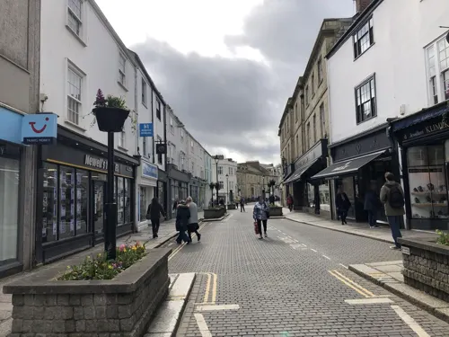
Hall for Cornwall
Cinema and theater
Theatre and music venue in Truro, Cornwall, England, UK
Back Quay, Truro


Museums and landmarks14

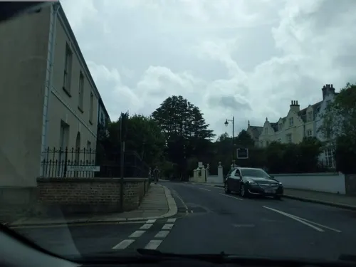
Lander's Monument
Monument and historic site · 0.4 mi
Monument in Truro, United Kingdom





2 more on the map.
Parks, trails and playgrounds13


Daubuz Moor
Park
Daubuz Moor nature reserve. Managed by Truro Town Council with the Freinds of Daubuz Moor.


1 more on the map.
Restaurants and cafes109
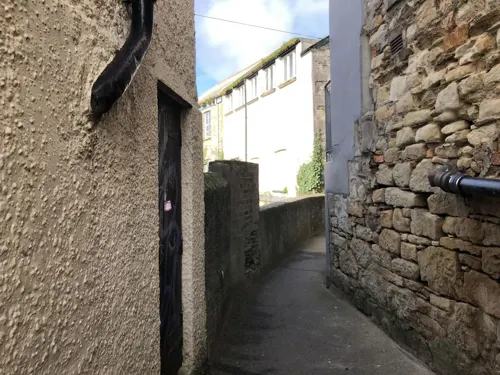
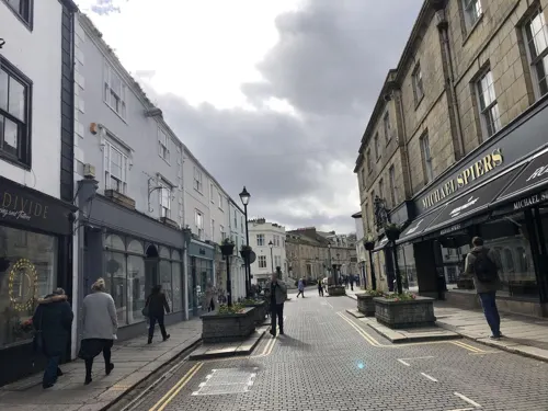
Caffè Nero
Cafe · Coffee Shop
27 Boscawen Street, Truro
Mo-Fr 07:00-18:30; Sa 07:30-18:30; Su 08:30-17:30
The Longstore
Restaurant
62 Lemon Street, Truro
Mo-Fr 16:30-21:00; Sa 10:00-14:45,16:45-21:00; Su 11:30-15:00,17:00-21:00



The Old Ale House
Bar and pub
7 Quay Street, Truro
Mo 11:00-23:30; Tu-Th 11:00-23:00; Fr 11:00-23:30; Sa 11:00-00:00;...

Bread & Butter
Cafe · Pankcake
24 River Street, Truro
Mo,We-Fr 10:00-14:00; Sa 09:00-14:30; Su 10:00-13:30

Hubbox
Restaurant · Burger, American, Chicken, Barbecue
116 Kenwyn Street, Truro
Su-Th 11:30-21:00; Fr-Sa 11:30-22:00
97 more on the map.
History
A castle was built in the 12th century by Richard de Luci, Chief Justice of England in the reign of Henry II who, for court services, was granted land in Cornwall, including the area round the confluence of the two rivers. The town grew below the castle and gained borough status from further economic activity. The castle has long disappeared.
Richard de Lucy fought in Cornwall under Count Alan of Brittany, after leaving Falaise late in 1138. The small adulterine castle at Truro, Cornwall, originally the parish of Kenwyn, later known as "Castellum de Guelon", was probably built by him in 1139–1140. He styled himself "Richard de Lucy, de Trivereu". The castle passed to Reginald FitzRoy, an illegitimate son of Henry I, when he was invested by King Stephen as the first Earl of Cornwall. Reginald married Mabel FitzRichard, daughter of William FitzRichard, a major landholder in Cornwall. The 75-foot (23 m)-diameter castle was in ruins by 1270 and the motte was levelled in 1840. Today Truro Crown Court stands on the site. In a charter of about 1170, Reginald FitzRoy confirmed to Truro's burgesses the privileges granted by Richard de Lucy. Richard held ten knights' fees in Cornwall before 1135. At his death, the county still accounted for a third of his considerable total holding.
Read more of the history
By the early 14th century, Truro was a major port, due to an inland location away from invaders, to prosperity from the fishing industry, and to a role as a stannary town for assaying and stamping tin and copper from Cornish mines. The Black Death brought a trade recession and an exodus that left the town in a very neglected state. Trade and prosperity gradually returned in the Tudor period. Local government came in 1589, with a new charter of Elizabeth I giving it an elected mayor and control over the port of Falmouth.
During the Civil War in the 17th century, Truro raised a sizeable force to fight for the king and a royalist mint was set up. Defeat by Parliamentary troops came after the Battle of Naseby in 1646, when the victorious General Fairfax led his army south-west to relieve Taunton and capture the Royalist-held West Country. The Royalist forces surrendered at Truro while leading Royalist commanders, including Lord Hopton, the Prince of Wales, Sir Edward Hyde, and Lord Capell, fled to Jersey from Falmouth.
Later in the century, Falmouth gained its own charter, giving rights to its harbour and starting a long rivalry with Truro. The dispute was settled in 1709 with control of the River Fal divided between them. The arms of Truro city are "Gules the base wavy of six Argent and Azure, thereon an ancient ship of three masts under sail, on each topmast a banner of St George, on the waves in base two fishes of the second."
Truro prospered in the 18th and 19th centuries through improved mining methods and higher prices for tin, and its consequent attraction to wealthy mine-owners. Elegant Georgian and Victorian townhouses of the period can be seen today in Lemon Street, named after the mining magnate and local Member of Parliament Sir William Lemon. Truro became the centre for county society, even dubbed "the London of Cornwall".
Through those prosperous times, Truro remained a social centre. Among the many notables were Richard Lander, the first European explorer to reach the mouth of the River Niger in Africa and was awarded the first gold medal of the Royal Geographical Society; Henry Martyn, who read mathematics at Cambridge, was ordained and became a missionary, translating the New Testament into Urdu and Persian. Others include Humphry Davy, educated in Truro and the inventor of the miner's safety lamp, and Samuel Foote, an actor and playwright from Boscawen Street.
Truro's importance increased later in the 19th century with an iron-smelting works, potteries and tanneries. From the 1860s, the Great Western Railway provided a direct link to London Paddington. The Bishopric of Truro Act 1876 gave the town a bishop and later a cathedral. In 1877 it gained city status. The New Bridge Street drill hall was completed in the late 19th century.
Truro was connected to the electric telegraph network in 1863, when the Electric and International Telegraph Company opened stations at Truro, Redruth, Penzance, Camborne, Liskard and St Austell.
From the History section of Truro on Wikipedia, under CC BY-SA 4.0.
More about Truro
Geography
Truro lies in the centre of western Cornwall, about 9 miles (14 kilometres) from the south coast, at the confluence of the rivers Kenwyn and Allen, which combine as the Truro River – one of a series of waterways and drowned valleys leading into the river Fal and then the large natural harbour of Carrick Roads. The valleys form a steep bowl surrounding the city on the north, east and west, open to the Truro river in the south. This shape, along with high precipitation that swells the rivers and a spring tide in the River Fal, were major factors in the 1988 floods that seriously damaged the city centre. Since then, flood defences have been constructed, including an emergency dam at New Mill on the river Kenwyn and a tidal barrier on the Truro river.
The city is amidst several protected natural areas, such as the historic parklands at Pencalenick and areas of ornamental landscape such as Trelissick Garden and Tregothnan down the Truro river. An area south-east of the city, including Calenick Creek, has been included in the Cornwall National Landscape. Other protected zones include an Area of Great Landscape Value comprising farmland and wooded valleys to the north east, and Daubuz Moors, a local nature reserve by the river Allen, close to the city centre.
Arts and culture
Truro's dominant feature is its Gothic-revival cathedral, designed by architect John Loughborough Pearson, rising 249 ft (76 m) above the city at its highest spire. It was built in 1880–1910 on the site of St Mary's Church, consecrated over 600 years earlier. Georgian architecture is well represented, with terraces and townhouses along Walsingham Place and Lemon Street often said to be "the finest examples of Georgian architecture west of the city of Bath."
The main attraction to the region is a wide variety of shopping facilities. Truro has various chain stores, speciality shops and markets that reflect its history as a market town. The indoor Pannier Market is open all year, with many stalls and small businesses. The city is also popular for catering and night life, with bars, clubs and restaurants. It houses the Hall for Cornwall, a performing arts and entertainment venue.
The Cornwall Museum and Art Gallery is the oldest and premier museum of Cornish history and culture. Its collections cover fields such as archaeology, art and geology. Among the exhibits is the so-called Arthur's inscribed stone. Its parks and open spaces include Victoria Gardens, Boscawen Park and Daubuz Moors.
Lemon Quay is the year-round centre of most festivities in Truro.
Education
A free grammar school associated with St Mary's Church was endowed in the 16th century. Its distinguished pupils have included the scientist Sir Humphry Davy, General Sir Hussey Vivian and the clergyman Henry Martyn.
The former Truro Girls Grammar School was converted into a Sainsbury's supermarket.
Archbishop Benson – A Church of England voluntary aided primary school
Polwhele House Preparatory School — since the closure of Truro Cathedral School educating also the 18 boy choristers of Truro Cathedral
Penair School — a state co-educational science college for ages 11–16
Richard Lander School — a state co-educational technology college for ages 11–16
Truro and Penwith College — A further and higher education college attached to the Combined Universities in Cornwall
From the Wikipedia article Truro, under CC BY-SA 4.0.
Notable people from Truro
 Helen GloverBritish rowerPhoto: Duk3L1xon, CC BY-SA 4.0
 Henry Charlton BastianBritish biologist (1837-1915)Photo: Unknown author Unknown author, Public domain
 Humphrey Tonkinprofessor of the University of Hartford, esperantistPhoto: Ziko, CC BY-SA 3.0
 Richard Lemon LanderCornish explorer (1804–1834)Photo: Mezzotint by C. Turner, 1835, after..., CC BY 4.0
 Henry MartynEnglish Anglican priest and missionary in India and PersiaPhoto: Unknown, Cambridge University, Public domain
 Samuel FooteBritish dramatistPhoto: Jean-François Gilles Colson, Public domain
 Hussey Vivian, 1st Baron VivianBritish cavalry officer (1775–1842)Photo: William Salter, Public domain
 Jack NowellEnglish rugby union footballerPhoto: exeterdaily0, CC0
 Chris OpieBritish cyclistPhoto: Cs-wolves, CC BY-SA 4.0
- Michael AdamsBritish chess grandmaster
- James MarshBritish film director
- Charles Spence BateBritish zoologist and dentist


Born in Truro, according to Wikidata (CC0). Each name links to its Wikipedia article.
Where to stay6
Churches and places of worship14
Kingdom Hall of Jehovahs Witnesses
Church · Jehovahs Witness · 0.7 mi
Dobbs Lane, Truro
Shopping41
Gas and EV charging1
Schools, colleges and libraries16
Healthcare18
Map of Truro
235 places. The map loads OpenStreetMap tiles when you open it.
Getting there and nearby towns
Cornwall Airport Newquay (NQY) is the nearest airport with scheduled flights listed in OpenStreetMap, 12 miles away.
- Chacewater 5 mi west, about 7 min by car
- Perranwell 5 mi southwest, about 7 min by car
- Probus 5 mi northeast, about 8 min by car
- Mylor Bridge 6 mi south, about 9 min by car
- Ponsanooth 6 mi southwest, about 10 min by car
- St. Day 6 mi west, about 10 min by car
- Penryn 7 mi south, about 11 min by car
- Falmouth 8 mi south, about 12 min by car
- Redruth 8 mi west, about 13 min by car
- Plymouth 41 mi east, about 1 h by car
Drive times are estimates from straight-line distance, not routes.
Keep exploring
Local news
Headlines from INDB.
Reviews, tips and questions
Loading what members have shared...
Sources and licences
- GeoNames (CC BY 4.0): population, coordinates, regions and time zone
- Mapillary (see each image): photos
- OpenStreetMap contributors (ODbL 1.0): places, airports, map data
- Wikidata (CC0 1.0): elevation, founding date, time zone, website, landmarks and historic places
- Wikimedia Commons (see each image): photos
- Wikipedia (CC BY-SA 4.0): overview and history text
Photo credits
- TruroCathedral, Tim Green, CC BY 2.0
- 24 and 25 Pydar Street, Truro, Cornwall - July 2024, Mutney, CC BY 4.0
- Carrick House & St Clement House - awaiting demolition, Truro, Cornwall - July 2022, Mutney, CC BY-SA 4.0
- Carrick House - awaiting demolition, Truro, Cornwall - July 2022, Mutney, CC BY-SA 4.0
- 21 and 21a Pydar Street, Truro, Cornwall - July 2024, Mutney, CC BY 4.0
- St Clement House - awaiting demolition, Truro, Cornwall - July 2022 (1), Mutney, CC BY-SA 4.0
- Pydar House, Truro. Cornwall - August 2024, Mutney, CC0
- St Clement House - awaiting demolition, Truro, Cornwall - July 2022 (2), Mutney, CC BY-SA 4.0
- Truro Cathedral (25985025800), Tim Green from Bradford, CC BY 2.0
- Sole Plaice fish and chip shop, Pydar Street, Truro, Cornwall - April 2023, Mutney, CC BY-SA 4.0
- Pydar House, Union Street, Truro, Cornwall - July 2022, Mutney, CC BY-SA 4.0
- Building on St Clement Street, Truro, Cornwall - July 2022, Mutney, CC BY-SA 4.0
- Graffiti on hordings near Pydar Pop-up, Truro, Cornwall - April 2023, Mutney, CC BY-SA 4.0
- Pydar Pop Up, St Clement Street, Truro, Cornwall - April 2023 (2), Mutney, CC0
- Pydar Pop Up, St Clement Street, Truro, Cornwall - April 2023 (1), Mutney, CC0
- Truro Cathedral August 2019 (1), Seth Whales, CC BY-SA 4.0
- Pydar House from St Clement Street, Truro, Cornwall - April 2023, Mutney, CC BY-SA 4.0
- Pydar Pop Up, St Clement Street, Truro, Cornwall - April 2023 (3), Mutney, CC0
- Lys Kernow 2023, NachoVy, CC BY-SA 4.0
- Church Of St. Hermes, Hanton01, CC BY-SA 4.0
- St Paul's Church Truro, Haydn Blackey, CC BY-SA 2.0
- St John's Church, Truro, Roger Templeman, CC BY-SA 2.0
- Truro Cathedral - Truro, tracey maclean, CC BY-SA 2.0
- Royal Cornwall Museum (26191628321), Tim Green from Bradford, CC BY 2.0
- Boscawenpark, Harrias, CC BY-SA 3.0
- Kenwyn Church, Tim Green, CC BY 2.0
- Alverton Hotel - Truro, Cornwall, England - DSC02021, Daderot, CC0
- Kea- All Hallows, Jowaninpensans, CC BY-SA 4.0
- Arwodhyow diwyethek a-ves dhe Ji Peddra, Flynn Peck, CC BY-SA 4.0
- Truro Plaza, Mike Smith, CC BY-SA 2.0
- John Wesley 20210904 130607 Truro, Dcs57, CC BY-SA 4.0
- Street-level photo, sjfos, CC BY-SA 4.0
- Street-level photo, WaggyDog, CC BY-SA 4.0
- Street-level photo, sjfos, CC BY-SA 4.0
- Street-level photo, WaggyDog, CC BY-SA 4.0
- Street-level photo, sjfos, CC BY-SA 4.0
- Street-level photo, sjfos, CC BY-SA 4.0
- Street-level photo, sjfos, CC BY-SA 4.0
- Street-level photo, sjfos, CC BY-SA 4.0
- Street-level photo, WaggyDog, CC BY-SA 4.0
- Street-level photo, sjfos, CC BY-SA 4.0
- Street-level photo, WaggyDog, CC BY-SA 4.0
- Street-level photo, sjfos, CC BY-SA 4.0
- Street-level photo, sjfos, CC BY-SA 4.0
- Street-level photo, sjfos, CC BY-SA 4.0
- Street-level photo, sjfos, CC BY-SA 4.0
- Street-level photo, WaggyDog, CC BY-SA 4.0
- Street-level photo, WaggyDog, CC BY-SA 4.0


Page built November 10, 2026. Spotted a mistake? Tell us or suggest a place.