


Ullapool, United Kingdom
Ullapool is a town of 1,500 people in Scotland, United Kingdom.
Why visit Ullapool
Townapedia lists 4 museums and landmarks, 1 park or trail, 15 places to eat, 28 places to stay and 3 attractions in and around town.
Highlights include Eas Dubh and Ullapool Museum.
Weather in Ullapool
Forecast from MET Norway (CC BY 4.0). Full forecast
About Ullapool
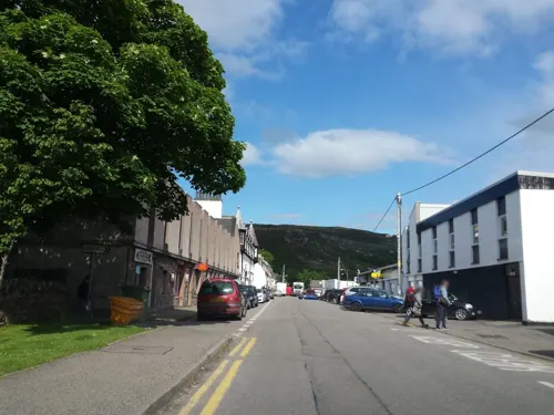
Ullapool (; Scottish Gaelic: Ulapul [ˈul̪ˠapʰul̪ˠ]) is a village and port located in the civil parish of Lochbroom in the county of Ross and Cromarty, Scottish Highlands. It is located around 45 miles (70 kilometres) northwest of Inverness. According to the Scottish Government in 2016, the village had a population of 1,520 people, making it the largest settlement in Wester Ross.
From the Wikipedia article Ullapool (this version), under CC BY-SA 4.0.
Travel tips from other travellers: Ullapool on Wikivoyage (CC BY-SA 4.0).
Things to do3

Eas Dubh
Waterfall · 1.6 mi
Waterfall on Ullapool River, Cromartyshire, Highland, Scotland, UK

Museums and landmarks4

Parks, trails and playgrounds1

Restaurants and cafes15
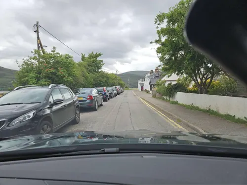
Seafood shack
Restaurant · Fish And Chips, Fish, Seafood, Local
9 West Argyle Street, Ullapool
Mo-Su 12:00-18:00
Rhidorroch Distillery Bar and Eatery
Restaurant
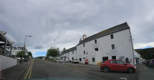
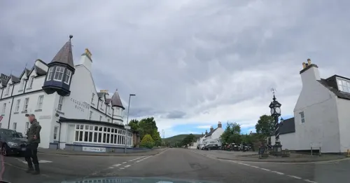
6 Shore Street, Ullapool
Su-Th 08:30-23:00, Fr,Sa 08:30-24:00




3 more on the map.
History
On the east shore of Loch Broom, Ullapool was founded in 1788 as a herring port by the British Fisheries Society. It was designed by Thomas Telford. Prior to 1788 the town was only an insignificant hamlet made up of just over 20 households. The harbour is used as a fishing port, yachting haven, and ferry port.
A road to link Ullapool with Dingwall was commenced in 1792. The village was historically in Cromartyshire, a county made up of many separate enclaves scattered across northern Ross-shire. Cromartyshire was abolished and combined with surrounding Ross-shire in 1890.
Ullapool has been described as the top geological hotspot in Scotland.
Parliament granted permission in the 1890s for a railway from Ullapool to the main Highland network at Garve railway station.
The name is possibly derived from the Norse word for "wool farm" or "Ulli's farm".
From the History section of Ullapool on Wikipedia, under CC BY-SA 4.0.
More about Ullapool
Arts and culture
Venues for music and the performing arts in Ullapool include the Macphail Centre, which is located in the High School and includes a small theatre, and The Ceilidh Place, a hotel, restaurant, and music venue which has previously held concerts by artists including Rab Noakes, Dick Gaughan, Kathleen MacInnes, and The Peatbog Faeries. The Ullapool Guitar Festival is also held annually in the village.
An talla solais, an arts center, is located in the village, along with a swimming pool and fitness center, and several pubs, restaurants, and tourist accommodation facilities. The 19th, and final, Ullapool Book Festival was held in the village in May 2023. The Tall Ships visited Ullapool in July 2011, whilst sailing from Greenock to Lerwick.
Ullapool was home to the shinty team Lochbroom Camanachd; however, the club has not completed a competitive fixture since 2015.
From the Wikipedia article Ullapool, under CC BY-SA 4.0.
Notable people from Ullapool
 Robert UrquhartScottish actor (1921-1995)Photo: [2], Public domain
 John KirkbrideBritish musicianPhoto: Alexander.ledig, CC BY-SA 3.0


Born in Ullapool, according to Wikidata (CC0). Each name links to its Wikipedia article.
Where to stay28
Churches and places of worship4
Shopping8
Gas and EV charging1
Schools, colleges and libraries4
Healthcare1
Map of Ullapool
69 places. The map loads OpenStreetMap tiles when you open it.
Getting there and nearby towns
Inverness Airport (INV) is the nearest airport with scheduled flights listed in OpenStreetMap, 48 miles away.
- Lairg 29 mi east, about 47 min by car
- Strathpeffer 31 mi southeast, about 51 min by car
- Dingwall 34 mi southeast, about 55 min by car
- Evanton 34 mi southeast, about 55 min by car
- Conon Bridge 35 mi southeast, about 57 min by car
- Maryburgh 35 mi southeast, about 56 min by car
- Alness 36 mi east, about 58 min by car
- Muir of Ord 37 mi southeast, about 59 min by car
- Invergordon 39 mi east, about 1 h by car
- Inverness 45 mi southeast, about 1 h 15 min by car
Drive times are estimates from straight-line distance, not routes.
Keep exploring
Local news
Headlines from INDB.
Reviews, tips and questions
Loading what members have shared...
Sources and licences
- GeoNames (CC BY 4.0): population, coordinates, regions and time zone
- Mapillary (see each image): photos
- OpenStreetMap contributors (ODbL 1.0): places, airports, map data
- Wikidata (CC0 1.0): elevation, founding date, time zone, website, landmarks and historic places
- Wikimedia Commons (see each image): photos
- Wikipedia (CC BY-SA 4.0): overview and history text
Photo credits
- Ullapool-2003, Thewhale (Walter A. Lüthi), CC BY-SA 3.0
- Bath^ No, Ullapool - panoramio, brian gillman, CC BY 3.0
- Ullapool Youth Hostel 2022, Victuallers, CC BY-SA 4.0
- Ferry Passengers (19866612120), Alan Jamieson from Aberdeen, Scotland, CC BY 2.0
- Stanley Coaches M1 STX (7939551630), Glen Wallace from Inverness, Scotland, CC BY-SA 2.0
- Pulham SR14 NGS (14852758354), Glen Wallace from Inverness, Scotland, CC BY-SA 2.0
- Street-level photo, rudolfmayer, CC BY-SA 4.0
- Street-level photo, toho, CC BY-SA 4.0
- Street-level photo, rudolfmayer, CC BY-SA 4.0
- Street-level photo, rudolfmayer, CC BY-SA 4.0
- Street-level photo, cromir, CC BY-SA 4.0
- Street-level photo, hobgoblin, CC BY-SA 4.0
- Street-level photo, rudolfmayer, CC BY-SA 4.0
- Street-level photo, toho, CC BY-SA 4.0
- Street-level photo, rudolfmayer, CC BY-SA 4.0
- Street-level photo, hobgoblin, CC BY-SA 4.0
- Street-level photo, hobgoblin, CC BY-SA 4.0
- Street-level photo, toho, CC BY-SA 4.0
- Street-level photo, toho, CC BY-SA 4.0
- Street-level photo, rudolfmayer, CC BY-SA 4.0
- Street-level photo, toho, CC BY-SA 4.0
- Street-level photo, cromir, CC BY-SA 4.0
- Street-level photo, hobgoblin, CC BY-SA 4.0
- Street-level photo, cromir, CC BY-SA 4.0
- Street-level photo, rudolfmayer, CC BY-SA 4.0
- Street-level photo, toho, CC BY-SA 4.0
- Street-level photo, toho, CC BY-SA 4.0
- Street-level photo, toho, CC BY-SA 4.0
- Street-level photo, toho, CC BY-SA 4.0
- Street-level photo, rudolfmayer, CC BY-SA 4.0
- Street-level photo, toho, CC BY-SA 4.0
- Street-level photo, cromir, CC BY-SA 4.0
- Street-level photo, toho, CC BY-SA 4.0
- Street-level photo, toho, CC BY-SA 4.0
- Street-level photo, joostjakob, CC BY-SA 4.0
- Street-level photo, hobgoblin, CC BY-SA 4.0
- Street-level photo, toho, CC BY-SA 4.0
- Street-level photo, rudolfmayer, CC BY-SA 4.0
- Street-level photo, toho, CC BY-SA 4.0
Page built November 10, 2026. Spotted a mistake? Tell us or suggest a place.