


Warrington, United Kingdom
Warrington is a city of 172,330 people in England, United Kingdom.
Why visit Warrington
Townapedia lists 18 museums and landmarks, 41 parks and trails, 272 places to eat, 9 places to stay and 6 attractions in and around town.
Highlights include Parr Hall, Thelwall Viaduct, Warrington Museum & Art Gallery and Warrington Museum and Art Gallery.
Weather in Warrington
Forecast from MET Norway (CC BY 4.0). Full forecast
About Warrington
Warrington () is an industrial town in Cheshire, England. The town is the main settlement of the Borough of Warrington and sits on the banks of the River Mersey, with the town centre and its suburbs north of that river historically having been part of Lancashire. It is 16 miles (26 km) east of Liverpool and the same distance west of Manchester.
From the Wikipedia article Warrington (this version), under CC BY-SA 4.0.
Travel tips from other travellers: Warrington on Wikivoyage (CC BY-SA 4.0).
Photos of Warrington


Things to do6


Thelwall Viaduct
Bridge · 3.1 mi
Motorway viaduct in Warrington, United Kingdom

Warrington Bridge
Bridge · 0.7 mi
Bridge in Warrington, Cheshire, England, United Kingdom

Gulliver's World Resort
Monument and historic site · 1.8 mi
Children's theme park resort in Warrington, Cheshire.

Howley Footbridge
Bridge · 0.4 mi
Footbridge in Warrington, Cheshire, England, UK

Museums and landmarks18

Warrington Museum & Art Gallery
Museum · 0.7 mi
We-Fr 10:00-16:30; Sa 10:00-16:00; Su 11:00-15:00; PH off
Warrington Museum and Art Gallery
Museum · 0.7 mi
Grade II listed building and museum in Warrington, United Kingdom

Boer War Memorial
Monument and historic site · 0.7 mi
For men of the South Lancashire Regiment

Warrington Academy
Monument and historic site · 0.7 mi
Bridge Street, Warrington



Total Eclipse of the Art Gallery
Museum · 1.3 mi
6, 6A Bruche Heath Gardens, Warrington
Tu-Sa 10:00-16:00
6 more on the map.
Parks, trails and playgrounds41

Paddington Meadows
Hiking and trails · 1.1 mi
Nature reserve in Paddington, Warrington, Cheshire, England, United Kingdom
24/7


The Halliwell Jones Stadium
Sports field and stadium · 0.7 mi
Mike Gregory Way, Warrington

Orford Park
Park · 0.8 mi
Park in Orford, Warrington, Cheshire, England, United Kingdom
Grappenhall Heys Walled Garden
Park · 2.2 mi
Park in Grappenhall, United Kingdom
Woolston Park
Park · 1.8 mi
Park in Woolston, Warrington, Cheshire, England, United Kingdom
29 more on the map.
Restaurants and cafes272
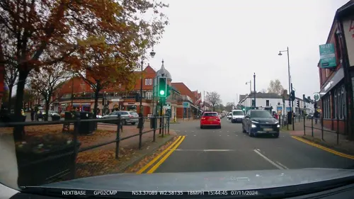
The Mulberry Tree
Bar and pub · 1.5 mi
Grappenhall Road, Warrington
Su-Th 10:00-23:00, Fr,Sa 10:00-01:00
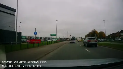
Nando's
Restaurant · Chicken, Portuguese · 1.3 mi
Unit 10 Winwick Road, Warrington
Su-Th 11:30-22:00; Fr-Sa 11:30-23:00
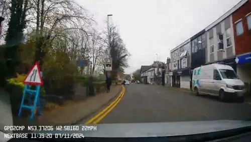


Satay Pan Asian Restaurant
Restaurant · Chinese · 1.4 mi
22 London Road, Warrington
Mo off; Tu-Su,PH 17:00-23:00

ASK Italian
Restaurant · Italian · 0.6 mi
12 Old Market Place, Warrington
Mo-Th 11:30-21:30; Fr 11:30-22:00; Sa 11:30-23:00; Su 11:30-21:00

The CoffeeHouse
Cafe · Coffee Shop, Sandwich · 0.6 mi
Unit 047 Old Market Place, Warrington
Mo-Sa 08:00-18:00; Su 09:00-16:00
A La Turka
Restaurant · Turkish · 1.5 mi
4 Victoria Square
We-Sa 12:00-23:00; Mo,Tu 17:00-23:00; Su 12:00-22:00
Rio Brazilian Steakhouse
Restaurant · Steak House, Brazilian · 0.6 mi
Unit 21 Golden Square, Warrington
Mo-Th 12:00-15:00, 16:45-21:00; Fr-Sa 12:00-15:00, 16:45-22:00; Su...
260 more on the map.
History
Warrington has been a major crossing point on the River Mersey since ancient times and there was a Roman settlement at Wilderspool. Local archaeological evidence indicates that there were also Bronze Age settlements. In medieval times Warrington's importance was as a market town and bridging point of the River Mersey. The first reference to a bridge at Warrington is found in 1285. The origin of the modern town was located in the area around St Elphin's Church, now included in the Church Street Conservation Area, established whilst the main river crossing was via a ford approximately 1 km upriver of Warrington Bridge. Warrington was the first paved town in Lancashire, which took place in 1321.
Read more of the history
Warrington was a fulcrum in the English Civil War. The armies of Oliver Cromwell and the Earl of Derby both stayed near the old town centre (the parish church area). Popular legend has it that Cromwell lodged near the building which survives on Church Street as the Cottage Restaurant. The Marquis of Granby public house bears a plaque stating that the Earl of Derby 'had his quarters near this site'. Dents in the walls of the parish church are rumoured to have been caused by the cannons from the time of the civil war. On 13 August 1651 Warrington was the scene of the last Royalist victory of the civil war when Scots troops under Charles II and David Leslie, Lord Newark, fought Parliamentarians under John Lambert at the Battle of Warrington Bridge.
The expansion and urbanisation of Warrington largely coincided with the Industrial Revolution, particularly after the Mersey was made navigable in the 18th century. As Britain became industrialised, Warrington embraced the Industrial Revolution, becoming a manufacturing town and a centre of steel (particularly wire), textiles, brewing, tanning and chemical industries. The navigational properties of the River Mersey were improved, canals were built, and the town grew yet more prosperous and popular. When the age of steam came, Warrington naturally welcomed it, both as a means of transport and as a source of power for its mills.
Warrington was the location of the Burtonwood RAF base and Risley Ordnance Factory. During World War II, RAF Burtonwood served as the largest US Army Air Force airfield outside the United States, and was visited by major American celebrities including Humphrey Bogart and Bob Hope who entertained the GIs. The RAF station continued to be used by the USAAF and subsequently USAF as a staging post for men and material until its closure in 1993.
Warrington was designated a new town in 1968 and consequently the population grew in size, with many of the town's new residents moving from Liverpool or Manchester, with the Birchwood area being developed on the former ROF Risley site. New council housing was built for families rehousing from slum clearances in Liverpool or Manchester, while Warrington's new private housing estates also became popular with homeowners.
Heavy industry declined in the 1970s and 1980s but the growth of the new town led to a great increase in employment in light industry, retail, distribution and technology.
On 20 March 1993, the Provisional Irish Republican Army (IRA) detonated two bombs in Warrington town centre. The blasts killed two children: three-year-old Johnathan Ball died instantly, and twelve-year-old Tim Parry, from the Great Sankey area, died five days later in hospital. Around 56 other people were injured, four seriously. Their deaths provoked widespread condemnation of the organisation responsible. The blast followed a bomb attack a few weeks earlier on a gas-storage plant in Warrington.
Tim Parry's father, Colin Parry, founded the charity The Tim Parry Johnathan Ball Foundation for Peace (operating from a purpose-built Peace Centre) with the aim of working to reconcile communities in conflict. The centre opened on the seventh anniversary of the bombing, 20 March 2000. He and his family still live in the town. In 2026 the building was converted to a school for children with special educational needs.
In 1981, Warrington was the first place to field a candidate for the new Social Democratic Party: former Home Secretary Roy Jenkins stood for Parliament but lost to Labour Party candidate Doug Hoyle by a small number of votes.
There was a RAF training camp at Padgate, a Royal Naval air base at Appleton Thorn (RNAS Stretton) and an army base at the Peninsula Barracks in O'Leary Street. The Territorial Army was based at the Bath Street drill hall until they moved to Peninsula Barracks.
In October 1987, Swedish home products retailer IKEA opened its first British store in the Burtonwood area of the town, bringing more than 200 retail jobs to the area.
From the History section of Warrington on Wikipedia, under CC BY-SA 4.0.
More about Warrington
Geography
Warrington has a temperate maritime climate with warm summers and cool winters. Rain is spread across the year, with thunderstorms only usually occurring in the summer months. Summer heat waves are rare but can cause temperatures to exceed 30 °C. Summers are usually snow free and rarely experience high winds. Winters are generally cold, with most days around 0 °C . Moreover, during occasional lengthy cold snaps, night-time temperatures have been known to fall to −12 °C with lying snow lasting for weeks. Ground frost regularly occurs from late October until late March. High winds are common in winter, although rarely above gale force 7.
Warrington is within a green belt region that extends into the wider surrounding counties, and is in place to reduce urban sprawl, prevent the towns in the nearby Manchester and Merseyside conurbations from further convergence, protect the identity of outlying communities, encourage brownfield reuse, and preserve nearby countryside. This is achieved by restricting inappropriate development within the designated areas, and imposing stricter conditions on permitted building.
Economy
This is a chart of trend of regional gross value added of Halton and Warrington at current basic prices.
There is a large Unilever factory in Warrington where powder detergents are made. In January 2020, Unilever put the plant under review owing to a fall in demand for washing powder compared with other forms of detergent.
Warrington Council and Warrington & Halton Hospitals NHS Foundation Trust are major employers in the borough.
In spite of its proximity to significant retail areas in Manchester, Liverpool, Chester and the out-of-town Trafford Centre, Warrington continues to have one of the larger shopping centres in North West England. Despite the competition, Warrington has seen an increase in its customer trade, due in part to the modernisation of the town centre. The town's main shopping centre, Golden Square, first opened in 1974, which has been extended to include a Primark store, and a new bus station.
Arts and culture
In March 2017 Warrington Borough Council made an unsuccessful bid to become the UK City of Culture in 2021. However, various aspects of the town's cultural heritage gained prominence as a result of the bid such as the Grade II-listed Warrington Transporter Bridge, the last railway transporter bridge in the world, and the Warrington Academy which once earned the town the nickname of the Athens of the North.
Warrington has a concert hall (the Parr Hall), an arts centre (the Pyramid), three museums, and various public libraries throughout the borough. Warrington Central Library was the first rate-supported library in the UK.
There is a cinema at Westbrook, and another opened in 2019 as part of a town centre redevelopment. There are several parks in Warrington and designated nature reserves at Woolston Eyes, Risley Moss, Rixton Claypits and Paddington Meadows.
Warrington Museum & Art Gallery is situated in Warrington's Cultural Quarter on the first floor of a building it currently shares with Warrington Central Library. The town is also home to the Museum of Policing in Cheshire, located in part of the working police station, and the Warrington Museum of Freemasonry.
A heritage centre for the village of Lymm was given planning permission in February 2016.
Education
The University of Chester has a campus at Padgate that was formerly part of Warrington Collegiate.
Warrington is home to three colleges: Priestley Sixth Form and Community College, Warrington and Vale Royal College and University Technical College Warrington. Most of the high schools have their own post-16 provision (sixth-form).
The Manchester Japanese School (マンチェスター日本人補習授業校 Manchesutā Nihonjin Hoshū Jugyō Kō), a weekend Japanese educational programme, is held at the Language Centre at Lymm High School.
From the Wikipedia article Warrington, under CC BY-SA 4.0.
Notable people from Warrington
 Jesse LingardEnglish footballer (born 1992)Photo: Explicit, CC BY-SA 4.0
 James Chesterassociation football playerPhoto: Steindy ( talk ) 16:11, 10 November..., CC BY-SA 3.0
 David BrooksWelsh association football player (born 1997)Photo: AFC Bournemouth, CC BY 3.0
 Arthur AikinBritish chemist, mineralogist, author (1771/73 - 1854)Photo: Dean & Munday; Painted by S...., Public domain
 Matthew PenningtonEnglish association football player (born 1994)Photo: Bradford City AFC, CC BY 3.0
 Hilda JamesBritish swimmer, Olympic silver medallist, former world record-holder, Cunard celebrity crew memberPhoto: Unknown author Unknown author, Public domain
 George Sampsonstreet dancerPhoto: NadolaNess at English Wikipedia, Public domain
- Pete PostlethwaiteEnglish character actor (1946–2011)
- Ian BrownEnglish musician; singer of The Stone Roses
- Polly WalkerBritish actress
- Kerry KatonaEnglish media personality and singer (born 1980)
- Rebekah BrooksEnglish journalist


Born in Warrington, according to Wikidata (CC0). Each name links to its Wikipedia article.
Where to stay9
Churches and places of worship49
Church of Our Lady of the Assumption
Church · Catholic · 0.6 mi
26 Saint Mary Street, Warrington
Saint Benedict's Catholic Church
Church · Catholic · 0.6 mi
Rhodes Street, Warrington
Shopping55
Gas and EV charging10
Schools, colleges and libraries36
Healthcare33
Map of Warrington
250 places. The map loads OpenStreetMap tiles when you open it.
Getting there and nearby towns
Liverpool John Lennon Airport (LPL) is the nearest airport with scheduled flights listed in OpenStreetMap, 12 miles away.
- Stockton Heath 2 mi south, about 2 min by car
- Grappenhall 2 mi southeast, about 3 min by car
- Great Sankey 2 mi west, about 4 min by car
- Winwick 3 mi north, about 5 min by car
- Croft 3 mi northeast, about 5 min by car
- Appleton Thorn 3 mi southeast, about 5 min by car
- Newton-le-Willows 4 mi north, about 7 min by car
- Lymm 4 mi east, about 7 min by car
- Daresbury 4 mi southwest, about 7 min by car
- Wigan 11 mi north, about 17 min by car
Drive times are estimates from straight-line distance, not routes.
Keep exploring
Local news
Headlines from INDB.
Reviews, tips and questions
Loading what members have shared...
Sources and licences
- GeoNames (CC BY 4.0): population, coordinates, regions and time zone
- Mapillary (see each image): photos
- OpenStreetMap contributors (ODbL 1.0): places, airports, map data
- Wikidata (CC0 1.0): elevation, founding date, time zone, website, landmarks and historic places
- Wikimedia Commons (see each image): photos
- Wikipedia (CC BY-SA 4.0): overview and history text
Photo credits
- 135-137 Church Street, Warrington, Reading Tom, CC BY 2.0
- 131-133 Church Street, Warrington, Reading Tom, CC BY 2.0
- 133 Church Street, Warrington, David Dixon, CC BY-SA 2.0
- Ring o' Bells, Warrington, David Dixon, CC BY-SA 2.0
- St Elphin's, Warrington, Reading Tom, CC BY 2.0
- The Ring O'Bells, Warrington, Reading Tom, CC BY 2.0
- Cromwell House, Warrington, Reading Tom, CC BY 2.0
- Thelwall viaduct, Martin Clark, CC BY-SA 2.0
- Mersey Street Bridge, Warrington, Lancs, Mersey_Street_Bridge,_Warrington_-_DSC05919.JPG : Green Lane derivative work: Hogweard ( talk ), CC BY-SA 3.0
- Sankey Valley Park May 2007, Daniel Bagshaw ( Dan1980 ), CC BY 3.0
- Woolston Eyes nature reserve main hide, Andy Mabbett, CC BY 3.0
- Thelwall All Saints 2, Peter I. Vardy, Public domain
- Front of Museum, RDJ226, CC BY 3.0
- Parr Hall in cherry blossom season, Deryck Chan, CC BY-SA 4.0
- A remnant of the Runcorn and Latchford canal on Wigg Island, Ian Greig, CC BY-SA 2.0
- Cairo Street Chapel, Warrington, Reading Tom, CC BY 2.0
- National Westminster Bank 3, Frombowen, CC BY-SA 4.0
- Warrington Town Hall, Racklever at en.wikipedia, Public domain
- The Old Academy, Warrington, Reading Tom, CC BY 2.0
- Sacred Heart Church, Warrington, David Dixon, CC BY-SA 2.0
- Aerial view of the Halliwell Jones Stadium, Harvey Milligan, CC BY-SA 4.0
- WarringtonAcademy, Dr. James Kendrick, Jr., Public domain
- Warrington Boer War Memorial, Warrington, Reading Tom, CC BY 2.0
- River Mersey at Paddington Meadows, Warrington, Szzuk, CC0
- Street-level photo, mapillarygelec, CC BY-SA 4.0
- Street-level photo, mapillarygelec, CC BY-SA 4.0
- Street-level photo, mapillarygelec, CC BY-SA 4.0
- Street-level photo, mapillarygelec, CC BY-SA 4.0
- Street-level photo, mapillarygelec, CC BY-SA 4.0


Page built November 10, 2026. Spotted a mistake? Tell us or suggest a place.