


Why visit Wishaw
Townapedia lists 16 museums and landmarks, 8 parks and trails, 21 places to eat and 1 attraction in and around town.
Highlights include Mauldslie Bridge, Cambusnethan Priory (ruin), Memorial to the Spanish Civil War and Wishaw Golf Club.
Weather in Wishaw
Forecast from MET Norway (CC BY 4.0). Full forecast
About Wishaw
Wishaw ( ; Scots: Wishae or Wisha ) is a town in North Lanarkshire, Scotland; it is sited on the edge of the Clyde Valley, 15 miles (24 km) south-east of Glasgow city centre. The town forms part of the Motherwell and Wishaw parliamentary constituency.
From the Wikipedia article Wishaw (this version), under CC BY-SA 4.0.
Photos of Wishaw


Things to do1
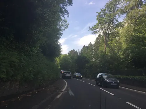
Mauldslie Bridge
Bridge · 2.5 mi
Bridge in South Lanarkshire, Scotland
Museums and landmarks16


Memorial to the Spanish Civil War
Monument and historic site · 3.3 mi
Memorial in Motherwell, Scotland, UK
Waterloo Community Centre
Monument and historic site · 0.7 mi
Wishaw Road, Wishaw
Lieutenant Colonel The Right Hon R G A Hamilton and Estate Workers Memorial
Monument and historic site · 0.9 mi
4 more on the map.
Parks, trails and playgrounds8





Restaurants and cafes21


The Wishaw Malt
Bar and pub · 0.5 mi
62-66 Kirk Road, Wishaw
Mo,Tu,We,Th,Su 08:00-24:00; Fr,Sa 08:00-25:00


9 more on the map.
History
The area of what is now Wishaw once lay on important Roman roads that ran through the areas of the Clyde (Latin – Cluta) and South Calder Water. In fact, the current Main Street is based on a road built by the Romans. Another such road ran close to Wishaw House. In the 1960s, a pagan religious figurine was found in the woods near Netherton, showing that there was some form of settlement near Wishaw before the Christianisation of Scotland, which occurred between 400 and 600 AD.
A small church was established by a bend (camas/cambo- in Cumbric) on the banks of the Clyde near what is now Netherton in the eighth century. There is however dispute to whether this was named after (or established by) Neithon of Alt Clut or perhaps St Ninian. Nonetheless, the area became known as Cambusnethan or Kamnethan from then on. The site of the original church remains as a ruined burial ground, including an impressive mausoleum to Lord Belhaven. The churchyard is notably round, similar to those found in Wales and Ireland, suggesting it could have been built on an earlier Celtic temple. Excavated from this area was the Cambusnethan Stone, a large Christian tablet created by the Strathclyde Britons.
Read more of the history
In the 12th century, a Norman lord constructed a large manor near Gowkthrapple, as well as another small church. This was the beginning of the parish of Cambusnethan, which lasted up until 1930. In the 13th century, administrative control of the parish was ceded to Glasgow from the previous Kelso Abbey. Small fortresses and tower houses were built; after the Scottish Wars of Independence, the barony was transferred by Robert the Bruce to local lords, however the title lay abandoned by the 20th century. The Somervilles of Cambusnethan were the principal aristocrats in the area, but sold their land to Sir James Steuart, later Lord Provost of Edinburgh, in 1653. Wishaw House is thought to date back to the 15th century and appears on Pont's map of Scotland from 1583, as Wisha. The settlements of Greenhead, Camnethan, Peddyr and Overtoun of Camnethan also appear.
The ruined church on Kirk Road, mere yards away from the current Cambusnethan church, is thought to date back to the 1600s or earlier.
In the 18th century, agriculture in the area consisted mainly of growing oats although some wheat and pear trees were cultivated. Members of the Reformed Presbyterian Church took up the favourable terms of the proprietor to enable them to establish a congregation in Wishaw in 1792. The village itself was laid out in 1794, named Cambusnethan and later renamed Wishawtown.
In 1801, the population of Wishaw was about 400 and that of the whole parish only 1,972. In the 1830s, Lord Belhaven set up a distillery in Wishaw. Other nineteenth century industries included coal mining, iron and steel making, foundry work, railway wagon building and fire-clay making.
Wishaw grew dramatically in the 1830s, with railways and gasworks coming to the town; many collieries opening during this decade. In 1840, the Old Parish Church was built. By the time the Caledonian Railway's main line came through Wishaw in 1848, it was a major mining centre fueling an important part of Scotland's industrial heartland. There were also factories for needle-work and tambouring, and confectionery. In 1848, Polish composer Frédéric Chopin visited Wishaw. Chopin was entertained at Wishaw house and played there for the family, the Hamiltons of Belhaven (the event has been commemorated by local residents in the past).
In the mid-19th century, the Coltness estate in the town was developed under ownership of the Houldsworths family, following the building of the Coltness Iron Company in 1837. The Jacobean style Coltness House was demolished in 1970, along with much of the historic estate, although the Category B-listed Gate House on Main Street and Kenilworth Avenue survives and was used as a public toilet until the early 21st century. On 4 September 1855, the town was incorporated with the villages of Coltness and Stewarton to form the Burgh of Wishaw, with a population of approximately 5,000. Four years later, in 1859, St.Ignatius Parish Church was established and the church built on Young Street, where it remains to this day. In 1882, Groome recorded that there were five schools in Wishaw, as well as others in nearby villages.
In 1905, the Category B-listed Clyde Chambers were built as tenement flats, shops and offices on Main Street. During the mid-20th century, Wishaw had five cinemas which have all since closed. These included the Classic Cinema at 57 Kirk Road which opened in 1920, closed in 1985 and was Category B-listed in 2001. The largest cinema in Wishaw was next door; the Greens Playhouse opened in 1940, with seating for 2,982 patrons. It closed in the 1970s, becoming a bingo club but then falling into disuse before being Category B-listed in 2004.
In the mid-to-late 20th century, deindustrialisation caused many factories and businesses to cease operation. The Coltness Iron company wound up in 1950. The local firm of R Y Pickering & Co Ltd (later Norbrit-Pickering) built railway rolling stock (especially wagons) and many tramcars for tram systems throughout the UK. One of its last orders was for ten double-decker trams for Aberdeen Corporation Tramways in 1949. Wishaw and its nearby neighbour of Motherwell were once the centre of steel manufacture in Scotland, as both towns were located either side of the former Ravenscraig Steelworks which closed in 1992.
In November 1996, the world's worst recorded outbreak of E. coli O157 occurred in the town, in which 21 people died and around 200 were infected.
From the History section of Wishaw on Wikipedia, under CC BY-SA 4.0.
More about Wishaw
Geography
Wishaw lies within North Lanarkshire, the fourth largest local authority in Scotland by population. The town is located in the relatively level Central Belt area; while there are valleys and high moors, there are no hills or summits over 1,640 feet (500 m).
The defined locality of Wishaw had a population of 30,290 in 2016, the 26th largest such place in the country. Along with its neighbours of Hamilton, Bellshill and Motherwell, it had been considered to form part of the Greater Glasgow conurbation, which had a population of around 1,670,000 (around a third of Scotland's total) in 2019; however, since 2016, Wishaw, Motherwell and Bellshill have been officially considered separate from the Glasgow settlement due to small gaps in the chain of occupied postcodes used to determine a grouping; instead, they form their own settlement which has the fifth largest population in Scotland at 124,000.
Wishaw experiences mild summers and cool winters, with the most rainfall coming between October and March; most winters see around 10–20 days of snow. The warmest month on average is July, with an average daily temperature of 14.7 °C, while the coldest is January with an average daily temperature of 2.3 °C.
Wishaw lies on two rivers: the Clyde, running near to Overton and Netherton, and its tributary the South Calder Water further north near Coltness and Newmains.
From the Wikipedia article Wishaw, under CC BY-SA 4.0.
Notable people from Wishaw
 John HigginsScottish snooker playerPhoto: Daniel King, CC BY 4.0
 David TurnbullScottish association football playerPhoto: Timmy96, CC0
 Chris TottenScottish snooker playerPhoto: Benutzer:Bill da Flute, CC BY-SA 3.0
 John ClelandBritish racecar driverPhoto: Cs-wolves, CC BY-SA 4.0
 Jim GrahamAmerican lawyer (1945–2017)Photo: dbking, CC BY 2.0
 Jon McCrackenScottish association football player (born 2000)Photo: Stuartp1213, CC0
 Bob TelferScottish and Australian soccer player, referee, manager (1904–1984)Photo: SHEEPD0G27, CC BY-SA 4.0
- Lennon MillerScottish footballer
- William John HamiltonBritish geologist (1805-1867)
- Thomas WinningArchbishop of Glasgow (1925–2001)
- Lewis MacleodScottish association football player
- Paul QuinnBritish footballer (born 1985)


Born in Wishaw, according to Wikidata (CC0). Each name links to its Wikipedia article.
Churches and places of worship9
Cambusnethan North Church
Church · Presbyterian · 0.9 mi
Cambusnethan Street, Wishaw
Cambusnethan Old Parish Church
Church · Church Of Scotland · 0.8 mi
Coronation Street, Wishaw
Shopping7
Gas and EV charging3
Schools, colleges and libraries13
Healthcare2
Map of Wishaw
80 places. The map loads OpenStreetMap tiles when you open it.
Getting there and nearby towns
Glasgow Airport (GLA) is the nearest airport with scheduled flights listed in OpenStreetMap, 21 miles away.
- Overtown 1 mi south, about 1 min by car
- Law 2 mi southeast, about 3 min by car
- Newmains 2 mi northeast, about 3 min by car
- Dalserf 2 mi south, about 4 min by car
- Morningside 2 mi east, about 3 min by car
- Cleland 2 mi north, about 4 min by car
- Ashgill 3 mi south, about 4 min by car
- Larkhall 3 mi southwest, about 5 min by car
- Glasgow 15 mi northwest, about 24 min by car
- Edinburgh 31 mi northeast, about 49 min by car
Drive times are estimates from straight-line distance, not routes.
Keep exploring
Local news
Headlines from INDB.
Reviews, tips and questions
Loading what members have shared...
Sources and licences
- GeoNames (CC BY 4.0): population, coordinates, regions and time zone
- Mapillary (see each image): photos
- OpenStreetMap contributors (ODbL 1.0): places, airports, map data
- Wikidata (CC0 1.0): elevation, founding date, time zone, website, landmarks and historic places
- Wikimedia Commons (see each image): photos
- Wikipedia (CC BY-SA 4.0): overview and history text
Photo credits
- 11592 Wishaw Church of God Assembly Hall, Wishaw 001, WeeHolly, CC BY-SA 4.0
- 05701 Wishaw South Church of Scotland, Wishaw 006, WeeHolly, CC BY-SA 4.0
- 05701 Wishaw South Church of Scotland, Wishaw 009, WeeHolly, CC BY-SA 4.0
- 05701 Wishaw South Church of Scotland, Wishaw 012, WeeHolly, CC BY-SA 4.0
- 05701 Wishaw South Church of Scotland, Wishaw 001, WeeHolly, CC BY-SA 4.0
- 05701 Wishaw South Church of Scotland, Wishaw 002, WeeHolly, CC BY-SA 4.0
- 05701 Wishaw South Church of Scotland, Wishaw 011, WeeHolly, CC BY-SA 4.0
- 05701 Wishaw South Church of Scotland, Wishaw 003, WeeHolly, CC BY-SA 4.0
- 05701 Wishaw South Church of Scotland, Wishaw 007, WeeHolly, CC BY-SA 4.0
- 05701 Wishaw South Church of Scotland, Wishaw 004, WeeHolly, CC BY-SA 4.0
- 05701 Wishaw South Church of Scotland, Wishaw 010, WeeHolly, CC BY-SA 4.0
- 05701 Wishaw South Church of Scotland, Wishaw 008, WeeHolly, CC BY-SA 4.0
- 05701 Wishaw South Church of Scotland, Wishaw 005, WeeHolly, CC BY-SA 4.0
- 11591 Former Thornlie Church of Scotland, Wishaw 010, WeeHolly, CC BY-SA 4.0
- 11591 Former Thornlie Church of Scotland, Wishaw 014, WeeHolly, CC BY-SA 4.0
- 11591 Former Thornlie Church of Scotland, Wishaw 012, WeeHolly, CC BY-SA 4.0
- 11591 Former Thornlie Church of Scotland, Wishaw 007, WeeHolly, CC BY-SA 4.0
- 11591 Former Thornlie Church of Scotland, Wishaw 006, WeeHolly, CC BY-SA 4.0
- 11591 Former Thornlie Church of Scotland, Wishaw 009, WeeHolly, CC BY-SA 4.0
- 11591 Former Thornlie Church of Scotland, Wishaw 013, WeeHolly, CC BY-SA 4.0
- Coltness High New Building, Richard Webb, CC BY-SA 2.0
- Cambusnethan House 1830 II, engraved by Joseph Swan, from drawings by John Fleming, Public domain
- Pather Community Park, Ross Watson, CC BY-SA 2.0
- Greenhead Moss Community Nature Park - panoramio (3), Allan R, CC BY-SA 3.0
- Street-level photo, laye, CC BY-SA 4.0
- Street-level photo, ccbb7766, CC BY-SA 4.0


Page built November 10, 2026. Spotted a mistake? Tell us or suggest a place.