


Germantown, Tennessee
Germantown is a city of 40,673 people in Shelby County, Tennessee, founded in 1825.
Why visit Germantown
Townapedia lists 6 museums and landmarks, 41 parks and trails, 119 places to eat, 20 places to stay and 3 attractions in and around town.
Highlights include Forest Hill Cinema Grill 8, Majestic Cinema, Memorial Park Funeral Home & Cemetery and Mosby-Bennett House.
July is the warmest month, with average highs of 92°F; January lows average 31°F.
Weather in Germantown
Forecast from the National Weather Service. Full forecast
About Germantown
Germantown is a city in Shelby County, Tennessee, United States. The population was 41,333 at the 2020 census, and was estimated at 40,128 in 2024, making it the 23rd-most populous city in Tennessee. It was given a Malcolm Baldrige National Quality Award for Performance Excellence in 2019.
From the Wikipedia article Germantown, Tennessee (this version), under CC BY-SA 4.0.
Things to do3

Museums and landmarks6
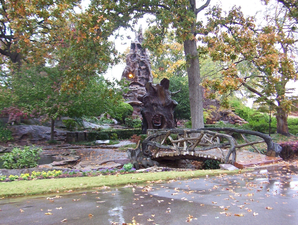
Memorial Park Funeral Home & Cemetery
Monument and historic site · National Register of Historic Places · 5.5 mi
Cemetery in Memphis, Tennessee

Mosby-Bennett House
Monument and historic site · National Register of Historic Places · 4.3 mi
Historic house in Tennessee, United States

Pauline Cheek Barton House
Monument and historic site · National Register of Historic Places · 3.6 mi
Single-family detached home in Memphis, United States of America


Wilks Brooks House
Monument and historic site · National Register of Historic Places · 4.0 mi
Memphis, Tennessee


Parks, trails and playgrounds41


Ducks Unlimited National Headquarters
Hiking and trails · 3.7 mi
1 Waterfowl Way, Memphis
Mo-Fr 08:00-17:00

29 more on the map.
Restaurants and cafes119

Asian Eatery
Restaurant · Asian Restaurant · 1.8 mi
2072 West Street, Germantown
Mo-Fr 11:00-21:00; Sa,Su 16:00-21:00

Buffalo Wild Wings
Restaurant · Wings · 2.6 mi
3770 Hacks Cross Road, Memphis
Mo-Th 11:00-24:00; Fr-Sa 11:00-01:00; Su 11:00-23:00

CitySilo
Restaurant · 1.8 mi
7605 West Farmington Boulevard, Germantown
Mo-Sa 07:00-20:00; Su 09:00-18:00
DWJ Eastern Grill & Sushi Bar
Restaurant · Asian · 2.6 mi
3758 Hacks Cross Road, Memphis
Mo-Fr 11:00-15:00 , 16:30-22:00; Sa 11:30-23:00; Su 11:30-22:00
107 more on the map.
History
Germantown was founded along the Chickasaw Trace on a ridge between the Wolf River and Nonconnah Creek, about 16 miles (26 km) east of the Mississippi River.
The first settlers arrived in Germantown about 1825. Between 1825 and 1830, Miss Frances Wright established Nashoba Plantation, a utopian community intended to educate emancipated slaves and teach them a trade. By 1830, the first store was opened as more settlers moved into the area.
The community became known as Pea Ridge in 1833. Town lots were laid out in 1834 by surveyor N. T. German. The name was changed to Germantown in 1836. This coincidentally also reflected the settling of German families.
The town was incorporated in 1841. The Memphis-Charleston Railroad was built through the community in 1852. Germantown experienced setbacks through the period of the Civil War (1861–1865); the yellow fever epidemics reduced its population to a few hundred.
The town rebounded slowly. Churches destroyed in the war were rebuilt, schools were constructed and the population began to return around the turn of the century. The city name was briefly changed to Neshoba, a Chickasaw word meaning 'wolf', during World War I, because of widespread anti-German sentiment in the United States at that time.
From the History section of Germantown, Tennessee on Wikipedia, under CC BY-SA 4.0.
Where to stay20
Hampton by Hilton Inn & Suites Memphis Germantown
Motel and hotel · 1.9 mi
1680 South Germantown Road, Germantown
Holiday Inn Express Hotel & Suites Memphis Germantown
Motel and hotel · 2.6 mi
7784 Wolf Trail Cove, Germantown
Holiday Inn & Suites Memphis Southeast - Germantown
Motel and hotel · 2.7 mi
7730 Centennial Drive, Memphis
Extended Stay America Memphis Mount Moriah
Motel and hotel · 3.7 mi
6520 Mount Moriah Rd Ext, Memphis
Churches and places of worship40
Riveroaks Reformed Presbyterian Church
Church · Presbyterian Church In America · 2.0 mi
1665 South Germantown Road, Germantown
Grace Evangelical Church
Church · Evangelical · 2.8 mi
9750 Wolf River Boulevard, Germantown
Shopping20
Gas and EV charging10
Schools, colleges and libraries69
Bailey Station Elementary School
School · 3.8 mi
3435 Bailey Station Rd, Collierville
Compass Community School Hickory Hill Campus
School · 5.9 mi
3572 Emerald, Memphis
Healthcare16
Allergy & Ashtma Care
Clinic and pharmacy · 3.3 mi
7205 Wolf River Boulevard, Germantown
Sutherland Cardiology Clinic
Clinic and pharmacy · 2.9 mi
7460 Wolf River Boulevard, Germantown
Map of Germantown
250 places. The map loads OpenStreetMap tiles when you open it.
Climate by month
Monthly table
| Month | High | Low | Rain | Snow |
|---|---|---|---|---|
| Jan | 50°F | 31°F | 4.3 in | 0.4 in |
| Feb | 55°F | 34°F | 4.7 in | 0.6 in |
| Mar | 64°F | 42°F | 5.6 in | 0.8 in |
| Apr | 74°F | 51°F | 5.9 in | 0.0 in |
| May | 82°F | 61°F | 5.3 in | 0.0 in |
| Jun | 89°F | 69°F | 4.7 in | 0.0 in |
| Jul | 92°F | 73°F | 4.2 in | 0.0 in |
| Aug | 91°F | 71°F | 3.6 in | 0.0 in |
| Sep | 85°F | 63°F | 3.3 in | 0.0 in |
| Oct | 75°F | 50°F | 4.0 in | 0.0 in |
| Nov | 62°F | 41°F | 4.5 in | 0.0 in |
| Dec | 53°F | 34°F | 5.2 in | 0.3 in |
U.S. Climate Normals 1991-2020 for Germantown 4Se (2 mi away), NOAA NCEI.
People and cost of living
American Community Survey 5-year estimates, 2020-2024, U.S. Census Bureau. Estimates have margins of error, larger for small towns.
Disaster history
Shelby County has had 24 federal disaster declarations since 2000, most often for severe storms.
- 2026-02-06: Severe Winter Storm (Winter Storm)
- 2026-01-24: Severe Winter Storm (Winter Storm)
- 2025-06-19: Severe Storms, Straight-Line Winds, Tornadoes, And Flooding (Severe Storm)
- 2025-04-02: Severe Storms, Straight-Line Winds, Tornadoes, And Flooding (Severe Storm)
- 2023-09-04: Severe Storms And Straight-Line Winds (Severe Storm)
- 2023-08-17: Severe Storms And Straight-Line Winds (Severe Storm)
OpenFEMA disaster declarations summaries.
Getting there and nearby towns
Olive Branch Airport (OLV) is the nearest airport with scheduled flights listed in OpenStreetMap, 7 miles away.
- Collierville 5 mi southeast, about 9 min by car
- Olive Branch 9 mi south, about 15 min by car
- Memphis 11 mi west, about 17 min by car
- Bartlett 11 mi north, about 17 min by car
- Southaven 14 mi southwest, about 23 min by car
- Arlington 14 mi northeast, about 22 min by car
- Horn Lake 18 mi southwest, about 28 min by car
- Hernando 20 mi southwest, about 32 min by car
- West Memphis 24 mi west, about 39 min by car
- Atoka 24 mi north, about 38 min by car
Drive times are estimates from straight-line distance, not routes.
Local news
Headlines from INDB, the NEMICO news database.
Reviews, tips and questions
Loading what members have shared...
Sources and licences
- NCES EDGE (Public domain): public schools
- NOAA NCEI U.S. Climate Normals 1991-2020 (Public domain): climate by month
- OpenFEMA (Public domain): disaster declarations
- OpenStreetMap contributors (ODbL 1.0): places, airports, map data
- U.S. Census Bureau (Public domain): population, income, housing, education, commute
- Wikidata (CC0 1.0): elevation, founding date, time zone, website, landmarks and historic places
- Wikimedia Commons (see each image): photos
- Wikipedia (CC BY-SA 4.0): overview and history text
Photo credits
- Germantown - panoramio (1), photophone02, CC BY-SA 3.0
- The Germantown Redoubt, Jim Roberts, CC BY-SA 4.0
- Germantown, TN, USA - panoramio, photophone02, CC BY-SA 3.0
- Old Germantown Baptist Church, Jim Roberts, CC BY-SA 4.0
- Germantown Commissary - panoramio, photophone02, CC BY-SA 3.0
- Germantown Commissary, Ben+Sam, CC BY-SA 2.0
- Germantown - panoramio, photophone02, CC BY-SA 3.0
- Light pole Germantown, TN - panoramio, md. childress, CC BY 3.0
- Germantown Cemetery 2 - panoramio, zantastik, CC BY-SA 3.0
- Germantown Cemetery - panoramio, zantastik, CC BY 3.0
- Germantown Cemetery 3 - panoramio, zantastik, CC BY 3.0
- Germantown, TN, USA - panoramio (2), photophone02, CC BY-SA 3.0
- Summer in Germantown - panoramio, photophone02, CC BY-SA 3.0
- Germantown, TN, USA - panoramio (1), photophone02, CC BY-SA 3.0
- Wills Brooks House, Jim Roberts, CC BY-SA 4.0
- The Mosby-Bennett House, Jim Roberts, CC BY-SA 4.0
- Crystal Shrine Grotto, DoxTxob at English Wikipedia, CC BY-SA 3.0
- Pauline Cheek Barton House, Jim Roberts, CC BY-SA 4.0
- Germantown Baptist Church, Sweetmoose6 at en.wikipedia, CC BY-SA 3.0
- Oaklawn Gardens Semaphore - panoramio, Matthew Nichols, CC BY-SA 3.0
- Glass icicle ornaments - clear and blue, Patrick, CC BY-SA 2.0
- Roomba (2131710263), Patrick from Austin, TX, CC BY-SA 2.0
- ISS066-E-108245 - View of Earth, Earth Science and Remote Sensing Unit , Lyndon B. Johnson Space Center, Public domain
- ISS047-E-26691 - View of Earth, Earth Science and Remote Sensing Unit , Lyndon B. Johnson Space Center, Public domain
- ISS066-E-108246 - View of Earth, Earth Science and Remote Sensing Unit , Lyndon B. Johnson Space Center, Public domain
- ISS066-E-108243 - View of Earth, Earth Science and Remote Sensing Unit , Lyndon B. Johnson Space Center, Public domain
- ISS066-E-108244 - View of Earth, Earth Science and Remote Sensing Unit , Lyndon B. Johnson Space Center, Public domain
- ISS066-E-108247 - View of Earth, Earth Science and Remote Sensing Unit , Lyndon B. Johnson Space Center, Public domain
- Jintan from Tokyo December 2014, TNGandhi, CC BY-SA 4.0
- Halictus ligatus 54592076 (cropped), Melissa McMasters, CC BY 4.0
- Halictus ligatus 54592076, Melissa McMasters, CC BY 4.0
- Example of orthostatic tachycardia in POTS patient, Apple teaa, CC0
- Poplar Estates - panoramio, photophone02, CC BY-SA 3.0
- Bharat International Market - panoramio, Zain Ghani, CC BY-SA 3.0
- 2023 02 08 PERiLS Media Day-0523, NOAA NSSL, CC BY 2.0
- 2023 02 08 PERiLS Media Day-0291, NOAA NSSL, CC BY 2.0
- 2023 02 08 PERiLS Media Day-0512, NOAA NSSL, CC BY 2.0
- 2023 02 08 PERiLS Media Day-0511, NOAA NSSL, CC BY 2.0
- 2023 02 08 PERiLS Media Day-0382-2, NOAA NSSL, CC BY 2.0
- 2023 02 08 PERiLS Media Day-0195, NOAA NSSL, CC BY 2.0


Page built October 30, 2026. Spotted a mistake? Tell us or suggest a place.