




Gloucester, Massachusetts
Gloucester is a city of 30,075 people in Essex County, Massachusetts, founded in 1623.
Why visit Gloucester
Townapedia lists 139 museums and landmarks, 180 parks and trails, 63 places to eat, 13 places to stay and 30 attractions in and around town.
Highlights include Eastern Point Light, Granite Keystone Bridge, Hammond Castle Museum and Annisquam Harbor Light.
July is the warmest month, with average highs of 80°F; January lows average 18°F, and about 51 inches of snow fall in a normal year.
Weather in Gloucester
Forecast from the National Weather Service. Full forecast
About Gloucester
Gloucester is a city in Essex County, Massachusetts, United States. It sits on Cape Ann and is a part of Massachusetts's North Shore. The population was 29,729 at the 2020 U.S. census. An important center of the fishing industry and a popular summer destination, Gloucester consists of an urban core on the north side of the harbor and the outlying neighborhoods of Annisquam, Bay View, Lanesville, Folly Cove, Magnolia, Riverdale, East Gloucester, and West Gloucester.
From the Wikipedia article Gloucester, Massachusetts (this version), under CC BY-SA 4.0.
Things to do30

Eastern Point Light
Lighthouse · National Register of Historic Places · 3.5 mi
Lighthouse in Massachusetts, United States

Granite Keystone Bridge
Bridge · National Register of Historic Places · 4.0 mi
Historic bridge in Rockport, Massachusetts, United States

Straitsmouth Island Light
Lighthouse · National Register of Historic Places · 5.5 mi
Lighthouse in Massachusetts, United States


Crane Beach
Beach · 5.9 mi
Conservation and recreation property located in Ipswich, Massachusetts
Ipswich Range Lights
Lighthouse · 5.7 mi
Range lights in Massachusetts, United States
Gloucester Breakwater Light
Lighthouse · 3.2 mi
White house and tower on brown square skeleton framework.

Nugent Boulders
Scenic view · 2.4 mi
Two large boulders with problems between V1 and V9.
18 more on the map.
Museums and landmarks139


Annisquam Harbor Light
Monument and historic site · National Register of Historic Places · 2.4 mi
Lighthouse in Massachusetts, United States
45 Norwood Heights

Central Gloucester Historic District
Monument and historic site · National Register of Historic Places · 1.4 mi
Historic district in Massachusetts, United States

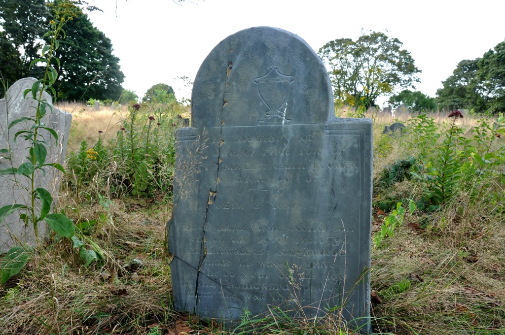
First Parish Burial Ground
Monument and historic site · National Register of Historic Places · 0.9 mi
Historic cemetery in Gloucester, Massachusetts, United States

Gloucester City Hall
Monument and historic site · National Register of Historic Places · 1.5 mi
Rathaus in Massachusetts, United States of America
9 Dale Avenue, Gloucester

Oak Grove Cemetery
Monument and historic site · National Register of Historic Places · 0.9 mi
Cemetery in Gloucester, Massachusetts

Ten Pound Island Light
Lighthouse · National Register of Historic Places · 2.1 mi
Lighthouse in Massachusetts, United States
Adventure
Monument and historic site · National Register of Historic Places · 1.8 mi
1926 schooner
Annisquam Bridge
Monument and historic site · National Register of Historic Places · 1.9 mi
Bridge in Gloucester, Massachusetts, United States
Babson-Alling House
Monument and historic site · National Register of Historic Places · 0.6 mi
Historic house in Massachusetts, United States

Beauport
Monument and historic site · National Register of Historic Places · 2.8 mi
House in Gloucester, Massachusetts
127 more on the map.
Parks, trails and playgrounds180



Coolidge Reservation
Park · 4.3 mi
Nature reserve in United States of America
Crane Wildlife Refuge
Park · 5.0 mi
Wildlife refuge in Ipswich and Essex, Massachusetts, USA

Ravenswood Park
Park · 2.4 mi
Nature reserve in Massachusetts, United States


168 more on the map.
Restaurants and cafes63


Jalapeno's Authentic Mexican Restaurant
Restaurant · Mexican · 1.5 mi
88 Main Street, Gloucester
Mo-We 16:00-21:30; Th-Sa 11:30-21:30
Machaca Taco and Tequila Bar
Restaurant · Mexican · 1.5 mi
14 Rogers Street
Tu-Th 16:30-21:00; Fr-Sa 14:00-21:00; Su 14:00-20:30; PH off
Minglewood Harborside
Restaurant · American, Sushi · 1.5 mi
25 Rogers Street
Su-Mo 11:00-21:00; Tu-We 16:00-21:00; Th-Sa 11:00-21:30; PH off

Sugar Magnolias
Restaurant · American, Breakfast · 1.5 mi
64 Main Street
We-Fr 07:00-14:00; Sa-Su 07:00-13:00; Mo-Tu off
Tonno Gloucester
Restaurant · Italian · 1.5 mi
2 Main Street
Su-Th 15:00-21:30; Fr-Sa 15:00-22:00; PH off
Causeway Restaurant
Restaurant · Seafood · 1.1 mi
76;78 Essex Avenue
Su-Th 11:00-20:00; Fr-Sa 11:00-21:00
51 more on the map.
History
The boundaries of Gloucester originally included the town of Rockport, in an area dubbed "Sandy Bay". The village separated formally from Gloucester on February 27, 1840. In 1873, Gloucester was reincorporated as a city.
From the History section of Gloucester, Massachusetts on Wikipedia, under CC BY-SA 4.0.
Where to stay13
Churches and places of worship16
Our Lady of Good Voyage Church
Church · National Register of Historic Places · 1.6 mi
Shopping17
Gas and EV charging3
Schools, colleges and libraries36
Healthcare4
Lahey Urgent Uare
Clinic and pharmacy · 1.6 mi
305 Gloucester Crossing Road, Gloucester
Map of Gloucester
250 places. The map loads OpenStreetMap tiles when you open it.
Climate by month
Monthly table
| Month | High | Low | Rain | Snow |
|---|---|---|---|---|
| Jan | 37°F | 18°F | 3.7 in | 16.0 in |
| Feb | 39°F | 18°F | 3.6 in | 16.4 in |
| Mar | 45°F | 25°F | 4.6 in | 7.6 in |
| Apr | 57°F | 34°F | 4.2 in | 1.4 in |
| May | 66°F | 44°F | 3.5 in | 0.0 in |
| Jun | 75°F | 54°F | 4.0 in | 0.0 in |
| Jul | 80°F | 60°F | 3.4 in | 0.0 in |
| Aug | 79°F | 58°F | 3.4 in | 0.0 in |
| Sep | 72°F | 51°F | 3.8 in | 0.0 in |
| Oct | 61°F | 40°F | 5.0 in | 0.3 in |
| Nov | 51°F | 31°F | 4.0 in | 0.9 in |
| Dec | 42°F | 24°F | 4.8 in | 8.8 in |
U.S. Climate Normals 1991-2020 for Beverly (8 mi away), NOAA NCEI.
People and cost of living
American Community Survey 5-year estimates, 2020-2024, U.S. Census Bureau. Estimates have margins of error, larger for small towns.
Disaster history
Essex County has had 26 federal disaster declarations since 2000, most often for severe storms.
- 2023-09-15: Hurricane Lee (Hurricane)
- 2020-03-27: Covid-19 Pandemic (Biological)
- 2020-03-13: Covid-19 (Biological)
- 2018-07-19: Severe Winter Storm And Snowstorm (Snowstorm)
- 2018-06-25: Severe Winter Storm And Flooding (Severe Storm)
- 2015-04-13: Severe Winter Storm, Snowstorm, And Flooding (Severe Storm)
OpenFEMA disaster declarations summaries.
Getting there and nearby towns
Beverly Municipal Airport (BVY) is the nearest airport with scheduled flights listed in OpenStreetMap, 12 miles away.
- Beverly 10 mi southwest, about 15 min by car
- Danvers 14 mi west, about 23 min by car
- Lynn 18 mi southwest, about 28 min by car
- Amesbury 21 mi northwest, about 33 min by car
- Chelsea 24 mi southwest, about 38 min by car
- Everett 24 mi southwest, about 39 min by car
- Boston 26 mi southwest, about 42 min by car
- Cambridge 28 mi southwest, about 45 min by car
- Arlington 28 mi southwest, about 46 min by car
- Burlington 28 mi west, about 45 min by car
Drive times are estimates from straight-line distance, not routes.
Local news
Headlines from INDB, the NEMICO news database.
Reviews, tips and questions
Loading what members have shared...
Sources and licences
- NCES EDGE (Public domain): public schools
- NOAA NCEI U.S. Climate Normals 1991-2020 (Public domain): climate by month
- OpenFEMA (Public domain): disaster declarations
- OpenStreetMap contributors (ODbL 1.0): places, airports, map data
- U.S. Census Bureau (Public domain): population, income, housing, education, commute
- Wikidata (CC0 1.0): elevation, founding date, time zone, website, landmarks and historic places
- Wikimedia Commons (see each image): photos
- Wikipedia (CC BY-SA 4.0): overview and history text
Photo credits
- Gloucester MA - Fisherman's Memorial, Paul Keleher from Mass, US, CC BY 2.0
- GloucesterMA BabsonAllingHouse, Magicpiano, CC BY-SA 3.0
- GloucesterMA FirstParishBurialGround Entrance, Magicpiano, CC BY-SA 3.0
- GloucesterMA FirstParishBurialGround 18thCenturyGravestone, Magicpiano, CC BY-SA 3.0
- GloucesterMA GloucesterNetAndTwineCompany, Magicpiano, CC BY-SA 3.0
- 2012 Annisquam Gloucester Massachusetts USA 6899286579, Max's Silver Hammer, CC BY-SA 2.0
- GloucesterMA DykeWheelerHouse, Magicpiano, CC BY-SA 3.0
- Gloucester station from Washington Street (1), April 2014, Pi.1415926535, CC BY-SA 3.0
- Gloucester station from Washington Street (2), April 2014, Pi.1415926535, CC BY-SA 3.0
- Gloucester (MBTA station), Fletcher6, CC BY-SA 3.0
- Gloucester, Massachusetts (2749535868), yeowatzup, CC BY 2.0
- MBTA station Gloucester, Ymblanter, CC BY-SA 4.0
- Inbound train at Gloucester station, April 2014, Pi.1415926535, CC BY-SA 3.0
- Mini-high platform at Gloucester station, April 2014, Pi.1415926535, CC BY-SA 3.0
- Gloucester High School, Cody Carlson, CC BY-SA 3.0
- 2013 Cape Pond Ice building Gloucester Massachusetts USA 8780267793, Steven Davy, CC BY 2.0
- 2009 house stairs Gloucester Massachusetts USA 5345370137, Raniero Corsetti Giusti di Ripalunga from Rome, Italy, CC BY 2.0
- 2013 harbor Gloucester Massachusetts USA 8786853968, Steven Davy, CC BY 2.0
- 2010 snow Blynman Canal Gloucester Massachusetts USA 4240935646, Kenny MacCarthy from Gloucester MA, USA, CC BY 2.0
- 2010 cemetery Gloucester Massachusetts USA 5365332518, Mike Babiarz, CC BY 2.0
- Gloucester fisherman at the helm, FrankJLaski, CC BY-SA 4.0
- 2015 Stacy Esplanade Gloucester Massachusetts USA 19236632016, Kenny MacCarthy from Gloucester MA, USA, CC BY 2.0
- 2011 Stacy Esplanade in Gloucester Massachusetts USA 5904377977, Todd Van Hoosear, CC BY-SA 2.0
- Gloucester Fisherman's Memorial 2019, Statue: Leonard Craske Photo: Sean Dudley, Public domain
- Gloucester Fisherman Statue and Memorial 9-17-25, Qwerty123uiop, CC0
- Main Street at Spring Street Gloucester MA, Lance Fairbanks, CC BY-SA 3.0
- Gloucester City Hall, Fletcher6, CC BY-SA 3.0
- Ten Pound Island Light, Unitzebra3 at en.wikipedia, Public domain
- Eastern point lighthouse, Esc861, Public domain
- GloucesterMA AnnisquamLight 4, User:Magicpiano, CC BY-SA 4.0
- Main St looking west, Gloucester MA, John Phelan, CC BY 3.0
- Oak Grove Cemetery, Gloucester MA, John Phelan, CC BY 3.0
- Wingaersheek beach summer sunset, Gabrielm199, CC BY-SA 4.0
- CogswellsGrant Barn, User:Magicpiano, CC BY-SA 4.0
- Crane estate (5), Djmcrenn, CC BY 3.0
- Gott House, Rockport MA, John Phelan, CC BY 3.0
- Beauport Gloucester, Ymblanter, CC BY-SA 3.0
- Norwood-Hyatt House, Gloucester MA, John Phelan, CC BY 3.0
- EssexMA DavidBurnhamHouse, Magicpiano, CC BY-SA 3.0
- Old Castle, Pigeon Cove MA, John Phelan, CC BY 3.0


Page built October 30, 2026. Spotted a mistake? Tell us or suggest a place.