

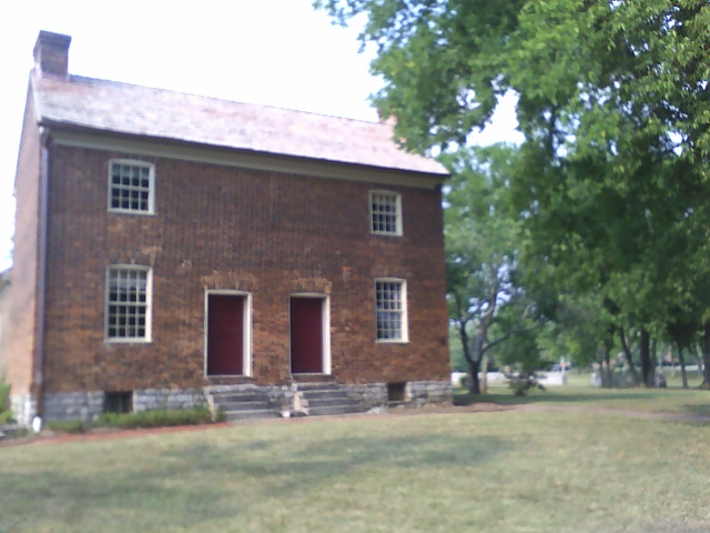


Goodlettsville, Tennessee
Goodlettsville is a city of 17,597 people in Davidson County, Tennessee, founded in 1958.
Why visit Goodlettsville
Townapedia lists 6 museums and landmarks, 5 parks and trails, 41 places to eat, 17 places to stay and 1 attraction in and around town.
Highlights include AMC Classic Madison 10, Abner T. Shaw House, Bowen-Campbell House and Moss–Wright Park.
August is the warmest month, with average highs of 90°F; January lows average 27°F.
Weather in Goodlettsville
Forecast from the National Weather Service. Full forecast
About Goodlettsville
Goodlettsville is a city in Davidson and Sumner Counties in the U.S. state of Tennessee. It was incorporated as a city in 1958 with a population of just over 3,000 residents; in 2020, its population was 17,789. It is part of the Nashville metropolitan area.
From the Wikipedia article Goodlettsville, Tennessee (this version), under CC BY-SA 4.0.
Things to do1

Museums and landmarks6

Abner T. Shaw House
Monument and historic site · National Register of Historic Places · 4.3 mi
Building in Tennessee, United States
Bowen-Campbell House
Monument and historic site · National Register of Historic Places · 1.0 mi
Historic house in Tennessee, United States
Cartwright-Moss House
Monument and historic site · National Register of Historic Places · 2.3 mi
House in Davidson County, Tennessee

Monthaven
Monument and historic site · National Register of Historic Places · 2.7 mi
Historic house in Tennessee, United States


Rainbow Ranch
Monument and historic site · National Register of Historic Places · 5.1 mi
Historic home in Nashville, Tennessee

Parks, trails and playgrounds5


Restaurants and cafes41



Dutch Bros. Coffee
Cafe · Coffee Shop · 2.5 mi
1713 Gallatin Pike North, Madison
Mo-Th 05:00-22:00; Fr-Sa 05:00-23:00; Su 05:00-22:00
88 Kitchen
Restaurant · Asian, Chinese, Oriental, Sushi · 2.3 mi
909 Rivergate Parkway
Su-Mo, We-Th 10:00-21:30; Fr-Sa 10:00-22:00
29 more on the map.
History
Long hunter and early Middle Tennessee settler Kasper Mansker was reportedly born on an immigrant ship bound for the American colonies. Little is known about his German ancestry or his early life. Mansker began to explore the wilds of Kentucky and Tennessee with a group of long hunters in 1769. A journey taken in 1772 introduced Mansker to the rich resources of Middle Tennessee, especially what is now Sumner and Davidson Counties. Near a salt lick and a large creek now known as Mansker's Creek in the present-day city of Goodlettsville, Mansker established his own fortified station, Mansker's Station, in the winter of 1779–1780, which was a winter remembered for its severe temperatures.
Goodlettsville was named for A. G. Goodlett, pastor of the Cumberland Presbyterian Church from 1848 to 1853.
In April 1892, two daughters of the white Bruce family of Goodlettsville claimed to have been assaulted. African-American brothers Ephraim and Henry Grizzard were arrested as suspects. Henry was lynched and hanged in the town on April 24, 1892. His brother Ephraim had been jailed in Nashville for the same incident. On April 30, 1892, Ephraim Grizzard was taken from jail and lynched by a mob of 10,000 in the courthouse square. His body was taken to Goodlettsville, where it was burned.
From the History section of Goodlettsville, Tennessee on Wikipedia, under CC BY-SA 4.0.
Where to stay17
TownePlace Suites Nashville Goodlettsville
Motel and hotel · 1.1 mi
830 Conference Drive, Goodlettsville
Nashville North RV Resort
Campground · 2.9 mi
1200 Louisville Highway, Goodlettsville
WoodSpring Suites Nashville Rivergate
Motel and hotel · 1.9 mi
122 Liberty Lane, Madison
Churches and places of worship26
Goodlettsville Church of the Nazarene
Church · Nazarene
400 Loretta Drive, Goodlettsville
Shopping5
Gas and EV charging9
Schools, colleges and libraries34
Healthcare2
Map of Goodlettsville
146 places. The map loads OpenStreetMap tiles when you open it.
Climate by month
Monthly table
| Month | High | Low | Rain | Snow |
|---|---|---|---|---|
| Jan | 47°F | 27°F | 3.7 in | 0.6 in |
| Feb | 51°F | 30°F | 4.3 in | 0.3 in |
| Mar | 60°F | 37°F | 4.6 in | 0.2 in |
| Apr | 71°F | 45°F | 4.7 in | 0.0 in |
| May | 79°F | 55°F | 4.5 in | 0.0 in |
| Jun | 86°F | 64°F | 3.8 in | 0.0 in |
| Jul | 90°F | 67°F | 4.0 in | 0.0 in |
| Aug | 90°F | 67°F | 3.4 in | 0.0 in |
| Sep | 83°F | 60°F | 3.7 in | 0.0 in |
| Oct | 72°F | 47°F | 3.3 in | 0.0 in |
| Nov | 60°F | 36°F | 3.4 in | 0.0 in |
| Dec | 50°F | 29°F | 4.4 in | 0.1 in |
U.S. Climate Normals 1991-2020 for Old Hickory Dam (4 mi away), NOAA NCEI.
People and cost of living
American Community Survey 5-year estimates, 2020-2024, U.S. Census Bureau. Estimates have margins of error, larger for small towns.
Disaster history
Davidson County has had 21 federal disaster declarations since 2000, most often for severe storms.
- 2026-02-06: Severe Winter Storm (Winter Storm)
- 2026-01-24: Severe Winter Storm (Winter Storm)
- 2025-06-19: Severe Storms, Straight-Line Winds, Tornadoes, And Flooding (Severe Storm)
- 2025-04-02: Severe Storms, Straight-Line Winds, Tornadoes, And Flooding (Severe Storm)
- 2023-12-13: Severe Storms And Tornadoes (Severe Storm)
- 2023-05-17: Severe Storms, Straight-Line Winds, And Tornado (Severe Storm)
OpenFEMA disaster declarations summaries.
Getting there and nearby towns
Nashville International Airport (BNA) is the nearest airport with scheduled flights listed in OpenStreetMap, 15 miles away.
- Nashville-Davidson 12 mi south, about 19 min by car
- Gallatin 14 mi east, about 22 min by car
- Brentwood 24 mi south, about 38 min by car
- Franklin 28 mi north, about 44 min by car
- Franklin 30 mi south, about 48 min by car
- Fairview 34 mi southwest, about 54 min by car
- Murfreesboro 37 mi southeast, about 59 min by car
- Clarksville 39 mi northwest, about 1 h by car
- Dickson 42 mi southwest, about 1 h by car
- Bowling Green 47 mi north, about 1 h 15 min by car
Drive times are estimates from straight-line distance, not routes.
Local news
Headlines from INDB, the NEMICO news database.
Reviews, tips and questions
Loading what members have shared...
Sources and licences
- NCES EDGE (Public domain): public schools
- NOAA NCEI U.S. Climate Normals 1991-2020 (Public domain): climate by month
- OpenFEMA (Public domain): disaster declarations
- OpenStreetMap contributors (ODbL 1.0): places, airports, map data
- U.S. Census Bureau (Public domain): population, income, housing, education, commute
- Wikidata (CC0 1.0): elevation, founding date, time zone, website, landmarks and historic places
- Wikimedia Commons (see each image): photos
- Wikipedia (CC BY-SA 4.0): overview and history text
Photo credits
- Goodlettsville, TN 37072, USA - panoramio (1), Evan Nichols (Virtua…, CC BY 3.0
- Bowen-Campbell House2007, Scottgink at English Wikipedia, Public domain
- Historic Monthaven (Front View), Robert L Young, CC BY-SA 3.0
- Rainbow Ranch, rossograph, CC BY-SA 4.0
Page built October 30, 2026. Spotted a mistake? Tell us or suggest a place.