


Havre de Grace, Maryland
Havre de Grace is a city of 14,994 people in Harford County, Maryland, founded in 1785.
Why visit Havre de Grace
Townapedia lists 37 museums and landmarks, 25 parks and trails, 44 places to eat, 4 places to stay and 8 attractions in and around town.
Highlights include Susquehanna River bridge, CSX Susquehanna River Bridge, Havre de Grace Historic District and Chestnut Ridge.
July is the warmest month, with average highs of 86°F; January lows average 25°F.
Weather in Havre de Grace
Forecast from the National Weather Service. Full forecast
About Havre de Grace
Havre de Grace (), abbreviated HdG, is a city in Harford County, Maryland, United States. It is situated at the mouth of the Susquehanna River and the head of the Chesapeake Bay. It is named after the port city of Le Havre, France, which in full was once Le Havre de Grâce (French for 'Harbor of Grace').
From the Wikipedia article Havre de Grace, Maryland (this version), under CC BY-SA 4.0.
Things to do8

Susquehanna River bridge
Bridge · 1.7 mi
Former bridge in Maryland, US
CSX Susquehanna River Bridge
Bridge · 2.1 mi
Bridge in United States of America

Fishing Battery Light
Lighthouse · 3.9 mi
Lighthouse in Maryland, United States
Millard E. Tydings Memorial Bridge
Bridge · 2.4 mi
Bridge over the Susquehanna River
Thomas J. Hatem Memorial Bridge
Bridge · 1.6 mi
Bridge in Havre de Grace, Maryland

Cultural Center at the Opera House
Cinema and theater · 1.2 mi
121 North Union Avenue, Havre de Grace

Museums and landmarks37

Havre de Grace Historic District
Monument and historic site · National Register of Historic Places · 1.1 mi
Historic district in Maryland, United States

Chestnut Ridge
Monument and historic site · National Register of Historic Places · 3.7 mi
Home on the National Register of Historic Places
Concord Point Light
Lighthouse · National Register of Historic Places · 1.6 mi
Lighthouse in Maryland, United States

Edward W. Haviland House
Monument and historic site · National Register of Historic Places · 4.2 mi
Historic house in Maryland, United States

James B. Baker House
Monument and historic site · National Register of Historic Places · 4.0 mi
Aberdeen, Maryland, listed on the NRHP in Maryland
Martha Lewis
Monument and historic site · National Register of Historic Places · 1.3 mi
Skipjack

Paw Paw Building
Monument and historic site · National Register of Historic Places · 4.2 mi
Building in Maryland, United States

Perry Point Mansion House and Mill
Monument and historic site · National Register of Historic Places · 2.3 mi
Historic house in Maryland, United States
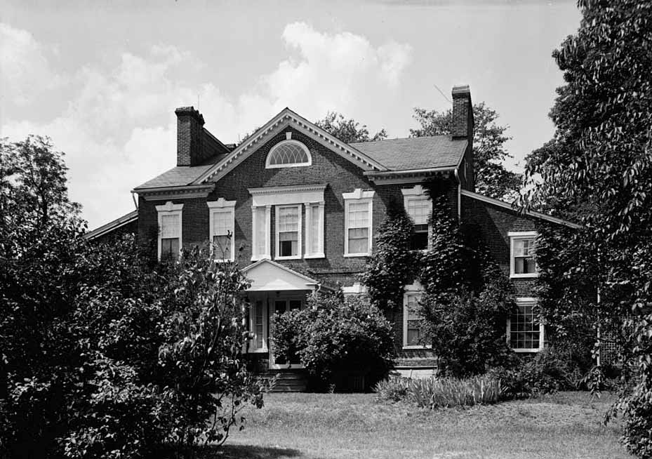
Sion Hill
Monument and historic site · National Register of Historic Places · 1.2 mi
Historic house in Maryland, United States

Southern Terminal, Susquehanna and Tidewater Canal
Monument and historic site · National Register of Historic Places · 1.2 mi
Historic district in Maryland, United States

Swansbury
Monument and historic site · National Register of Historic Places · 2.7 mi
Building in Maryland, United States


Tome School
Monument and historic site · National Register of Historic Places · 3.9 mi
Private secondary school in Maryland, United States
25 more on the map.
Parks, trails and playgrounds25

Frank J. Hutchins Memorial Park
Park · 1.4 mi
218 Congress Avenue, Havre de Grace

Havre de Grace High School Stadium
Sports field and stadium · 0.9 mi
200 North Juniata Street, Havre de Grace



Ice House Park
Park · 2.3 mi
Local Park and Free Fishing Area
411 Roundhouse Drive, Perryville
13 more on the map.
Restaurants and cafes44

Bella's Tea Room
Cafe · Tea · 1.2 mi
421 Saint John Street, Havre de Grace
Mo-Tu off; We-Su 10:00-17:00; PH off

Coakley's Pub
Diner · American · 1.2 mi
406 Saint John Street, Havre de Grace
Su-Mo 09:00-21:00; We-Th 09:00-21:00; Fr-Sa 09:00-12:00

Frank's Pizza & Grill
Restaurant · Pizza · 0.6 mi
1123 Revolution Street, Havre de Grace
Mo-Sa 11:00-22:00; Su 12:00-21:00

Goll's Bakery
Bakery · 1.3 mi
Closed for remodelling as of June 16, 2023
234 North Washington Street, Havre de Grace
"closed for remodeling"
La Cucina Italian Restaurant
Restaurant · Italian · 1.3 mi
103 North Washington Street, Havre de Grace
Su 12:00-21:30; Mo 10:30-21:30; We-Th 10:30-21:30; Fr 10:30-22:30;...
Nonnie's Brick Oven Pizza
Restaurant · Italian, Pizza · 1.0 mi
801 Otsego Street, Havre de Grace
Mo,Su,We-Sa 11:00-20:30; Tu 11:00-21:00
Pat's Pizzeria
Restaurant · Pizza · 0.6 mi
1201 Revolution Street, Havre de Grace
Mo-Tu,Th 11:00-21:00; We,Su 10:00-21:00; Fr-Sa 10:30-22:00
Pizza Hut
Restaurant · Pizza · 0.7 mi
600 Ohio Street, Havre De Grace
Mo-Th,Su 10:30-22:00; Fr-Sa 10:30-23:00
River City Crabs & Seafood
Restaurant · Seafood · 0.6 mi
921 Pulaski Highway, Havre de Grace
Mo-Th,Su 11:00-19:00; Fr-Sa 11:00-20:00
Water Street Seafood
Restaurant · Seafood · 1.2 mi
654 Water Street, Havre de Grace
Mo-Tu off; We-Th 11:00-20:00; Fr-Sa 11:00-21:00; Su 11:00-20:00; PH off
32 more on the map.
Where to stay4
Churches and places of worship15
First Baptist Church of Havre de Grace
Church · Baptist · 1.1 mi
108 South Stokes Street, Havre de Grace
Saint James African Methodist Episcopal Church
Church · Methodist · 1.1 mi
613-617 Green Street, Havre de Grace
Perryville United Methodist Church
Church · Methodist · 2.2 mi
301 Susquehanna Avenue, Perryville
Saint Matthews AUMP Church
Church · African Union Methodist Protestant · 1.1 mi
563 Revolution Street, Havre de Grace
Havre De Grace Presbyterian Church
Church · Presbyterian Church Usa · 1.1 mi
551 Franklin Street, Havre de Grace
Havre de Grace United Methodist Church
Church · United Methodist · 1.2 mi
101 South Union Avenue, Havre de Grace
Saint John's Episcopal Church
Church · Episcopal · 1.2 mi
114 North Union Avenue, Havre de Grace
Shopping17
Gas and EV charging5
Schools, colleges and libraries22
Harford County Public Library - Havre de Grace Branch
Library · 1.2 mi
120 North Union Avenue, Havre de Grace
Healthcare2
Map of Havre de Grace
179 places. The map loads OpenStreetMap tiles when you open it.
Climate by month
Monthly table
| Month | High | Low | Rain |
|---|---|---|---|
| Jan | 42°F | 25°F | 3.3 in |
| Feb | 44°F | 27°F | 2.8 in |
| Mar | 52°F | 33°F | 4.1 in |
| Apr | 65°F | 43°F | 3.5 in |
| May | 73°F | 53°F | 4.0 in |
| Jun | 82°F | 62°F | 4.3 in |
| Jul | 86°F | 68°F | 4.8 in |
| Aug | 84°F | 66°F | 4.2 in |
| Sep | 78°F | 59°F | 4.8 in |
| Oct | 67°F | 46°F | 4.2 in |
| Nov | 56°F | 37°F | 3.3 in |
| Dec | 46°F | 30°F | 3.9 in |
U.S. Climate Normals 1991-2020 for Aberdeen Phillips Fld (6 mi away), NOAA NCEI.
People and cost of living
American Community Survey 5-year estimates, 2020-2024, U.S. Census Bureau. Estimates have margins of error, larger for small towns.
Disaster history
Harford County has had 14 federal disaster declarations since 2000, most often for hurricanes.
- 2026-01-24: Severe Winter Storm (Winter Storm)
- 2020-03-26: Covid-19 Pandemic (Biological)
- 2020-03-13: Covid-19 (Biological)
- 2016-03-04: Severe Winter Storm And Snowstorm (Snowstorm)
- 2012-11-20: Hurricane Sandy (Hurricane)
- 2012-10-28: Hurricane Sandy (Hurricane)
OpenFEMA disaster declarations summaries.
Getting there and nearby towns
Havre de Grace Seaplane Base is the nearest airport with scheduled flights listed in OpenStreetMap, 1 miles away.
- Aberdeen 4 mi southwest, about 6 min by car
- Bel Air South 11 mi west, about 17 min by car
- Bel Air 12 mi west, about 20 min by car
- Edgewood 13 mi southwest, about 21 min by car
- Bel Air North 14 mi west, about 22 min by car
- Elkton 16 mi east, about 26 min by car
- Fallston 17 mi west, about 28 min by car
- Honeygo 20 mi southwest, about 31 min by car
- Glasgow 20 mi east, about 32 min by car
- Newark 21 mi northeast, about 34 min by car
Drive times are estimates from straight-line distance, not routes.
Local news
Headlines from INDB, the NEMICO news database.
Reviews, tips and questions
Loading what members have shared...
Sources and licences
- NCES EDGE (Public domain): public schools
- NOAA NCEI U.S. Climate Normals 1991-2020 (Public domain): climate by month
- OpenFEMA (Public domain): disaster declarations
- OpenStreetMap contributors (ODbL 1.0): places, airports, map data
- U.S. Census Bureau (Public domain): population, income, housing, education, commute
- Wikidata (CC0 1.0): elevation, founding date, time zone, website, landmarks and historic places
- Wikimedia Commons (see each image): photos
- Wikipedia (CC BY-SA 4.0): overview and history text
Photo credits
- August 2011 Trip to Charleston 013 (6027964048), Ted Kerwin, CC BY 2.0
- Havre de Grace, Maryland - panoramio (48), Patrick Nouhailler's…, CC BY-SA 3.0
- 2019-05-21 16 04 53 View east along U.S. Route 40 (Pulaski Highway) just east of Lewis Lane in Havre de Grace, Harford County, Maryland, Famartin, CC BY-SA 4.0
- 2019-08-25 17 35 19 View east along U.S. Route 40 (Pulaski Highway) just west of Maryland State Route 155 and Maryland State Route 7 in Havre de Grace, Harford County, Maryland, Famartin, CC BY-SA 4.0
- 2016-06-11 11 29 45 View west along U.S. Route 40 (Pulaski Highway) just west of Maryland State Route 7 (Otsego Street) in Havre de Grace, Harford County, Maryland, Famartin, CC BY-SA 4.0
- 2019-10-16 10 44 04 View east along Maryland State Route 155 (Ohio Street) at the junction with U.S. Route 40 (Pulaski Highway) in Havre de Grace, Harford County, Maryland, Famartin, CC BY-SA 4.0
- 2016-06-11 08 40 25 View west along Maryland Route 7 (Otsego Street) near U.S. Route 40 (Pulaski Highway) in Havre de Grace, Harford County, Maryland, Famartin, CC BY-SA 4.0
- 2019-10-16 08 39 58 View east along Maryland State Route 7 (Otsego Street) at the junction with U.S. Route 40 (Pulaski Highway) in Havre de Grace, Harford County, Maryland, Famartin, CC BY-SA 4.0
- 2016-06-11 09 09 25 View east from the west end of Maryland State Route 763 (Superior Street) in Havre de Grace, Harford County, Maryland, Famartin, CC BY-SA 4.0
- 2016-06-11 08 29 45 View east along Maryland State Route 7 (Revolution Street) near Adams Street in Havre de Grace, Harford County, Maryland, Famartin, CC BY-SA 4.0
- 2019-05-21 15 59 16 View east along Maryland State Route 155 (Ohio Street) at Maryland State Route 763 (Superior Street) in Havre de Grace, Harford County, Maryland, Famartin, CC BY-SA 4.0
- 2016-06-11 09 14 11 View west along Maryland State Route 155 (Level Road) at the west end of Maryland State Route 763 (Superior Street) in Havre de Grace, Harford County, Maryland, Famartin, CC BY-SA 4.0
- 2019-10-16 10 37 14 View east along Maryland State Route 155 (Level Road) just west of Maryland State Route 763 (Superior Street) in Havre de Grace, Harford County, Maryland, Famartin, CC BY-SA 4.0
- Woodlands Perryville, Arkaytee, CC BY-SA 3.0
- Jacob Tome Institute, Memorial Hall, Tome Road, Port Deposit, Cecil County, MD HABS MD,8-PODEP cropped, HABS photographer, Public domain
- Baker House photo, Robert K. Taylor, CC BY-SA 3.0
- Haviland House CecilCo MD, Smallbones, CC0
- Winstead photo, RobertK. Taylor, CC BY-SA 3.0
- Susquehanna and Tidewater Canal S end MD1, Acroterion, CC BY-SA 4.0
- SWANSBURY, HARFORD COUNTY, MD, Jerrye & Roy Klotz, MD, CC BY-SA 4.0
- Sion Hill, E.H. Pickering, photographer for HABS, Public domain
- Paw Paw Port Deposit MD 2, Smallbones, CC0
- Perry Point Mansion House Apr 10, Pubdog ( talk ), Public domain
- Chestnut ridge photo, Robert K. Taylor, CC BY-SA 3.0
- Rodgers Tavern Apr 10, Pubdog ( talk ) (Transferred by rohith_goura /Originally uploaded by Pubdog ), Public domain
- Little Castle Motel, Jason Knauer, CC BY 3.0
- Grand View, Jason Knauer, CC BY 3.0
- MD 7 WB past US 40-MD 155, Dough4872, CC BY-SA 4.0
- Grave of William S. McCombs (1850-1928) and R. Elzabeth McCombs (1850-1922) 1, Engineerchange, CC BY-SA 4.0
- Grave of William S. McCombs (1850-1928) and R. Elzabeth McCombs (1850-1922) 2, Engineerchange, CC BY-SA 4.0
- Grave of A. P. McCombs (1824-1916) and Maria C. McCombs (1828-1916), Engineerchange, CC BY-SA 4.0
- Grave of Louis McCombs (1853-1867), Ella McCombs (1866-1866), Sallie McCombs Jackson (1867-1899) 2, Engineerchange, CC BY-SA 4.0
- Grave of Louis McCombs (1853-1867), Ella McCombs (1866-1866), Sallie McCombs Jackson (1867-1899) 1, Engineerchange, CC BY-SA 4.0
- Grave of Walter H. Weber (1869-1941) and Wilhelmina Weber (1870-1956), Engineerchange, CC BY-SA 4.0
- Grave of George T. Pennington (1871-1947) and Mary M. Pennington (1873-1948), Engineerchange, CC BY-SA 4.0
- Admiral John Rodgers Post Civil War Memorial at Angel Hill Cemetery 2, Engineerchange, CC BY-SA 4.0
- Admiral John Rodgers Post Civil War Memorial at Angel Hill Cemetery 1, Engineerchange, CC BY-SA 4.0
- Graves of Suvilla, Geneva, Mary, children of Samuel and Elizabeth J. Russell, Engineerchange, CC BY-SA 4.0
- Grave of Henry D. Lawder Sr. (1842-1921), Engineerchange, CC BY-SA 4.0
- Grave of John A. Russell (1848-1930) and Sarah W. Russell (1858-1912), Engineerchange, CC BY-SA 4.0


Page built October 30, 2026. Spotted a mistake? Tell us or suggest a place.