


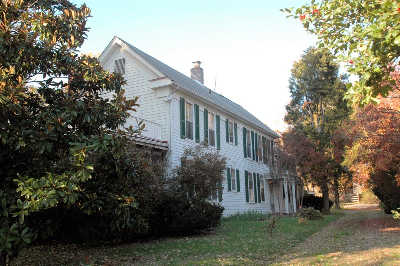
Hutchison, Virginia
Hutchison is a community of 7,284 people in Fairfax County, Virginia.
Why visit Hutchison
Townapedia lists 12 museums and landmarks, 14 parks and trails, 93 places to eat, 16 places to stay and 1 attraction in and around town.
Highlights include AMC Worldgate 9, Herndon Depot Museum, Herndon Historic District and Frying Pan Farm Park.
July is the warmest month, with average highs of 88°F; January lows average 25°F, and about 21 inches of snow fall in a normal year.
Weather in Hutchison
Forecast from the National Weather Service. Full forecast
About Hutchison
Hutchison is a census designated place in Fairfax County, Virginia, United States. It is a residential development just north of Virginia State Route 267, located 23 miles west of Washington, D.C. The community is one of the census-designated places newly recognized for the 2020 United States census.
From the Wikipedia article Hutchison, Virginia (this version), under CC BY-SA 4.0.
Things to do1

Museums and landmarks12

Herndon Depot Museum
Museum · National Register of Historic Places · 1.5 mi
Railway station in Herndon, the United States of America
717 Lynn Street
Su 12:00-15:00; Dec 15-Dec 31 off; Jan-Apr off

Herndon Historic District
Monument and historic site · National Register of Historic Places · 1.5 mi
Historic district in Virginia, United States

A. Smith Bowman Distillery
Monument and historic site · National Register of Historic Places · 3.4 mi
Whisky distillery in Fairfax County, Virginia

Floris Historic District
Monument and historic site · National Register of Historic Places · 1.9 mi
Historic district in Virginia, United States
Merrybrook
Monument and historic site · National Register of Historic Places · 0.7 mi
Historic house in Virginia, United States


U.S. Geological Survey National Center
Monument and historic site · National Register of Historic Places · 2.7 mi
Government building in Fairfax County, Virginia, United States


Andrew Gooden
Monument and historic site · 1.0 mi
Ghost bike in memory of Andrew Gooden, 38, killed on August 31, 2015.
Parks, trails and playgrounds14

Frying Pan Farm Park
Park · 2.0 mi
Park in Virginia, United States of America, United States of America


2 more on the map.
Restaurants and cafes93


China Village
Restaurant · Asian, Chicken, Chinese, Curry, Dumplings, Noodle, Seafood · 0.8 mi
1080 Elden St, Herndon
Mo-Th 11:00-21:30; Fr-Sa 11:00-22:30; Su 11:30-21:30
Chuck E. Cheese
Restaurant · Pizza · 1.0 mi
2465 Centreville Road, Herndon
Su-Th 11:00-21:00, Fr 11:00-22:00, Sa 10:00-22:00

Cold Stone Creamery
Ice cream · Ice Cream · 0.9 mi
13027 Worldgate Drive, Herndon
Su-Th 11:00-22:00, Fr-Sa 11:00-23:00
Hama Sushi
Restaurant · Sushi · 1.1 mi
2415 Centreville Road, Herndon
Su 12:00-21:30; Mo-Fr 11:30-21:30; Sa 12:00-21:30
Kalpasi
Restaurant · Indian · 0.8 mi
1355 Worldgate Drive, Herndon
Mo-Th 11:30-14:30, Mo-Th 17:30-20:00, Fr-Sa 11:30-15:00, Fr-Sa...
Mellow Mushroom
Restaurant · Pizza · 0.9 mi
1030 Elden Street, Herndon
Mo-Th,Su 11:00-22:00; Fr-Sa 11:00-01:00
Noodles & Company
Restaurant · Pasta · 1.0 mi
2405 Centreville Road
Su-Th 11:00-21:00, Fr-Sa 11:00-22:00
81 more on the map.
History
Northwestern Fairfax County was not destroyed during the Civil War and instead used as a supply station for both the Union and the Confederate armies. After the war, Union soldiers and Northern civilians alike relocated to the inexpensive area, with most residents being dairy farmers for the next few decades. In 1912, Herndon began receiving service from an electric trolley operated by the Washington & Old Dominion Railroad, and the area experienced further growth from Washington workers who commuted via the trolley.
Hutchison itself began to be developed during the 1970s, with a mixture of single-family homes and townhomes modeled on those of nearby Reston. In 1975, Hutchison Elementary School was founded to serve the small community, previously served by Herndon Elementary School.
From the History section of Hutchison, Virginia on Wikipedia, under CC BY-SA 4.0.
Where to stay16
Candlewood Suites Washington Dulles Herndon
Motel and hotel · 1.1 mi
13845 Sunrise Valley Drive, Herndon
Churches and places of worship9
Frying Pan Meetinghouse
Church · National Register of Historic Places · 1.7 mi
Shopping12
Gas and EV charging11
Schools, colleges and libraries46
Chantilly Governor'S Stem Academy
School · 5.9 mi
4201 Stringfellow Rd, Chantilly
Healthcare2
Map of Hutchison
216 places. The map loads OpenStreetMap tiles when you open it.
Climate by month
Monthly table
| Month | High | Low | Rain | Snow |
|---|---|---|---|---|
| Jan | 43°F | 25°F | 2.9 in | 6.9 in |
| Feb | 46°F | 27°F | 2.6 in | 7.0 in |
| Mar | 55°F | 34°F | 3.5 in | 3.9 in |
| Apr | 67°F | 43°F | 3.5 in | 0.1 in |
| May | 75°F | 53°F | 4.7 in | 0.0 in |
| Jun | 83°F | 62°F | 4.3 in | 0.0 in |
| Jul | 88°F | 67°F | 4.2 in | 0.0 in |
| Aug | 86°F | 65°F | 3.5 in | 0.0 in |
| Sep | 79°F | 58°F | 3.9 in | 0.0 in |
| Oct | 68°F | 45°F | 3.6 in | 0.0 in |
| Nov | 56°F | 36°F | 3.1 in | 0.3 in |
| Dec | 46°F | 29°F | 3.3 in | 2.8 in |
U.S. Climate Normals 1991-2020 for Washington Dc Dulles Ap 72403 (3 mi away), NOAA NCEI.
People and cost of living
American Community Survey 5-year estimates, 2020-2024, U.S. Census Bureau. Estimates have margins of error, larger for small towns.
Disaster history
Fairfax County has had 14 federal disaster declarations since 2000, most often for hurricanes.
- 2026-01-23: Severe Winter Storm (Winter Storm)
- 2020-04-02: Covid-19 Pandemic (Biological)
- 2020-03-13: Covid-19 (Biological)
- 2018-09-11: Hurricane Florence (Hurricane)
- 2016-03-07: Severe Winter Storm And Snowstorm (Snowstorm)
- 2012-10-29: Hurricane Sandy (Hurricane)
OpenFEMA disaster declarations summaries.
Getting there and nearby towns
Washington Dulles International Airport (IAD) is the nearest airport with scheduled flights listed in OpenStreetMap, 3 miles away.
- McNair 1 mi south, about 1 min by car
- Herndon 1 mi east, about 2 min by car
- Sterling 3 mi north, about 4 min by car
- Reston 3 mi east, about 6 min by car
- Dranesville 3 mi northeast, about 5 min by car
- Franklin Farm 4 mi south, about 6 min by car
- Dulles Town Center 4 mi north, about 6 min by car
- Ashburn 5 mi northwest, about 8 min by car
- Chantilly 5 mi south, about 9 min by car
- Sugarland Run 5 mi northeast, about 9 min by car
Drive times are estimates from straight-line distance, not routes.
Local news
Headlines from INDB, the NEMICO news database.
Reviews, tips and questions
Loading what members have shared...
Sources and licences
- NCES EDGE (Public domain): public schools
- NOAA NCEI U.S. Climate Normals 1991-2020 (Public domain): climate by month
- OpenFEMA (Public domain): disaster declarations
- OpenStreetMap contributors (ODbL 1.0): places, airports, map data
- U.S. Census Bureau (Public domain): population, income, housing, education, commute
- Wikidata (CC0 1.0): elevation, founding date, time zone, website, landmarks and historic places
- Wikimedia Commons (see each image): photos
- Wikipedia (CC BY-SA 4.0): overview and history text
Photo credits
- Herndon Depot1, Cecouchman, CC BY-SA 3.0
- HERNDON HISTORIC DISTRICT, JERRYE & ROY KLOTZ MD, CC BY-SA 3.0
- FryingPanMeetingHouse south, Cecouchman, CC BY-SA 3.0
- Oldbowmanwinedistill, Joshua Davis, CC BY-SA 2.5
- KidwellFarm 2, Cecouchman, CC BY-SA 3.0
- Merrybrook Exterior, Shape Of Air at en.wikipedia, Public domain
- Usgs-headquarters, No machine-readable author provided. Joshuadavisphotography assumed (based on copyright claims)., CC BY-SA 2.5
- 2017-06-01 07 34 05 View west at the east end of Virginia State Route 209 (Innovation Avenue) at Rock Hill Road, just west of Herndon in Fairfax County, Virginia, Famartin, CC BY-SA 4.0
- 2018-10-24 13 23 36 View west along Virginia State Route 267 (Dulles Toll Road) at the last exit for the Dulles Airport Access Road in McNair, Fairfax County, Virginia, Famartin, CC BY-SA 4.0
- WMATA train arriving at Innovation Center station, Sdkb, CC BY-SA 4.0
- Innovation Center Station 2023, Joseph Zadeh, CC BY-SA 4.0
- 2018-10-24 13 26 00 View west along Virginia State Route 267 (Dulles Toll Road) at Exit 9B (Virginia State Route 28 NORTH, Sterling) in McNair, Fairfax County, Virginia, Famartin, CC BY-SA 4.0
- Innovation Center Metro construction 2016c, Antony-22, CC BY-SA 4.0
- 2016-10-23 13 27 48 View east along Virginia State Route 267 (Dulles Toll Road) just west of Exit 10 (Virginia State Route 657, Herndon, Chantilly) in McNair, Fairfax County, Virginia, Famartin, CC BY-SA 4.0
- Innovation Center Metro construction 2016a, Antony-22, CC BY-SA 4.0
- Diabase boulders 20210302, Jstuby, CC0
- Innovation Center Metro construction 2016b, Antony-22, CC BY-SA 4.0
- Innovation Center Washington Metro June 29th 2025, Joewiki915, CC BY 4.0
- 2018-10-24 11 57 47 View east along Virginia State Route 267 (Dulles Toll Road) at Exit 10 (Virginia State Route 657, Herndon, Chantilly) in McNair, Fairfax County, Virginia, Famartin, CC BY-SA 4.0
- CIT Building Herndon Va, Gregory F. Maxwell < [email protected] > PGP : 0xB0413BFA, GFDL 1.2
- Piedmont City - panoramio, GibranParvez, CC BY 3.0
- 2016-10-29 10 19 16 View west from the former eastern terminus of Virginia State Route 209 (Innovation Avenue) in Dulles, Loudoun County, Virginia, Famartin, CC BY-SA 4.0
- 2016-10-29 10 20 53 View east along the former Virginia State Route 209 (Innovation Avenue) in Dulles, Loudoun County, Virginia, Famartin, CC BY-SA 4.0
- 2017-10-13 12 44 52 View east along the Dulles Access Road and the Silver Line of the Washington Metro from the ramp from Virginia State Route 28 (Sully Road) northbound to Dulles Airport in Dulles..., Famartin, CC BY-SA 4.0
- 2017-10-13 12 44 34 View west along the Dulles Access Road and the Silver Line of the Washington Metro from the ramp between Virginia State Route 28 (Sully Road) northbound and Dulles Airport in..., Famartin, CC BY-SA 4.0
- 2020-09-23 13 13 24 View south along Virginia State Route 657 (Centreville Road) at the exit for Virginia State Route 267 WEST (Dulles Airport) in Oak Hill, Fairfax County, Virginia, Famartin, CC BY-SA 4.0
- Approaching the grave enclosure of Laura Ratcliffe, Ser Amantio di Nicolao, CC BY-SA 4.0
- 2020-09-23 13 25 46 View north along Virginia State Route 657 (Centreville Road) at the exit for Virginia State Route 267 WEST (Dulles Airport) in Oak Hill, Fairfax County, Virginia, Famartin, CC BY-SA 4.0
- 2020-09-23 13 26 43 View north along Virginia State Route 657 (Centreville Road) from the overpass for Virginia State Route 267 (Dulles Toll Road) in Oak Hill, Fairfax County, Virginia, Famartin, CC BY-SA 4.0
- Iron plaque on the fence surrounding Laura Ratcliffe's grave, Ser Amantio di Nicolao, CC BY-SA 4.0
- Laura Ratcliffe grave, Ser Amantio di Nicolao, CC BY-SA 4.0
- 2020-09-23 13 29 53 View south along Virginia State Route 657 (Centreville Road) from the overpass for Virginia State Route 267 (Dulles Toll Road) in the McNair section of Oak Hill, Fairfax County..., Famartin, CC BY-SA 4.0
- 2020-09-23 13 20 53 View south along Virginia State Route 657 (Centreville Road) at the exit for Virginia State Route 267 EAST (Washington) in the McNair section of Oak Hill, Fairfax County, Virginia, Famartin, CC BY-SA 4.0
- Herndon, VA 20170, USA - panoramio, Eric Friedebach, CC BY 3.0
- Laura Ratcliffe grave vertical, Ser Amantio di Nicolao, CC BY-SA 4.0
- Laura Ratcliffe grave vertical, angled, Ser Amantio di Nicolao, CC BY-SA 4.0
- Laura Ratcliffe's grave and enclosure, Ser Amantio di Nicolao, CC BY-SA 4.0
- 2020-09-23 13 23 47 View north along Virginia State Route 657 (Centreville Road) at the exit for Virginia State Route 267 EAST (Washington) in the McNair section of Oak Hill, Fairfax County, Virginia, Famartin, CC BY-SA 4.0
- 2016-10-27 10 47 08 View north along Virginia State Route 228 (Elden Street) at Virginia State Route 228 Truck and Virginia State Secondary Route 606 Truck (Herndon Parkway) in Herndon, Fairfax..., Famartin, CC BY-SA 4.0
- 2016-01-22 23 52 49 Snow falling at night during the Blizzard of 2016 along Virginia State Route 228 (Elden Street) at Virginia State Route 228 Truck and Virginia State Secondary Route 606 Truck..., Famartin, CC BY-SA 4.0


Page built October 30, 2026. Spotted a mistake? Tell us or suggest a place.