
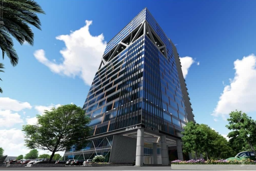


Why visit Avadi
Townapedia lists 13 parks and trails, 17 places to eat, 2 places to stay and 3 attractions in and around town.
Highlights include St. Peter's Institute of Higher Education and Research and Rakki Cinemas.
Weather in Avadi
Forecast from MET Norway (CC BY 4.0). Full forecast
About Avadi
Avadi (Tamil: [aːʋaɖi]) is a City in Chennai metropolitan area, Thiruvallur district, Tamil Nadu, India. Its the headquarters of Avadi City Police, Avadi City Corporation and Avadi Taluk located within the Thiruvallur district of Tamil Nadu, India. Situated at about 22 kilometres (14 mi) from Chennai Central Railway Station and 24 kilometres (15 mi) from It's district headquarters Tiruvallur and 58 kilometres (36 mi) from Another Railway Junction Arrakonam. Avadi is surrounded by major defence establishments and is home to various universities and engineering colleges.
From the Wikipedia article Avadi (this version), under CC BY-SA 4.0.
Things to do3

St. Peter's Institute of Higher Education and Research
School · 1.2 km
Higher education institution in India

Parks, trails and playgrounds13



1 more on the map.
Restaurants and cafes17

Perambur Sri Srinivasa Sweets, Snacks and restaurant (Pure veg)
Restaurant · Sweets, Snacks, Veg Food Dishes, Sandwich, Regional, Indian · 4.3 km
453 Chennai - Tiruttani - Renigunta Road, Chennai
Hotel Kumar's (Pure Veg)
Restaurant · South Indian · 4.3 km
399A Chennai - Tiruttani - Renigunta Road, Chennnai

Karupatti Kaapi
Cafe · Tea, Indian, South Indian Snacks · 3.3 km
Avadi Road, Paruthipattu
Aaladipattiyan Sweets / Restaurant
Restaurant · Coffee Shop, Regional, Sweets, Traditional Food Items, Snacks, Dessert · 4.0 km

5 more on the map.
Where to stay2


History
The suburb is part of the "auto belt" that developed when the automobile industry developed in Madras, primarily in the city's industrial north and west regions, in the early post-World War II years.
The famous session of the Indian National Congress was held at Avadi on 10 January 1955 where the Avadi Resolution was declared that the objective of the Congress was the establishment of a "socialistic pattern of society" in India. This historical meet emphasised the importance of socialism and its impact on social development. Jawaharlal Nehru with Morarji Desai and other Congress leaders at the AICC session declared that a socialistic pattern of society was the goal of the Congress.
From the History section of Avadi on Wikipedia, under CC BY-SA 4.0.
Churches and places of worship39
Full Gospel Telugu Baptist Church
Church · Baptist · 1.0 km
1 Church street, ESI Annanagar, Avadi, Chennai
Masilamaneeswarar Temple
Place of worship · Shaivism · 3.5 km
Tirumullaivoyal Road
Chinna Tirupati Temple
Place of worship · Vaishnavism · 4.2 km
5th cross street, Ram Nagar, Ambattur
CSI Holy Trinity Church
Church · Csi · 2.5 km
Chennai Tiruvallur High Road, Chennai
Guruvayur Krishnan Temple
Place of worship · Vaishnavism · 4.1 km
Nainiammal Street, Ambattur, Chennai
Mounaswamy Madam Shiva Temple
Place of worship · Shaivism · 4.5 km
Mounaswamy Madam Street, Chennai
Arulmigu Kubera Vinayagar Temple
Place of worship · 4.4 km
Old Township Road, Chennai
Arulmigu Sri Subramanya Swamy Temple
Place of worship · 4.7 km
South Park Street, Chennai
Shopping13
Ganesh Hardware
Hardware store · 4.3 km
Chennai - Tiruttani - Renigunta Road, Chennai
Kaveri Supermarket
Grocery · 4.4 km
Chennai - Tiruttani - Renigunta Road, Chennai
Gas and EV charging5
Bharat Petroleum
Gas station · 4.4 km
Chennai - Tiruttani - Renigunta Road, Chennai
Schools, colleges and libraries25
Velammal Vidhyashram, Ambattur
School · 4.5 km
Venkateswara Nagar Main Road, Oragadam, Chennai
Hussain Memorial Matric Hr. Sec. School
School · 4.1 km
Nainiammal Street, Ambattur, Chennai
Healthcare23
Dr. Agarwal's Eye Hospital - Ambattur
Hospital · 4.1 km
Chennai - Tiruttani - Renigunta Road, Chennai
Iswarya Fertility Center
Clinic and pharmacy · 4.2 km
Chennai - Tiruttani - Renigunta Road, Chennai
Mahalakshmi Multi-Speciality Hospital
Hospital · 4.1 km
Chennai - Tiruttani - Renigunta Road
Map of Avadi
140 places. The map loads OpenStreetMap tiles when you open it.
Getting there and nearby towns
Chennai International Airport (MAA) is the nearest airport with scheduled flights listed in OpenStreetMap, 15 km away.
- Reddipālaiyam 1 km southeast, about 1 min by car
- Kannapalayam 3 km south, about 3 min by car
- Vīrarāghavapuram 5 km south, about 5 min by car
- Vellānūr 5 km north, about 5 min by car
- Ambattur 6 km east, about 6 min by car
- Pallāvaram 17 km south, about 17 min by car
- Chennai 19 km east, about 19 min by car
- Tiruvottiyūr 21 km east, about 21 min by car
- Tambaram 21 km south, about 21 min by car
- Kanchipuram 54 km southwest, about 54 min by car
Drive times are estimates from straight-line distance, not routes.
Local news
Headlines from INDB.
Reviews, tips and questions
Loading what members have shared...
Sources and licences
- GeoNames (CC BY 4.0): population, coordinates, regions and time zone
- OpenStreetMap contributors (ODbL 1.0): places, airports, map data
- Wikidata (CC0 1.0): elevation, founding date, time zone, website, landmarks and historic places
- Wikimedia Commons (see each image): photos
- Wikipedia (CC BY-SA 4.0): overview and history text
Photo credits
- Tidel Park Avadi, KSPRR, CC BY-SA 4.0
- Tirumullaivayil2, Ssriram mt at English Wikipedia, Public domain
- Srmhss, பரிதிமதி, CC BY-SA 3.0
- Sriram kesavan at entrepreneurs meet, The Googley, CC BY-SA 4.0
- Entrepreneurs meeting, Sriram Kesavan, CC BY-SA 4.0
- Dawn clouds,chennai,tamilnadu - panoramio, rajaraman sundaram, CC BY 3.0
- ISS008-E-18992 - View of India, Earth Science and Remote Sensing Unit , Lyndon B. Johnson Space Center, Public domain
- ISS042-E-61888 - View of Earth, Earth Science and Remote Sensing Unit , Lyndon B. Johnson Space Center, Public domain
- ISS042-E-61889 - View of Earth, Earth Science and Remote Sensing Unit , Lyndon B. Johnson Space Center, Public domain
- ISS030-E-247660 - View of Earth, Earth Science and Remote Sensing Unit , Lyndon B. Johnson Space Center, Public domain
- ISS030-E-247661 - View of Earth, Earth Science and Remote Sensing Unit , Lyndon B. Johnson Space Center, Public domain
- ISS030-E-217762 - View of Earth, Earth Science and Remote Sensing Unit , Lyndon B. Johnson Space Center, Public domain
- Maruti Suzuki Alto Front Disc Brake, Vjdeep, CC BY-SA 4.0
- MY KNOWLEDGEABLE STUDENT 3, முனைவா் அ.சேவியா் ஜான், CC BY-SA 4.0
- MY KNOWLEDGEABLE STUDENT 2, முனைவா் அ.சேவியா் ஜான், CC BY-SA 4.0
- Yellow flowerzzzz, Manokari, CC BY-SA 3.0
- Tamilnewyear, Inbathamilan, CC BY-SA 4.0
- Nethrodaya Campus, Nethrodaya, CC BY-SA 4.0
- Ambattur OT Singapore Complex junction, TamizhanEditor, CC BY-SA 4.0
- CTH Road stretch near Ambattur OT bus stand, TamizhanEditor, CC BY-SA 4.0
- Chennai Suburban Train Inside, Ramesh Ramaiah, CC BY-SA 3.0
- ValluvarOnToothpasteCarton, Rasnaboy, CC BY-SA 4.0
- Acer Predator Helios 300 back panel open, Vjdeep, CC BY 3.0


Page built November 2, 2026. Spotted a mistake? Tell us or suggest a place.